Current indications are 1 to 2 rounds of severe weather this week, first will be on Thursday and the other Friday Afternoon/Evening. There may be some spill over into Saturday, but at this time it has the lowest risk out of the three days.
Update - 4/14/09 9AM: The following will be my rough outlooks. SPC outlooks will likely differ as I normally focus in on a smaller area than what their outlooks will do. I'll also keep this first post to my outlook graphics and link theirs in a later post since mine will change and theirs will vary on the date.
Thursday 4/16/2009
Storm system begins to wrap up across CO. Dryline will become established throughout the day in the TX panhandle. Current risk looks low for most of the day in Oklahoma, increase at night as storms move off the dryline and into OK. Main threat right now appears to be hail and winds, though there may be a tornado or two, especially into CO/KS. Storms that develop on Thursday may impact the OKC Metro, but more so in the period covered by the Friday outlook.
Friday 4/17/2009
Storm system continues to strengthen into Western KS. Dryline will be setup early in western OK as overnight activity is moving through this area. Some indications that we could have an on going squall line/MCS in this area in the morning that will move through Central OK during the day. Extent of severe weather will be impacted by the on going activity. If storms remain in a complex/squall line formation tornado threat will be pretty low, though wind damage may be increased some. This part of the forecast is going to be dependent on the Thursday batch, so getting too specific this far out is impractical right now.
Saturday 4/18/2009
Saturday will finally see the storm system move out. Dryline will likely be mostly dispersed by this time, but it indicated on the map to show where a boundary/area of storms is expected, in addition to back along the cold front. Again, all activity will be dependent on that of the day before. Would expect any development along the cold front to be pretty isolated, but can't rule it out right now.
Forecasts will be fine tuned and my graphics updated as we get closer. So if the text doesn't match the graphics, that would be why.
Real Time Weather Information
Satellite Image (1KM)
NEXRAD Mosaic Radar
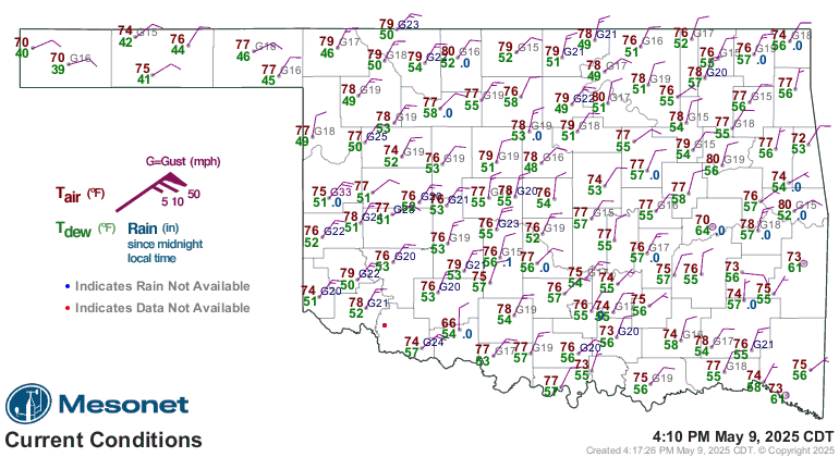
Oklahoma Mesonet Current Conditions (red air temp, green dewpoint)


 Reply With Quote


Bookmarks