Yes, I am still updating the chatroom, not many people are awake it seems.
Tornado Emergency issued for Cordell area. For reference, there has only been 8 of these issued in the USA in the last 3 years.


Yes, I am still updating the chatroom, not many people are awake it seems.
Tornado Emergency issued for Cordell area. For reference, there has only been 8 of these issued in the USA in the last 3 years.


Storms coming into metro now are not severe. Just some thunder and heavy rain. Initial gust front could be upwards of 30mph, but even that is dissipating relatively quick here around 1am.
As mentioned earlier, main focus for severe threat will be just S of the metro and points to the west where unstable conditions still exist.


I went to the Killers concert tonight at the Zoo Amp. I’d been watching the forecast the last few days not wanting to get caught in bad weather and bought tickets this afternoon believing it wasn’t going to hit before midnight. I guess people were spooked because I found VIP tickets online that had face value with fees of $100 a ticket for $65 bucks apiece...
At about 10pm, halfway through the Killers set, it just started pouring... It was really an excellent concert and nobody seemed to care or were leaving, we were all just having a great time and dancing in the rain. It actually made it just that much more fun...
I’m really happy I went


SPC has dropped the Slight risk for majority of OK this morning. Current rain and overcast will prevent any major destabilization.
However, HRRR model shows clouds eroding quickly later this morning across W OK that could lead to 1-2 isolated supercells to develop if everything pans out just right. Will have to watch the trends all day.


does anyone have the state map of oklahoma with the rainfall totals for the year?


This is where we are at so far:


http://www.mesonet.org/index.php/wea...egory/rainfall
they don't have just for this year. but they do have 30 day, 60 day, 90 day, etc


I was there as well. The skies opening up certainly made it more memorable during the last few songs. The crowd went absolutely nuts during "When You Were Young." I got a rash of texts from friends telling me that I needed to take cover (another joked that it was Mike Morgan being his usual self), but at that point it was really just a steady rain before absolutely raining cats and dogs. And of course, just 5-10 minutes after the show, it stopped.


The storm in OKC was initially trying to ramp up a bit before weakening. So that's why they made a big deal about the people at the Killers concert. It wouldn't have been the first time to see small quick night tornadoes out of a storm.
I was switching between Mick an Damon last night and seems like Damon Lane was hyping up the storm more last night. Morgan was basically saying some levels of mid-level rotation, "No big deal". While Lane seem sure it was going to ramp up and produce a tornado at any moment.


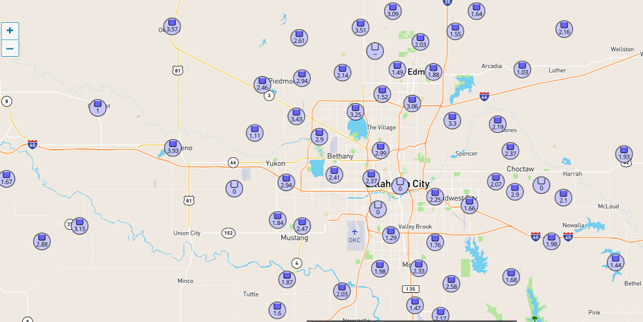
Between that first isolated cell that moved over the Metro and the the rest of the rain that followed after midnight, my place 4 miles east of the airport picked up 2.63" of rain.
A look at how much it rained in the OKC area as of 1pm, May 8. Source: wunderground.

It is looking like we will be getting back into the severe weather mode starting next weekend or so...


Rain is moving up into SW OK now, should be hitting C OK toward 11pm. Cold rain, maybe some thunder, but nothing severe.
Temperatures will struggle for Saturday, but if the sun can come out, we could hit upper 60s. Sunday and heading into next week looks great.
Whoever made the call to move OU graduation inside Lloyd Noble last night - good job. Was raining by the end and would have been a miserable mess outside.
Keystone Dam is currently releasing 75k cfs and will go to 85k on Monday, the largest release in 26 years. Downstream locations in Sand Springs, Tulsa and Jenks are bracing for possible flooding in low areas.
Get ready, the OK severe weather hype machine will be in full effect this week for next weekends storm system. Reed Timmer is already calling this one of the more active periods this generation will remember.


Lol I wonder what he defines as a generation? It does look more active and things will probably get bumpy at least 1 or 2 times next week as any kind of setup in late May usually does. Have to keep I'm mind that not all the severe weather days that chasers are looking at are going to take place in central Oklahoma.


SPC has 15% probabilities indicated on both Friday and Saturday. Friday is panhandle into western OK (possible MCS coming into C OK late). Saturday is the same, but pushed further east.
At this time, both days appear to be dryline supercells developing that may eventually turn into squall lines and push off to the east.
Also looking past this weekend, it appears there is potentially additional severe weather setups mid-week.
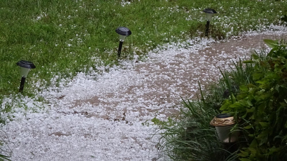
Hail in Stillwater Tues. evening around 7:30. Mostly pea to marble size with some a little bigger. Fortunately hail didn't get bigger. 62" rain, so far. The storm formed from overhead to the west side of the county and moved SE.

There are currently 1 users browsing this thread. (0 members and 1 guests)
Bookmarks