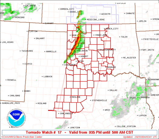
How long will this stick around? I have to drive home. Just waiting it out right now...
How long will this stick around? I have to drive home. Just waiting it out right now...
Today looks relatively quiet for the most part. Marginal risk out all day but uncertainties with anything going up due to last night's storms. Clouds will limit instability some as well. Western OK is sunny at this time, so we might see a couple pop up along the dryline out there but the atmosphere is pretty worked over right now.
Tomorrow SPC removed the slight risk from much of the state (except far NE) and just has a marginal risk in eastern OK. Models really don't kick up much of anything, but the atmosphere could be very unstable ahead of the front/dryline by mid to late afternoon. We'll have to see if things are able to form.
Ok guys, How are things looking for our next round of storms starting on Sunday? What can we expect for next weeks rounds?
Thank You,
SPC has removed the risk area for much of North Central back through Southwest OK today. Marginal to Slight risk remains from Northeast through South Central and a Marginal Risk over far NW OK.

How are things shaping up for tomorrow?
Tomorrow would probably be a moderate risk day if this was late April or May. Very high instability, composite indices pretty high (supercell and sig tor), but the entire thing appears as it will be shut down due to a strong cap reinforced by a dryslot moving over the area. Still need to keep an eye incase moisture remains in place.
Marginal risk today over South Central and Southeast Oklahoma. Slight Risk over much of NE OK. Enhanced Risk over extreme NE OK.
Few storms going up now overhead...nothing major expected.

Looks like the cap is weakening to the north.
For the readers in NE OK.

For Central OK...dryline is starting to retreat to the west (cold front not here yet) so there will be a window until about 11 PM for an isolated storm to pop up. HRRR hints at it...

What professional Android apps would you guys suggest for mobile weather coverage with good detail etc that is not for the general everyday public, but more for a weather knowledgeable person. I am trying to put together an few aps on my cell phone for severe weather coverage with great detail on warnings etc.
Next week appears to be a pretty busy week. 4 to 6 days of severe weather at least somewhere in Oklahoma appears to be getting pretty likely. Won't dive into a lot of details now (gotta work), but a quick overview...
Sunday - Very low severe risk, storms possible W OK.
Monday - One or two isolated storms, if they get through the cap they will probably be severe. High instability. Central OK best chance.
Tuesday - Chance of storms, likely severe if they form over SW to Central to NE OK. Very high instability.
Wednesday - Chance of storms, likely severe if they form. Best risk almost same area as Tuesday but possibly more wide spread. Very high instability in place.
Thursday - Chance of isolated storms, if they form will be severe. More isolated than Tue & Wed due to more inhibition. Best chances along and west of I-35 early evening, moving east.
Friday - Chance of storms, more widespread. Severe possible depending on how much day time heating we get or if it turns out to be an early show. Best chance Central and Eastern OK.
Saturday - Slight chance of storms Central to East, better SE OK with severe risk of storms form.
Working on getting forecast put together for this coming week. General trend though...
First part of the week - isolated stuff, nothing lock in.
Wednesday & Thursday...have a plan in place and stay weather aware. One of these two days, if not both, will probably be Moderate Risk days.
Finally some CU going up along the dryline, we'll if it does anything.
I thought Thursday was going to be mostly big for eastern Oklahoma. Has it shifted westward to include OKC?
There are currently 5 users browsing this thread. (0 members and 5 guests)
Bookmarks