Widgets Magazine
Page 12 of 21 FirstFirst ... 7891011121314151617 ... LastLast
Results 276 to 300 of 522

Thread: General Weather Discussion - March 2015

  1. Default Re: General Weather Discussion - March 2015

    00Z NAM Update...

    No major changes. Initiation still planned for late afternoon/early evening near or just west of Central OK. Storms will push off to the east through the evening. Still looking for supercells along the dryline and then a linear setup along the cold front coming in from the north. We could see the wind or hail categories push this into an Enhanced risk, but slight is still good for now.

  2. Default Re: General Weather Discussion - March 2015

    SPC has upgraded the Metro area and much of Oklahoma to an Enhanced Risk for Wednesday.


    (See Loco's post)

  3. #278

    Default Re: General Weather Discussion - March 2015

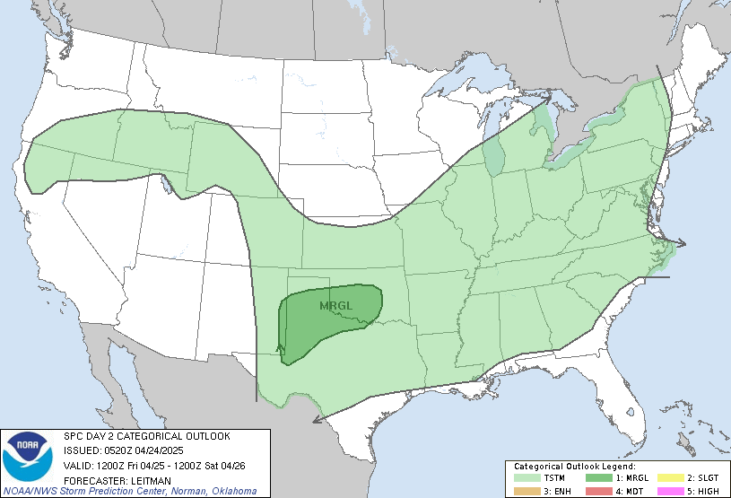
    New Day 2 outlook is out from the SPC, with probabilities upped to Enhanced:


    ...SRN PLAINS TO MID MS VALLEY...

    STRONG MID-LEVEL SPEED MAX/SHORT-WAVE TROUGH WILL EJECT ACROSS THE
    GREAT LAKES WEDNESDAY. IN THE WAKE OF THIS FEATURE...SECONDARY
    SIGNIFICANT SHORT WAVE WILL DIG SEWD ACROSS THE CNTRL ROCKIES INTO
    MEAN LONG WAVE TROUGH OVER THE CNTRL/SRN HIGH PLAINS BY EARLY
    WEDNESDAY EVENING. IN RESPONSE...SFC ANTICYCLONE WILL BUILD ACROSS
    THE PLAINS FORCING A STRONG POLAR FRONT ACROSS MUCH OF KS INTO THE
    NRN TX PANHANDLE BY 25/18Z. THIS BOUNDARY WILL SURGE TO A POSITION
    NEAR THE I-44 CORRIDOR ACROSS OK/MO BY EARLY EVENING.

    LATEST SHORT-RANGE GUIDANCE CONTINUES TO SUGGEST AT LEAST 60F SFC
    DEW POINTS WILL EXTEND ACROSS THE WARM SECTOR PRIOR TO CONVECTIVE
    DEVELOPMENT. OBSERVATIONAL DATA LATE THIS EVENING SEEMS SUPPORTIVE
    OF THIS SCENARIO AS 60F DEW POINTS HAVE ALREADY ADVANCED INLAND TO
    NEAR THE BALCONES ESCARPMENT. THIS AIR MASS SHOULD EASILY LIFT NWD
    INTO OK AHEAD OF DRY LINE/COLD FRONT. ADDITIONALLY...STRONG HEATING
    IS EXPECTED ACROSS NWRN TX INTO CNTRL OK WHERE SFC-3KM LAPSE RATES
    WILL RANGE FROM 8-9C/KM. WITH COLD MID-LEVEL TEMPERATURES...ROUGHLY
    MINUS 18C AT 500MB...AND SFC TEMPERATURES RISING INTO THE LOWER 80S
    ACROSS SWRN OK...MODERATE INSTABILITY WILL BE IN PLACE FOR ROBUST
    UPDRAFTS. LATEST THINKING IS CONVECTIVE INITIATION WILL OCCUR
    AROUND 22-23Z AS CAP ERODES JUST AFTER PEAK HEATING. INITIAL STORMS
    MAY BE DISCRETE...ESPECIALLY ALONG THE DRY LINE AHEAD OF WEAK SFC
    LOW. HOWEVER...FRONTAL FORCING SHOULD QUICKLY ENCOURAGE AN
    ORGANIZED BAND OF SEVERE CONVECTION ALONG THE I-44 CORRIDOR THAT
    WILL PROPAGATE SEWD. HAIL...POSSIBLY IN EXCESS OF 2 INCHES...WILL
    BE THE GREATEST THREAT WITH THIS ACTIVITY AND DAMAGING WINDS COULD
    BE NOTED WITH STRONGER DOWNDRAFTS. ISOLATED SEVERE STORMS MAY
    EXTEND NEWD ALONG THE POLAR FRONT ACROSS SRN MO...PERHAPS SPREADING
    INTO SRN IL IF SUFFICIENT MOISTURE/INSTABILITY CAN RETURN TO THE
    LOWER OH VALLEY BEFORE FRONTAL PASSAGE.

  4. Default Re: General Weather Discussion - March 2015

    Few storms over North Central OK...small hail main risk. Movement to the east.


  5. #280

    Default Re: General Weather Discussion - March 2015

    Venture.. If storms start to fire tomorrow, do you think there will be enough lift? Like I said yesterday, I believe these will be the typical march storms which will fire quickly and become severe rapidly and die off after the heating of the day. Where do you think will be the most likely area to see all modes of severe weather?

  6. #281

    Default Re: General Weather Discussion - March 2015

    GFS and NAM both further east/delayed with development. OKC could dodge this one, it will be close.

  7. #282

    Default Re: General Weather Discussion - March 2015

    Quote Originally Posted by Anonymous. View Post
    GFS and NAM both further east/delayed with development. OKC could dodge this one, it will be close.
    How much further east?

  8. #283

    Default Re: General Weather Discussion - March 2015

    Anon... Further east like Tulsa (my area)? Do you think there will be enough wind shear and updraft for these storms to rotate, or most likely a hail/wind event? If the composite pans out it looks like the storms could be supercells to start off. But as you were saying if its further east the supercells would probably fire off around the Stillwater area instead of Enid.

  9. #284

    Default Re: General Weather Discussion - March 2015

    BTW, i'm referring to the Wednesday evening time frame.

  10. #285

    Default Re: General Weather Discussion - March 2015

    Damn, so has anyone noticed the composite reflectivity for Tuesday at 7pm?

  11. #286

    Default Re: General Weather Discussion - March 2015

    Quote Originally Posted by Anonymous. View Post
    GFS and NAM both further east/delayed with development. OKC could dodge this one, it will be close.
    Sweet... my replacement driveway/sidewalk is being formed and concrete installed this week.

  12. #287

    Default Re: General Weather Discussion - March 2015

    It will depend on the timing of the dryline/front to determine where they form. But as of latest data, I would place initiation to the extreme SE parts of the OKC metro, then really cranking in a wind-damaging line as they shove into eastern OK.

    I-44 and points east should stay alert, but as of now it looks like initial hail threat quickly becoming wind threat as the entire line will fire up.


    If I had to guess where storm will first fire at this time, I put them on a line from near Lawton to around Norman to near Harrah, east of most of OKC proper.

  13. #288

    Default Re: General Weather Discussion - March 2015

    Anon.. Are you talking about today or tomorrow?

  14. #289

    Default Re: General Weather Discussion - March 2015

    Tomorrow, extreme E and SE OK is the only play in our state, today.

  15. Default Re: General Weather Discussion - March 2015

    SPC should have the new Day 1 out here shortly...

    12Z Model Discussion...

    Today

    NAM - Storms initiate today over SE MO and will backbuild towards Jay and Talequah. Through the evening and overnight storms could continue to back build until about McAlester before finally ending and pushing off to the east. NAM Sim Reflectivity does suggestion we could see a storm or two fire in South Central OK, but not nearly as favorable there for development. For Oklahoma...hail and wind main threats.

    GFS - Storms initiate this afternoon from Vinita to Muskogee to McAlester, so further west than NAM.


    Tomorrow

    NAM - Storm initiation between 4PM and 7PM to the North and West of I-44...generally just to the west or far west sides of the Metro area. Supercells initial mode from OKC down to Lawton. Instability very high to extreme (CAPE 3500-4000 j/kg) over Central OK by mid afternoon. This all depends on moisture return, so we'll have to watch it. All modes possible early transferring to a wind threat as the cold front eventually undercuts storms after dark.

    GFS - Initiates storms faster than NAM, between 1PM and 4PM from El Reno to Perry to Pawnee, building south along the front. GFS restricts a lot of development along the dryline, so it keeps SW OK dry. Instability is less than NAM, as usual, with a highly unstable atmosphere (CAPE ~2000 j/kg) ahead of the front. Forecast sounding has more of a wind threat with a large hail threat with earlier storms. Notable is GFS has slowly trended slower with the arrival of the cold front and much slower with the dryline. So we'll just need to watch.

  16. Default Re: General Weather Discussion - March 2015

    Short term discussion...

    HRRR initiates storms over far Ottawa and Delaware counties around 5PM. Could also see a few additional storms over SE OK at this time. It then weakens those storms off and fires additional storms around 8PM over SE OK from McAlester up to Fort Smith, AR. Few of the storms could rotate with some larger hail.

    SPC has maintained an ENHANCED risk over Delaware and Adair counties, with a SLIGHT risk over the of extreme NE OK back through much of East Central and Southeast Oklahoma.

  17. Default Re: General Weather Discussion - March 2015

    For those that enjoy comparing to past setups/events, here are the analogs CIPS just put out to compare the setup for tomorrow with past events. Severe weather pretty likely, but tornado output was low in the previous events.


  18. Default Re: General Weather Discussion - March 2015

    For Wednesday... Enhanced Risk remains for areas along I-44 and to the SE.


    ...SRN PLAINS...
    A POSITIVELY-TILTED UPPER-LEVEL TROUGH WILL MOVE INTO THE SRN
    ROCKIES AND CNTRL HIGH PLAINS ON WEDNESDAY AS A COLD FRONT ADVANCES
    SWD ACROSS THE CNTRL AND SRN PLAINS. THE AIRMASS AHEAD OF THE FRONT
    IS FORECAST TO BECOME MODERATELY UNSTABLE DURING THE DAY AS A
    CAPPING INVERSION WEAKENS BY AFTERNOON. THESE FACTORS COMBINED WITH
    INCREASING LOW-LEVEL CONVERGENCE WILL RESULT IN SFC-BASED
    THUNDERSTORM DEVELOPMENT ALONG THE BOUNDARY IN THE LATE AFTERNOON.
    SEVERAL CONVECTIVE CLUSTERS SHOULD ORGANIZE LATE WEDNESDAY AFTERNOON
    WITH MCS DEVELOPMENT POSSIBLE ACROSS THE REGION DURING THE EARLY
    EVENING.

    NAM FORECAST SOUNDINGS NEAR THE STRONGEST INSTABILITY AT 21Z
    WEDNESDAY FOR TULSA AND OKLAHOMA CITY SWD TO NEAR THE RED RIVER SHOW
    SFC DEWPOINTS FROM 60 TO 65 F WITH MLCAPE VALUES IN THE 2500 TO 3500
    J/KG RANGE. THIS COMBINED WITH 0-6 KM SHEAR OF 45 TO 50 KT AND 850
    TO 500 MB LAPSE RATES NEAR 8.5 C/KM SHOULD BE FAVORABLE FOR
    SUPERCELLS WITH LARGE HAIL. CELLS THAT ARE DISCRETE EARLY IN THE
    EVENT AND COINCIDE WITH MAXIMIZED INSTABILITY MAY PRODUCE HAILSTONES
    OF GREATER THAN 2 INCHES IN DIAMETER. THE AMOUNT OF INSTABILITY
    COMBINED WITH VERY STEEP LOW-LEVEL LAPSE RATES WILL ALSO MAKE WIND
    DAMAGE LIKELY WITH THE STRONGER CELLS. A TORNADO OR TWO CAN NOT BE
    RULED OUT ESPECIALLY IF CELLS CAN BECOME ENHANCED BY MESOSCALE
    INFLUENCES SUCH AS AN OUTFLOW BOUNDARY.
    HOWEVER...THE COLD FRONT IS
    EXPECTED TO UNDERCUT THE CONVECTION AS STORM COVERAGE INCREASES IN
    THE LATE AFTERNOON WHICH SHOULD MITIGATE THE TORNADO THREAT AS THE
    EVENT UNFOLDS. ALTHOUGH SEVERE STORMS WILL ALSO BE POSSIBLE ACROSS
    NCNTRL AND WCNTRL TX...A CAPPING INVERSION SHOULD MAKE CONVECTIVE
    DEVELOPMENT MORE ISOLATED WITH SWWD EXTENT.

  19. #294

    Default Re: General Weather Discussion - March 2015

    Quote Originally Posted by Anonymous. View Post
    GFS and NAM both further east/delayed with development. OKC could dodge this one, it will be close.
    Well, I guess it is that time of year when most of the storms are east of us.

  20. Default Re: General Weather Discussion - March 2015

    Quote Originally Posted by jn1780 View Post
    Well, I guess it is that time of year when most of the storms are east of us.
    Typical March setups have storms fire near 35 and race east.

    And holy cow...FIRST Severe Thunderstorm watch of the year - for the entire country...


  21. Default Re: General Weather Discussion - March 2015

    18Z NAM Update for Wednesday...

    NAM has taken a decided shift back to the west for initiation tomorrow. We could still see the first storm pop up around the Stillwater area by mid afternoon, but between 4PM and 7PM it has a an area of storms stretching from the Altus area to the NE over Rush Springs to El Reno and then up towards Guthrie/Perry/ and then back to the NE corner of OK. Between 7PM and 10PM is expected to be the heaviest rain for Oklahoma City. It has some areas getting over an inch to an inch and a half under the heaviest storms. Keep in mind, some of this is likely to be in those nice roundish frozen balls.

    Much of the area ahead of the dryline and cold front is forecast to be extremely unstable. I still think this is mostly overdone, but not by much. We've been discussing questions about moisture return ahead of this system both today (Tuesday) and the one for tomorrow. Looking at the Mesonet we actually did manage to get dews into the lower 60s ahead of it. The main question will be how much the atmosphere can recover tonight with us just having the first "cold" front move through this afternoon.

    Forecast soundings for the OKC/Norman area tomorrow at 4PM is pretty impressive for March. Wind profile is some what favorable for rotation, though low level winds are still not fully supportive of tornadic development. Large hail though is pretty likely for someone with the storms that do rotate. Cap is fairly weak to nonexistent by mid afternoon. The other saving grace in the tornado department are LCLs which are forecast to be somewhat high...base of the storms may only get to about 3000' off the ground. Of course, better moisture coming in could change that. Instability wise we have CAPEs forecast now over 4000 j/kg, Lifted Index at -11, SWEAT at nearly 600, BRN around 40, and Total Totals at 63. If we look at the Tornado Parameters on the sounding, considering we have some obstructions in place with the lower level moisture content, aren't extreme at all. Low level shear is pretty weak unless we get some localized influences near a rotating storm. We will have to watch any storms that remain isolated into the early evening as the low level jet kicks in, however we'll also have a front crashing in undercutting storms at the same time.

    So just stay aware, this is probably going to get some hype since it has been a VERY long time since we had any real severe weather around here.


  22. #297

    Default Re: General Weather Discussion - March 2015

    Yea with slower action, could see dryline fire, then sweeping line of storm with cold front. It will all happen so quickly.

    The timing should be nice for peak heating. I would say heavy rain and wind threat is primary concern.

  23. Default Re: General Weather Discussion - March 2015

    18Z GFS is mix compared to the NAM. It is slower dropping the front through early tomorrow afternoon, but then accelerates it to bypass the NAM's evening timing. Forecast sounding wise, still paints a really unstable picture for Central OK with winds a bit more favorable for damaging winds but large hail threat is going to be main risk early.

  24. #299

    Default Re: General Weather Discussion - March 2015

    I didn't catch KFOR but David Payne is being very level headed about tomorrow, I figured they'd take the opportunity to hype the thing up.

  25. Default Re: General Weather Discussion - March 2015

    Quote Originally Posted by John1744 View Post
    I didn't catch KFOR but David Payne is being very level headed about tomorrow, I figured they'd take the opportunity to hype the thing up.
    Most are level headed, but I'm really annoyed at how non-uniform risk categories have become.

Thread Information

Users Browsing this Thread

There are currently 5 users browsing this thread. (0 members and 5 guests)

Similar Threads

  1. General Weather Discussion - January/February 2015
    By venture in forum Weather & Geosciences
    Replies: 525
    Last Post: 03-01-2015, 03:38 PM
  2. General Weather Discussion - May 2014
    By venture in forum Weather & Geosciences
    Replies: 429
    Last Post: 05-30-2014, 09:39 AM
  3. General Weather Discussion - March 2014
    By venture in forum Weather & Geosciences
    Replies: 240
    Last Post: 03-31-2014, 09:23 PM
  4. Oklahoma Weather Discussion - February/March 2013
    By venture in forum Weather & Geosciences
    Replies: 1248
    Last Post: 04-02-2013, 02:29 PM
  5. March '10 Weather Discussion
    By venture in forum Current Events & Open Topic
    Replies: 131
    Last Post: 03-30-2010, 05:17 PM

Bookmarks

Posting Permissions

  • You may not post new threads
  • You may not post replies
  • You may not post attachments
  • You may not edit your posts
  •  
Single Sign On provided by vBSSO