Just doing the weekend in this post. Monday will have another risk, but will leave it to then...as well as the rest of next week.
Initial Discussion
A strong cold front will be dipping into NW Oklahoma throughout the day, as well as a dryline from NW OK through the NW Texas Panhandle into NM. Deep moisture has returned from the Gulf with dewpoints well into the mid 60s in a lot of locations. Some heating is also taking place out west this morning with partly cloudy skies. Current short term model guidance points to development during the mid to late afternoon today in NW Oklahoma. Most of the activity looks like it will be from I-40 North until it potentially consolidates until a compacted area of thunderstorms that will move east later tonight across Central Oklahoma. For SW Oklahoma, there will be less forcing in this area for most of the day due to the dryline being pretty far west. It looks like it may make a run for the state line this evening which should spark a few storms along it. Either way, the majority of the area today will be very unstable with CAPE values from 2000-4000 j/kg and LI numbers in the -4 to -9 range. Helicity values also appears to be reasonably high across western OK today, which will lead to a isolated tornado threat.
Primary Threats
Tornado: Moderate - 15% chance with in 25 miles of any given point in Western OK.
Hail: Very High - 45% chance with in 25 miles of any given point in Western OK of hail greater than 1", with a 10% or higher prop that hail will get over 2".
Wind: Moderate - 15% chance with in 25 miles of any given point in the Western half of OK of winds over 57 mph.
Will post more through out the day and add a discussion for tomorrow as well.
Day 1 Severe Weather Outlook: Storm Prediction Center Apr 25, 2009 1300 UTC Day 1 Convective Outlook
Day 2 Severe Weather Outlook: Storm Prediction Center Apr 25, 2009 0600 UTC Day 2 Convective Outlook
Real Time Weather Information
Satellite Image (1KM)
NEXRAD Mosaic Radar
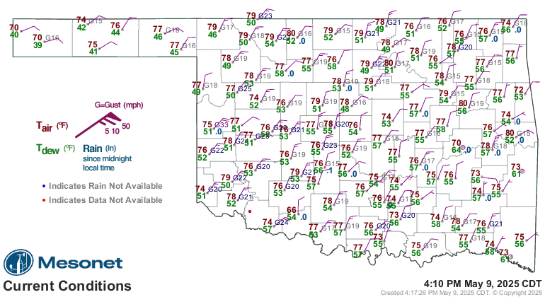
Oklahoma Mesonet Current Conditions (red air temp, green dewpoint)


 Reply With Quote


Bookmarks