

Does anyone know how often satellite photos are done? The images of Oklahoma were obviously taken during the winter months, where the grass is yellow and the trees are bare. It just looks crappy. Are the photos done annually.

 VIP Member

Does anyone know how often satellite photos are done? The images of Oklahoma were obviously taken during the winter months, where the grass is yellow and the trees are bare. It just looks crappy. Are the photos done annually.
...this shortest straw has been pulled for you
VIP Member
Annually? Heck no...The picture of my area is at least 5 years old.
If I could find out when the next one was going to be taken...I'd SOOO be mowing my name in the field behind my house.
Administrator


or you could do what these students did in britain... ok... maybe not.
-M
VIP Member
You can also use the County Assessor's aerials ... more current than Google's ... the entry page is here: Oklahoma County Assessor Mapping/GIS Disclaimer Notice
Aerials as current as 2005 are there.
Participating Member
Try this link
Live Local Search
They have some very impressive birds eye view of only a few select areas in the United States and OKC is one of them. Be careful because this is VERY addicting, or at least for me. Judging from the views in Norman, I'd say they they were taken between late winter and early summer 2006.
Participating Member
Originally Posted by adaniel

The view of my house in South West OKC is definately winter 06/07 or very early spring 07. My neighbors pool is shown and it was installed in July 06.
Participating Member
Are you looking at the 3D arieal photos? (when you move over an area, the button with the building shape on it turns blue indicating their is a 3D pic for that region) The reason I was thinking it was the 1st part of 2006 is the flyover pic of Riverwind and the new SuperTarget in Norman show them both under construction. In any event, its a lot more up to date than Google Earth.
Participating Member
Edmond on that site looks identical to Google Earth.
Andrew Stewart
A feature on Live is that the images are different depending how close you are.
VIP Member
Thanks, adaniel, I'd not been aware of that Microsoft product.
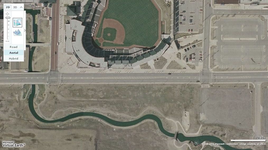
In brief investigation, though, I don't find its "images" to be the same, depending on the close-up-ness of the view. As a test, I looked at the Bricktown Ballpark relative to Lower Bricktown.
The 1st image is the "closest" MS view ... Lower Bricktown is undeveloped ...
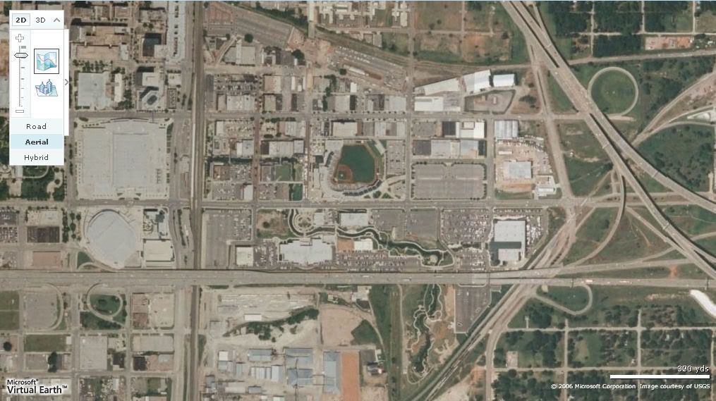
... and this one is one level out ... showing Lower Bricktown developments that the that the top image does not ...
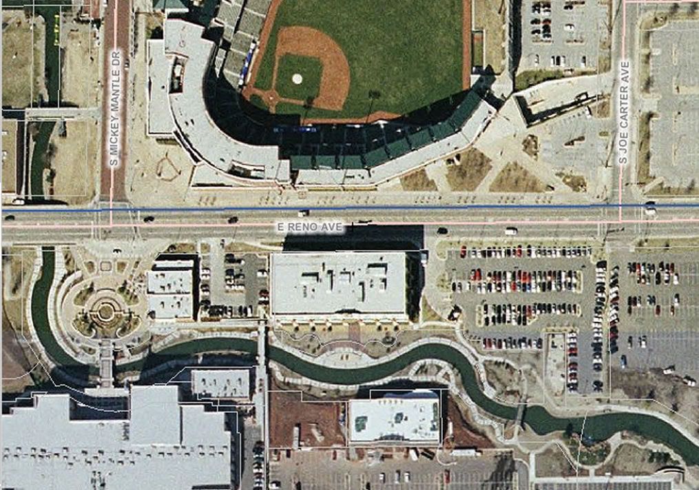
Here is a cropped view of the same area in 2005 from the County Assessor's website ...
That said, the Microsoft source is still a nice alternative resource. But, my guess is that, of all that we have available, the Assessor's aerials are likely the most current and reliabile, regardless of "zoom" factor.
Participating Member
You all are absolutely right. My bad. I didn't explore each level very closely. I noticed on the higher levels, the images were much newer. Doug, thanks for the tip about the Assessor's site. I never have explored it... I'll be checking it out now.
VIP Member
Thanks. And I like your dog ... truth is, I like all dogs. My favorite (Sun Set Sam) was a beagle, who, after ten + years long gone by, I love to this day. I think its time for me to consider changing my avatar, now that the Hornets, and my "flying" avatar, are for the forseeable future passe!
There are currently 1 users browsing this thread. (0 members and 1 guests)
 Posting Permissions

Bookmarks