Widgets Magazine
Page 1 of 12 123456 ... LastLast
Results 1 to 25 of 287

Thread: Oklahoma Severe Weather Discussion - April 2011

  1. Default Oklahoma Severe Weather Discussion - April 2011

    This thread will be used to discussion upcoming/ongoing severe weather events through the month of April. This initial post will contain information, images, and links that can be used at any time. Images posted later through the thread may or may not be accurate on the day you are viewing them (check the post comments). Information contained in this thread should not be used as an alternative to weather radios, media, or other means of getting weather warnings/advisories.


    _________Norman Warning Area Map __________________ Tulsa County Warning Area Map____

    Tornado Warning | Tornado Watch | Severe Thunderstorm Warning | Severe Thunderstorm Watch | Blizzard Warning | Red Flag Warning | Fire Warning | Winter Storm Warning | Winter Storm Watch | Freezing Rain Advisory | Heavy Snow Warning | Winter Weather Advisory | Severe Weather Statement | Special Weather Statement | Hazardous Weather Outlook | Fire Weather Watch
    Other Color Meanings: http://www.weather.gov/wwamap-prd/faq.php

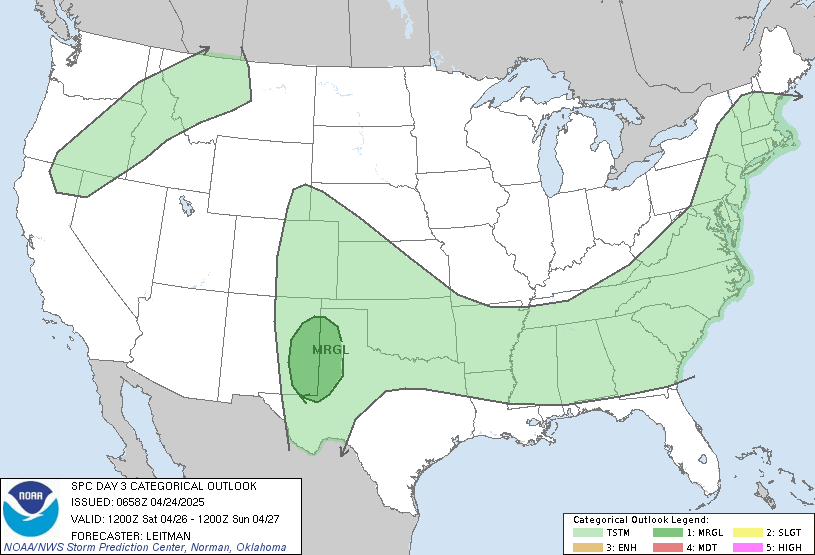
    SPC Convection (Severe Weather) Outlooks

    ________ Day 1 ________________ Day 2 _________________ Day 3 ___________ Days 4 through 8 ___


    *Click any above graphic to view discussion.*

    SPC Fire Weather Outlooks

    ________ Day 1 ________________ Day 2 ______________ Days 3 to 8 _____


    *Click any above graphic to view discussion.*

    CoD NEXRAD Radar Mosaic


    CoD Visible Satellite Image (will appear blank overnight)


    Oklahoma Mesonet Current Conditions


    SPC Severe Weather Reports (Today and Yesterday)
    ________ Today _____________ Yesterday _____


    Useful Links
    COD Weather Analysis Page: http://weather.cod.edu/analysis/
    NWS Norman Enhanced Page: http://www.srh.noaa.gov/oun/enhanced.php
    Storm Prediction Center: http://www.spc.noaa.gov/
    Oklahoma Mesonet: http://www.mesonet.org/
    West Texas Mesonet: http://www.mesonet.ttu.edu/
    Oklahoma Fire Weather: http://www.srh.noaa.gov/oun/?n=fireweather
    Oklahoma Road Conditions: http://www.dps.state.ok.us/cgi-bin/weathermap.cgi
    Severe Weather Values Reference Guide: http://weatherspotter.net/index11.php -or- http://www.theweatherprediction.com/severe/indices/
    TwisterData Model Page: http://www.twisterdata.com/
    Earl Barker's Central US Model Page: http://128.121.193.153/central_models.htm
    NSSL WRF Model: http://www.nssl.noaa.gov/wrf/
    NSSL 4KM WRF Model Forecast Soundings: http://www.nssl.noaa.gov/wrf/sdg/

  2. Default Re: Oklahoma Severe Weather Discussion - April 2011

    Will do more of a discussion tomorrow, but for right now some quick comments.

    First, updated the amount of information in the initial post of this thread. Added all the SPC Convective and Fire outlooks to make them quicker to see (when taking a glance). I'll be tweaking things a bit to provide links from the images back to their source or for more detailed information. If are more items we need to add, I'll do that down the road for the May edition.

    Coming up two or three major headlines.

    1) Extreme fire danger this week - BOTH Saturday and Sunday. Sunday looks to be the highest risk day for fire weather.

    2) Slight risk of severe storms on Sunday. This isn't set in stone yet due to the strong cap we'll have in place.

    3) Strong cold front will be coming through Monday making it much cooler than what we'll have this weekend. Don't be shocked if someone hits 100 somewhere in the state this weekend.

  3. Default Re: Oklahoma Severe Weather Discussion - April 2011

    Risk is increasing for some higher end severe weather for Sunday now. Risk area is now covering most of Oklahoma.


    DAY 2 CONVECTIVE OUTLOOK
    NWS STORM PREDICTION CENTER NORMAN OK
    1258 AM CDT SAT APR 02 2011

    VALID 031200Z - 041200Z

    ...THERE IS A SLGT RISK OF SVR TSTMS SUNDAY AFTERNOON AND NIGHT FROM
    THE MIDWEST/LOWER OH VALLEY TO THE SRN PLAINS...

    ...SYNOPSIS...
    MODELS REMAIN IN FAIRLY GOOD AGREEMENT SHOWING A FULL LATITUDE
    TROUGH AMPLIFYING/DEVELOPING INTO THE CENTRAL U.S. DURING DAY
    2...WITH THE 12Z ECMWF/00Z GFS FASTER WITH EWD PROGRESSION THAN THE
    WRF-NAM. BY 12Z MONDAY...A POSITIVELY-TILTED TROUGH SHOULD EXTEND
    FROM THE UPPER MS VALLEY TO THE SRN HIGH PLAINS. 60-90 METER 500 MB
    HEIGHT FALLS ARE EXPECTED FROM OK/KS TO IA/NRN IL DURING THE LATTER
    HALF OF THE FORECAST PERIOD. SWLY MIDLEVEL WINDS WILL STRENGTHEN TO
    50-60 KT FROM THE SRN ROCKIES TO THE LOWER MO VALLEY AND MIDWEST BY
    SUNDAY AFTERNOON...WITH A FURTHER INCREASE SUNDAY NIGHT TO 70-90 KT
    FROM THE SRN PLAINS TO LOWER OH VALLEY.

    AT THE SURFACE...MODELS HAVE TRENDED NORTH WITH THE INITIAL POSITION
    OF LOW PRESSURE AT 12Z SUNDAY...WITH THIS FEATURE LOCATED OVER SERN
    SD. THIS LOW WILL TRACK EWD INTO NERN IA BY 04/00Z...AND THEN REACH
    THE CENTRAL GREAT LAKES BY 12Z MONDAY. A TRAILING COLD FRONT WILL
    ADVANCE SSEWD THROUGH THE CENTRAL AND SRN PLAINS...AND INTERSECT AND
    OVERTAKE A DRY LINE FROM ERN KS THROUGH CENTRAL OK TO NRN TX FROM
    SUNDAY AFTERNOON TO EARLY MONDAY MORNING. THE NRN EXTENT OF THE
    COLD FRONT WILL PROCEED ESEWD THROUGH THE LOWER MO VALLEY REACHING
    LOWER MI TO THE OZARKS BY THE END OF THE FORECAST PERIOD.
    MEANWHILE...A WARM FRONT WILL LIFT NEWD FROM THE LOWER MO VALLEY
    THROUGH THE OH VALLEY TO LOWER GREAT LAKES BY SUNDAY NIGHT.

    UNCERTAINTY EXISTS IN THE GUIDANCE FOR WHETHER TSTMS INITIATE SWD
    ALONG THE DRY LINE...S OF THE KS BORDER...THROUGH OK TO NRN TX. THE
    00Z WRF-NAM/21Z ETAKF MEMBER OF THE SREF/12Z ECMWF DO NOT INITIATE
    ACROSS THESE AREAS...WHILE 00Z GFS TO SOME EXTENT AND THE EACH OF
    THE 21Z WRF-ARW MEMBERS OF THE SREF SUGGEST STORMS DO FORM INTO OK/N
    TX SUNDAY AFTERNOON. DESPITE THESE DIFFERENCES...STEEP MIDLEVEL
    LAPSE RATES /8-9 C PER KM/... MODERATE INSTABILITY AND STRENGTHENING
    BULK SHEAR TO 50 KT INDICATES A SLIGHT RISK REMAINS WARRANTED WITH
    SWD EXTENT. IF STORMS DEVELOP...THEN THE POTENTIAL WILL EXIST FOR
    LARGE HAIL...SOME SIGNIFICANT...PRIOR TO THE COLD FRONT REACHING
    THIS REGION AND PROGRESSING SWD INTO TX.

  4. #4

    Default Re: Oklahoma Severe Weather Discussion - April 2011

    I wonder if the OU-PRIME radar is available for public use online somewhere? That would be fun to look at during a tornado! lol.

  5. Default Re: Oklahoma Severe Weather Discussion - April 2011

    Quote Originally Posted by diggyba View Post
    I wonder if the OU-PRIME radar is available for public use online somewhere? That would be fun to look at during a tornado! lol.
    http://arrc.ou.edu/ouprime/status/

    That will probably be all you can find outside of the campus network right now. It provided some amazing images of the tornado (that eventually produced EF4 damage) that went down Highway 9 last here on the east side of Norman.

    Tomorrow looks to remain on track as a major fire weather day and also a maintaining a risk for severe weather. Both GFS and NAM 12Z runs are pretty close, though NAM is a bit faster and further east with the dryline. By evening is should be somewhere around 50-70 miles west of I-35. Looks like it will stall out around this area and we'll end up waiting for the cold front to pass through to push the risk out. That looks like it will happen early on Monday between 2 and 5 AM. Both models keep things dry with a decently strong cap in place. As the cold front moves in, that will start to trigger storms along it - with the highest chance in far eastern OK.

    Instability in central OK will remain very high until the front pushes through. For the figures we are looking at LI values from -6 to -9 across the area, CAPE values around 2000 to 2500 j/kg, EHI 0-1km anywhere from 2.0 to 3.0, and EHI 0-3km from 6.0 to 8.0. LCLs look pretty high, so tornado risk won't be high. However, with the that will be present if a storm does manage to fire along the dryline (and able to bust the cap) it will go severe with the risk of very large hail and perhaps a tornado or two. Winds won't be ideal for tornadoes as we won't have much backing from the southeast, but there will be a decent enough variation in wind direction as you go up.

    Of course, the cap rules all tomorrow. Won't be shocked if we have a typical day with most of the ingredients for a very active severe weather day but the cap shuts it down completely. One of those days with a tornado watch up but not a cloud in the sky type of things. :-)

    New Day 2 outlook from SPC should be out in the next few minutes. Will post when the update arrives.

    Edit to add SPC Day 2 Outlook text...

    FARTHER S/SW ACROSS THE SOUTH-CENTRAL PLAINS...DEEP CONVECTIVE
    INITIATION PRE-EARLY EVENING/ROUGHLY PRE-03Z IS QUITE UNCERTAIN AMID
    A STRONG ELEVATED MIXED LAYER/STOUT CAP. IN TERMS OF NUMERICAL
    GUIDANCE...ONLY SOME WRF-ARW MEMBERSHIP OF THE 09Z SREF SUPPORTS
    ISOLATED TSTM DEVELOPMENT IN VICINITY OF THE NORTH-SOUTH ORIENTED
    DRYLINE ACROSS CENTRAL OK/NORTH TX...WITH OTHER/TRADITIONAL
    DETERMINISTIC GUIDANCE INDICATIVE OF LITTLE OPPORTUNITY FOR PRE-DARK
    INITIATION. IF STORMS DO INDEED FORM IN VICINITY OF THE DRYLINE
    DURING THE LATE AFTERNOON/EARLY EVENING...RELATIVELY STRONG
    INSTABILITY/HIGHLY FAVORABLE SHEAR PROFILES WOULD SUPPORT SUPERCELLS
    CAPABLE OF VERY LARGE HAIL...WITH A TORNADO THREAT PROBABLY LIMITED
    BY A RELATIVELY WELL-MIXED BOUNDARY LAYER. THE MOST LIKELY SCENARIO
    IS FOR ISOLATED TSTMS TO DEVELOP LATE IN THE PERIOD AS THE SOUTHEAST
    ADVANCING COLD FRONT OVERTAKES THE DRYLINE.
    Last edited by venture; 04-02-2011 at 11:36 AM. Reason: Edit to add SPC Day 2 Outlook text

  6. Default Re: Oklahoma Severe Weather Discussion - April 2011

    No real changes so far for today. The SPC did move the slight risk a bit further east out of Central OK, but honestly it just depends if something can bust the cap today. Until the cold front & dryline move east, there is going to be a risk...very slight...but a risk for a storm.

    Extreme fire danger today and probably into tomorrow. We won't see much help from the winds at all as they will stay up over night into tomorrow.

  7. Default Re: Oklahoma Severe Weather Discussion - April 2011

    Hi, David.

    Take a look at what Rick said.

    http://kocoweatherblog.wordpress.com...severe-storms/

    However, temperatures in the mid levels of the atmosphere will be quite warm, and that will limit the chances of any storms.
    I posted a comment saying...

    Can you explain that? How is it that much later in the Spring when we really get warmer weather, cap breaks easily (I have seen frequently how the weather men have said the cap need more daytime heating to break), but you are saying for tomorrow, such warm weather will limit the storm chances? Totally weird.
    Your thoughts?

    They always have excuses as to why storms/tornadoes is not spawning during the cold and hot weather. :-/

    Its like, oh a cold core tornado during the fall/winter, then later on during the Spring, not enough heat, but we all know we have tornado-spawning storms during the fall/winter. Can they ever make up their mind and be consistent?!

  8. Default Re: Oklahoma Severe Weather Discussion - April 2011


    MESOSCALE DISCUSSION 0333
    NWS STORM PREDICTION CENTER NORMAN OK
    0951 PM CDT SUN APR 03 2011

    AREAS AFFECTED...CNTRL/ERN OK...EXTREME SWRN MO AND EXTREME NWRN AR

    CONCERNING...SEVERE POTENTIAL...WATCH POSSIBLE

    VALID 040251Z - 040415Z

    A SEVERE THUNDERSTORM WATCH IS POSSIBLE /30-50% CHANCE/ ACROSS
    PORTIONS OF CNTRL/ERN OK AND FAR SW MO/NW AR LATER THIS EVENING.
    PRIMARY THREATS WILL BE LARGE HAIL AND DAMAGING WIND GUSTS WITH
    STORMS BACKBUILDING SWWD FROM SERN KS.

    WATER VAPOR IMAGERY SUGGESTS THAT 30+ METER HEIGHT FALLS WILL BE
    SPREADING ACROSS CNTRL/NRN OK OVERNIGHT. THIS MAY BE SUFFICIENT TO
    WEAKEN THE CAP SAMPLED BY 00Z SOUNDINGS OVER OK. IN FACT...00Z NAM
    AND...TO SOME DEGREE...00Z PARALLEL RAPID REFRESH MODEL BACKBUILD KS
    CONVECTION SWWD ALONG/N OF THE COLD FRONT FROM ROUGHLY I-35 CORRIDOR
    EWD AND N OF I-44 BY 06Z. THIS ACTIVITY WILL LIKELY CONTINUE SSEWD
    INTO THE 50 KT SLY LLJ AND THETA-E AXIS INTO MUCH OF ERN OK AND SW
    MO/NW AR BY 09Z. THERE IS A NON-ZERO CHANCE THAT THE WWD EXTENT OF
    STORMS MAY GRAZE PARTS OF THE OKC METRO AREA...BUT MOST LIKELY STAY
    EAST OF I-35 FROM 06-09Z.

    THE STEEP MID-LEVEL LAPSE RATES AND EFFECTIVE SHEAR OF 40 KTS WILL
    BE FAVORABLE FOR LARGE HAIL...ESPECIALLY AS STORMS FIRST FORM.
    CONVECTIVE MODE SHOULD BE GENERALLY LINEAR...ALTHOUGH THERE MAY BE A
    COUPLE OF DISCRETE ENTITIES THAT MAY EVOLVE WITHIN THE LINE. CELLS
    THAT CAN DEVELOP AND BE MAINTAINED WITHIN THE FRONTAL ZONE COULD BOW
    AND PRODUCE DAMAGING WINDS.

  9. Default Re: Oklahoma Severe Weather Discussion - April 2011

    Storm development so far is now down to almost Garber in Eastern Garfield County. The front is currently from Ponca City to Hennessey to Watonga and the dryline is running SSW of there just entering Caddo and Comanche counties.

    Depending on how fast the storm can move down the zip line will determine if we can get some moisture here in the metro area.

    Update: Cold front is through the NW sides of the Metro area now. No hints of anything else developing in the state right now outside of the activity in Osage county. However, people can shut the A/C off...cold front will drop temps 20 degrees.
    Last edited by venture; 04-03-2011 at 10:20 PM. Reason: Front update

  10. Default Re: Oklahoma Severe Weather Discussion - April 2011

    Bulletin - immediate broadcast requested
    severe thunderstorm warning
    national weather service norman ok
    1034 pm cdt sun apr 3 2011

    the national weather service in norman has issued a

    * severe thunderstorm warning for...
    Northeastern kay county in northern oklahoma...

    * until 1100 pm cdt

    * at 1035 pm cdt...national weather service radar indicated a severe
    thunderstorm 3 miles east of kildare...moving east at 45 mph.

    Hazards in the warning include...
    Hail up to the size of quarters...
    Wind gusts to 60 mph...

    * locations in the warning include hardy...kildare and northern kaw
    lake.

  11. Default Re: Oklahoma Severe Weather Discussion - April 2011

    Appears to be rapid storm development in NW Cleveland county at this time. Already radar indicated small hail with it as it continues to develop. Other storms continues from Perkins and Cushing NE to Bartlesville and Nowata.

  12. Default Re: Oklahoma Severe Weather Discussion - April 2011

    SPECIAL WEATHER STATEMENT
    NATIONAL WEATHER SERVICE NORMAN OK
    1231 AM CDT MON APR 4 2011

    OKZ020-025>030-037>040-044-045-TXZ083>086-040600-
    LINCOLN OK-OKLAHOMA OK-POTTAWATOMIE OK-PAYNE OK-CLEVELAND OK-GRADY
    OK-MCCLAIN OK-COTTON OK-JEFFERSON OK-TILLMAN OK-COMANCHE OK-GARVIN
    OK-STEPHENS OK-HARDEMAN TX-WILBARGER TX-FOARD TX-WICHITA TX-1230 AM
    CDT MON APR 4 2011

    ...SIGNIFICANT WEATHER ADVISORY...

    THIS SIGNIFICANT WEATHER ADVISORY IS FOR CLEVELAND...COMANCHE...
    COTTON...FOARD...GARVIN...GRADY...HARDEMAN...JEFFE RSON...LINCOLN...
    MCCLAIN...OKLAHOMA...PAYNE...POTTAWATOMIE...STEPHE NS...TILLMAN...
    WICHITA AND WILBARGER COUNTIES.

    AT 1228 AM CDT...A COLD FRONT WAS LOCATED FROM NEAR VERNON TEXAS...
    TO LAWTON...NORMAN...AND CUSHING...MOVING SOUTHEAST AT 35 MPH. BY
    1 AM...THE FRONT IS EXPECTED TO EXTEND FROM CROWELL AND GRAYBACK
    TEXAS...TO DUNCAN...PURCELL...SHAWNEE...AND SPARKS.

    AS THE FRONT APPROACHES YOUR LOCATION...THE WIND WILL SHIFT FROM
    SOUTHERLY TO WESTERLY FOR ABOUT 10 TO 15 MINUTES BEFORE BECOMING
    VERY STRONG OUT OF THE NORTH. MOST AREAS BEHIND THE FRONT WILL SEE
    NORTHERLY WINDS OF 25 TO 35 MPH WITH GUSTS OF 40 TO 50 MPH. SOME
    LOCATIONS MAY SEE THE WIND GUST TO AROUND 60 MPH.

    THIS WIND SHIFT WILL AFFECT FIRE FIGHTING EFFORTS. PLEASE ADVISE FIRE
    CREWS IN THE FIELD OF THE CHANGE IN WIND DIRECTION.
    Currently mesonet is reporting winds of 50 to 60 mph on the west side of the Metro area behind this front.

    The storm in Central OK is sort of stretched out with rain from near Meeker to Norman.

  13. #13

    Default Re: Oklahoma Severe Weather Discussion - April 2011

    WOW. I was watching on GRLevel. It jumped 25k feet (echo tops reported from Tulsa) in about 30 minutes time.

  14. Default Re: Oklahoma Severe Weather Discussion - April 2011

    Tons of energy out there still, but we have one dandy of a cap as well. These winds are going to be screaming for awhile and will be over severe limits in some locations. May not get the rain and storms, but won't be shocked to see some reports of damage from the non-thunderstorm winds.

  15. Default Re: Oklahoma Severe Weather Discussion - April 2011

    SPECIAL WEATHER STATEMENT
    NATIONAL WEATHER SERVICE NORMAN OK
    1236 AM CDT MON APR 4 2011

    OKZ025-026-029-030-040600-
    LINCOLN OK-OKLAHOMA OK-POTTAWATOMIE OK-CLEVELAND OK-
    1236 AM CDT MON APR 4 2011

    ...SIGNIFICANT WEATHER ADVISORY...

    THIS SIGNIFICANT WEATHER ADVISORY IS FOR CLEVELAND...LINCOLN...
    OKLAHOMA AND POTTAWATOMIE COUNTIES.

    AT 1236 AM CDT...A STRONG THUNDERSTORM WAS LOCATED OVER SOUTHEASTERN
    OKLAHOMA CITY...MOVING NORTHEAST AT 50 MPH.

    HAZARDS INCLUDE...
    HAIL UP TO ONE-HALF INCH...
    WIND GUSTS TO 50 MPH...

    MONITOR THE WEATHER SITUATION CLOSELY AND BE ALERT FOR THREATENING
    WEATHER CONDITIONS.
    Missed this advisory.

  16. Default Re: Oklahoma Severe Weather Discussion - April 2011

    Submitted a question up above.

  17. #17

    Default Re: Oklahoma Severe Weather Discussion - April 2011

    Thunder, he said in the mid-levels of the atmosphere. You need surface heating combined with cooler temperatures up top. When you have a temperature inversion, a cap is created and the "warm" air on the bottom can not rise above the warmer air on top of it. So, not much vertical movement in the atmosphere.

  18. Default Re: Oklahoma Severe Weather Discussion - April 2011

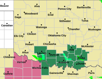
    Widespread Extreme Fire Danger tomorrow and continuing through the week (see graphic at the bottom).

    URGENT - FIRE WEATHER MESSAGE
    NATIONAL WEATHER SERVICE NORMAN OK
    932 PM CDT MON APR 4 2011

    .WITH VERY DRY AIR EXPECTED TO BE IN PLACE ON TUESDAY...AND A
    RETURN TO MODERATE OR STRONG WINDS...THE FIRE WEATHER WATCH FOR
    TUESDAY HAS BEEN EXPANDED TO INCLUDE MUCH OF CENTRAL AND NORTHERN
    OKLAHOMA.

    OKZ005>008-011>013-017>020-023>032-039>042-045-046-050-051045-
    /O.EXA.KOUN.FW.A.0013.110405T1600Z-110406T0100Z/
    WOODS-ALFALFA-GRANT-KAY-MAJOR-GARFIELD-NOBLE-BLAINE-KINGFISHER-
    LOGAN-PAYNE-CADDO-CANADIAN-OKLAHOMA-LINCOLN-GRADY-MCCLAIN-
    CLEVELAND-POTTAWATOMIE-SEMINOLE-HUGHES-STEPHENS-GARVIN-MURRAY-
    PONTOTOC-JEFFERSON-CARTER-LOVE-
    932 PM CDT MON APR 4 2011

    ...FIRE WEATHER WATCH IN EFFECT FROM TUESDAY MORNING THROUGH
    TUESDAY EVENING FOR MOST OF CENTRAL OKLAHOMA.

    THE NATIONAL WEATHER SERVICE IN NORMAN HAS EXPANDED THE FIRE
    WEATHER WATCH... WHICH IS IN EFFECT FROM TUESDAY MORNING THROUGH
    TUESDAY EVENING FOR A LARGE PART OF CENTRAL OKLAHOMA.

    * WIND...SOUTH TO SOUTHWEST 15 TO 25 MPH WITH GUSTS AROUND 30 MPH.

    * HUMIDITY...MINIMUM 15 TO 20 PERCENT.

    * TEMPERATURE...LOW TO MID 70S.

    * IMPACTS...ANY FIRES THAT DEVELOP WILL LIKELY SPREAD RAPIDLY.
    OUTDOOR BURNING IS NOT RECOMMENDED.

    PRECAUTIONARY/PREPAREDNESS ACTIONS...

    MONITOR WEATHER FORECASTS AND INFORMATION.
  19. Default Re: Oklahoma Severe Weather Discussion - April 2011

    News reports coming via Twitter indicate fires in the follow locations as of 4:30 PM...

    - Between Duncan & Comanche (Stephens County)
    - Alex (Grady County)
    - 1 Mile South of Sharon (Woodward County)
    - Near Thomas (Dewey & Custer Counties)

  20. Default Re: Oklahoma Severe Weather Discussion - April 2011

    Quick update for the night. GFS has been consistent for several runs now developing storms along I-44 in SW Oklahoma into Central OK and along I-35 up to Kansas on Friday. If this verifies it could be a definite severe weather day. Forecast soundings point to favorable conditions for severe storms should any develop and shear looks favorable for rotating storms. Still 3 days out, so things can change greatly. NAM is still not buying this solution, but has started picking up on storms in the state (but located in southern OK instead). We'll see how trends continue. GFS is holding the same forecast and NAM is starting to develop precip.

    As I'm typing this, the new Day 3 has come out from SPC and they have picked up on it as well. Their discussion below...


    ...SRN PLAINS...
    MODEL UNCERTAINTY EXISTS WITH THE EXACT PLACEMENT OF A N-S ORIENTED
    DRY LINE ACROSS THE SRN PLAINS TO KS ON FRIDAY AFTERNOON. DESPITE
    THIS FACTOR...INCREASING SLY LOW LEVEL WINDS WILL ALLOW BETTER
    MOISTURE RETURN ALONG AND E OF THE DRY LINE FROM ERN TX THROUGH
    CENTRAL/ERN OK TO ERN KS ON DAY 3. MODELS SUGGEST A WEAK MIDLEVEL
    IMPULSE SHOULD TRACK NEWD REACHING N TX/OK AREA BY PEAK HEATING AND
    AID IN THE DEVELOPMENT OF TSTMS ALONG THE DRY LINE. EFFECTIVE BULK
    SHEAR STRENGTHENING TO 50 KT AND ORIENTED PERPENDICULAR TO THE DRY
    LINE SHOULD SUPPORT ISOLATED SUPERCELLS.

    BY MID-EVENING INCREASING SBCINH SHOULD RESULT IN A DIMINISHING
    TREND FOR NEW SURFACE BASED TSTM DEVELOPMENT. HOWEVER...A VEERING
    LLJ INTO THE LOWER MO/MID MS VALLEYS FRIDAY NIGHT IS EXPECTED TO
    SUPPORT ELEVATED TSTMS ACROSS THESE AREAS. MODERATE ELEVATED
    INSTABILITY MAY SUPPORT A FEW STRONGER STORMS WITH HAIL...THOUGH
    WEAKENING BULK SHEAR SHOULD LIMIT THE SEVERE THREAT WITH ERN EXTENT.

  21. #21

    Default Re: Oklahoma Severe Weather Discussion - April 2011

    Maybe we'll get lucky and see some rain. As long as the tornados stay in the fields.

  22. Default Re: Oklahoma Severe Weather Discussion - April 2011

    NWS and all the news stations are saying Saturday.

  23. Default Re: Oklahoma Severe Weather Discussion - April 2011

    Working on the forecast now. Looks like we will have a potential for severe weather Friday & Saturday.

  24. Default Re: Oklahoma Severe Weather Discussion - April 2011

    A few slight differences between NAM and GFS, but both develop precip in the state now. The forecast below is based on an average between the two models to help blend their thinking together some. It should be noted, as I stated earlier, GFS has been consistent with developing storms in OK.

    Friday
    By 7PM storms are forecast to be forming ahead of the dryline from near OKC southwest to near Wichita Falls. Instability forecast appears to be anywhere from 2000 to 3000 j/kg. Lifted Index values will range from -5 to -9 across most of OK east of the dryline. Convective inhibition values appear to be fairly low and cap strength doesn't look to be an issue at all. EHI values will be pretty decent for both 0-1km and 0-3km. Storm activity appears it will move NE around 35 mph and continue through most of the night. Don't see widespread outbreak from this but isolated supercells with the risk for hail and a tornado or two looks probably.

    Will touch on Saturday more later. Right now GFS and NAM have it completely dry, but instability will be high as again.

  25. Default Re: Oklahoma Severe Weather Discussion - April 2011

    Bulletin - eas activation requested
    fire warning
    oklahoma city fire department
    relayed by national weather service norman ok
    322 pm cdt wed apr 6 2011

    the following message is being transmitted at the request of the
    oklahoma city fire department.

    Some residents of the jones and spencer area are being urged to
    evacuate due to a wildfire. The evacuation order is for those people
    located north of wilshire boulevard and south of britton
    road...between westminster and douglas. You are instructed to
    evacuate toward the north on either post road or westminster.

Thread Information

Users Browsing this Thread

There are currently 1 users browsing this thread. (0 members and 1 guests)

Similar Threads

  1. US Volcano Activity Discussion - 2011
    By venture in forum Current Events & Open Topic
    Replies: 9
    Last Post: 09-17-2011, 05:17 PM
  2. Oklahoma Severe Weather Discussion - March 2011
    By venture in forum Weather & Geosciences
    Replies: 94
    Last Post: 04-03-2011, 10:39 AM
  3. Winter Weather Discussion - Jan/Feb 2011
    By venture in forum Weather & Geosciences
    Replies: 620
    Last Post: 02-23-2011, 01:31 AM
  4. Winter Weather Discussion - Feb 2011
    By Matt in forum Current Events & Open Topic
    Replies: 0
    Last Post: 01-31-2011, 01:28 AM
  5. Oklahoma Weather!
    By houseguy2007 in forum Weather & Geosciences
    Replies: 2
    Last Post: 08-04-2010, 04:27 PM

Bookmarks

Posting Permissions

  • You may not post new threads
  • You may not post replies
  • You may not post attachments
  • You may not edit your posts
  •  
Single Sign On provided by vBSSO