

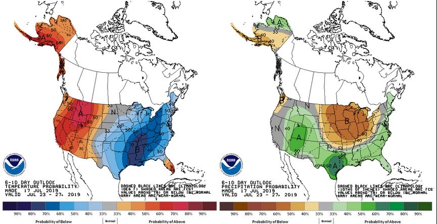
Appears as though below average to average temperatures will start out the month of July. Slim chances of rain through the week. Worth watching, some of the models hint at a storm complex coming through over the weekend/next week.

 Participating Member

Appears as though below average to average temperatures will start out the month of July. Slim chances of rain through the week. Worth watching, some of the models hint at a storm complex coming through over the weekend/next week.
Participating Member
I would be concerned with the on air health of Mike Morgan and David Payne if this happened in Oklahoma.
https://www.cnn.com/2019/07/01/ameri...rnd/index.html
Participating Member

Haha true...but Damon Lane would be chill
Participating Member
Perhaps a few random bubbling up storms this afternoon into the evening, placement is random and best shot is SW and C OK today. Otherwise we continue holding steady with highs near 90F and lows near 70F.
We had a pretty good rain with some thunder this AM in far NW OKC. Didn't last long, but came down pretty hard when it did.
Participating Member
Some rain and thunderstorms coming out slowly from SW OK is going through a slow death, but they are trying their best to push toward C OK overnight, but will likely die out. Nothing severe expected.
Participating Member
Should see more heat-of-day storms bubble up this afternoon. Best shot is just E of I-35 corridor.
Looks like we will make a run at 100F on Wednesday here in OKC. Highs back into the lowers 90s heading into the weekend.
Platinum Member
This weather sucks for those of us driving jeeps without tops. Is there a good website for rain prediction and radar by the hour for the metro area.Originally Posted by Anonymous.

Participating Member
You can use tropical tidbits and switch to HRRR model. It uses rapid refresh, but there is basically nothing that can (and likely never will) predict where exactly thunderstorms will pop up. But you can use this model to anticipate development of storms based on constant refreshing of atmospheric data.
Participating Member
Tropical development in the GOM is looking increasingly likely with Invest 92L. Dependent on how far west it can travel before being swept up in the jetstream to the north, this could affect OK weather late next week.
Banned
If you follow the historical path of this system, wasn't it here once before, went east, then south and is forecast to circle back to the west in the gulf as a tropical system?
Participating Member
Storms will develop later this afternoon across NW and N OK along a cool front that is sagging southward. This will be focal point for potentially severe storms, but the coverage will be very limited.
This will be a scenario this evening of if you do get a storm over you, it will likely be severe with heavy rain and wind gusts, but the chances of getting a storm are relatively low.
Moving on the tropics, Invest 92L is still gaining strength out in the GOM. At this time, most models are bringing the storm onto land somewhere between TX/LA border and then dissipate it northward into AR. However, there are some models sticking to a further W/SW track that take the storm into C TX, this scenario obviously would have more potential to impact OK weather next week. Will be keeping an eye on this.
Participating Member
Outflow from the sagging MCS across NE OK will help be an igniter for storms here in C OK. Should see some cells begin to develop just to the N and NE of OKC heading into the evening commute. Storms will have random pathing, but likely a S/SW movement due to nature of the outflow boundary plus cold front.
Participating Member
5pm Update: OKC has probably dodged the storm potential this evening, the outflow boundary from E OK is only washing out any of the cumulus towers that tried to get going. Short-range models have abandoned all storms in C and W OK.
Looks like Barry will stay to the east. Potential significant impacts in New Orleans.

Banned
Hey look on the bright side! It's the middle of July, the temps are above 90, and we are completely out of severe weather season! No more filthy, filthy thunderstorm action!!! Go heat ridge, go!
Participating Member
Perfect Weather!
Participating Member
Ridge of death will be running full duty cycles the rest of the week. Today will be our coolest day with a high in the low 90s. After that highs in C OK will range from 98-102 depending where you are. Lows will be in upper 70s and low 80s.
This will last through the weekend until late Sunday into Monday when we can expect a potential front to come through and provide relief.
Gold Member
I guess I picked a good week to be out of town. Hope the front comes in Sunday!
^When you miss the "ridge of death" I'd say that is good timing.
Participating Member
Yep.... I was in Colorado hiking when the first wave hit and came back last Thursday to have a nice evening to play a round of golf.
Participating Member
Will this high heat come with lower humidity?
Gold Member
The humidity will still be high. That is what it taking the temps into the hundreds. Just checked on NWS site.
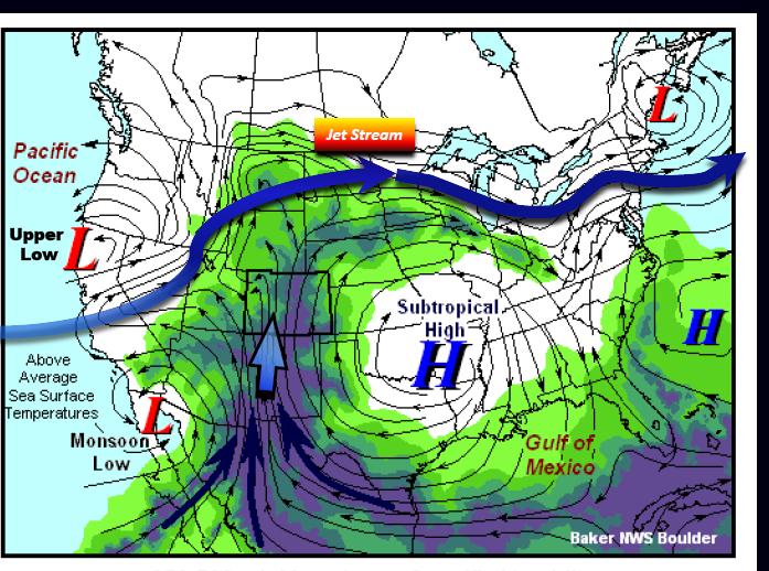
Colorado and especially Arizona and New Mexico rely on the "ridge of death" to bring in the southwest monsoon. It usually starts toward the end of July and typically lasts until early September. That's when frontal systems start making their way back down to Oklahoma with more regularity after being blocked by high pressure for several weeks. The big wild card every summer is what happens in the Gulf as tropical weather can influence the prevailing weather pattern.
So if you want cooler weather Colorado is a good place to go in July/August because of the stormy weather. Denver is still hot but has more clouds and storms around especially in the afternoons. The humidity is also noticeably higher though still lower than in Oklahoma.
There are currently 1 users browsing this thread. (0 members and 1 guests)
 Posting Permissions

 Reply With Quote
Bookmarks