Widgets Magazine
Page 7 of 12 FirstFirst ... 234567891011 ... LastLast
Results 151 to 175 of 287

Thread: Oklahoma Severe Weather Discussion - April 2011

  1. Default Re: Oklahoma Severe Weather Discussion - April 2011

    The evening run of the GFS painted a pretty bad picture for rain. Thurs/Fri seem like our best shots for any precip. After that however, almost zero in the way of any rainfall through the first couple days of May. Not really good news considering we have maybe 2 months left of our "wet" season before things dry out even more. It very well may come down to waiting for a tropical system to move on shore along the TX gulf coast and move up over us.

  2. Default Re: Oklahoma Severe Weather Discussion - April 2011

    Updated Storm Report Information...this is just for the Tulsa warning area.

    PUBLIC INFORMATION STATEMENT...UPDATED
    NATIONAL WEATHER SERVICE TULSA OK
    610 PM CDT SUN APR 17 2011

    ARZ001-002-010-011-019-020-029-OKZ049-053>076-180100-
    BENTON-CARROLL-WASHINGTON AR-MADISON-CRAWFORD-FRANKLIN-SEBASTIAN-
    PUSHMATAHA-CHOCTAW-OSAGE-WASHINGTON OK-NOWATA-CRAIG-OTTAWA-PAWNEE-
    TULSA-ROGERS-MAYES-DELAWARE-CREEK-OKFUSKEE-OKMULGEE-WAGONER-
    CHEROKEE-ADAIR-MUSKOGEE-MCINTOSH-SEQUOYAH-PITTSBURG-HASKELL-
    LATIMER-LE FLORE-
    610 PM CDT SUN APR 17 2011

    ...TORNADO DAMAGE SURVEYS ONGOING FOR 14 APRIL 2011 EVENT...
    ...13 TORNADOES CONFIRMED AT THIS TIME...

    TWO TEAMS OF METEOROLOGISTS FROM THE NATIONAL WEATHER SERVICE IN
    TULSA ARE CURRENTLY SURVEYING REPORTS OF STORM DAMAGE AND
    POSSIBLE TORNADOES FROM THE WIDESPREAD SEVERE THUNDERSTORM ACTIVITY
    ON 14 APRIL 2011.

    MOST RECENT STORM SURVEY INFORMATION...
    A TORNADO WAS CONFIRMED SOUTH OF BRANCH IN FRANKLIN COUNTY
    ARKANSAS. THIS TORNADO WAS RATED EF1.

    STORM SURVEY INFORMATION UPDATED APRIL 16...
    A TORNADO WAS CONFIRMED SOUTH TO SOUTHEAST OF BACHE IN EASTERN
    PITTSBURGH COUNTY. THIS TORNADO HAS BEEN RATED EF1.

    A SHORT TORNADO TRACK WAS FOUND NEAR JUMBO IN FAR WESTERN PUSHMATAHA
    COUNTY. THIS TORNADO HAS BEEN RATED EF1.

    ANOTHER SEPARATE TORNADO TRACK WAS LOCATED SOUTH OF DAISY ACROSS FAR
    WESTERN PUSHMATAHA COUNTY. THIS TRACK WAS ORIENTED TO THE EAST
    NORTHEAST. THIS TORNADO WAS RATED EF1.

    A TORNADO WAS CONFIRMED TO THE NORTHWEST OF THE CITY OF WAGONER IN
    WAGONER COUNTY. THIS TORNADO WAS RATED EF1.

    A TORNADO WAS CONFIRMED NEAR LAKE EACH IN DELAWARE COUNTY. THIS
    TORNADO WAS RATED EF2 BASED ON DAMAGE TO SEVERAL MOBILE HOMES AND
    SURROUNDING TREES.


    STORM SURVEY INFORMATION UPDATED APRIL 15...

    ONE OF THE DAMAGE SURVEY TEAMS HAS CONFIRMED TWO TORNADOES IN LE
    FLORE COUNTY SOUTH OF POTEAU. ONE TORNADO WAS CYCLONIC AND ONE WAS
    ANTICYCLONIC. BOTH TORNADOES HAVE BEEN RATED AS EF1. AN EF1 TORNADO
    WAS CONFIRMED FROM APPROXIMATELY 4 WSW TO 0.5 W OF TALIHINA IN
    LATIMER COUNTY. A SHORT TRACK EF0 TORNADO WAS CONFIRMED FROM 1.0
    TO 1.5 W TO 1.0 NW OF YANUSH IN LATIMER COUNTY. SURVEY TEAM COULD
    NOT CONFIRM A TORNADO IN THE ALETA/CORINNE/SOBOL AREA OF SOUTHERN
    PUSHMATAHA COUNTY. DAMAGE THERE APPEARED TO BE CONSISTENT WITH A BOW
    ECHO. ADDITIONAL DETAILS WILL BE AVAILABLE OVER THE NEXT FEW DAYS
    ONCE THE SURVEY TEAM HAS ANALYZED THE DATA COLLECTED IN THE FIELD.

    THE SECOND DAMAGE SURVEY TEAM HAS CONFIRMED THREE TORNADOES.
    TORNADO NORTHEAST OF BURBANK RATED EF0
    TORNADO 2 MILES NORTH OF HOMINY RATED EF1
    TORNADO 7 MILES EAST OF DEWEY RATED EF1
    ADDITIONAL DETAILS WILL BE AVAILABLE OVER THE NEXT FEW DAYS ONCE THE
    SURVEY TEAM HAS ANALYZED THE DATA COLLECTED IN THE FIELD.

    REPORTS OF POSSIBLE TORNADOES AND/OR DAMAGE ARE BEING INVESTIGATED
    AT THE FOLLOWING LOCATIONS. THESE REPORTS OF TORNADOES WILL REMAIN
    PRELIMINARY UNTIL A DAMAGE SURVEY HAS BEEN COMPLETED.


    SUMMARY OF CURRENT AND POTENTIAL TORNADO TRACK INFORMATION...

    IN OKLAHOMA...
    1. CONFIRMED EF1 TORNADO 2 MILES NORTH OF HOMINY...OSAGE COUNTY
    2. CONFIRMED EF0 TORNADO NE OF BURBANK...OSAGE COUNTY
    3. CONFIRMED EF1 TORNADO 7 MILES EAST OF DEWEY...WASHINGTON/NOWATA
    COUNTY LINE
    4. CONFIRMED EF1 TORNADO...POTEAU/WISTER/HOWE AREA...LE
    FLORE COUNTY
    5. CONFIRMED EF1 ANTICYCLONIC TORNADO...POTEAU/WISTER/HOWE
    AREA...LE FLORE COUNTY
    6. OCHELATA AREA...WASHINGTON COUNTY
    7. CONFIRMED EF1 NORTHWEST OF WAGONER...WAGONER COUNTY
    8. CONFIRMED EF1 SOUTH TO ENE OF DAISY...PUSHMATAHA COUNTY
    9. CONFIRMED EF1 NEAR JUMBO...PUSHMATAHA COUNTY
    10. ALETA/CORINNE/SOBOL AREA...PUSHMATAHA COUNTY. NO TORNADO
    CONFIRMED.
    11. CONFIRMED EF0 TORNADO...YANUSH AREA...LATIMER COUNTY
    12. CONFIRMED EF1 TORNADO...TALIHINA AREA...LATIMER COUNTY
    13. CASTLE AREA...OKFUSKEE COUNTY
    14. WELTY AREA...OKFUSKEE COUNTY
    15. OKFUSKEE AREA...OKFUSKEE COUNTY
    16. CONFIRMED EF2 LACK EACH AREA...DELAWARE COUNTY
    17. CONFIRMED EF1 TORNADO SOUTH OF BACHE...PITTSBURG COUNTY

    IN ARKANSAS...
    18. DYER AREA...CRAWFORD COUNTY
    19. CONFIRMED EF1 TORNADO...BRANCH AREA...FRANKLIN COUNTY


    INFORMATION FROM THIS EVENT IS STILL CONSIDERED PRELIMINARY AND
    WILL BE MODIFIED BASED ON ADDITIONAL INFORMATION THAT MAY BECOME
    AVAILABLE. UPDATED INFORMATION ON THE DAMAGE SURVEYS CAN BE FOUND
    FROM THE NWS TULSA HOMEPAGE AT WWW.WEATHER.GOV/TULSA AS WELL AS FROM
    FOLLOW UP PUBLIC INFORMATION STATEMENTS.

    ANYONE WITH INFORMATION THAT COULD ENHANCE THE RECORD OF THIS
    EVENT SHOULD CONTACT THE NATIONAL WEATHER SERVICE OFFICE IN TULSA
    AT 918-838-7838 DURING BUSINESS HOURS...OR SEND US AN E-MAIL AT
    SR-TSA.STORMREPORT@NOAA.GOV.

  3. #153

    Default Re: Oklahoma Severe Weather Discussion - April 2011

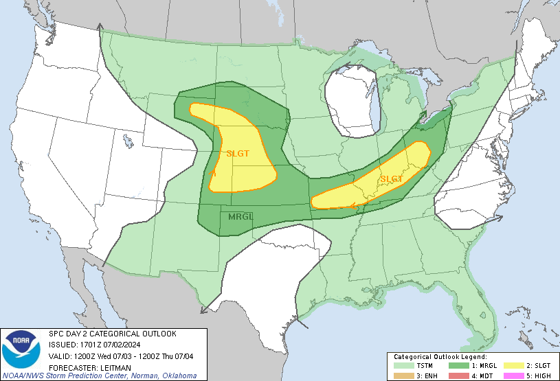
    It looks like storms will be forming in the same locations Tuesday, maybe further east along the 75 corridor. It will be interesting to see how everything looks in the morning to see if storms develop further to the west. The moderate risk area is further north and east with a slight risk for eastern OK.

    http://www.spc.noaa.gov/products/outlook/day2otlk.html

  4. Default Re: Oklahoma Severe Weather Discussion - April 2011

    http://kocoweatherblog.wordpress.com...n-returning-2/

    Is everyone ready to be soaked? :-)

  5. Default Re: Oklahoma Severe Weather Discussion - April 2011

    Going to do a quick run down based on the GFS run this evening. It looks like we are finally going to transition into Spring Time with extended periods of storm chances and yes...severe weather nearly every day we have a chance for storms. It looks like the pattern may start to chance in Early May. So hopefully...we get a decent amount of water finally.

    Tues 4/19 - Ahead of the dryline tomorrow instability will be very high, but it appears it will get quickly over taken by the front by the early afternoon. Best chance for any severe weather looks confined to far eastern and southeast OK. There is a slight risk east of I-35 tomorrow with a moderate risk over far eastern OK, but I wouldn't be shocked to see that moved even more E or SE based on the front's speed.

    Weds 4/20 - Some remnant rain in SE OK, otherwise dry.

    Thurs 4/21 - Front will be retreating across OK as a warm front. Instability will be increasing through he day. Severe risk will be mainly south of I-40, but rain chances will increase state wide...beginning in the morning.

    Fri 4/22 - Scattered showers and storms throughout the day. Instability will increase along the I-44 corridor with severe storms possible.

    Sat 4/23 - Again a chance for storms across the state. Severe weather possible most areas except NW OK.

    Sun 4/24 - Same thing. Chance of storms. Severe weather is possible but not as high as previous days. GFS is pinpointing significant rainfall in Central OK through the first half of the day. However, I'm a bit skeptic on seeing 3 to 6 inches of rain unless we get a cluster of storms that just park it. Anything that extreme though would likely cause flash flooding with our concrete soil.

    Mon 4/25 - Chance for more widespread significant rain fall over 1" early in the day, then more concentrated in the SE 1/3rd of OK by evening. Severe risk is slight with CAPE not really forecast to be all that great.

    Tue 4/26 - Looks mostly dry but very unstable. Could see some scattered storms.

    Weds 4/27 - Storms east of I-35 early, otherwise fairly dry. Dryline in the state, but instability pretty low.

    Thur 4/28 - Dry.

    Fri 4/29 - No widespread areas of precip forecast, but instability will be high ahead of a dryline across most of OK except for far western sections.

    Sat 4/30 - Dryline remains in play...sitting mostly over western OK. Instability is forecast to very high with scattered/isolated storms. Severe looks possible.

    Sun 5/1 - Dryline backs into the panhandle some. Again, very high to extreme instability. Scattered/isolated storms. Yup...its May.

    Mon 5/2 - Dryline moves some, but not much back into OK. Again, high to extreme instability with scattered storms. Severe chances as expected this time of year.

    Tue 5/3 - A day a lot of people get nervous on, but doesn't seem as bad as the previous days. Some widespread areas of rain expected and moderate to high instability will provide risk for some severe.

    Wed 5/4 - Widespread rain early then getting more isolated late. Front comes through from the NW and starts to clear things out. Severe weather doesn't look probably except for spill over from the 3rd.

  6. Default Re: Oklahoma Severe Weather Discussion - April 2011

    Tue 5/3 - A day a lot of people get nervous on, but doesn't seem as bad as the previous days. Some widespread areas of rain expected and moderate to high instability will provide risk for some severe.
    I agree. Each year on that date, basically just about everyone is usually expecting a monster hurling down their path.

  7. Default Re: Oklahoma Severe Weather Discussion - April 2011


    MESOSCALE DISCUSSION 0471
    NWS STORM PREDICTION CENTER NORMAN OK
    0140 PM CDT TUE APR 19 2011

    AREAS AFFECTED...PORTIONS OF WRN AR / ERN OK / N-CNTRL TX

    CONCERNING...SEVERE POTENTIAL...WATCH LIKELY

    VALID 191840Z - 191945Z

    A TORNADO WATCH WILL LIKELY BE REQUIRED BY MID AFTERNOON. STORM
    INITIATION IS FIRST EXPECTED OVER ERN OK/NWRN AR ALONG COLD FRONT.
    LARGE TO VERY LARGE HAIL AND DMGG WINDS WILL BE THE PRIMARY HAZARDS
    BUT AN ISOLD TORNADO RISK SEEMS TO BE EVOLVING...ESPECIALLY OVER ERN
    OK AND THEN EVENTUALLY INTO WRN AR AND PERHAPS FAR NERN TX.

    18Z SURFACE ANALYSIS PLACES A COLD FRONT LOCATED FROM NEAR JLN SWWD
    NEAR ADM WITH AN ATTENDANT DRYLINE EXTENDING SWD NEAR THE AUS AND
    SAT VICINITY. THE AIRMASS HAS BECOME QUITE UNSTABLE AHEAD OF THE
    EWD MOVING SURFACE FEATURES WITH MLCAPE ALREADY 3000-4000 J/KG /PER
    OBJECTIVE ANALYSIS/ AND EXPECTED TO INCREASE AND BECOME EXTREMELY
    UNSTABLE AS TEMPS CLIMB WELL INTO THE 80S/90S. WATER VAPOR IMAGERY
    SHOWS A SHORTWAVE TROUGH CURRENTLY MOVING INTO WRN OK AND HEIGHT
    FALLS ASSOCIATED WITH THE DISTURBANCE MAY GLANCE THE REGION AS FAR S
    AS N-CNTRL TX. THIS COMBINED WITH HEATING AND LOW LEVEL
    CONVERGENCE/FRONTAL LIFT WILL ENABLE THE CAP TO ERODE INITIALLY
    ACROSS ERN OK/FAR NWRN AR WHERE CU ARE ALREADY BECOMING AGITATED
    ALONG THE BOUNDARY AND WHERE STORM COVERAGE WILL LIKELY BE GREATEST
    /N OF THE RED RIVER/. FARTHER S...THE CAP IS EXPECTED TO BE
    BREACHED LOCALLY--RESULTING IN WIDELY SCATTERED STORMS. GIVEN THE
    VERY UNSTABLE AIRMASS AND INCREASING MID-UPPER WSWLY/S...UPDRAFTS
    WILL RAPIDLY DEVELOP WITH SUPERCELLS THE FAVORED STORM MODE. A
    LARGE TO VERY LARGE HAIL THREAT WILL LIKELY EXIST...IN ADDITION TO
    DMGG WINDS AND SOME TORNADO POTENTIAL. THE TORNADO RISK APPEARS
    GREATEST GENERALLY OVER OK/AR/FAR NERN TX WHERE LOW LEVEL FLOW IS
    FORECAST TO BE STRONGEST.


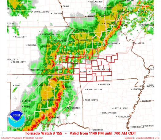
    URGENT - IMMEDIATE BROADCAST REQUESTED
    TORNADO WATCH NUMBER 155
    NWS STORM PREDICTION CENTER NORMAN OK
    220 PM CDT TUE APR 19 2011

    THE NWS STORM PREDICTION CENTER HAS ISSUED A
    TORNADO WATCH FOR PORTIONS OF

    WESTERN ARKANSAS
    EASTERN OKLAHOMA
    NORTH-CENTRAL AND NORTHEAST TEXAS

    EFFECTIVE THIS TUESDAY AFTERNOON AND EVENING FROM 220 PM UNTIL
    1000 PM CDT.

    SEVERAL TORNADOES
    WIDELY SCATTERED DAMAGING WINDS
    ISOLATED WIND GUSTS TO 70 MPH POSSIBLE
    WIDESPREAD LARGE HAIL
    HAIL TO 4.0 INCHES IN DIAMETER LIKELY

    THE TORNADO WATCH AREA IS APPROXIMATELY ALONG AND 85 STATUTE
    MILES EAST AND WEST OF A LINE FROM 15 MILES NORTH OF HARRISON
    ARKANSAS TO 60 MILES EAST SOUTHEAST OF DALLAS TEXAS. FOR A
    COMPLETE DEPICTION OF THE WATCH SEE THE ASSOCIATED WATCH OUTLINE
    UPDATE (WOUS64 KWNS WOU5).

    REMEMBER...A TORNADO WATCH MEANS CONDITIONS ARE FAVORABLE FOR
    TORNADOES AND SEVERE THUNDERSTORMS IN AND CLOSE TO THE WATCH
    AREA. PERSONS IN THESE AREAS SHOULD BE ON THE LOOKOUT FOR
    THREATENING WEATHER CONDITIONS AND LISTEN FOR LATER STATEMENTS
    AND POSSIBLE WARNINGS.

    OTHER WATCH INFORMATION...CONTINUE...WW 154...

    DISCUSSION...EXPLOSIVE TSTM DEVELOPMENT IS EXPECTED ALONG COLD FRONT
    THIS AFTERNOON AS IT ENCOUNTERS A STRONGLY UNSTABLE AIR MASS WITH
    MLCAPE APPROACHING 3000-4500 J/KG. DEEP-LAYER SHEAR VECTORS
    ORIENTED AT AN ANGLE TO THE FRONT IS SUGGESTIVE OF SUPERCELL
    EVOLUTION GIVEN THE DEGREE OF INSTABILITY AND 40-50 KT SWLY MIDLEVEL
    WIND FIELD. VERY LARGE HAIL /I.E. GREATER THAN BASEBALL SIZE/ WILL
    BE POSSIBLE IN ADDITION TO A RISK OF A FEW TORNADOES GIVEN EFFECTIVE
    SRH VALUES OF 150-300 M2/S2.

    AVIATION...TORNADOES AND A FEW SEVERE THUNDERSTORMS WITH HAIL
    SURFACE AND ALOFT TO 4 INCHES. EXTREME TURBULENCE AND SURFACE
    WIND GUSTS TO 60 KNOTS. A FEW CUMULONIMBI WITH MAXIMUM TOPS TO
    600. MEAN STORM MOTION VECTOR 25030.

  8. Default Re: Oklahoma Severe Weather Discussion - April 2011

    Have been watching this storm and it has been showing signs of rotation for about 30 minutes and now in an area already suffering...

    BULLETIN - EAS ACTIVATION REQUESTED
    TORNADO WARNING
    NATIONAL WEATHER SERVICE NORMAN OK
    331 PM CDT TUE APR 19 2011

    THE NATIONAL WEATHER SERVICE IN NORMAN HAS ISSUED A

    * TORNADO WARNING FOR...
    CENTRAL ATOKA COUNTY IN SOUTHEAST OKLAHOMA...

    * UNTIL 415 PM CDT

    * AT 332 PM CDT...NATIONAL WEATHER SERVICE RADAR INDICATED A SEVERE
    THUNDERSTORM CAPABLE OF PRODUCING A TORNADO NEAR ATOKA...MOVING
    EAST AT 35 MPH.

    * LOCATIONS IN THE WARNING INCLUDE ATOKA RESERVOIR...ATOKA...DAISY...
    NORTHERN MCGEE CREEK LAKE...REDDEN AND STRINGTOWN.

  9. Default Re: Oklahoma Severe Weather Discussion - April 2011

    Comparing tonight GFS to last nights does dry things out long term again and not as much rain in the forecast. However, these flop around all the time so here is just a quick update.

    4/20 - Chance of showers/storms far SE OK.
    4/21 - Chance of showers/storms statewide, maybe some strong storms in south central OK mainly south of I-40.
    4/22 - Risk of severe weather roughly east of a line from Altus to Weatherford to Ponca City. Looks like highest probably of any rotating storms will be I-40 and north.
    4/23 - Storm chances move southeast of a line from Wichita Falls to Ada to Muskogee...give or take.
    4/24 - Looks like a fairly widespread chance area of showers/storms. Some will be severe. North Central OK may be the one area that doesn't see much.
    4/25 - Chance of storms shifts east of I-35 and wrapping around back into North Central OK.
    4/26 to 4/29 - Looks Dry.
    4/30 - Chance of storms central to north central OK.
    5/1 - Chance of storms east of I-35.
    5/2 to 5/5 - Looks dry as well.

  10. #160

    Default Re: Oklahoma Severe Weather Discussion - April 2011

    The NWS is forcasting 3-4 inches or rain for south central Oklahoma within the next five days.

  11. #161

    Default Re: Oklahoma Severe Weather Discussion - April 2011

    Quote Originally Posted by jn1780 View Post
    The NWS is forcasting 3-4 inches or rain for south central Oklahoma within the next five days.
    Hopefully that happens.

  12. #162

    Default Re: Oklahoma Severe Weather Discussion - April 2011

    It will suck on Easter as we have around 20 folks coming over but we cannot be choosy at this point

  13. Default Re: Oklahoma Severe Weather Discussion - April 2011

    Quote Originally Posted by Easy180 View Post
    It will suck on Easter as we have around 20 folks coming over but we cannot be choosy at this point
    Make plans for indoor event.


  14. #164

    Default Re: Oklahoma Severe Weather Discussion - April 2011

    Thursday, April 21


    They updated their outlook graphics. You can now trigger interstates, cities, and counties which is a nice feature. Slight risk color was changed from green to yellow.

  15. Default Re: Oklahoma Severe Weather Discussion - April 2011

    With that graphic above saying Day 2, I assume that is for tomorrow, counting today as 1.

    Oh, venture, where are you?

  16. #166

    Default Re: Oklahoma Severe Weather Discussion - April 2011

    Im doing a rain dance right now.. It better rain right over my house..

  17. Default Re: Oklahoma Severe Weather Discussion - April 2011

    Mmmk. Going to try to get a bit more specific with this forecast...but also have 6 days I'm going to cover. I won't go past Monday at this point since it seems to dry out. Side note right away, there is some disagreement between GFS and NAM throughout this forecast period, for the most part i've settled on a blend of the two, but it appears ECMWF is the favored model right now...but its access is restricted from the general public.

    Today - 4/20/11 - Outlook Map

    The easy day out of everything. Front is starting to hang up in Texas. Southeast OK may see some showers this afternoon/evening...mainly east of an Ardmore/Ada/Muskogee line. Other than that a pretty cool and enjoyable day.


    Thursday - 4/21/11 - Outlook Map

    Severe risk will increase as the front moves back north as the day goes by. Dryline will be established out in the panhandles, but may not be a major player. This looks to be a fairly widely scattered setup where not everyone will get rain, but it can happen nearly anywhere in the state. Most of the storms should be elevated and be mostly heavy rain and severe hail producers.

    Generalized rainfall amounts from 0.10 to 0.25".

    Additional details in the SPC DY2 Outlook...

    WEAK MID LEVEL HEIGHT FALLS WILL OVERSPREAD THE CNTRL ROCKIES INTO
    THE CNTRL PLAINS DURING THE DAY2 PERIOD AS WRN U.S. TROUGH BEGINS TO
    SHIFT EAST. SEVERAL EMBEDDED SPEED MAXIMA/SHORTWAVES WILL EJECT
    WITHIN SWLY FLOW ALOFT ACROSS THE 4-CORNERS REGION ATOP COOLER
    RETREATING SFC ANTI-CYCLONE OVER THE PLAINS. AS A RESULT...BROAD
    LOW LEVEL WARM ADVECTION WILL INDUCE MOISTENING THROUGH
    ASCENT/ADVECTION NORTH OF RETREATING WARM FRONT ACROSS THE SRN
    PLAINS INTO THE MID MS VALLEY REGION WHERE STEEP MID LEVEL LAPSE
    RATES ARE WELL ESTABLISHED. DESPITE THE INCREASING WARM ADVECTION
    THE AFOREMENTIONED STEEP LAPSE RATES AND SIGNIFICANT INHIBITION WILL
    LIKELY PROVE AN IMPEDIMENT TO ORGANIZED SEVERE THUNDERSTORM
    DEVELOPMENT NEAR THE IMMEDIATE FRONTAL ZONE. FOR THIS REASON IT
    APPEARS THE MORE ORGANIZED CONVECTIVE THREAT WILL EVOLVE
    CONSIDERABLY NORTH OF THE WARM FRONT AND THUNDERSTORMS SHOULD BE
    ROOTED AOA 850MB WITHIN THE STRONGEST LOW LEVEL JET CORE. GIVEN
    THAT WARM ADVECTION WILL BE THE PRIMARY INSTIGATOR IN THIS
    DEVELOPMENT ELEVATED THUNDERSTORMS COULD DEVELOP THROUGHOUT THE
    PERIOD...BUT MAY BE MORE CONCENTRATED DURING THE NOCTURNAL PEAK IN
    LLJ. LARGE HAIL WILL BE THE THREAT WITH THIS ACTIVITY.
    Friday - 4/22/11 - Outlook Map

    Friday could be more elevated severe weather day. I've added an "enhanced" area ahead of the cold front and dryline. Storms appear as they will fire along of the boundaries early in the afternoon, especially in SW OK. Storms will move to the ENE or East along the boundaries through the day. After dark additional showers and storms are likely to develop across southern sections and over most of Northern Oklahoma behind the front. Setup appears favorable for rotating storms with large hail and tornadoes. However, details can change a lot just 12 hours before...so don't get hung up too much. Low level surface winds don't appear to be all that strong, so that may limit the tornado threat some.

    Generalized rainfall amounts from 0.5 to 1.0" depending on storm locations.

    Additional details in the SPC DY3 Outlook...

    DAY 3 CONVECTIVE OUTLOOK
    NWS STORM PREDICTION CENTER NORMAN OK
    0228 AM CDT WED APR 20 2011

    VALID 221200Z - 231200Z

    ...THERE IS A SLGT RISK OF SVR TSTMS FROM THE SOUTHERN PLAINS TO THE
    MIDDLE MS/LOWER OH RIVER VALLEYS...

    ...SOUTHERN PLAINS/LOWER MO VALLEY TO THE MIDDLE MS/LOWER OH RIVER
    VALLEYS...

    AT LEAST MODEST HEIGHT FALLS WILL CONTINUE TO OVERSPREAD MUCH OF THE
    CENTRAL STATES ON FRIDAY AS A SHORTWAVE TROUGH/ATTENDANT POLAR JET
    ARE EXPECTED TO ADVANCE NORTHEASTWARD OVER THE UPPER MIDWEST TOWARD
    THE UPPER MS VALLEY/UPPER GREAT LAKES REGION. A CORRESPONDING
    SURFACE LOW SEEMS LIKELY TO ADVANCE/POTENTIALLY DEEPEN NORTHEASTWARD
    FROM KS EARLY FRIDAY TO THE UPPER MS RIVER VALLEY/UPPER GREAT LAKES
    VICINITY FRIDAY NIGHT...WHILE A SECONDARY SURFACE LOW REMAINS
    ANCHORED ACROSS NORTHWEST TX/FAR WESTERN OK.

    INITIALLY...AT THE TERMINUS OF A STRONG/VEERING LOW LEVEL
    JET...ELEVATED TSTMS CAPABLE OF SEVERE HAIL ARE LIKELY TO BE ONGOING
    FRIDAY MORNING ACROSS THE LOWER MO VALLEY/OZARKS TOWARD THE LOWER OH
    RIVER VALLEY. WHILE THE EXACT IMPACTS OF THIS EARLY DAY CONVECTION
    ARE UNCERTAIN...AS THIS ACTIVITY COULD EFFECTIVELY IMPEDE THE DEGREE
    OF MOISTENING/DESTABILIZATION WITH NORTHWARD EXTENT...AN
    INCREASINGLY MOIST AIRMASS /LOWER TO MIDDLE 60S F SURFACE DEWPOINTS/
    WILL OTHERWISE CONTINUE TO RETURN NORTH-NORTHEASTWARD ACROSS THE
    MIDDLE MS/LOWER OH VALLEYS AHEAD OF AN ADVANCING SURFACE LOW AND
    NORTHEAST-SOUTHWEST ORIENTED COLD FRONT.

    AS THE PRE-COLD FRONTAL AIRMASS BECOMES MODERATELY UNSTABLE DURING
    THE AFTERNOON...CURRENT THINKING IS THAT SURFACE BASED TSTMS WILL
    DEVELOP BY LATE AFTERNOON/EARLY EVENING...ESPECIALLY ACROSS
    MO/PERHAPS WESTERN IL ALONG/AHEAD OF THE COLD FRONT...SOUTHWESTWARD
    INTO OK NEAR/EAST OF AN EXPECTED SURFACE LOW AND FRONTAL
    BOUNDARY/DRYLINE TRIPLE POINT ACROSS WESTERN OK. GIVEN MODERATELY
    STRONG CYCLONIC UPPER FLOW ALOFT /40-55 KT AROUND 500 MB/ COLOCATED
    WITH THE FRONTAL ZONE/ADJACENT MOIST AXIS...INITIAL MODAL SUPERCELLS
    AND SUBSEQUENTLY EVOLVING LINEAR CLUSTERS /DURING THE EVENING/ WILL
    POSE AN INITIAL LARGE HAIL THREAT IN ADDITION TO THE POSSIBILITY OF
    TORNADOES AND DAMAGING WINDS. THE SEVERE THREAT WILL LIKELY DEVELOP
    EASTWARD ACROSS THE OH VALLEY FRIDAY NIGHT.

    FARTHER SOUTH ACROSS TX...OTHER MORE ISOLATED SEVERE TSTMS /HAIL AS
    THE MAIN THREAT/ MAY DEVELOP IN VICINITY OF THE DRYLINE ACROSS
    WEST-CENTRAL TX FRIDAY AFTERNOON/EARLY EVENING.
    Saturday - 4/23/11 - Outlook Map

    Front will continue to move to the southeast some but stall out...again. Severe threat doesn't look very high, but a condition thread with instability still in the moderate to high categories. Best chance of storms appear to be south and east of I-44, but rain possible (maybe even likely) statewide.

    Generalized rainfall amounts from 0.5 to 1.0" depending on storm locations, especially along I-44 corridor.

    Sunday - 4/24/11 - Outlook Map

    Not a major day, most just wet with some isolated storms around. Best areas appear south of I-44 and out in the panhandles where instability will be best. Severe threat looks pretty low and marginal though.

    Generalized rainfall amounts around 1 to 2 inches along I-44...lower towards the SE higher in the NE where amounts could hit 3 inches.

    Monday - 4/25/11 - Outlook Map

    System will start to move out over Oklahoma. Low with a dryline extending south should be in Northern OK with a cold front back in the panhandles (also stretching up into Kansas to another low). Risk of severe weather looks probably ahead of the dryline and near the low pressure center.

    Rainfall amounts light west (under 0.25"), around 0.25 to a half inch central and up to an inch east.

  18. #168

    Default Re: Oklahoma Severe Weather Discussion - April 2011

    Forecast for the 22nd is exactly what I was hoping not to see. Flying in (and out) that day and arriving back in the early afternoon.

  19. Default Re: Oklahoma Severe Weather Discussion - April 2011

    Chat room is up for the duration of the severe weather now. For those that are regulars, if you want to send me a private message on the forum here with your email address...I'll send you an invite email for the chat room. This will contain a link to keep you from having to get cleared by a moderator to chat.

    Severe risk for hail storms increasing through the night...

    ...OVERNIGHT/MORNING -- SRN PLAINS TO AR...
    TSTMS FCST TO DEVELOP OVER PORTIONS N TX...OK AND/OR AR IN BROAD
    REGIME OF STG ISENTROPIC LIFT...AS WAA AND RELATED LLJ STRENGTHEN
    AFTER 03Z. STEEP LOW-MIDLEVEL LAPSE RATES ASSOCIATED WITH ELEVATED
    MIXED-LAYER AIR...ALONG WITH MOISTURE ADVECTION/TRANSPORT...WILL
    YIELD 1000-2000 J/KG MUCAPE AMIDST FAVORABLE DEEP-LAYER SHEAR FOR A
    FEW BETTER-ORGANIZED TSTMS TO PRODUCE SVR HAIL.

  20. Default Re: Oklahoma Severe Weather Discussion - April 2011

    Bulletin - immediate broadcast requested
    severe thunderstorm warning
    national weather service norman ok
    1036 pm cdt wed apr 20 2011

    the national weather service in norman has issued a

    * severe thunderstorm warning for...
    Carter county in southern oklahoma...
    Northwestern love county in southern oklahoma...
    Central murray county in southern oklahoma...

    * until 1115 pm cdt

    * at 1036 pm cdt...national weather service radar indicated a severe
    thunderstorm 3 miles south of wilson...moving northeast at 30 mph.

    Hazards in the warning include...
    Hail up to the size of half dollars...

    * locations in the warning include ardmore...courtney...gene autry...
    Lone grove...milo...northwestern lake murray...rubottom...springer
    and wilson.

  21. Default Re: Oklahoma Severe Weather Discussion - April 2011

    Interesting. Prayers answered. Now the wrath of Mother Nature (or God, depending on your belief).

  22. Default Re: Oklahoma Severe Weather Discussion - April 2011

    Tomorrow forecast looks pretty spot on to earlier.

    Thursday - 4/21/11 - Outlook Map

    Severe risk pretty much state wide for severe hail. Largest hail possibilities appear to be down along the Red River.

    Additional details in the SPC DY1 Outlook...

    ...PORTIONS OK/KS/MO/AR THROUGHOUT PERIOD...
    SCATTERED TSTMS ARE POSSIBLE AT START OF PERIOD OVER PORTIONS ERN
    OK/WRN AR...INVOF NWD-MOVING/850-800 MB LAYER WARM FRONT WHERE
    ISENTROPIC ASCENT TO LFC IS OCCURRING IN REGIME OF INCREASING
    LOW-LEVEL MOISTURE. STEEP MIDLEVEL LAPSE RATES AND 30-45 KT
    EFFECTIVE SHEAR MAGNITUDES MAY SUPPORT AT LEAST ISOLATED SVR HAIL
    FROM BEST-ORGANIZED TSTMS. CONVECTION SHOULD MOVE NEWD OVER SRN
    OZARKS REGION THROUGH MID-DAY AND WEAKEN. SECOND ROUND OF ELEVATED
    TSTMS SHOULD DEVELOP OVERNIGHT...AFTER ABOUT 22/06Z...OVER PORTIONS
    WRN/NWRN OZARKS REGION NWD ACROSS WRN MO/ERN KS. SIMILAR VALUES OF
    LOW-LEVEL MOISTURE...MIDLEVEL LAPSE RATES AND DEEP-LAYER SHEAR ARE
    EXPECTED AS WITH EARLIER CONVECTION FARTHER S. ENOUGH UNCERTAINTY
    EXISTS ON SPATIAL SEPARATION BETWEEN TEMPORALLY DISTINCT REGIMES
    THAT HAIL OUTLOOK AREAS ARE COMBINED ATTM.
    Friday - 4/22/11 - Outlook Map

    GFS and NAM continue to disagree. They are roughly 75 miles or so apart from each other (NAM being the further east solution). NAM dries most of Oklahoma out overnight so going into the day, there shouldn't be much ongoing precip. GFS on the other hand continues to indicate ongoing activity across most of Central and Eastern OK. With severe development starting around 1PM in SW OK moving up I-44. Additional activity should be ongoing along I-44 by 7PM from Chickasha to the OK/MO border. The big issue is going to be how fast does the cold front move in. NAM has it passing central OK by early afternoon where as the GFS has the cold front hanging up just north of I-40 and keeping the dryline back along I-44. So if we would go by the GFS for this, we would easily be looking at a Moderate Risk situation. Supercell potential will be north of 90% with very favorable winds for rotating storms and tornadoes. Conditions remain favorable after dark as well and GFS maintains developments of strong storms in Central Oklahoma.

    SPC Day 2 Outlook is not available yet as of this writing.

    Will post more in a few on the rest of the weekend.

  23. Default Re: Oklahoma Severe Weather Discussion - April 2011

    Saturday - 4/23/11 - Outlook Map

    Storm chances continue as the front lingers in the state. Again, GFS and NAM are split on the positioning of the boundaries. NAM dries out Oklahoma by later afternoon/early evening except for far SE OK. However it does paint a general area of rain over most of OK SE of I-44. GFS is slightly different. It does move the front into SE OK, but not all the way through. It also keeps areas along and southeast of I-44 wet for most of the day. By midnight, rainfall rates begin to increase as moisture starts to increase again as the front begins to move back north.

    The Day 3 outlook is not issues yet, but will post once it comes out.

    Sunday - 4/24/11 - Outlook Map

    NAM doesn't go that far into Sunday but it does develop rain and some storms across the southern half of Oklahoma through mid morning. GFS has the full day covered so that is the basis for this discussion. The boundary will be moving NW through the state but is forecast to washout by early afternoon. A dryline will sharpen in the TX panhandle as the storm system begins to mature in the Rockies. Strong SE winds will open up the Gulf right back into Oklahoma. Instability will increase through the day and get to moderate/high levels by evening. Forecast soundings do indicate the probability that storms that do form will likely go severe with large hail. Tornadic potential will also be there. Most precip looks like it will be along and north of I-44.

    Saturday - 4/24/11 - Outlook Map

    Storm chances continue as the front lingers in the state. Again, GFS and NAM are split on the positioning of the boundaries. NAM dries out Oklahoma by later afternoon/early evening except for far SE OK. However it does paint a general area of rain over most of OK SE of I-44. GFS is slightly different. It does move the front into SE OK, but not all the way through. It also keeps areas along and southeast of I-44 wet for most of the day. By midnight, rainfall rates begin to increase as moisture starts to increase again as the front begins to move back north.

    The Day 3 outlook is not issues yet, but will post once it comes out.

    Monday - 4/25/11 - Outlook Map

    Severe risk will continue into Monday. The dryline will be racing east across the state and move through central OK by early evening. Storms will be likely ahead of the front. The cold front extending from a strong low in Kansas will move through NW OK into central sections by evening. Additional strong to marginally severe storms will be possible along this boundary. Highest severe potential though will be in eastern OK.

    Extended Outlook...

    4/26 - Storm chances continue in SE OK and also NW OK.
    4/27 - Chance of storms early in Western OK & SE OK then dry.
    4/30 - Chance of storms I-44 corridor and to the south.
    5/3 - Chance of storms across most of OK.
    5/4 - Chance of storms across most of OK. Severe possible.
    5/5 - Chance of storms across most of OK.
    5/6 - Chance of storms across most of OK. Severe possible.

  24. Default Re: Oklahoma Severe Weather Discussion - April 2011

    Day 2 Discussion is now available...they have extended the enhanced risk area over most of Oklahoma from Lawton to Watonga and back to the NE.

    DAY 2 CONVECTIVE OUTLOOK
    NWS STORM PREDICTION CENTER NORMAN OK
    1258 AM CDT THU APR 21 2011

    VALID 221200Z - 231200Z

    ...THERE IS A SLGT RISK OF SVR TSTMS FROM THE SOUTHERN PLAINS/OZARKS TO THE MIDDLE MS/OH RIVER VALLEYS...

    ...SYNOPSIS...
    A SLIGHT AMPLIFICATION OF THE LARGE SCALE PATTERN WILL CONTINUE TO OCCUR INTO FRIDAY...AS AT LEAST MODEST HEIGHT FALLS OVERSPREAD MUCH OF THE CENTRAL STATES ON FRIDAY AS A SHORTWAVE TROUGH/ATTENDANT POLAR JET SPREAD NORTHEASTWARD OVER THE UPPER MIDWEST TOWARD THE UPPER MS VALLEY/UPPER GREAT LAKES REGION. A CORRESPONDING SURFACE LOW SEEMS LIKELY TO ADVANCE/EVENTUALLY DEEPEN NORTHEASTWARD FROM THE SOUTH-CENTRAL PLAINS EARLY FRIDAY TO THE UPPER MS RIVER VALLEY/UPPER GREAT LAKES VICINITY FRIDAY NIGHT...WHILE A SECONDARY SURFACE LOW WILL BE ANCHORED ON THE WEST EDGE OF THE MOIST SECTOR ACROSS NORTHWEST TX/FAR SOUTHWEST OK.

    ...SOUTHERN PLAINS/OZARKS TO THE MIDDLE MS/LOWER OH VALLEYS...
    INITIALLY...AT THE TERMINUS OF A STRONG/SPLIT AND GRADUALLY VEERING LOW LEVEL JET...ELEVATED TSTMS CAPABLE OF SEVERE HAIL ARE LIKELY TO BE ONGOING FRIDAY MORNING WITHIN A CORRIDOR ACROSS THE LOWER MO VALLEY/MIDDLE MS VALLEY TOWARD THE LOWER OH VALLEY. AN ISOLATED SEVERE HAIL THREAT MAY CONTINUE THROUGH THE MORNING AS STORMS SPREAD EASTWARD ON THE EDGE OF THE EASTWARD ADVANCING LOWER MO VALLEY ELEVATED MIXED LAYER.

    THIS EARLY DAY CONVECTION CREATES A DEGREE OF UNCERTAINTY REGARDING THE SPATIAL EXTENT OF THE SUBSEQUENT AFTERNOON/EVENING WARM/MOIST SECTOR FOR AREAS SUCH AS NORTHEAST MO INTO CENTRAL/SOUTHERN PORTIONS OF IL/INDIANA...AS THIS EARLY DAY ACTIVITY COULD EFFECTIVELY IMPEDE THE DEGREE OF MOISTENING/SURFACE BASED STABILIZATION WITH NORTHWARD EXTENT. REGARDLESS...AN INCREASINGLY MOIST AIRMASS...CHARACTERIZED BY LOWER TO MIDDLE 60S F SURFACE DEWPOINTS WILL OTHERWISE QUICKLY RETURN NORTH-NORTHEASTWARD ACROSS THE MIDDLE MS/LOWER OH VALLEYS AHEAD OF THE NORTHEASTWARD ADVANCING MIDWEST SURFACE LOW AND NORTHEAST-SOUTHWEST ORIENTED COLD FRONT.

    THE PRE-COLD FRONTAL AIRMASS WILL LIKELY BECOME MODERATELY TO STRONGLY UNSTABLE DURING THE AFTERNOON...WITH 1000-2500 J/KG MLCAPE PROBABLE ACROSS PORTIONS OF MO/DOWNSTATE IL...AND STRONGER 3000+ J/KG MLCAPE ACROSS OK/FAR NORTH TX. CURRENT THINKING IS THAT SURFACE BASED TSTMS WILL DEVELOP BY LATE AFTERNOON/EARLY EVENING...ESPECIALLY ACROSS THE EASTERN/SOUTHERN HALVES OF MO INTO WESTERN IL ALONG/AHEAD OF THE COLD FRONT...AS WELL AS SOUTHWESTWARD INTO FAR SOUTHEAST KS/FAR NORTHWEST AR...AND OK NEAR/NORTHEAST OF AN EXPECTED SURFACE LOW AND FRONTAL BOUNDARY/DRYLINE TRIPLE POINT.

    GIVEN STRONG CYCLONIC MID-UPPER FLOW ALOFT /45-60 KT AROUND 500 MB/ COLOCATED WITH THE FRONTAL ZONE/ADJACENT MOIST SECTOR...INITIAL MODAL SUPERCELLS ARE PROBABLE...WITH LARGE HAIL AND TORNADOES POSSIBLE. CURRENT THINKING IS THE RELATIVELY GREATEST TORNADO THREAT MAY EXIST ACROSS EAST/SOUTHEAST MO INTO DOWNSTATE IL FRIDAY LATE AFTERNOON/EARLY EVENING...AHEAD OF THE ADVANCING SURFACE LOW AND ALONG/JUST SOUTH OF WHAT MAY BE A CONVECTIVELY REINFORCED WEST-EAST EFFECTIVE FRONTAL ZONE...ALTHOUGH A TORNADO THREAT WILL EXIST SOUTHWESTWARD INTO OK AS WELL.

    BY FRIDAY EVENING...A MORE LINEAR CONVECTIVE MODE IS LIKELY TO EVOLVE ESPECIALLY ACROSS THE OH VALLEY...WITH UPSCALE GROWING QUASI-LINEAR CLUSTERS/BOWING SEGMENTS POSING A DAMAGING WIND/ISOLATED TORNADO RISK FRIDAY NIGHT. FARTHER SOUTHWEST ACROSS THE REMAINDER OF THE NORTHEAST-SOUTHWEST FRONTAL ZONE...OTHER TSTMS WILL CONTINUE TO POSE AT LEAST AN ISOLATED SEVERE HAIL THREAT FRIDAY NIGHT ACROSS SOUTHERN MO/NORTHERN AR INTO OK AMID A WARM ADVECTION/ISENTROPIC LIFT REGIME ALONG/NORTH OF THE SURFACE FRONT.

  25. Default Re: Oklahoma Severe Weather Discussion - April 2011


Thread Information

Users Browsing this Thread

There are currently 7 users browsing this thread. (0 members and 7 guests)

Similar Threads

  1. US Volcano Activity Discussion - 2011
    By venture in forum Current Events & Open Topic
    Replies: 9
    Last Post: 09-17-2011, 06:17 PM
  2. Oklahoma Severe Weather Discussion - March 2011
    By venture in forum Weather & Geosciences
    Replies: 94
    Last Post: 04-03-2011, 11:39 AM
  3. Winter Weather Discussion - Jan/Feb 2011
    By venture in forum Weather & Geosciences
    Replies: 620
    Last Post: 02-23-2011, 02:31 AM
  4. Winter Weather Discussion - Feb 2011
    By Matt in forum Current Events & Open Topic
    Replies: 0
    Last Post: 01-31-2011, 02:28 AM
  5. Oklahoma Weather!
    By houseguy2007 in forum Weather & Geosciences
    Replies: 2
    Last Post: 08-04-2010, 05:27 PM

Bookmarks

Posting Permissions

  • You may not post new threads
  • You may not post replies
  • You may not post attachments
  • You may not edit your posts
  •  
Single Sign On provided by vBSSO