Widgets Magazine
Page 4 of 6 FirstFirst 123456 LastLast
Results 76 to 100 of 142

Thread: Oklahoma Severe Weather Discussion - May 2012

  1. Default Re: Oklahoma Severe Weather Discussion - May 2012


    MESOSCALE DISCUSSION 0963
    NWS STORM PREDICTION CENTER NORMAN OK
    0306 PM CDT TUE MAY 29 2012

    AREAS AFFECTED...SW KS...WRN OK...NW TX

    CONCERNING...SEVERE POTENTIAL...WATCH LIKELY

    VALID 292006Z - 292130Z

    PROBABILITY OF WATCH ISSUANCE...95 PERCENT

    SUMMARY...A SEVERE THREAT IS EXPECTED TO DEVELOP ACROSS SW
    KS...WCNTRL OK AND NW TX LATE THIS AFTERNOON. LARGE HAIL AND WIND
    DAMAGE SHOULD BE THE PRIMARY THREATS ALTHOUGH AN ISOLATED TORNADO
    THREAT MAY ALSO DEVELOP. WW ISSUANCE WILL BE LIKELY BY 2130Z.

    DISCUSSION...LATEST SFC ANALYSIS SHOWS A 1007 MB SFC LOW NEAR
    CHILDRESS WITH A MOIST AXIS EXTENDING NWD FROM NORTH TX INTO WRN OK
    WHERE SFC DEWPOINTS ARE IN THE UPPER 60S F. WARMING SFC TEMPS ALONG
    THE MOIST AXIS HAVE RESULTED IN THE DEVELOPMENT OF STRONG
    INSTABILITY ACROSS THE MCD AREA. MESOANALYSIS IS ESTIMATING MLCAPE
    VALUES ARE NOW IN THE 3000 TO 4500 J/KG RANGE. IN ADDITION...THE
    CAPPING INVERSION HAS DIMINISHED ACROSS MOST OF WRN OK AND PARTS OF
    SW KS WHERE STORM INITIATION IS EXPECTED TO TAKE PLACE AROUND 21Z.
    SHORT-TERM MODEL FORECASTS SUGGEST THE FAVORED ZONE FOR INITIATION
    WILL BE FROM GAGE OK ARCHING SWD ACROSS WRN OK AND BACK SWWD INTO NW
    TX WHERE SEVERAL FIELDS OF CUMULUS ARE BECOMING AGITATED ACCORDING
    TO VISIBLE SATELLITE IMAGERY. REGIONAL PROFILERS FROM SW KS INTO WRN
    OK HAVE 0-6 KM SHEAR OF 35 TO 45 KT WITH STRONG DIRECTIONAL SHEAR
    FROM 1 KM TO 4 KM AGL. THE SHEAR ENVIRONMENT ALONG WITH STEEP
    MID-LEVEL LAPSE RATES AND STRONG INSTABILITY...SHOULD BE FAVORABLE
    FOR SUPERCELLS WITH LARGE HAIL. HAIL GREATER THAN 2 INCHES IN
    DIAMETER AND A TORNADO OR TWO WILL BE POSSIBLE WITH THE MORE
    DOMINANT SUPERCELLS. AS STORMS INCREASE IN COVERAGE AND CELL MERGERS
    OCCUR...A SEVERE MCS APPEARS LIKELY. THE WIND DAMAGE THREAT SHOULD
    INCREASE BY EARLY EVENING ESPECIALLY IF A WELL-DEVELOPED BOWING LINE
    SEGMENT CAN ORGANIZE ACROSS CNTRL OK.

    ..BROYLES/BUNTING/WEISS.. 05/29/2012

  2. Default Re: Oklahoma Severe Weather Discussion - May 2012

    Things are starting to go now in SW KS. Watch will be up shortly.

  3. Default Re: Oklahoma Severe Weather Discussion - May 2012

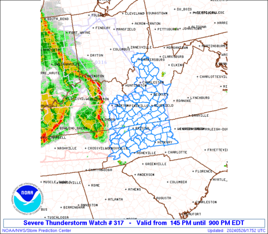
    Ww 317 severe tstm ks ok tx 292055z - 300400z
    axis..85 statute miles east and west of line..
    25nw p28/medicine lodge ks/ - 30wsw adm/ardmore ok/ ..aviation coords.. 75nm e/w /64w ict - 17wsw adm/ hail surface and aloft..3 inches. Wind gusts..70 knots.
    Max tops to 550. Mean storm motion vector 29025.


    Hazard Tornadoes EF2+ Tornadoes
    Likelihood Low Very Low
    Severe Wind 65 kt+ Wind
    High Low
    Severe Hail 2"+ Hail
    High Moderate
    Tornadoes
    Probability of 2 or more tornadoes
    Low (20%)
    Probability of 1 or more strong (F2-F5) tornadoes
    Low (5%)
    Wind
    Probability of 10 or more severe wind events
    High (70%)
    Probability of 1 or more wind events > 65 knots
    Low (20%)
    Hail
    Probability of 10 or more severe hail events
    High (70%)
    Probability of 1 or more hailstones > 2 inches
    Mod (40%)
    Combined Severe Hail/Wind
    Probability of 6 or more combined severe hail/wind events
    High (80%)
    URGENT - IMMEDIATE BROADCAST REQUESTED
    SEVERE THUNDERSTORM WATCH NUMBER 317
    NWS STORM PREDICTION CENTER NORMAN OK
    355 PM CDT TUE MAY 29 2012

    THE NWS STORM PREDICTION CENTER HAS ISSUED A
    SEVERE THUNDERSTORM WATCH FOR PORTIONS OF

    FAR SOUTHWEST AND SOUTH CENTRAL KANSAS
    WESTERN AND CENTRAL OKLAHOMA
    A SMALL PART OF NORTHWEST TEXAS

    EFFECTIVE THIS TUESDAY AFTERNOON AND EVENING FROM 355 PM UNTIL
    1100 PM CDT.

    SCATTERED DAMAGING WINDS TO 80 MPH
    SCATTERED LARGE HAIL
    ISOLATED HAIL TO 3.0 INCHES IN DIAMETER POSSIBLE
    ISOLATED TORNADOES

    THE SEVERE THUNDERSTORM WATCH AREA IS APPROXIMATELY ALONG AND 85
    STATUTE MILES EAST AND WEST OF A LINE FROM 25 MILES NORTHWEST OF
    MEDICINE LODGE KANSAS TO 30 MILES WEST SOUTHWEST OF ARDMORE
    OKLAHOMA. FOR A COMPLETE DEPICTION OF THE WATCH SEE THE
    ASSOCIATED WATCH OUTLINE UPDATE (WOUS64 KWNS WOU7).

    REMEMBER...A SEVERE THUNDERSTORM WATCH MEANS CONDITIONS ARE
    FAVORABLE FOR SEVERE THUNDERSTORMS IN AND CLOSE TO THE WATCH
    AREA. PERSONS IN THESE AREAS SHOULD BE ON THE LOOKOUT FOR
    THREATENING WEATHER CONDITIONS AND LISTEN FOR LATER STATEMENTS
    AND POSSIBLE WARNINGS. SEVERE THUNDERSTORMS CAN AND OCCASIONALLY
    DO PRODUCE TORNADOES.

    OTHER WATCH INFORMATION...CONTINUE...WW 313...WW 314...WW
    315...WW 316...

    DISCUSSION...VISIBLE IMAGERY SHOWS CU/TCU FIELD DEVELOPING FROM SWRN
    KS INTO NWRN OK...AND WITH CAP CONTINUING TO WEAKEN...DEEP
    CONVECTION IS EXPECTED TO DEVELOP WITHIN THE NEXT 1-2 HRS ACROSS
    PARTS OF SWRN KS AND WRN OK. STEEP LAPSE RATES AND WARM SURFACE
    TEMPERATURES WITH INCREASING MOISTURE OVER OK ARE CONTRIBUTING TO
    VERY UNSTABLE CONDITIONS WITH MLCAPE OF 2500-3500 J/KG. VEERING
    WINDS WITH HEIGHT AND RESULTANT STRONG DIRECTIONAL SHEAR WILL
    PROVIDE A FAVORABLE ENVIRONMENT FOR INITIAL SUPERCELL DEVELOPMENT
    WITH STORMS CAPABLE OF PRODUCING VERY LARGE HAIL AND DAMAGING WINDS.
    STORMS MAY GROW UPSCALE INTO A SEWD MOVING MCS LATER THIS EVENING
    WITH AN INCREASING THREAT FOR MORE WIDESPREAD DAMAGING WINDS.

    AVIATION...A FEW SEVERE THUNDERSTORMS WITH HAIL SURFACE AND ALOFT
    TO 3 INCHES. EXTREME TURBULENCE AND SURFACE WIND GUSTS TO 70
    KNOTS. A FEW CUMULONIMBI WITH MAXIMUM TOPS TO 550. MEAN STORM
    MOTION VECTOR 29025.

  4. Default Re: Oklahoma Severe Weather Discussion - May 2012

    New cell going up fast in Blaine/Major counties just SW of Fairview...

    Most attention will be on the chat room now as things are going to go very fast.


  5. Default Re: Oklahoma Severe Weather Discussion - May 2012

    Severe
    Thunderstorm Warning for Alfalfa, Woods [OK] till 5:30 PM CDT

    Major County storm is increasing now and the storms in the SW are picking up a little steam as well.

  6. Default Re: Oklahoma Severe Weather Discussion - May 2012

    Closer to the Metro:
    Severe Thunderstorm Warning for Alfalfa, Blaine, Garfield, Grant, Kingfisher, Major [OK] till 6:30 PM

    Also a new tower trying to go up between Hydro and Bridgeport.

  7. #82

    Default Re: Oklahoma Severe Weather Discussion - May 2012

    It looks like the line forming is weakest in the middle.

    Is there a cap or something similar in place over the central part of the state?

  8. #83

    Default Re: Oklahoma Severe Weather Discussion - May 2012

    The storm northwest of the city seems very familiar to the storm a few years ago that caused all that hail damage. Hope this won't be the case.

  9. Default Re: Oklahoma Severe Weather Discussion - May 2012

    Game of squeeze play for the Metro area coming up. Severe storm in Kingfisher Co moving SE will impact the Northern Metro area. Another severe storm moving NE out of Caddo County will impact the Southern Metro area...as it looks now.

  10. Default Re: Oklahoma Severe Weather Discussion - May 2012

    Tornado
    Warning for Canadian, Oklahoma [OK] till 9:00 PM CDT

  11. Default Re: Oklahoma Severe Weather Discussion - May 2012

    Full attention is at the chat right now. Two storms with increasing rotation to the west in Canadian County. Hail sizes seem to be getting more reasonable now, but strong winds/heavy rain still very possible.

  12. #87

    Default Re: Oklahoma Severe Weather Discussion - May 2012

    I got hit hard by the hail... several shattered windows on the south side

  13. Default Re: Oklahoma Severe Weather Discussion - May 2012

    I was trying to leave 50 penn place in time but got trapped there. I ran up on a curb and parked under a tree. still have bumps on the car but no window damage. could have been a lot worse for me. but I saw cars just get shattered

  14. #89

    Default Re: Oklahoma Severe Weather Discussion - May 2012

    We lost power here in Edmond for well over an hour...had a few 3" diameter hail stones

  15. #90

    Default Re: Oklahoma Severe Weather Discussion - May 2012

    Small hail. Wind enough to snap a small treeee. Not enough to topple far larger dead tree ... Drat.
    Poeer out my block anyay, couple of hours now. Sad am I. My cpap is askeered of the dark, or something like that. Sure wish it wasn't though.

  16. Default Re: Oklahoma Severe Weather Discussion - May 2012

    MODERATE RISK for TODAY (Wednesday)
    Area: West of a line from Medford to Stillwater to Wewoka to Coalgate to Durant
    Risk Values: Tornado (10%), Significant Wind (30%), Significant Hail (45%)

    DAY 1 CONVECTIVE OUTLOOK
    NWS STORM PREDICTION CENTER NORMAN OK
    1253 AM CDT WED MAY 30 2012

    VALID 301200Z - 311200Z

    ...THERE IS A MDT RISK OF SVR TSTMS ACROSS WRN AND CENTRAL OK/N TX
    AND A SMALL PORTION OF SRN KS...

    ...THERE IS A SLGT RISK OF SVR TSTMS EXTENDING FROM PARTS OF WRN NEB
    SWD INTO N TX/SWRN MO/WRN AR...

    ...SYNOPSIS...
    BROAD/WEAK TROUGHING OVER THE ERN U.S. IS FORECAST TO BECOME
    REINFORCED ON ITS WRN FRINGE AS SHORT-WAVE TROUGHING MOVES OUT OF
    THE ROCKIES AND INTO THE CENTRAL U.S. THROUGH THE PERIOD.

    AT THE SURFACE...DEPARTING T.D. BERYL IS PROGGED TO BE SHIFTING OFF
    THE SERN U.S. COAST EARLY...LEAVING A WEAK WIND SHIFT/CONVERGENCE
    AXIS IN ITS WAKE -- EXTENDING WWD ALONG THE GULF COAST REGION.
    MEANWHILE...LOW PRESSURE IS FORECAST TO REMAIN INVOF NWRN TX DURING
    THE DAY...WITH A COMBINATION FRONT/OUTFLOW EXTENDING EWD ACROSS THE
    OK VICINITY AND A DRYLINE EXTENDING SWD. THESE TWO BOUNDARIES IN
    THE OK/TX VICINITY AND THE WIND SHIFT ACROSS THE GULF COAST REGION
    SHOULD SERVE AS THE PRIMARY CONVECTIVE FOCI THIS PERIOD.

    ...PARTS OF THE CENTRAL AND SRN PLAINS REGION...
    ANOTHER DAY OF SUBSTANTIAL SEVERE WEATHER POTENTIAL IS EXPECTED
    ACROSS THE OK/TX VICINITY...WITH SOME THREAT EXTENDING NWWD INTO THE
    CENTRAL HIGH PLAINS REGION. ACROSS THE SRN
    PLAINS...HEATING/DESTABILIZATION IS FORECAST IN THE WAKE OF
    OVERNIGHT CONVECTION -- AND AN ASSOCIATED OUTFLOW BOUNDARY WHICH
    SHOULD BE RETREATING NWD ACROSS THE RED RIVER VALLEY/SRN OK DURING
    THE DAY. BY MID TO LATE AFTERNOON...THIS BOUNDARY -- EXPECTED TO
    RESIDE ACROSS CENTRAL OR NRN OK...AND A DRYLINE MIXING EWD ACROSS
    THE TX PANHANDLE/NWRN TX TOWARD WRN OK...WILL LIKELY FOCUS UPDRAFT
    INITIATION -- AIDED BY THE A SUBTLE FEATURE ALOFT WHICH SHOULD BE
    SHIFTING INTO THE SRN HIGH PLAINS.

    WITH VERY STEEP MID-LEVEL LAPSE RATES BEING CONTINUALLY SUPPLIED BY
    WLY FLOW ALOFT -- SPREADING ATOP A MOIST/HEATING BOUNDARY
    LAYER...STRONG DESTABILIZATION WILL OCCUR...WITH AFTERNOON CAPE
    VALUES OVER WRN OK AND VICINITY FORECAST TO EXCEED 4000 J/KG
    MIXED-LAYER CAPE. THIS THERMODYNAMIC ENVIRONMENT WILL ALLOW
    EXPLOSIVE CONVECTIVE GROWTH ONCE STORMS INITIATE...FURTHER AIDED BY
    DEEP-LAYER SHEAR SUPPORTIVE OF UPDRAFT ROTATION. ISOLATED STORMS
    DEVELOPING ACROSS WRN OK AND VICINITY WILL LIKELY PRODUCE VERY
    LARGE/DAMAGING HAIL...AND WILL ALSO BE CAPABLE OF PRODUCING DAMAGING
    WINDS. WHILE SOMEWHAT WEAK LOW-LEVEL FLOW MAY LIMIT TORNADO
    POTENTIAL IN MOST AREAS...ENHANCED SHEAR NEAR/N OF THE SURFACE
    FRONT/REMNANT OUTFLOW MAY SUPPORT A ZONE OF SLIGHTLY HIGHER TORNADO
    PROBABILITY.

    MORE ISOLATED STORMS MAY ALSO DEVELOP NWWD ACROSS THE CENTRAL HIGH
    PLAINS REGION...WHERE LESSER -- BUT SUFFICIENT -- INSTABILITY WILL
    SUPPORT SOME HAIL/WIND POTENTIAL.

    AS STORMS INCREASE IN COVERAGE ACROSS OK AND VICINITY...COLLIDING
    STORM OUTFLOWS COMBINED WITH THE DEGREE OF INSTABILITY SUGGEST THAT
    STORM CLUSTERING/UPSCALE GROWTH IS LIKELY INTO THE EVENING. ALONG
    WITH VERY LARGE HAIL AND ISOLATED TORNADO POTENTIAL WITH ROTATING
    CELLS...WIND POTENTIAL SHOULD INCREASE -- WITH STORMS EVENTUALLY
    FORECAST TO SHIFT EWD ACROSS OK/N TX LIKELY IN THE FORM OF ONE OR
    MORE MCS/S.

  17. #92

    Default Re: Oklahoma Severe Weather Discussion - May 2012

    So sorry for all the people with damage from last night's storm. I checked the house, this morning, and other than twigs, two seed grown tomato plants and a cajun pepper plant that deserved to die, anyway, we didn't have any damage. I am amazed that is so because we got lots of rain, high winds and two inch hail.

  18. #93

    Default Re: Oklahoma Severe Weather Discussion - May 2012

    Quote Originally Posted by PennyQuilts View Post
    So sorry for all the people with damage from last night's storm. I checked the house, this morning, and other than twigs, two seed grown tomato plants and a cajun pepper plant that deserved to die, anyway, we didn't have any damage. I am amazed that is so because we got lots of rain, high winds and two inch hail.
    I got off pretty lightly. The worst that happened to me was my already damaged fence blew over twice(First it fell one way, then the wind shifted and flipped it over the other way) and my flowers got shredded. Tons of trees down in my neighborhood, though. I had to zig zag around them on my way to work.

  19. #94

    Default Re: Oklahoma Severe Weather Discussion - May 2012

    Large hail, lots of rain and wind here. Total of 8 broken out windows on the south side and the hail hit hard enough to ruin the blinds over the windows. Large tree limb down in the back yard too.

  20. Default Re: Oklahoma Severe Weather Discussion - May 2012

    Managed to get out just fine here. I was worried about my little garden plot, but dang if it doesn't look happier today than it's looked so far this spring. Weird. It was hard to sleep this morning with the hail on the roof.

    Hey, venture, about what time are we looking for today's weather to start?
    Still corrupting young minds

  21. #96

    Default Re: Oklahoma Severe Weather Discussion - May 2012

    I was wondering what's going to happen today too

  22. Default Re: Oklahoma Severe Weather Discussion - May 2012

    Now to a topic those that suffered damage yesterday don't want to hear...Round 2.

    Morning model guidance is indicating that the activity going on right now should continue to push east and skies remain mostly clear back to the West and North. Now the setup for today is a bit complex so I wanted to point out all the main features for today.

    Click image for larger version. 

Name:	053012surface.jpg 
Views:	118 
Size:	97.2 KB 
ID:	1771

    So we have the main storm system out in the TX PH today that will be pulling out. The stationary front has moved north over Northern OK. Then as you can see on the graphic we have several outflow boundaries (black lines). These can become a focal point for development later and could also provide enhanced areas of storms to intensify/rotate later on. Current the atmosphere is fairly worked over behind the complex moving south. Instability is pretty low right now, but should rebound pretty quickly. In the next few hours we are expecting instability to become extreme especially from the OKC area and back to the west.

    HRRR model is showing things should start to pop around 4-6PM across Western OK. We should also be looking at a developing complex across Western KS that will likely drop south as a strong complex with the potential for widespread damaging winds. These initial storms will have the risk of very large to giant hail and tornadoes. The greatest risk for those will be across NW OK and W KS. Then like we have seen in past years (think 2001 and 2006?) and even a bit yesterday, they will combine into a large forward moving bow complex. The threat will transition quickly from large hail and tornadoes to significant widespread destructive winds. As we saw yesterday we had many reports of 80 mph or higher. It would not be out of the realm of possibility that we could see widespread 70-90 mph winds with the MCC/MCS. These are typically called Derechos and here is a quick info page on a major one we had about 10 years ago: http://www.spc.noaa.gov/misc/AbtDere...282001page.htm.

    More Derecho Info: http://www.spc.noaa.gov/misc/AbtDere....htm#srnplains

    So main rule today is be prepared, have things secured down that didn't fly away last night, and just be prepared. We'll see a new SPC outlook out here soon, but as of right now the Moderate Risk area (most likely area for the above mentioned activity) covers nearly all of Western and Central OK - including the Metro Area.

  23. #98

    Default Re: Oklahoma Severe Weather Discussion - May 2012

    Thank you for the update Venture! I have a question concerning the HRRR model. I know you have a link to it posted on the first page of this thread but am having trouble using it. I don't know what I'm looking at and what I should select. Yesterday you posted the HRRR and it looped to show convective development and motion, etc. What do I need to do to be able to look at the information myself today and going forward? I understand if you don't have time to do this today, but at some point a quick tutorial would be nice. I get lost trying to figure it out.

  24. #99

    Default Re: Oklahoma Severe Weather Discussion - May 2012

    I went through a derecho in 2006 in St Louis. They are every bit as scary as a tornado. This occurred during the same weekend as the opening of the new Busch Stadium, and several people were hurt very badly during a Cardinals game. The best way I would describe it is 3-5 minutes of howling 70-80 mph winds (no gusts just straight unrelenting winds). Since they are huge geographically there is no escape. I just got my power back on at my house this morning and I definitely will be preparing for this tonight. During the height of the storm, something like 70% of St Louis City/County was without power.

    Venture, maybe I heard wrong but I always understood that derechos were summer events that usually occurred in the Midwest and Northeast?

  25. Default Re: Oklahoma Severe Weather Discussion - May 2012

    Quote Originally Posted by Kaye View Post
    Thank you for the update Venture! I have a question concerning the HRRR model. I know you have a link to it posted on the first page of this thread but am having trouble using it. I don't know what I'm looking at and what I should select. Yesterday you posted the HRRR and it looped to show convective development and motion, etc. What do I need to do to be able to look at the information myself today and going forward? I understand if you don't have time to do this today, but at some point a quick tutorial would be nice. I get lost trying to figure it out.
    Sure...so the main page is: http://ruc.noaa.gov/hrrr/
    Step 2) Click on 3km HRRR-CONUS hourly
    Step 3) Under Domain select SC for South Central US
    Step 4) Look at the time frames available. Usually if it isn't through Hour 06 yet, I'll just go up to Date and select the previous time.
    Step 5) Depending on what you want to see you can click on the specific time or to loop all the times available you'll see a Check Mark under loop. You can click that to loop them all.

    So for the simulated radar image you will go under the 3rd product called Composite Reflectivity and click the check mark under loop. That will provide the image I normally put. There are a ton of other products available for this model so enjoy.

Thread Information

Users Browsing this Thread

There are currently 1 users browsing this thread. (0 members and 1 guests)

Similar Threads

  1. Oklahoma Severe Weather Discussion - April 2012
    By venture in forum Weather & Geosciences
    Replies: 399
    Last Post: 05-01-2012, 10:00 AM
  2. Oklahoma Severe Weather Discussion - March 2012
    By Tydude in forum Weather & Geosciences
    Replies: 91
    Last Post: 03-30-2012, 08:03 PM
  3. Oklahoma Severe Weather Discussion - June 2011
    By venture in forum Weather & Geosciences
    Replies: 155
    Last Post: 06-29-2011, 05:47 AM
  4. Oklahoma Severe Weather Discussion - May 2011
    By venture in forum Weather & Geosciences
    Replies: 377
    Last Post: 06-01-2011, 12:33 AM
  5. Oklahoma Severe Weather Discussion - April 2011
    By venture in forum Weather & Geosciences
    Replies: 286
    Last Post: 04-30-2011, 12:28 AM

Tags for this Thread

Bookmarks

Posting Permissions

  • You may not post new threads
  • You may not post replies
  • You may not post attachments
  • You may not edit your posts
  •  
Single Sign On provided by vBSSO