Widgets Magazine
Page 2 of 2 FirstFirst 12
Results 26 to 33 of 33

Thread: Last Trace Of Old Streetcar Route?

  1. #26

    Default Re: Last Trace Of Old Streetcar Route?

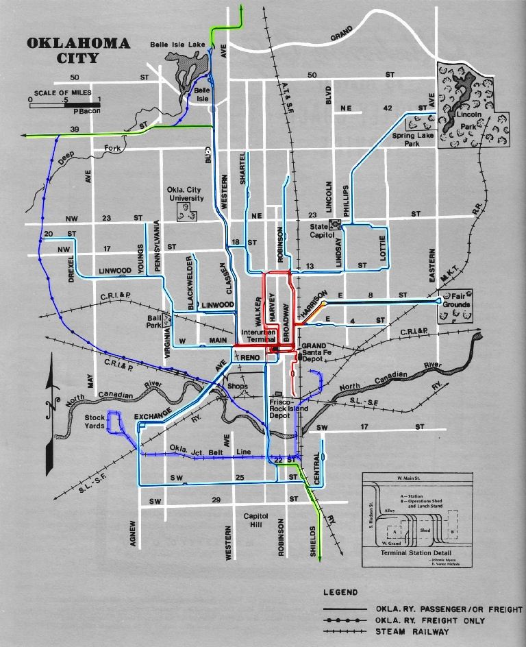
    That map HAS to date from after the time that the old Rock Island yards were replaced by Civic Center (and the CRI&P station adjacent to the Skirvin abandoned). That would put it in the mid to late 30s. It's also wrong in at least one area; there was never a trolley line on NW 20 -- it was on NW 19 instead. That error, however, might have been deliberate to trap anyone trying to copy the map.

  2. #27

    Default Re: Last Trace Of Old Streetcar Route?

    Quote Originally Posted by Jim Kyle View Post
    It's also wrong in at least one area; there was never a trolley line on NW 20 -- it was on NW 19 instead. That error, however, might have been deliberate to trap anyone trying to copy the map.
    I caught that too Jim, and wondered about that because old timers I had talked to in the past told me that the trolley ran on 19th, and the swing from N/S Drexel to E/W 19th is marked by the present day curve at eastbound 19th onto southbound Drexel.

    Also, judging by the map, would it be safe to say that the west loop of the freight route swung through the current fairgrounds and pretty much followed Grand Blvd up to 39th street? In fact it looks like the main road through the fairgrounds could have been on the old freight route.

  3. #28

    Default Re: Last Trace Of Old Streetcar Route?

    Rezman, yes and yes. I have an aerial image. Let me post it...

  4. #29

    Default Re: Last Trace Of Old Streetcar Route?

    Decided to google for some more info on the station and hit the motherlode.

    Naturally, the info comes from Doug Loudenback, who seems to have documented everything about OKC. Kudos to Doug.

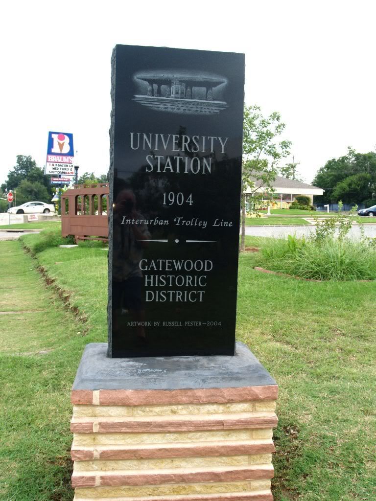
    Here's some more shots of the monument and trolley sculpture:


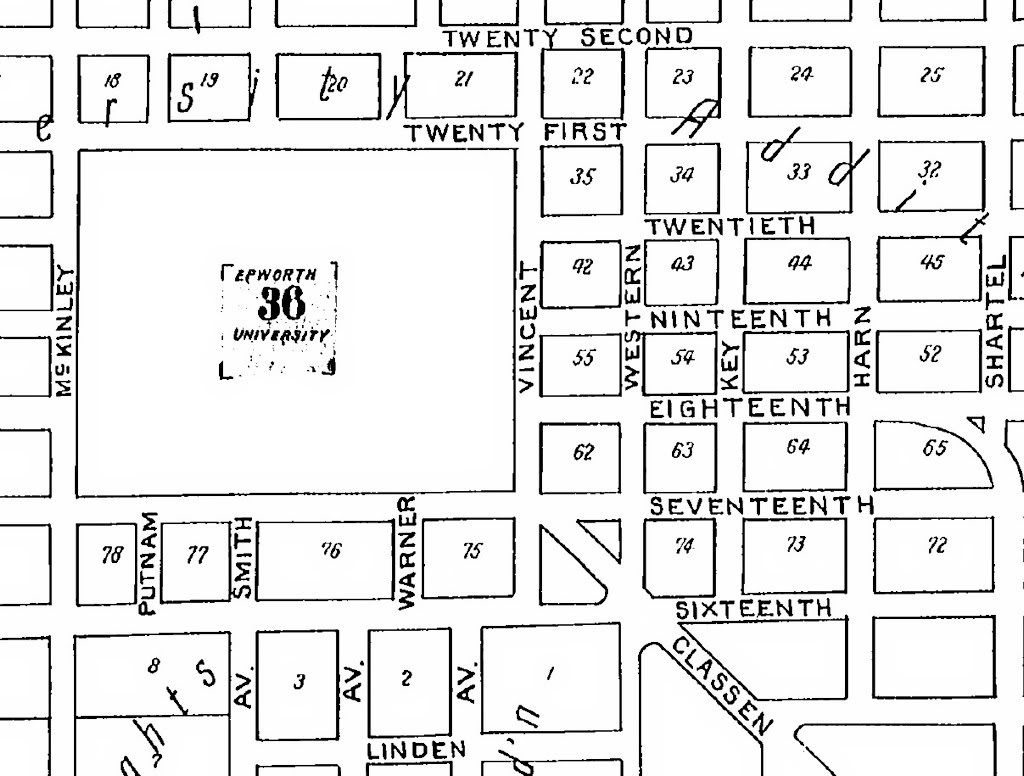
    Here's a 1904 map showing where Epworth University was:


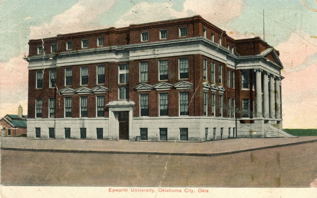
    Here's Epworth University (in what appears to be a postcard):


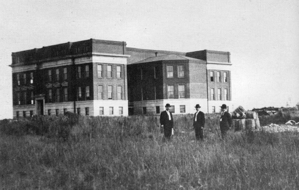
    Another photo:


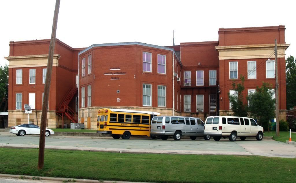
    And how it looks today, as Epworth United Methodist Church


    University Station -- Epworth University can be seen behind it:


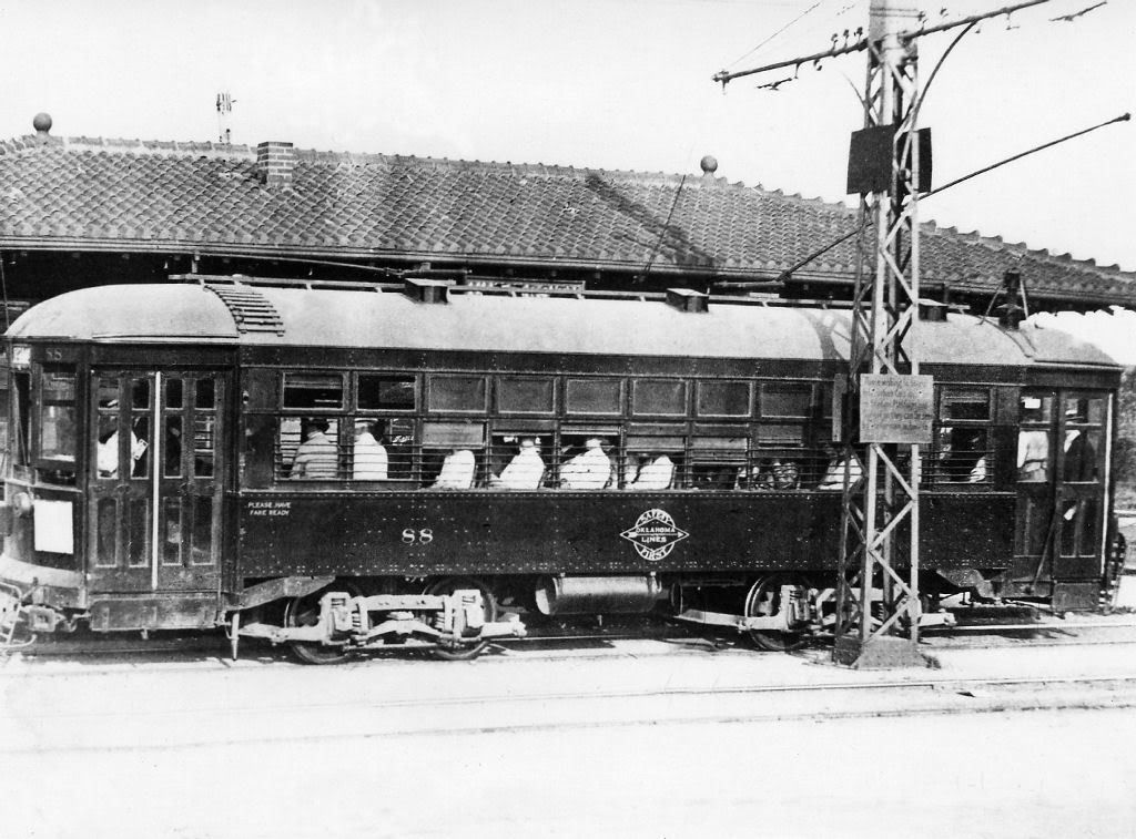
    Another shot of University Station, with a trolley pulling up:


    And another one, with a trolley at the station:


    Here's the source for all these photos:

    Doug Dawgz Blog: Okc Trolleys Part 1
    [hr][/hr]


    Such a wonderful resource. Chocked full of great photos. And that's only Part 1. He has a whole host of other links on the trolley/streetcar that I haven't even gotten to yet!


    Here's a couple of interesting items:

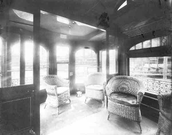
    An inside view of a trolley with a wicker chair lounge in the rear:


    A close-up view of the wicker chair lounge:


    Who knew that the old trolleys had wicker chair lounges in the back (well, some of them, anyway)? I sure didn't!


    Doug has posted the same map that Triple-M posted just above. He's also made a color-coded version for reference.


    Red = original tracks
    Light Blue = later passenger or freight
    Purple = freight only
    Green = interurban

  5. #30

    Default Re: Last Trace Of Old Streetcar Route?

    Can't resist posting a few more photos from Doug's site.


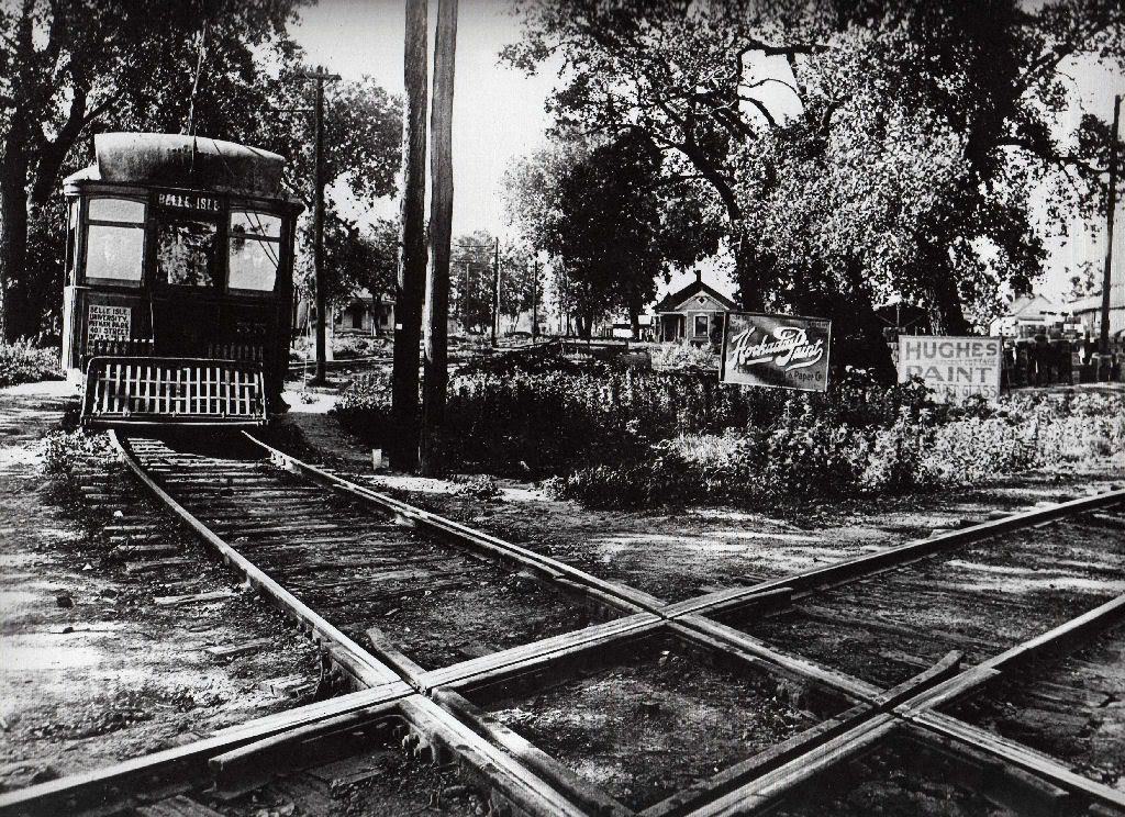
    Laying down the track:


    This pic kills me. Looks like something straight out of Walnut Grove. I half expect Laura Ingalls to stick her head out the window:


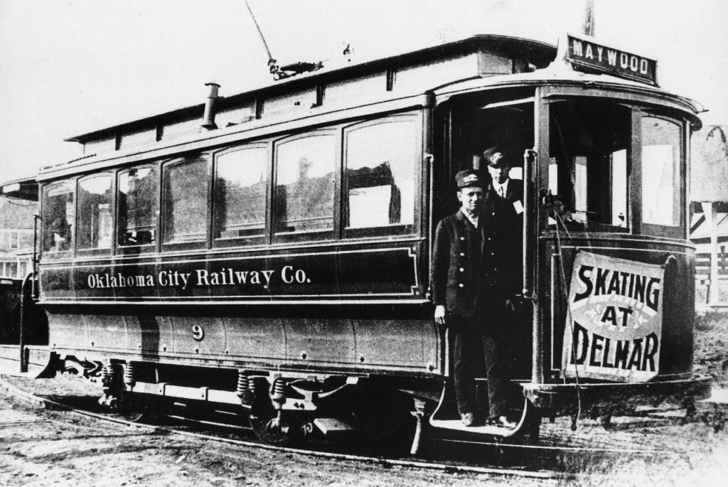
    Skating at Delmar, anyone?


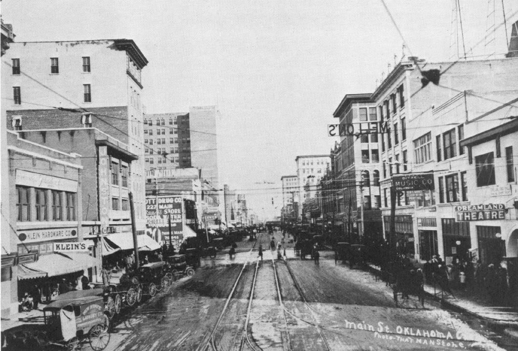
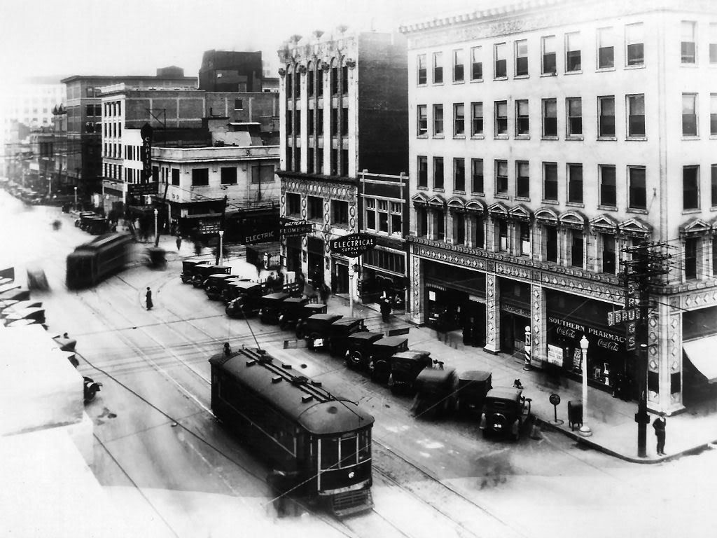
    Or maybe take a jaunt down Main Street:


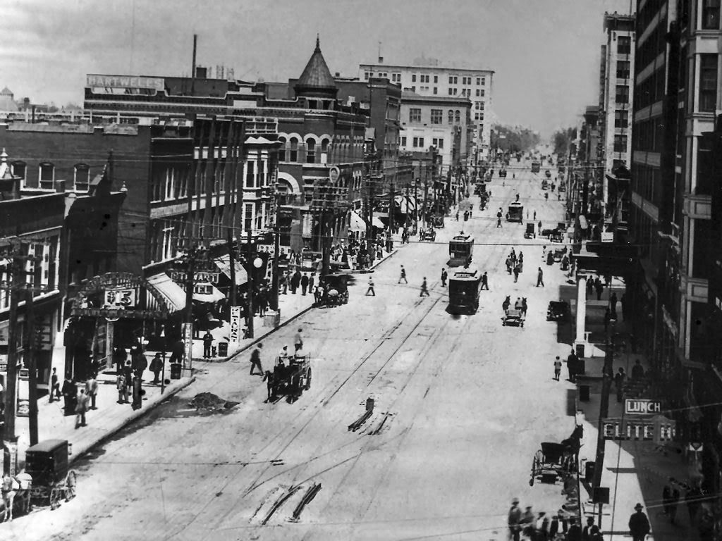
    Or perhaps down Broadway:


    Or take a swing by Levy Mercantile:


  6. #31

    Default Re: Last Trace Of Old Streetcar Route?

    University Station -- Epworth University can be seen behind it:
    That's the photo of the station that I mention4ed up-thread. The "259" indicates that it's from one of the "Vanished Splendor" volumes.

  7. #32

    Default Re: Last Trace Of Old Streetcar Route?

    Quote Originally Posted by Praedura View Post
    Laying down the track:
    I'd like to recreate this shot at 4th & Robinson when they're putting in the crossing there. Although, if ran like Project 180, it might just be the track forms I snap a pic of!

  8. #33

    Default Re: Last Trace Of Old Streetcar Route?

    I drove around downtown today and snapped this pic of the tracks on 4th street under the BNSF viaduct:

Thread Information

Users Browsing this Thread

There are currently 3 users browsing this thread. (0 members and 3 guests)

Similar Threads

  1. New Streetcar Routes in Other Cities
    By shane453 in forum Transportation
    Replies: 229
    Last Post: 08-09-2016, 03:08 PM
  2. Cool Streetcar Rendering video
    By Praedura in forum Transportation
    Replies: 10
    Last Post: 09-30-2013, 03:31 PM
  3. Streetcar Phase 1A (What's within a block of the line in Midtown?)
    By Urban Pioneer in forum General Civic Issues
    Replies: 26
    Last Post: 04-17-2011, 03:36 PM
  4. Thoughts on Robinson Ave--streetcar-appropriate?
    By Spartan in forum Transportation
    Replies: 67
    Last Post: 02-24-2011, 03:22 PM
  5. Replies: 67
    Last Post: 01-10-2011, 09:31 AM

Bookmarks

Posting Permissions

  • You may not post new threads
  • You may not post replies
  • You may not post attachments
  • You may not edit your posts
  •  
Single Sign On provided by vBSSO