

It's wood.Originally Posted by OKCisOK4me

Could be!
Venture, it looks like the clouds is moving E/SE, according to that link I visited and clicked on animation. I could be wrong, but I'm noticing multiple moving directions from all areas.

 Poster

It's wood.
Venture, it looks like the clouds is moving E/SE, according to that link I visited and clicked on animation. I could be wrong, but I'm noticing multiple moving directions from all areas.
David
Initiation appears imminent in NW Oklahoma in Custer County.
Storms that form in the NW are likely to me ESE/SE and the potential to form the typical complex we've had the last couple nights. It is still WAY too early.
Participating Member

I just got done looking at the wunderground.com radar and there are a few storms developing between Ark City, KS & Ponca City, north of the Oklahoma state line.
Those storms that formed yesterday in Texas were big time right now this time. We have hardly anything. Not to say nothing will happen. It will be interesting to see if anything goes up. I agree with the forecasters though and don't really expect anything here again until this weekend.
David
There is a ton of instability out there, so if it can break the cap...being by itself it could have some fun. Appears another cell going up in Central Dewey County as well.
There are plenty times where initiation doesn't happen until almost sunset, so can't write things off yet.
David
There is one chaser who is following this new development.
Mike Phelps
Poster
Venture, are you on AIM or YIM? I'm on those, if you want to accept? I got some questions. lol
VIP Member
Who knew Michael Phelps was so multi-faceted. Gold medalist swimmer, pot head AND storm chaser!
David
LOL I caught that too Luke. : )
Storm in Custer County has broke the cap and is around 42K feet right now. We'll see what happens. The cell north of it in Dewey is at 34K feet and another little cell is trying by Taloga.
Poster
David
Day 1 convective outlook
nws storm prediction center norman ok
0749 pm cdt thu apr 30 2009
valid 010100z - 011200z
...there is a slgt risk of svr tstms from the cntrl/srn plains ewd into the lwr oh/mid-ms vlys...
...ok/ks/swrn mo/cntrl-wrn ar...
00z mesoanalysis places a low over roger mills county ok with a dryline swd along the ok/tx border to swrn tx. An outflow boundary extended ese through logan county ok then to near fort smith ar.
Subsidence in wake of the departing mcv in wrn ky in combination with weak convergence and strengthening sbcinh ridging nwd into the red rvr vly has kept sfc-based storms from developing through 00z.
However...satl/radar suggests that sfc-based storms will likely form invof the mesolow over wcntrl ok where strongest mass convergence and weakest sbcinh exist. 00z oun sounding exhibited mucape of 3147 j/kg and 8.4 c/km h5-h7 lapse rates and around 40 kts of effective shear. Storms that initiate will likely become supercells with very large hail...dmgg wind gusts and perhaps an early evening tornado or two.
Nocturnal swly llj is expected to strengthen to 35 kts...impinging on the nw-se oriented outflow boundary later tonight. Thus...it is reasonable to expect storms to expand in coverage ene through cntrl/nrn ok and into sern ks...swrn mo and wrn ar through 12z.
These storms will mostly be elevated...but storms closer to the boundary across cntrl ok could maintain near-sfc based inflow with threats for dmgg winds increasing along with hail threats.
David
Bulletin - immediate broadcast requested
severe thunderstorm warning
national weather service norman ok
758 pm cdt thu apr 30 2009
the national weather service in norman has issued a
* severe thunderstorm warning for...
Northwestern custer county in western oklahoma...
* until 900 pm cdt
* at 758 pm cdt...national weather service doppler radar indicated a
severe thunderstorm 6 miles east of moorewood...moving east at 10
mph.
Hazards in the warning include...
Hail up to the size of quarters...
Wind gusts to 60 mph...
David
URGENT - IMMEDIATE BROADCAST REQUESTED
SEVERE THUNDERSTORM WATCH NUMBER 218
NWS STORM PREDICTION CENTER NORMAN OK
755 PM CDT THU APR 30 2009
THE NWS STORM PREDICTION CENTER HAS ISSUED A SEVERE THUNDERSTORM WATCH FOR PORTIONS OF
CENTRAL AND NORTHWEST OKLAHOMA
EFFECTIVE THIS THURSDAY NIGHT AND FRIDAY MORNING FROM 755 PM UNTIL 100 AM CDT.
HAIL TO 3 INCHES IN DIAMETER...THUNDERSTORM WIND GUSTS TO 70 MPH...AND DANGEROUS LIGHTNING ARE POSSIBLE IN THESE AREAS.
THE SEVERE THUNDERSTORM WATCH AREA IS APPROXIMATELY ALONG AND 40 STATUTE MILES NORTH AND SOUTH OF A LINE FROM 25 MILES SOUTH SOUTHWEST OF GAGE OKLAHOMA TO 20 MILES SOUTHEAST OF CHANDLER OKLAHOMA. FOR A COMPLETE DEPICTION OF THE WATCH SEE THE ASSOCIATED WATCH OUTLINE UPDATE (WOUS64 KWNS WOU8).
REMEMBER...A SEVERE THUNDERSTORM WATCH MEANS CONDITIONS ARE FAVORABLE FOR SEVERE THUNDERSTORMS IN AND CLOSE TO THE WATCH AREA. PERSONS IN THESE AREAS SHOULD BE ON THE LOOKOUT FOR THREATENING WEATHER CONDITIONS AND LISTEN FOR LATER STATEMENTS AND POSSIBLE WARNINGS. SEVERE THUNDERSTORMS CAN AND OCCASIONALLY DO PRODUCE TORNADOES.
OTHER WATCH INFORMATION...CONTINUE...WW 217...
DISCUSSION...SCATTERED THUNDERSTORMS HAVE BEGUN TO FORM OVER NORTHWEST OK ALONG A WEAK OUTFLOW BOUNDARY. THESE STORMS MAY TRACK SOUTHEASTWARD INTO CENTRAL OK THROUGH THE EVENING. A VERY MOIST/UNSTABLE AIRMASS AND SUFFICIENT EFFECTIVE SHEAR SUGGEST A RISK OF SUPERCELLS CAPABLE OF VERY LARGE HAIL AND DAMAGING WINDS.
SEVERE THUNDERSTORM WATCH PROBABILITIES FOR WS 0218 NWS STORM PREDICTION CENTER NORMAN OK
0754 PM CDT THU APR 30 2009
WS 0218
PROBABILITY TABLE:
PROB OF 2 OR MORE TORNADOES : 20%
PROB OF 1 OR MORE STRONG /F2-F5/ TORNADOES : 05%
PROB OF 10 OR MORE SEVERE WIND EVENTS : 30%
PROB OF 1 OR MORE WIND EVENTS >= 65 KNOTS : 30%
PROB OF 10 OR MORE SEVERE HAIL EVENTS : 50%
PROB OF 1 OR MORE HAIL EVENTS >= 2 INCHES : 30%
PROB OF 6 OR MORE COMBINED SEVERE HAIL/WIND EVENTS : 80%
&&
ATTRIBUTE TABLE:
MAX HAIL /INCHES/ : 3.0
MAX WIND GUSTS SURFACE /KNOTS/ : 60
MAX TOPS /X 100 FEET/ : 500
MEAN STORM MOTION VECTOR /DEGREES AND KNOTS/ : 28025
PARTICULARLY DANGEROUS SITUATION : NO
Ww 218 severe tstm ok 010055z - 010600z
axis..40 statute miles north and south of line..
25ssw gag/gage ok/ - 20se cqb/chandler ok/ ..aviation coords.. 35nm n/s /23s gag - 52e okc/ hail surface and aloft..3 inches. Wind gusts..60 knots.
Max tops to 500. Mean storm motion vector 28025.
Lat...lon 36529994 36099656 34939656 35389994
Poster
In connection to above, Severe Thunderstorm Warning.

Participating Member
Dont you know thats got to be really pretty going up right at sunset.Someones getting a nice view out west.
Poster
Watches posted.
THE NATIONAL WEATHER SERVICE HAS ISSUED SEVERE THUNDERSTORM WATCH
218 IN EFFECT UNTIL 1 AM CDT FRIDAY FOR THE FOLLOWING AREAS
IN OKLAHOMA THIS WATCH INCLUDES 21 COUNTIES
IN CENTRAL OKLAHOMA
CANADIAN CLEVELAND GRADY
KINGFISHER LINCOLN LOGAN
MCCLAIN OKLAHOMA PAYNE
POTTAWATOMIE
IN EAST CENTRAL OKLAHOMA
SEMINOLE
IN NORTHWEST OKLAHOMA
BLAINE DEWEY ELLIS
MAJOR WOODWARD
IN SOUTHWEST OKLAHOMA
CADDO
IN WESTERN OKLAHOMA
BECKHAM CUSTER ROGER MILLS
WA****A
THIS INCLUDES THE CITIES OF...ANADARKO...ARNETT...CHANDLER...
CHEYENNE...CHICKASHA...CLINTON...CORDELL...EL RENO...ELK CITY...
FAIRVIEW...GUTHRIE...KINGFISHER...MOORE...MUSTANG. ..NORMAN...
OKLAHOMA CITY...PURCELL...SAYRE...SEMINOLE...SHAWNEE...
STILLWATER...TALOGA...WATONGA...WEATHERFORD...WOOD WARD AND YUKON.
Participating Member
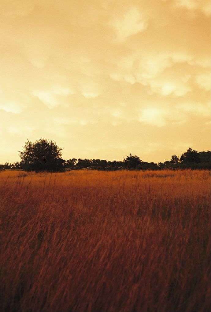
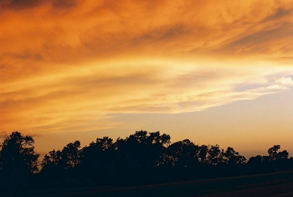
Here are some pics following i took following some storms around sunset S of Woodward last spring.. I didn't have the best camera or skills at the time, but it was very photogenic.
(I hope they're not to big. feel free to resize, mod.)
Poster
As Venture had posted, there is a chaser tracking that storm and the streaming is going right now.
Mike Phelps
I don't see any AWESOME sunset. Just AWESOME storm clouds. If you look closely, you can see some lowerings.
David
Oh yeah definitely. It is up over 53K feet right now. For those of us not lucky to be there, a simulated view of what it looks like. : )
AnvilCrawlers.com Photo Gallery: Click image to close this window
David
Oh...and wouldn't you know, right on time. The bats have arrived in northern Woods County.
AnvilCrawlers.com Photo Gallery: Click image to close this window
I'm still trying to decide if I like the new color table I made for the radar image.
David
Bulletin - eas activation requested
tornado warning
national weather service norman ok
827 pm cdt thu apr 30 2009
the national weather service in norman has issued a
* tornado warning for...
Southwestern custer county in western oklahoma...
* until 915 pm cdt
* at 827 pm cdt...national weather service doppler radar indicated a
severe thunderstorm capable of producing a tornado 7 miles
northwest of foss reservoir...moving east at 15 mph.
* locations in the warning include butler...foss reservoir and
stafford.
Participating Member
wait, your telling me that little circle are the mexican free-tailed bats???
Poster
David
LOL yes. Those are bats. There are others that normally come out of caves in SW OKlahoma.
Updated on Phelps video. Nice shock now of the wall cloud. No visual tornado or funnel that I can tell right now. Video quality isn't great, but looks like some definite striating to the clouds.
David
Update....
Tornado warned supercell moving over SW Custer County right now is taking a much bigger jog to the south than before. Rotation continues to look pretty string, not very tight right now. Live video from chasers in the area show a massive lowering with this storm and amazing structure. If only there was daylight we would probably see an amazingly classic southern plains supercell.
During typing, tornado warning update to reflect the new track to the south-southeast.
Other storms are pulsing trying to get going. Storm near Putnam has some hail with it and seems to be the second strongest right now. Two other small storms near Canton and Eagle City. More near Taloga, Trail/Camargo, and SW of Leedey.
Poster
2nd Tornado Warning issued.
BULLETIN - EAS ACTIVATION REQUESTED
TORNADO WARNING
NATIONAL WEATHER SERVICE NORMAN OK
905 PM CDT THU APR 30 2009
THE NATIONAL WEATHER SERVICE IN NORMAN HAS ISSUED A
* TORNADO WARNING FOR...
SOUTHWESTERN CUSTER COUNTY IN WESTERN OKLAHOMA...
NORTHERN WA****A COUNTY IN WESTERN OKLAHOMA...
* UNTIL 945 PM CDT
* AT 905 PM CDT...NATIONAL WEATHER SERVICE DOPPLER RADAR INDICATED A
SEVERE THUNDERSTORM CAPABLE OF PRODUCING A TORNADO NEAR FOSS
RESERVOIR...MOVING SOUTHEAST AT 10 MPH.
* LOCATIONS IN THE WARNING INCLUDE BURNS FLAT...FOSS AND SOUTHERN
FOSS RESERVOIR.
THIS INCLUDES INTERSTATE 40 BETWEEN MILE MARKERS 49 AND 61.
PRECAUTIONARY/PREPAREDNESS ACTIONS...
IN ADDITION TO A TORNADO THREAT... THIS STORM LIKELY CONTAINS
DAMAGING HAIL TO THE SIZE OF BASEBALLS OR LARGER.
TAKE COVER NOW. LEAVE MOBILE HOMES AND VEHICLES. IF POSSIBLE...MOVE
TO A BASEMENT OR STORM SHELTER. OTHERWISE MOVE TO AN INTERIOR ROOM OR
HALLWAY ON THE LOWEST FLOOR. STAY AWAY FROM WINDOWS AND OUTSIDE
WALLS.
DO NOT STOP UNDER BRIDGES OR HIGHWAY OVERPASSES SINCE THEY OFFER NO
PROTECTION FROM TORNADO WINDS. STOPPING UNDER BRIDGES WILL BLOCK THE
ROAD AND PREVENT YOU AND OTHERS FROM REACHING SAFE SHELTER.
TORNADOES ARE ESPECIALLY DANGEROUS AT NIGHT BECAUSE THEY ARE HARD TO
SEE. TAKE COVER NOW. IF A BASEMENT IS NOT AVAILABLE...MOVE TO AN
INTERIOR ROOM OR HALLWAY ON THE LOWEST FLOOR. LEAVE MOBILE HOMES AND
VEHICLES FOR REINFORCED SHELTER. STAY AWAY FROM WINDOWS.
There are currently 2 users browsing this thread. (0 members and 2 guests)
 Posting Permissions

 Reply With Quote


Bookmarks