Widgets Magazine
Page 4 of 25 FirstFirst 123456789 ... LastLast
Results 76 to 100 of 624

Thread: General Weather Discussion - May 2015

  1. Default Re: General Weather Discussion - May 2015

    ...tornado emergency for newcastle into western moore and
    southwest oklahoma city...


    The national weather service in norman has issued a


    * tornado warning for...
    Northwestern mcclain county in central oklahoma...
    Northeastern grady county in central oklahoma...
    Northwestern cleveland county in central oklahoma...


    * until 600 pm cdt

    * at 523 pm cdt...a confirmed large and destructive tornado was
    observed near bridge creek...moving northeast at 20 mph.


    This is a tornado emergency for newcastle into western moore and
    southwest oklahoma city. Take cover now. This is a particularly
    dangerous situation.


    Hazard...deadly tornado.

  2. #77

    Default Re: General Weather Discussion - May 2015

    KOCOdamonlane: TORNADO EMERGENCY SW OKC AND MOORE 525PM

  3. Default Re: General Weather Discussion - May 2015

    Large tornado in West Norman.


  4. #79

    Default Re: General Weather Discussion - May 2015

    The national weather service in norman has issued a

    * tornado warning for...
    Northwestern mcclain county in central oklahoma...
    Northwestern cleveland county in central oklahoma...

    * until 600 pm cdt

    * at 529 pm cdt...a confirmed tornado was located near newcastle...
    Moving northeast at 10 mph.

    Hazard...damaging tornado and golf ball size hail.

    Source...weather spotters confirmed tornado.

    Impact...flying debris will be dangerous to those caught without
    shelter. Mobile homes will be damaged or destroyed.
    Damage to roofs...windows and vehicles will occur. Tree
    damage is likely.

    * locations impacted include...
    Western norman...moore and newcastle.

  5. Default Re: General Weather Discussion - May 2015

    The national weather service in norman has issued a


    * tornado warning for...
    North central cleveland county in central oklahoma...


    * until 630 pm cdt

    * at 556 pm cdt...a severe thunderstorm capable of producing a
    tornado was located over western norman...moving northeast at 15
    mph.


    Hazard...tornado and golf ball size hail.


    Source...radar indicated rotation.

  6. Default Re: General Weather Discussion - May 2015

    The national weather service in norman has issued a


    * tornado warning for...
    South central oklahoma county in central oklahoma...
    North central cleveland county in central oklahoma...


    * until 645 pm cdt

    * at 617 pm cdt...a severe thunderstorm capable of producing a
    tornado was located near moore...moving northeast at 15 mph.


    Hazard...tornado and golf ball size hail.


    Source...radar indicated rotation.

  7. Default Re: General Weather Discussion - May 2015

    Storm near Verden producing....storm near Bridge Creek (another) close to producing or did have a brief touch down...another in eastern Oklahoma/Cleveland county.

  8. #83

    Default Re: General Weather Discussion - May 2015

    Will things quiet down after sunset?

  9. Default Re: General Weather Discussion - May 2015

    Quote Originally Posted by bchris02 View Post
    Will things quiet down after sunset?
    No.

  10. Default Re: General Weather Discussion - May 2015

    The national weather service in norman has issued a


    * tornado warning for...
    Southwestern oklahoma county in central oklahoma...


    * until 830 pm cdt

    * at 756 pm cdt...a severe thunderstorm capable of producing a
    tornado was located over southwestern oklahoma city...moving north
    at 10 mph.


    Hazard...tornado and ping pong ball size hail.


    Source...radar indicated rotation.

  11. Default Re: General Weather Discussion - May 2015


  12. Default Re: General Weather Discussion - May 2015


    MESOSCALE DISCUSSION 0527
    NWS STORM PREDICTION CENTER NORMAN OK
    0808 PM CDT WED MAY 06 2015

    AREAS AFFECTED...WRN AND CENTRAL OK/WRN N TX

    CONCERNING...TORNADO WATCH 133...

    VALID 070108Z - 070215Z

    THE SEVERE WEATHER THREAT FOR TORNADO WATCH 133 CONTINUES.

    SUMMARY...SCATTERED SEVERE/SUPERCELL STORMS CONTINUE ACROSS PARTS OF
    WW 133 -- WHERE ALL-HAZARD SEVERE RISK PERSISTS.

    DISCUSSION...SEVERAL SEVERE/SUPERCELL STORMS ARE ONGOING ATTM FROM
    CENTRAL KS SWD INTO THE TX SOUTH PLAINS...IN AT LEAST THREE CLUSTERS
    -- ONE OVER NRN OK...ONE OVER CENTRAL OK...AND A THIRD OVER SWRN
    OK/WRN N TX. STORM COVERAGE HAS GRADUALLY INCREASED -- PARTICULARLY
    OVER SRN PORTIONS OF THE WW AS THE LOW-LEVEL JET AND ASSOCIATED
    ASCENT/WARM ADVECTION INCREASE.

    ATTM...IT APPEARS THAT SEVERE RISK -- MAINLY IN THE FORM OF LARGE
    HAIL AND LOCALLY DAMAGING WINDS -- MAY CONTINUE FOR AT LEAST THE
    NEXT FEW HOURS...GIVEN A BACKGROUND ENVIRONMENT WHICH REMAINS
    SUPPORTIVE FOR SUPERCELLS. WHILE TENDENCY MAY BE FOR
    CLUSTERING/MESSIER STORM MODE WITH TIME -- AND AN INCREASE IN RISK
    FOR LOCALLY HEAVY RAIN...SEVERE/ISOLATED TORNADO POTENTIAL LIKELY TO
    PERSIST BEYOND 02Z /THE SCHEDULED EXPIRATION FOR WW 133/ SUGGESTS
    THAT A NEW WW FOR AT LEAST PARTS OF THIS AREA WILL BE NEEDED.

    ..GOSS.. 05/07/2015

  13. #88

    Default Re: General Weather Discussion - May 2015

    Saw a funnel directly overhead the airport about 10 mins ago.

  14. Default Re: General Weather Discussion - May 2015

    Baseball hail moving towards Mustang.

  15. Default Re: General Weather Discussion - May 2015

    The national weather service in norman has issued a


    * tornado warning for...
    South central oklahoma county in central oklahoma...
    North central cleveland county in central oklahoma...


    * until 900 pm cdt

    * at 825 pm cdt...a severe thunderstorm capable of producing a
    tornado was located over southern oklahoma city...moving east at 20
    mph.


    Hazard...tornado and golf ball size hail.

  16. Default Re: General Weather Discussion - May 2015

    The national weather service in norman has issued a


    * tornado warning for...
    Northwestern mcclain county in central oklahoma...
    Northeastern grady county in central oklahoma...


    * until 900 pm cdt

    * at 827 pm cdt...a severe thunderstorm capable of producing a
    tornado was located near newcastle...moving east at 25 mph.


    Hazard...tornado and golf ball size hail.


    Source...radar indicated rotation.

  17. #92

    Default Re: General Weather Discussion - May 2015

    This seems like basically a repeat of May 31st. Kudos to the TV meteorologists for telling people to stay in their safe spots rather than getting out on the roads.

  18. Default Re: General Weather Discussion - May 2015


  19. #94
    Join Date
    Feb 2015
    Posts
    2,064
    Blog Entries
    1

    Default Re: General Weather Discussion - May 2015

    Have the storm sirens ever gone off this much in one day/night? wow

  20. #95

    Default Re: General Weather Discussion - May 2015

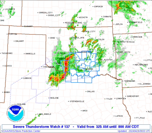
    For probably the first time ever a Flash Flood Emergency has been issued for Oklahoma City. This warning covers Caddo, Canadian, Cleveland, Grady, McClain, and Oklahoma counties until 9 AM. Map below gives an idea how extra heavy the rain has been for the past two days just to the southwest of OKC.


  21. #96

    Default Re: General Weather Discussion - May 2015

    Crap, it's been hell getting the little one to bed. We finally got her to agree to lie down if we put earbuds and Pandora on her. This is rough for the kids.

  22. #97

    Default Re: General Weather Discussion - May 2015

    Is the weather tomorrow going to be much like today?

  23. Default Re: General Weather Discussion - May 2015

    The national weather service in norman has issued a

    * tornado warning for...
    Southeastern oklahoma county in central oklahoma...
    Northeastern cleveland county in central oklahoma...

    * until 1000 pm cdt

    * at 928 pm cdt...a severe thunderstorm capable of producing a
    tornado was located over southeastern oklahoma city...moving
    northeast at 20 mph.

    Hazard...tornado and golf ball size hail.

  24. Default Re: General Weather Discussion - May 2015

    Quote Originally Posted by coov23 View Post
    Is the weather tomorrow going to be much like today?
    It's going to be busy through Sunday. One thing to point out...today probably exceeded what most expected due to the conditional elements we had today. A lot could have gone wrong and we would be seeing posts about another "bust" and forecasts screwing it up. Well...this is why we always say there is a chance. Though no one could have predicted this much water and and total number of tornadoes.

  25. #100

    Default Re: General Weather Discussion - May 2015

    Quote Originally Posted by coov23 View Post
    Is the weather tomorrow going to be much like today?
    A 60% chance for thunderstorms in OKC for Thursday night.

Thread Information

Users Browsing this Thread

There are currently 13 users browsing this thread. (0 members and 13 guests)

Similar Threads

  1. General Weather Discussion - April 2015
    By venture in forum Weather & Geosciences
    Replies: 364
    Last Post: 04-29-2015, 11:39 PM
  2. General Weather Discussion - March 2015
    By venture in forum Weather & Geosciences
    Replies: 521
    Last Post: 04-06-2015, 11:04 PM
  3. General Weather Discussion - January/February 2015
    By venture in forum Weather & Geosciences
    Replies: 525
    Last Post: 03-01-2015, 03:38 PM
  4. General Weather Discussion - May 2014
    By venture in forum Weather & Geosciences
    Replies: 429
    Last Post: 05-30-2014, 09:39 AM
  5. General Weather Discussion - January 2014
    By venture in forum Weather & Geosciences
    Replies: 203
    Last Post: 02-02-2014, 09:54 AM

Bookmarks

Posting Permissions

  • You may not post new threads
  • You may not post replies
  • You may not post attachments
  • You may not edit your posts
  •  
Single Sign On provided by vBSSO