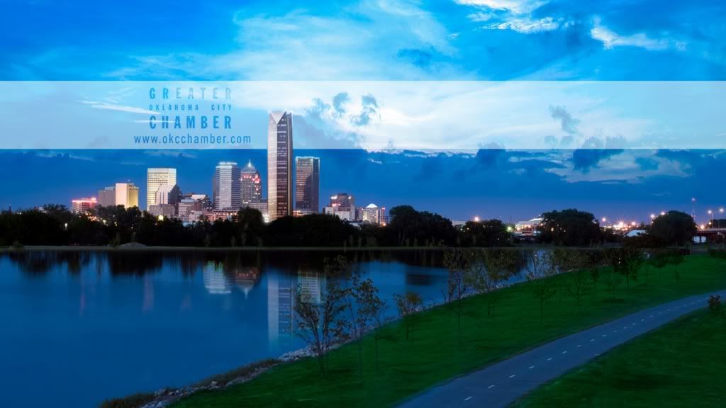


From the top of Devon tower, you will see a lot of trees if you look out a east window and desert grassland if you look out a west window.
And a lot of unfinished roadway if you look down.

grass doesn't grow in a desert. I think you mean 'a grassland in the west.'
Oklahoma City, the RENAISSANCE CITY!

But grass does grow in the desert, just different varieties and in a different pattern.
http://www.desertusa.com/mag05/jul/food6.html

Can someone get the devon tower listed on Wikipedia's "List of Tallest Buildings in the U.S. at #33. It will be tied with GE Building in New York City and Chase in Chicago (850 ft.) or is it still to soon to add it. 850ft. is the height given by Devon as the official measurement not 844ft.


it is 844

I realize the actual height that we were told is 844 ft. but Wikipedia still shows 850 ft. as the height (259 m) and seems to be the height that is always thrown out there in any articles about the tower. I'm just guessing 850 ft. is what will be used.

I prefer it without the rock banks.

Nice work! That's my one complaint about the river, they went with what I assume is the cheapest shoreline/erosion control option. I have seen different sized rock, or masonry, or even timber used in different applications that look much nicer. Anybody have a few extra million laying around?

I was watching the movie 'Skulls' the other night and I don't know exactly what college it was filmed at but the river, although exclusively natural, did have retainer rock embankments like the Oklahoma River. I guess it's more common than we think. I think we just would like to see more natural habitats like how it is closer to Meridian and down past the last dam over near and east of the Fort Smith Junction.
I am not knocking it, just stating that the rock embankments were never part of a plan for river beautification. As far as why it was chosen, I expect is similar in that it handles rushing flood water better than several other options which was the entire point of channelizing it in the first place, when the city's core was being repeatedly flooded.
You're right, I didn't think about that. However, was that just happenstance, or was it planned? Since they try to maintain the water level at a specific height, there could be other, more aesthetic solutions to the wakes from the launches.
When they built the venue for the London games, they used grass all the way down to the waters edge along most of the course. I don't think there is any current at all there, and of course the weather is a little more conducive to greenery. But it does look nicer. These pictures of the finish line bridge aren't the best, but you can see what they did.

The Army Corps of Engineers seems open other options above the normal waterline, it will just be expensive and covers approximately 19 feet of elevation for the several miles. Along about 500 meters of the boathouses they removed the rip rap above the waterline on the north bank and put in a sidewalk about water level and tiers for seating near the the finish line (with current plans showing extending the tiers most of the 500 meters, though some show the full 900-ish meters to the drainage channel). The middle and west basins will probably be able to do something, though lack a likely contributor organization along the river willing to pay for it to happen near them but may be possible due to the main buffer is lake overholser. However whatever goes their needs to be well prepared to be flooded without much warning.
The rip rap continues on the river miles after it is dry till the river passes NE 16th street.was that just happenstance, or was it planned?


Is it just me or does that Chamber picture make the Devon Tower look shorter than it actually is?
There are currently 259 users browsing this thread. (0 members and 259 guests)
Bookmarks