Widgets Magazine
Page 1 of 11 123456 ... LastLast
Results 1 to 25 of 275

Thread: Oklahoma Weather Discussion - November/December 2011

  1. Exclamation Oklahoma Weather Discussion - November/December 2011

    This thread is used to discussion upcoming/ongoing severe weather events through the months of November and December. During this time period Oklahoma can have some severe swings in types of weather. Tornado events can still happen during November and winter storms become a real possibility moving into December. Fire danger is also a on the rise during this time of year as vegetation returns to dormancy. This initial post will contain information, images, and links that can be used at any time. Images posted later through the thread may or may not be accurate on the day you are viewing them (check the post comments). Information contained in this thread should not be used as an alternative to weather radios, media, or other means of getting weather warnings/advisories.


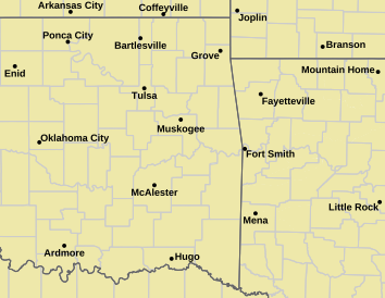
    _________Norman Warning Area Map __________________ Tulsa County Warning Area Map____
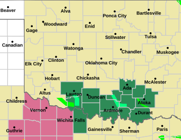
    Tornado Warning | Tornado Watch | Severe Thunderstorm Warning | Severe Thunderstorm Watch | Blizzard Warning | Red Flag Warning | Fire Warning | Winter Storm Warning | Winter Storm Watch | Freezing Rain Advisory | Heavy Snow Warning | Winter Weather Advisory | Severe Weather Statement | Special Weather Statement | Hazardous Weather Outlook | Fire Weather Watch
    Other Color Meanings: http://www.weather.gov/wwamap-prd/faq.php

    NWS NEXRAD Radar Loop - Twin Lakes/Oklahoma City/Norman


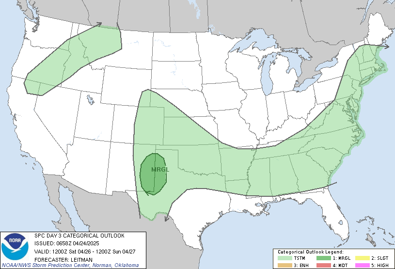
    SPC Convection (Severe Weather) Outlooks

    ________ Day 1 ________________ Day 2 _________________ Day 3 ___________ Days 4 through 8 ___


    *Click any above graphic to view discussion.*

    SPC Fire Weather Outlooks

    ________ Day 1 ________________ Day 2 ______________ Days 3 to 8 _____

    *Click any above graphic to view discussion.*

    Oklahoma Mesonet Visible Satellite Image (will appear blank overnight)


    Oklahoma Mesonet IR Satellite Image (will appear blank overnight)


    Oklahoma Mesonet Water Vapor Satellite Image (will appear blank overnight)


    Oklahoma Mesonet Current Conditions


    SPC Severe Weather Reports (Today and Yesterday)
    ________ Today _____________ Yesterday _____

    Useful Links
    COD Weather Analysis Page: http://weather.cod.edu/analysis/
    NWS Norman Page: http://www.srh.noaa.gov/oun/
    Storm Prediction Center: http://www.spc.noaa.gov/
    Oklahoma Mesonet: http://www.mesonet.org/
    West Texas Mesonet: http://www.mesonet.ttu.edu/
    Oklahoma Fire Weather: http://www.srh.noaa.gov/oun/?n=fireweather
    Oklahoma Road Conditions: http://www.dps.state.ok.us/cgi-bin/weathermap.cgi
    Severe Weather Values Reference Guide: http://weatherspotter.net/index11.php -or- http://www.theweatherprediction.com/severe/indices/
    TwisterData Model Page: http://www.twisterdata.com/
    Earl Barker's Central US Model Page: http://128.121.193.153/central_models.htm
    NSSL WRF Model: http://www.nssl.noaa.gov/wrf/
    NSSL 4KM WRF Model Forecast Soundings: http://www.nssl.noaa.gov/wrf/sdg/

  2. Default Re: Oklahoma Weather Discussion - November/December 2011

    Any upcoming weather events (or chance of rain as normal people call them LOL) are going to take place in November, so going to go ahead and get the new thread rolling now. You will also notice I've made a few additions and changes to the maps available. I really do want to try to watch how long the first post gets, but there is also a lot of information that I feel should be in it. With that here are some days to look at coming up.

    November 2 - Wednesday
    Good chance of rain coming up. Some storms might be mixed in but nothing looks severe right now. Showers/Storms will fire up late Wednesday afternoon and increase in coverage overnight, but move out quickly Thursday morning. Some areas could see at least up to an inch of rain. Most likely area is going to be just east of I-35. The rain chances will be along a cold front that will be moving in. Ahead of it temps will be in the low 60s but fall quickly into 40s behind it. Air will modify behind it some, but some areas may not get out of the 40s or 50s for the rest of the week.

    November 5 - Saturday
    Chance of storms developing early in the day. Some storms could be severe - especially Central & Eastern Oklahoma. Storms will move east of I-35 around noon and increase in coverage/strength as they move into Eastern OK and Arkansas. Storm will develop in SE Colorado and move northeast through Kansas. Ahead of it, very warm air with temps in the mid 60s to mid 70s are likely. Areas behind the trailing cold front will fall into the 40s and 50s by evening and then into the upper 20s and low 30s overnight into Sunday. Temps after this won't get out of the 40s or 50s it looks like through Tuesday.

    November 7 - Monday and November 8 - Tuesday
    As mentioned earlier, temps will remain cool through this period. Rain chances will increase through the day on Monday, but amounts should stay light and less than a half inch. Monday Night into Tuesday morning precip will increase in intensity, especially over far Southeast OK, where amounts could reach 2 inches. Amounts under a half inch likely further west. Everything should move out by Tuesday evening. This forecast might get tricky with the cold air around, however I'll keep it pretty boring. Northern OK may see some snow mix in early, but transition to all rain by Monday afternoon. Monday night into Tuesday could see winter precip chances increase. While I'm not biting on it yet, I'll at least give you want things are showing right now.

    Temps in Northwest Oklahoma should be in the low 30s. Here a slight chance of rain and snow seems possible, but amounts are forecast to be very light. Moving close to Central Oklahoma north of a line from Altus to Pauls Valley to Tulsa temps will be in the mid to upper 30s. This area could see either a very cold rain or a rain/snow mix. Temps at the 850mb level (couple thousand feet up) will be just above freezing. If more cold air mixes in, the chance of snow will go up. If it stays like it is now, it should stay all rain. Precip amounts will be light though, generally less than a quarter of an inch. So worst case if it was all snow would be around 2 inches. Nothing to get excited about at all. Further south of the line mentioned earlier, everything should stay liquid.

    That wraps up what I can cover now. The site I normally use to go out further isn't getting GFS data so we are going to end it here for this time. :-)

    Last thing I'll hit on. Yes I mentioned snow. Don't freak out at all, but do think of one thing. If you start to see supplies go on sale (ice melt, shovels, etc)...do yourself a favor and get them now. Don't get them the evening before a major snow storm in December. Also keep in mind that you guy supplies to keep your both your drive clear and also the sidewalk in front of your house. Neighborhood school kids and mail carriers use them and it would be nice if they didn't have to risk falling because you didn't clear your sidewalk. Just a courtesy/kindness thing.

  3. Default Re: Oklahoma Weather Discussion - November/December 2011

    Posting to subscribe!

  4. #4

    Default Re: Oklahoma Weather Discussion - November/December 2011

    Subscribed

  5. #5

    Default Re: Oklahoma Weather Discussion - November/December 2011

    LOL The storms held off until gametime in Norman against Tech two weeks ago, now it looks like they're gonna roll through just before gametime again Saturday (kickoff 2:30 this time, possible storms in central OK around noon). Another storm delay for a home OU game and I'm gonna start thinking Someone is trying to tell us something...

  6. Default Re: Oklahoma Weather Discussion - November/December 2011

    Just a quick update. I'm going to wait for the evening run of the GFS to get into a more specific outlook.

    1) Wednesday - NW Oklahoma could see a dusting to 1" of snow. Rest of us pretty dry except for far eastern OK.
    2) Next Monday Evening through Wednesday Evening widespread heavy rain. NW OK could see 1 to 3 inches. Rest of OK could see 3 to 6 inches of rain. Looks like it would be over a few days so that will help to get it to soak in.
    3) Monday the 14th - More rain. Looks lighter though, less than a half inch.

    Bonus item. Starting Saturday the 12th something starts to expand, the question becomes (other than will it happen)...how long can it be held in place before breaking free...


  7. Default Re: Oklahoma Weather Discussion - November/December 2011

    Skipping the long outlook again for now.

    - Wednesday looks on target. No changes.
    - Mon-Wed rain event is pushed further east. Less than a half inch west, 0.5 to 1 inch Central, and 1-2 inches East.
    - 14th dried out completely.
    - Arctic pool still predicted and a strong low will form in the Rockies and moves out into the Plains on the 16th. That would help pull down the cold air.

    Like normal, outlooks this far out can't be relied upon - only used as guidance. Things will flip flop for another week or so until the models can really nail it down.

  8. #8

    Default Re: Oklahoma Weather Discussion - November/December 2011

    Thanks for all the info and work you put into this.

  9. #9

    Default Re: Oklahoma Weather Discussion - November/December 2011

    Quote Originally Posted by Roadhawg View Post
    Thanks for all the info and work you put into this.
    +1

  10. #10

    Default Re: Oklahoma Weather Discussion - November/December 2011

    Quote Originally Posted by Roadhawg View Post
    Thanks for all the info and work you put into this.
    I as well. Gracias, Senor venture.

  11. Default Re: Oklahoma Weather Discussion - November/December 2011

    Quote Originally Posted by Roadhawg View Post
    Thanks for all the info and work you put into this.
    Quote Originally Posted by ou48A View Post
    +1
    Quote Originally Posted by MDot View Post
    I as well. Gracias, Senor venture.
    Shake it! Shake it to the left, shake it to the right, c'mon Venture, you know how we like it!

  12. Default Re: Oklahoma Weather Discussion - November/December 2011

    Okay so very quick...I'll do a more extensive forecast update here and on the Storm Scope blog (http://www.storm-scope.com) - which now will feed directly to my twitter account (@venturewx).

    - Tomorrow's front, big ol' wind bag and thats about it. Some showers east and north. Maybe a few flakes (the frozen precip kind) mixed in north.
    - Next week's heavy rain is getting more depressing. Hope the system slows down some. Dry West & North, < 0.50" Central, 0.5 to 1.0" East...maybe 1-2 inches in some areas far Southeast.
    - Arctic blast is on schedule for mid month. Talking highs in the 20s and 30s with rain and snow around. Snow doesn't look crazy right now, but the cold air is definitely going to be a wake up call.

  13. #13

    Default Re: Oklahoma Weather Discussion - November/December 2011

    Dang, and I just bought a hoodie. Sounds like I'm gonna have to buy an Eskimo jacket and wear my hoodie underneath it.

  14. #14

    Default Re: Oklahoma Weather Discussion - November/December 2011

    And I officially follow you on Twitter as of 45 seconds ago. :-)

  15. #15

    Default Re: Oklahoma Weather Discussion - November/December 2011

    Quote Originally Posted by MDot View Post
    Dang, and I just bought a hoodie. Sounds like I'm gonna have to buy an Eskimo jacket and wear my hoodie underneath it.
    I moved down here from Nebraska about 4 years ago and glad I kept my cold weather gear.

  16. #16

    Default Re: Oklahoma Weather Discussion - November/December 2011

    Quote Originally Posted by Roadhawg View Post
    I moved down here from Nebraska about 4 years ago and glad I kept my cold weather gear.
    It gets darn cold in Nebraska.

    In 1993 I attended an OU football game in Lincoln. If I remember correctly the kickoff temp was +13 but the wind was 30 mph or so with gust to around 40 inside the stadium. I knew it was going to be cold so I bought some extra cold weather gear. It wasn’t enough, I bought more later. Now If they can play a football game I can go in relative comfort.

    Most fans should never let cold weather keep them from going to a game…
    Cabela's has some great extreme cold weather gear.

  17. #17

    Default Re: Oklahoma Weather Discussion - November/December 2011

    I've never been to Nebraska but I heard it gets pretty cold up there.

  18. #18

    Default Re: Oklahoma Weather Discussion - November/December 2011

    Arctic blast? Bring it on.....

  19. #19

    Default Re: Oklahoma Weather Discussion - November/December 2011

    I was hoping for rain. Still, I was out west of Mustang, this morning, and the farm ponds had all filled and some were considerably overflowing. Where did THAT come from?

  20. Default Re: Oklahoma Weather Discussion - November/December 2011

    Posted this early this morning on the Storm Scope site... http://www.storm-scope.com/?p=202

    Definitely looking like a crazy November coming up. Very cold air and a hard freeze seems probably for most of the state Friday morning. We will have the very cold air here in the short term, then warming, then severe weather, then snow, and then back to cold. Hold on tight. More details after the break…

    Short Term

    Wind Advisories are gone but Freeze Warnings are up for Friday morning. Temps will be in the upper 20s and low 30s over much of Oklahoma. If you have any potted plants outside still, time to bring them in. The good news, should hopefully signal the near end of having to mow your lawn.

    Heavy Rain & Severe Weather – Monday through Wednesday

    Some upcoming big (and welcome) news will be heavy rain. Precip looks like it will start after Midnight in the early morning hours of Monday the 7th. Rain will start in the far east and southeast and gradually spread back to the North and West. Much of Southern OK should see rain by early Afternoon. Through the afternoon instabilities will increase and severe weather chances will increase for Monday. The Storm Prediction Center has already highlighted this in their extended outlook.

    BY MON/D5...MODELS ARE IN GOOD AGREEMENT BRINGING THE
    UPPER TROUGH AND LEADING EDGE OF HEIGHT FALLS ACROSS
    THE FOUR CORNERS STATES AND INTO THE SRN HIGH PLAINS
    BY MON AFTERNOON. LOW PRESSURE IS FORECAST TO DEEPEN
    OVER THE TX PANHANDLE AREA...WITH SLY FLOW
    INTENSIFYING THROUGH THE DAY AND OVERNIGHT WITH A
    50+ KT LLJ AND AT LEAST LOWER 60S F DEWPOINTS INTO OK.
    THE GFS SHOWS A WARM FRONT ALONG THE KS/OK BORDER...
    BUT THE ECMWF SUGGESTS THIS FEATURE WILL BE MUCH
    FARTHER N INTO NRN KS/SRN NEB. WHILE THE NRN EXTENT
    OF ANY SEVERE THREAT MAY BE IN QUESTION...IT APPEARS
    LIKELY THAT SEVERE STORMS WILL OCCUR OVER PORTIONS
    OF WRN OK AND NWRN TX NEAR THE DRYLINE. HERE...STEEP
    LAPSE RATE PROFILES SHOULD EXIST. WHILE INSTABILITY
    WILL NOT BE PARTICULARLY LARGE WITH ONLY NEAR 60
    DEWPOINTS...SHEAR PROFILES WILL BE QUITE FAVORABLE
    FOR SUPERCELLS DURING THE AFTERNOON AND EVENING. A
    FEW TORNADOES ALONG WITH HAIL AND WIND WILL BE POSSIBLE.
    OVERNIGHT...A COLD FRONT WILL EVENTUALLY MOVE INTO
    CNTRL OK AND TX. IT IS POSSIBLE MORE CONVECTION
    WILL OCCUR ALONG THIS FRONT...BUT THE PRIMARY THREAT
    WILL LIKELY BE WITH DIURNAL SUPERCELLS.
    Severe weather forecasting this far out is really tough, but we’ll just stick with what SPC is advising right now and keep an eye on it. The flip side, and good side, of this is the rain potential. GFS has been bouncing around and has gone a bit wetter again like a couple days ago. Most of Oklahoma could see a half to a full 1 inch of rain. Some areas will see more under any thunderstorms. This clear out Wednesday evening, but not before we could see some snow in Oklahoma. Best chances for any accumulating snow will be in Northwest Oklahoma. However, through the day on Wednesday and into the evening hours, any remaining light showers/drizzle around could mix with or change to light snow/flurries – including Central areas. Don’t get the sleds out…I’m not convinced it will happen, but the potential is there.

    Long Term

    Precip chances go down quite a bit after early next week. Some chances for rain will be on Tuesday and Wednesday (15th and 16th) as the cold dome I’ve been mentioned begins to move south. Cold front moves in late Wednesday with temps falling into the 40s. Thursday the 17th we may not even make it out of the 40s, but this isn’t even the heart of the cold air yet. It is still forecast to be in BC and Alberta. Cold air will spread over much of the country with areas in the Rockies to Central Plains and up to to the Great Lakes not getting above freezing on Friday the 18th. The cold dome does appear to weaken a bit and shift back North into the northern provinces of Canada. However, this is all WAY in the future and may not even happen. Just throwing this out there. It is almost the Holiday Season, so this was all bound to happen. Another way to look at it, Meteorological Winter starts in less than a month now.

    Next update will probably be this weekend as we get a better idea on severe weather and heavy rain chances for early next week.

  21. Default Re: Oklahoma Weather Discussion - November/December 2011


    DAY 3 CONVECTIVE OUTLOOK
    NWS STORM PREDICTION CENTER NORMAN OK
    0149 AM CDT SAT NOV 05 2011

    VALID 071200Z - 081200Z

    ...THERE IS A SLGT RISK OF SVR TSTMS ACROSS PORTIONS OF OK AND
    TX....

    ..SYNOPSIS...
    IMPRESSIVE SHORTWAVE TROUGH WILL PROGRESS EWD FROM AZ/UT INTO THE
    ERN NM/TX PANHANDLE AND BE THE PRIMARY FACTOR FOR SEVERE CONVECTION
    THIS PERIOD. WHILE LATEST DETERMINISTIC MODELS ARE IN REASONABLE
    AGREEMENT ON OVERALL PATTERN...00Z NAM/ECMWF CYCLOGENESIS IS
    SLOWER...AS IS THE EWD MOTION OF THE DEVELOPING LOW...AS COMPARED TO
    THE 00Z GFS. LATEST NAM/ECMWF ARE PREFERRED GIVEN THAT THE STRONGER
    FORCING/JET MAX WILL BE LOCATED ON THE SRN BASE OF THE TROUGH UNTIL
    THE END OF THE PERIOD. THEREFORE BY LATE MONDAY AFTERNOON...AT THE
    SURFACE...EXPECT WEAKENING FRONT TO EXTEND FROM NEAR CNU SWWD TO A
    WEAK SURFACE LOW NEAR CDS...WITH A DRYLINE STRETCHING SWD FROM THE
    LOW ACROSS WRN TX. SURFACE LOW/FRONT/DRYLINE SHOULD EDGE ONLY SLOWLY
    EWD OVERNIGHT.

    ...TX/OK...
    STRONG UPPER LEVEL DIFFLUENCE....BETWEEN THE POLAR AND SUBTROPICAL
    JETS...IS EXPECTED TO RESULT IN CONSIDERABLE CLOUDS AND CONVECTION
    ACROSS THE REGION MUCH OF THE DAY...LIMITING HEATING AND CONSEQUENT
    SURFACE INSTABILITY. HOWEVER...AS THE STRONGER DIFFLUENCE SHIFTS
    EWD...PCPN/CLOUDS MAY DECREASE SUFFICIENTLY FOR TEMPERATURES TO WARM
    INTO THE 70S...ESPECIALLY ACROSS SWRN OK AND NWRN TX. THESE READINGS
    COMBINED WITH 60-65 DEGREE DEWPOINTS AND STEEP MID/HIGH LEVEL LAPSE
    RATES WOULD YIELD MLCAPES AROUND 1500 J/KG. THIS INSTABILITY PLUS
    VEERING AND STRENGTHENING WIND PROFILES WITH HEIGHT...YIELDING 50-60
    KT OF DEEP LAYER SHEAR...WOULD BE FAVORABLE FOR SUPERCELLS. WHILE
    LARGE HAIL WOULD BE THE MAIN THREAT...THE MOIST BOUNDARY LAYER AND
    20-30 KT OF LOW LEVEL SHEAR ALSO FAVOR TORNADOES.
    ATTM...THE
    GREATEST THREAT FOR THE MORE INTENSE STORMS APPEARS TO EXIST ACROSS
    SWRN OK/NWRN TX AND IS DEPICTED BY THE 30% SEVERE PROBABILITY LINE
    ON THE PROBABILITY GRAPHIC. WHILE THE SEVERE THREAT SHOULD PERSIST
    INTO THE EVENING AS THE STORMS SPREAD NEWD INTO CENTRAL OK/NRN
    TX...WEAKER INSTABILITY/LAPSE RATES SUGGESTS THE STORMS WILL NOT BE
    AS INTENSE OR AS NUMEROUS AS THE STORMS THAT DEVELOP EARLIER IN THE
    AFTERNOON.

    ..IMY.. 11/05/2011

  22. Default Re: Oklahoma Weather Discussion - November/December 2011

    The chat room is up and running to prepare for Monday and Tuesday. The direct link is: http://www.storm-scope.com/chat.html It also is coded for mobile devices as well (well should be) to allow for easier viewing.

  23. Default Re: Oklahoma Weather Discussion - November/December 2011

    Pay attention to Monday...

    DAY 2 CONVECTIVE OUTLOOK
    NWS STORM PREDICTION CENTER NORMAN OK
    1255 AM CDT SUN NOV 06 2011

    VALID 071200Z - 081200Z

    ...THERE IS A SLGT RISK OF SVR TSTMS ACROSS THE SRN PLAINS...

    ...SRN AND CNTRL PLAINS...
    A FAIRLY POTENT LOOKING UPPER-LEVEL TROUGH WILL MOVE ACROSS THE
    DESERT SOUTHWEST MONDAY AS A 60 TO 75 KT MID-LEVEL JET EJECTS NEWD
    INTO THE GREAT PLAINS. WELL TO THE EAST OF THE TROUGH...A SFC LOW
    WILL DEVELOP ACROSS WEST TX DURING THE DAY AS LOW-LEVEL SLY FLOW
    INCREASES ACROSS THE SRN PLAINS. STRONG MOISTURE ADVECTION WILL
    BRING SFC DEWPOINTS INTO THE LOWER 60S F ACROSS NORTH TX INTO CNTRL
    OK WHERE SCATTERED THUNDERSTORMS MAY BE ONGOING MONDAY MORNING INTO
    THE AFTERNOON IN THE REGION OF STRONG WARM ADVECTION. THE CONVECTIVE
    COVERAGE SHOULD BE GREATEST ALONG THE AXIS OF THE LOW-LEVEL JET FROM
    THE TX HILL COUNTRY NWD ACROSS NW TX INTO WCNTRL OK. FURTHER TO THE
    WEST OF THE MIDDAY STORMS ON THE WRN EDGE OF THE LOW-LEVEL JET...THE
    MODELS FORECAST MODERATE DESTABILIZATION WITH SBCAPE VALUES POSSIBLY
    REACHING THE 1000 TO 1500 J/K RANGE BY LATE AFTERNOON. DUE TO THE
    INSTABILITY AND STRONG LARGE-SCALE ASCENT MOVING OUT INTO THE SRN
    PLAINS...DISCRETE CELL INITIATION SHOULD TAKE PLACE DURING THE EARLY
    AFTERNOON WITH A RAPID INCREASE IN CONVECTIVE COVERAGE. ALTHOUGH THE
    MODELS ALL DEVELOP STORMS...THE GFS IS MUCH MORE AGGRESSIVE
    CONCERNING CONVECTIVE COVERAGE AND THIS SOLUTION SEEMS REASONABLE.
    AT THIS POINT...IT APPEARS A SQUALL-LINE WILL DEVELOP IN WRN OK AND
    NW TX AND MOVE EWD INTO WCNTRL OK AND ACROSS NORTH TX SIMILAR TO THE
    GFS SOLUTION.

    FORECAST SOUNDINGS ACROSS WCNTRL OK AND NORTHWEST TX ON TUESDAY
    GRADUALLY INCREASE DEEP LAYER SHEAR PROFILES AS THE EXIT REGION OF
    THE MID-LEVEL JET MOVES OUT INTO THE SRN PLAINS. WITH 0-6 KM SHEAR
    VALUES AS HIGH AS 50 KT COMBINED WITH SUBSTANTIAL VEERING WITH
    HEIGHT FROM THE SFC TO 850 MB SHOULD EASILY SUPPORT AN ORGANIZED
    SEVERE THREAT. THE MAIN QUESTION IS STORM MODE. THE CURRENT THINKING
    IS THAT SUPERCELLS MAY DEVELOP EARLY IN THE EVENT WITH A FAIRLY
    QUICK TRANSITION TO A LINEAR STRUCTURED MCS. THE EXCEPTION MAY BE ON
    THE SRN END OF THE LINE FROM NORTHWEST SWD INTO WCNTRL TX WHERE MORE
    DISCRETE CONVECTION MAY PERSIST INTO THE EARLY EVENING. THIS SHOULD
    RESULT IN A LONGER-LIVED SUPERCELL THREAT FROM FAR SW OK SWD TO
    AROUND SAN ANGELO WITH SEVERAL TORNADOES AND POSSIBLY LARGE HAIL
    GREATER THAN 2 INCHES IN DIAMETER WHERE A HATCHED AREA FOR
    SIGNIFICANT HAIL HAS BEEN ADDED. A STRONG TORNADO ALSO CAN NOT BE
    RULED OUT. ALTHOUGH LARGE HAIL AND AN ISOLATED TORNADO THREAT MAY
    ALSO EXIST FURTHER NORTH INTO CNTRL OK...THE MORE PREDOMINANT THREAT
    COULD BECOME WIND DAMAGE AS A SQUALL-LINE MOVES EWD INTO ECNTRL OK
    AND ACROSS NORTH TX DURING THE EARLY EVENING.


    ..BROYLES.. 11/06/2011

  24. Default Re: Oklahoma Weather Discussion - November/December 2011

    We will be having tornadoes tomorrow. So, the question is what time and where? No one know! When you run for cover at the sound of a tornado siren and suddenly feel violent shakes.....it may be a tornado destroying your home or *gasps* an earthquake! Maybe both... This does not look good for Oklahoma.

  25. Default Re: Oklahoma Weather Discussion - November/December 2011

    Here is the afternoon updated. Haven't got a chance to post it. Oops

    DAY 2 CONVECTIVE OUTLOOK
    NWS STORM PREDICTION CENTER NORMAN OK
    1130 AM CST SUN NOV 06 2011

    VALID 071200Z - 081200Z

    ...THERE IS A SLGT RISK OF SVR TSTMS ACROSS THE SOUTHERN PLAINS...

    ...SYNOPSIS...
    WITH THE POLAR JET/SHORTWAVE TROUGH CURRENTLY AMPLIFYING/DIGGING
    SOUTH-SOUTHEASTWARD ALONG THE CA COAST...THIS SHORTWAVE TROUGH IS
    EXPECTED TO TURN MORE EAST/EVENTUALLY NORTHEASTWARD THROUGH MONDAY
    NIGHT AS IT TAKES ON A MORE NEUTRAL TILT WHILE CROSSING THE SOUTHERN
    ROCKIES. IN RESPONSE...SURFACE CYCLOGENESIS WILL OCCUR ACROSS THE
    SOUTHERN HIGH PLAINS...WITH AN INCREASINGLY MOIST AIRMASS TO THE
    EAST OF A SHARPENING WEST TX DRYLINE...AND TO THE SOUTH OF
    SOUTHWEST-NORTHEAST ORIENTED FRONTAL ZONE EXTENDING FROM THE
    SOUTH-CENTRAL PLAINS TO THE MIDWEST/MIDDLE MS VALLEY. THIS SCENARIO
    WILL SET THE STAGE FOR A POTENTIALLY ACTIVE SEVERE WEATHER DAY ON
    MONDAY /AND INTO TUESDAY/ ACROSS THE SOUTH-CENTRAL CONUS.

    ...CENTRAL/SOUTHERN PLAINS TO OZARKS/ARKLATEX...
    GIVEN THE LARGE SCALE SCENARIO AS DESCRIBED...SCATTERED TSTMS ARE
    LIKELY TO BE ONGOING/INCREASE EARLY IN THE PERIOD WITHIN A WARM
    ADVECTION/ISENTROPIC LIFT REGIME...AND THIS INCLUDES THE POSSIBILITY
    OF ELEVATED STRONG/SEVERE TSTMS MAINLY CAPABLE OF HAIL ACROSS
    NORTHWEST TX INTO OK MONDAY MORNING. WITH TIME...GIVEN THE ARRIVAL
    OF DEEP FORCING FOR ASCENT AND A CONTINUALLY MOISTENING/DIURNALLY
    WARMING BOUNDARY LAYER...CONDITIONS WILL BECOME MORE FAVORABLE INTO
    THE AFTERNOON/EARLY EVENING HOURS FOR SURFACE BASED SEVERE TSTM
    DEVELOPMENT...ESPECIALLY TO THE IMMEDIATE EAST OF THE GRADUALLY
    DEEPENING SURFACE LOW/PERIPHERAL DRYLINE ACROSS NORTHWEST/PARTS OF
    NORTH-CENTRAL TX INTO SOUTHWEST OK. HERE...SURFACE DEWPOINTS IN THE
    LOWER/PERHAPS MIDDLE 60S F WILL BE PREVALENT BENEATH AN
    EASTWARD-ADVECTING ELEVATED MIXED LAYER...WHICH SHOULD ALLOW FOR
    MLCAPES TO REACH AS HIGH AS 1000-1500 J/KG BY AFTERNOON.

    WHILE THE SPECIFIC DETAILS OF CONVECTIVE MODE ARE A BIT
    UNCERTAIN...A MIXED MODE SEEMS PROBABLE WITHIN A HIGHLY SHEARED
    ENVIRONMENT. THIS INCLUDES THE POSSIBILITY OF INITIAL MODE
    SUPERCELLS ESPECIALLY ACROSS NORTHWEST/PARTS OF NORTH-CENTRAL TX TO
    SOUTHWEST OK...ASIDE FROM A GENERAL TENDENCY FOR LINEAR/SQUALL
    LINE-TYPE DEVELOPMENT MONDAY NIGHT ACROSS MUCH OF OK AND WEST/NORTH
    TX...ESPECIALLY AS THE COLD FRONT BEGINS TO ACCELERATE EASTWARD LATE
    MONDAY NIGHT/EARLY TUESDAY. OVERALL...ALL FACETS OF SEVERE WEATHER
    WILL BE POSSIBLE...INCLUDING LARGE HAIL...DAMAGING WINDS...AND
    TORNADOES...INCLUDING RISKS FOR A STRONG TORNADO GIVEN THE
    INCREASINGLY LARGE/ELONGATED HODOGRAPHS THAT ARE EXPECTED ACROSS THE
    WARM SECTOR BY MONDAY AFTERNOON/NIGHT.

    ..GUYER.. 11/06/2011

Thread Information

Users Browsing this Thread

There are currently 4 users browsing this thread. (0 members and 4 guests)

Similar Threads

  1. Oklahoma Severe Weather Discussion - June 2011
    By venture in forum Weather & Geosciences
    Replies: 155
    Last Post: 06-29-2011, 05:47 AM
  2. Oklahoma Fire Weather Discussion 2011
    By venture in forum Weather & Geosciences
    Replies: 17
    Last Post: 06-14-2011, 11:54 AM
  3. Oklahoma Severe Weather Discussion - May 2011
    By venture in forum Weather & Geosciences
    Replies: 377
    Last Post: 06-01-2011, 12:33 AM
  4. Oklahoma Severe Weather Discussion - April 2011
    By venture in forum Weather & Geosciences
    Replies: 286
    Last Post: 04-30-2011, 12:28 AM
  5. Oklahoma Severe Weather Discussion - March 2011
    By venture in forum Weather & Geosciences
    Replies: 94
    Last Post: 04-03-2011, 11:39 AM

Bookmarks

Posting Permissions

  • You may not post new threads
  • You may not post replies
  • You may not post attachments
  • You may not edit your posts
  •  
Single Sign On provided by vBSSO