Widgets Magazine
Page 8 of 12 FirstFirst ... 3456789101112 LastLast
Results 176 to 200 of 287

Thread: Oklahoma Severe Weather Discussion - April 2011

  1. Default Re: Oklahoma Severe Weather Discussion - April 2011

    Quick update on today and tomorrow.

    Today looks to be what we see right now. Isolated areas of showers/storms and cool weather. Some will produce severe criteria hail mainly in South Central and Northeast Oklahoma. Activity will quickly move east by this evening and should have a relatively dry night. GFS does indicate some chance for precip overnight into early tomorrow, so we'll have to see.

    As far as Friday, NAM has dramatically shifted west to within 20 miles of the GFS solution now (unlike yesterday where they were 75-100 miles apart). Activity initiation in Oklahoma will be tricky still. NAM tends to keep it mostly to the east and Northeast until early evening. GFS has a few chances in SW OK by early afternoon. They both come together showing a line of convection forming right over the I-44 corridor by early evening 5-7PM time frame. Evaluating the forecast soundings for KOKC for the 36 hr time frame (00Z Friday/7PM Thurs) from the NAM, GFS, and UKMET...indications are for a high end slight risk (which is what SPC has us in now) with just a hair shy of being upgraded to a moderate risk.

    Things that are still not perfect for storms. Relative humidity is forecast to be fairly low upstairs, but this shouldn't be an issue. Instability is really going to depend on where things setup. If things shift west just 20-30 miles that will mean a lot for the Metro area. CAP strength is forecast to be fairly strong, but not unbreakable at all. This could put a lid on convection until the front gets closer. Most shear values look good for rotating storms, but not all the measurements are in line.

    Tomorrow still appears to be a day to watch however and don't be shocked if things get upgraded to a moderate risk by SPC some where in the state.

  2. #177

    Default Re: Oklahoma Severe Weather Discussion - April 2011

    I just want a bit of rain.... :-/

  3. Default Re: Oklahoma Severe Weather Discussion - April 2011


    URGENT - IMMEDIATE BROADCAST REQUESTED
    SEVERE THUNDERSTORM WATCH NUMBER 175
    NWS STORM PREDICTION CENTER NORMAN OK
    235 PM CDT THU APR 21 2011

    THE NWS STORM PREDICTION CENTER HAS ISSUED A
    SEVERE THUNDERSTORM WATCH FOR PORTIONS OF

    WESTERN ARKANSAS
    SOUTHEAST KANSAS
    SOUTHWEST MISSOURI
    EASTERN OKLAHOMA

    EFFECTIVE THIS THURSDAY AFTERNOON AND EVENING FROM 235 PM UNTIL
    1000 PM CDT.

    SCATTERED LARGE HAIL
    ISOLATED HAIL TO 2.0 INCHES IN DIAMETER POSSIBLE
    ISOLATED TORNADOES

    THE SEVERE THUNDERSTORM WATCH AREA IS APPROXIMATELY ALONG AND 80
    STATUTE MILES EAST AND WEST OF A LINE FROM 50 MILES SOUTH
    SOUTHEAST OF POTEAU OKLAHOMA TO 65 MILES NORTH NORTHEAST OF
    JOPLIN MISSOURI. FOR A COMPLETE DEPICTION OF THE WATCH SEE THE
    ASSOCIATED WATCH OUTLINE UPDATE (WOUS64 KWNS WOU5).

    REMEMBER...A SEVERE THUNDERSTORM WATCH MEANS CONDITIONS ARE
    FAVORABLE FOR SEVERE THUNDERSTORMS IN AND CLOSE TO THE WATCH
    AREA. PERSONS IN THESE AREAS SHOULD BE ON THE LOOKOUT FOR
    THREATENING WEATHER CONDITIONS AND LISTEN FOR LATER STATEMENTS
    AND POSSIBLE WARNINGS. SEVERE THUNDERSTORMS CAN AND OCCASIONALLY
    DO PRODUCE TORNADOES.

    DISCUSSION...ELEVATED TSTMS ARE INCREASING IN COVERAGE AND INTENSITY
    THIS AFTERNOON ALONG A SSWLY LLJ WHICH HAS STRENGTHENING TO 30-40
    KT. THIS LLJ WILL CONTINUE TO DEVELOP NEWD TOWARD THE MID MS VALLEY
    BY EVENING IN ADVANCE OF A MIDLEVEL VORTICITY MAXIMUM TRANSLATING
    ENEWD ACROSS THE CNTRL AND SRN PLAINS. THE INCREASING MOISTURE ATOP
    A STABLE BOUNDARY LAYER AND BELOW MIDLEVEL LAPSE RATES OF 7-8 C/KM
    IS YIELDING A MODERATELY UNSTABLE ENVIRONMENT WITH MUCAPE VALUES OF
    1500-2500 J/KG. WHEN COUPLED WITH EFFECTIVE BULK SHEAR OF 35-45
    KT...SETUP WILL SUPPORT THE DEVELOPMENT OF SUPERCELLS CAPABLE OF
    LARGE HAIL.

    AVIATION...A FEW SEVERE THUNDERSTORMS WITH HAIL SURFACE AND ALOFT
    TO 2 INCHES. EXTREME TURBULENCE AND SURFACE WIND GUSTS TO 60
    KNOTS. A FEW CUMULONIMBI WITH MAXIMUM TOPS TO 500. MEAN STORM
    MOTION VECTOR 25035.

  4. #179

    Default Re: Oklahoma Severe Weather Discussion - April 2011

    So the rain they predicted we would get today missed us again here in central okla?

  5. #180

    Default Re: Oklahoma Severe Weather Discussion - April 2011

    High and Dry. High and Dry

  6. #181

    Default Re: Oklahoma Severe Weather Discussion - April 2011

    $#@^%(*&@%!&&%$#&!!!

  7. #182

    Default Re: Oklahoma Severe Weather Discussion - April 2011

    ^ditto!

  8. Default Re: Oklahoma Severe Weather Discussion - April 2011

    Looks like yesterdays 18Z and 00Z GFS model run handled today's precip the best. Bulk of the precip is in the east, everything else was expected to be widely scattered so not everyone was going to get some. We haven't seen much materialize yet to the west so that part of the forecast hasn't worked out all that well. Rainfall rates not all that great, and any rainfall around the Metro area today has been mainly sprinkles or a light shower that hasn't done much.


  9. Default Re: Oklahoma Severe Weather Discussion - April 2011

    Before everyone gets all depressed. :-P Afternoon discussion from Norman...

    AREA FORECAST DISCUSSION
    NATIONAL WEATHER SERVICE NORMAN OK
    340 PM CDT THU APR 21 2011

    .DISCUSSION...
    ALTHOUGH I HATE TO POSSIBLY JINX US... BUT IT APPEARS THAT A MORE ACTIVE PERIOD THAN WE HAVE SEEN IN A WHILE COULD EVOLVE OVER THE NEXT SEVERAL DAYS.

    ELEVATED CONVECTION TO THE NORTH OF THE WARM FRONT...CURRENTLY LOCATED ACROSS NORTHERN TX... WILL LIKELY CONT TO PUSH OFF EAST OF THE AREA THIS AFTN. HOWEVER AS FRONT CONT TO LIFT NORTHWARD LATE TODAY AND THIS EVENING... COULD SEE A FEW MORE SFC-BASED STORMS AFFECT FAR SOUTHERN OK. THESE STORMS WILL HAVE THE POTENTIAL TO BE SEVERE.

    SFC FRONT WILL CONT TO PULL BACK NORTHWARD OVERNIGHT RESULTING IN IMPROVING MOISTURE PROFILE... RESULTING IN MORE NUMEROUS SHOWERS AND THUNDERSTORMS. STILL QUITE A BIT OF ELEVATED INSTABILITY... SO SEVERE STORMS NOT OUT OF THE QUESTION... WITH BEST CHANCES ACROSS NORTHERN OK TONIGHT CLOSER TO LIFT ASSOCIATED WITH STRONGER WAA.

    STRONGER MID-LEVEL STORM SYSTEM WILL MAKE ITS WAY EAST ACROSS THE CENTRAL AND NORTHERN PLAINS ON FRI... WHICH WILL PUSH COLD FRONT BACK SOUTH THROUGH NORTHERN OK. MEANWHILE... A DRYLINE WILL TAKE SHAPE NEAR THE WESTERN OK BORDER EARLY IN THE DAY AND WILL MAKE A RUN EAST TOWARD I-44 CORRIDOR DURING THE AFTN. EXPECT CONVECTION TO FIRE ALONG COLD FRONT/DRYLINE DURING AFTN HOURS TOMORROW. BEST ESTIMATE OF THESE BOUNDARIES LOCATIONS WOULD RUN NORTHEAST TO SOUTHWEST ALONG THE I-44 CORRIDOR. INSTABILITY AND WIND PROFILES WILL SUPPORT SEVERE STORMS FRI AFTN AND EVENING.

    ALTHOUGH MODELS CONT TO SHOW MAIN SYNOPTIC BOUNDARY REMAINING NEAR I-44 THROUGH THE NIGHT INTO THE DAY ON SATURDAY... UNKNOWN DETAILS OF MESOSCALE BOUNDARIES WILL LIKELY PLAY A SIGNIFICANT ROLE ON WHERE LINES OF CONVECTION DEVELOP SAT NIGHT AND SUNDAY.

    ANOTHER UPPER LEVEL STORM WILL MOVE OUT OF SOUTHERN ROCKIES INTO THE SOUTHERN PLAINS ON SUN. AS THIS OCCURS MAIN SFC BOUNDARY WILL LIFT BACK TO THE NORTH AND COULD SEE ANOTHER... MORE BROAD AREA OF SHOWERS/TSTMS SUN AFTN AND SUN NIGHT AS STORM SYSTEM MOVES EAST ACROSS THE AREA. IT APPEARS THAT THIS STORM SYSTEM MAY BE A BIT FASTER THAN HAS BEEN ADVERTISED... WHICH WILL RESULT IN STORM
    DEVELOPMENT MONDAY AFTN EAST OF CENTRAL OKLAHOMA.

    ANOTHER WAVE DROPS SE THROUGH THE ROCKIES ON TUE PROVIDING ANOTHER ROUND OF PRECIP.

  10. Default Re: Oklahoma Severe Weather Discussion - April 2011

    Quote Originally Posted by PennyQuilts View Post
    $#@^%(*&@%!&&%$#&!!!
    Breathe. We're here for you.

  11. #186

    Default Re: Oklahoma Severe Weather Discussion - April 2011

    Venture, how's the weather looking to affect flights into OKC tomorrow? Obviously a tough call, but I will be flying in (or scheduled to) when these storms start to gain some steam (around 4-5pm). Will the line quickly move off to the east or does it look to be slow moving?

  12. Default Re: Oklahoma Severe Weather Discussion - April 2011

    Working on the forecast for tomorrow now. Cluster of strong storms now moving into SW OK and will be moving generally North to Northeast. Hail main threats. HRRR has a good handle on things showing this convection. It doesn't appear it will get north of I-40 and die out in the next few hours.

  13. Default Re: Oklahoma Severe Weather Discussion - April 2011


    Here is the basic thinking I'm going with right now. NAM has snapped back to moving the front through OKC proper by early evening and has it just SE of the Metro area. GFS holds it back to just west of I-44, which is what I went with here. However, the severe probability are a blend of the two. Conditions ahead of the front will be very unstable. CAPE values are expected to be well north of 3000 j/kg. CIN values look pretty nonexistent by mid afternoon which would permit convection to begin developing by 4PM.

    At this point it is looking like large hail is going to be the main threat, and thats why I went moderate. However, there will be some tornadoes in the state. Storm motions look pretty similar on most model runs with an almost due east movement of 25-30 mph. So these things won't really be moving all that fast. The main area that would have my interest though would be SW of the Metro area near the triple point intersection of the front and dryline. Instabilities are just forecast to be crazy high down there on all models and we could see a very significant storm pop up there. The CAP may come into play a bit tomorrow, especially further SW. The big thing in all of this is watching the speed of the cold front. If it blasts through here early then we end up with another eastern OK event. If it follows GFS of approaching OKC and stalling (and moving back north overnight)...storm chances will be decently high around here - for a change.

  14. Default Re: Oklahoma Severe Weather Discussion - April 2011


    MESOSCALE DISCUSSION 0512
    NWS STORM PREDICTION CENTER NORMAN OK
    1127 PM CDT THU APR 21 2011

    AREAS AFFECTED...NRN OK INTO SRN AND ERN KS

    CONCERNING...SEVERE POTENTIAL...WATCH POSSIBLE

    VALID 220427Z - 220700Z

    STORMS ARE EXPECTED TO FORM ACROSS FAR NRN OK INTO SRN AND ERN KS
    OVER THE NEXT SEVERAL HOURS...CONTINUING INTO FRIDAY MORNING. VERY
    LARGE HAIL WILL BE POSSIBLE AND A WW MAY BE REQUIRED BY 07-08Z.

    00Z SOUNDINGS FROM AROUND THE REGION INDICATE VERY STEEP MID TO
    UPPER LEVEL LAPSE RATES AND STRONG INSTABILITY IN PLACE WITH AMPLE
    DEEP LAYER SHEAR FOR STORM ORGANIZATION AHEAD OF AN UPPER TROUGH NOW
    BEGINNING TO AFFECT THE CNTRL/SRN HIGH PLAINS. WITH A PERSISTENT
    SWLY LOW LEVEL LET...MOISTURE AS SEEN ON 00Z OUN AND LMN SOUNDINGS
    WILL CONTINUE TO STREAM NWD ACROSS OK AND INTO KS...AND EVENTUALLY
    WRN MO.

    AS THE MOIST AND UNSTABLE AIR MASS CONTINUES NWD...FORCING
    ASSOCIATED WITH WARM ADVECTION AND THE LOW LEVEL JET SHOULD BREACH
    THE CAPPING INVERSION JUST BELOW 700 MB...WITH AN ERUPTION OF STRONG
    TO SEVERE CONVECTION POSSIBLE FROM FAR N CNTRL OK INTO MUCH OF ERN
    KS AND MOVING INTO WRN MO BY MORNING. VERY LARGE HAIL WILL BE THE
    PRIMARY THREAT WITH THESE STORMS.

  15. Default Re: Oklahoma Severe Weather Discussion - April 2011

    You said that there are storms coming in now, are the risks laid out applied to the storms happening now or for later on in the day?

  16. #191

    Default Re: Oklahoma Severe Weather Discussion - April 2011

    For once I am praying for a non-event. Any day except for tomorrow!

  17. Default Re: Oklahoma Severe Weather Discussion - April 2011

    Quote Originally Posted by Thunder View Post
    You said that there are storms coming in now, are the risks laid out applied to the storms happening now or for later on in the day?
    The storms in SW OK have dissipated as expected. My risk is for storms after noon tomorrow. The boundary positions are for early evening based on GFS.

  18. Default Re: Oklahoma Severe Weather Discussion - April 2011

    Quote Originally Posted by venture79 View Post
    The storms in SW OK have dissipated as expected. My risk is for storms after noon tomorrow. The boundary positions are for early evening based on GFS.
    Kool. Lets see if its gonna be cloudy all day or actually clear skies with total sunshine.

  19. Default Re: Oklahoma Severe Weather Discussion - April 2011

    SPC outlook is going with the faster solution of the NAM moving the front through quickly. Agreement that main threat is going to be very large hail with a minimal tornado threat. SPC slight risk runs roughly right along I-44 and to the south and east. This puts the southern and eastern sections of the OKC metro area (Lincoln/Pott/Cleveland/McClain counties) in the slight risk area. They do have a hatched area for large area over the slight risk area with 30% probabilities.

    Like I said above, my outlook leans much more on the GFS than NAM. Reading the latest HPC model discussion they are going with a GFS/ECMWF blend for the forecast as the bulk of the models are similar with the NAM being an outliers going further south with the frontal boundary. So we will just have to see how it works out.

    DAY 1 CONVECTIVE OUTLOOK
    NWS STORM PREDICTION CENTER NORMAN OK
    1251 AM CDT FRI APR 22 2011

    VALID 221200Z - 231200Z

    ...THERE IS A SLGT RISK OF SVR TSTMS OH WWD TO MO THEN SWWD TO
    PORTIONS CENTRAL TX....

    ...SYNOPSIS...
    IN MID-UPPER LEVELS...INITIALLY STRONGER SHORTWAVE TROUGH NOW MOVING
    EWD OVER ID IS FCST TO WEAKEN...MOVE SLOWLY SEWD TO WY AND BECOME
    STRONGLY POSITIVELY-TILTED. MEANWHILE...LEADING SHORTWAVE TROUGH --
    NOW EVIDENT IN MOISTURE CHANNEL IMAGERY OVER WRN WY...WILL BECOME
    DOMINANT PERTURBATION...EVOLVING INTO CLOSED 500-MB LOW CENTERED
    OVER NWRN SD BY 22/18Z. THIS FEATURE THEN SHOULD ACCELERATE ENEWD
    TO LS BY END OF PERIOD...EITHER AS MRGL CLOSED CYCLONE OR STG
    OPEN-WAVE TROUGH.

    LEE-SIDE SFC CYCLONE -- INITIALLY ANALYZED OVER SERN CO -- IS
    EXPECTED TO LIFT NEWD ALONG STRENGTHENING FRONTAL ZONE FROM SRN KS
    TO WRN IL BY 23/00Z...EVOLVING INTO TRIPLE-POINT CYCLONE FOR
    OCCLUDED SFC LOW OVER SD MORE CLOSELY ASSOCIATED WITH UPPER TROUGH.
    THIS SHOULD BECOME DOMINANT CYCLONE...OCCLUDE...AND REACH SSM AREA
    BY END OF PERIOD. MEANWHILE...COLD FRONT WILL SWEEP EWD ACROSS
    MO/IL/OH BY 23/12Z...STALLING OVER SE OK AND NW TX AS SECONDARY/WEAK
    LOW DEVELOPS INVOF SPS. ADVECTION AND MIXING SHOULD FORCE DRYLINE
    EWD ACROSS W-CENTRAL/NW TX AND SWRN OK DURING DAY...REACHING FROM
    CENTRAL OK SWWD ACROSS W-CENTRAL TX TO EXTREME NRN COAHUILA BY
    23/00Z. COLD FRONT WILL OVERTAKE DRYLINE OVER CENTRAL/SWRN OK PRIOR
    TO AFOREMENTIONED SFC LOW DEVELOPMENT...WHERE FRONT/DRYLINE TRIPLE
    POINT SHOULD SET UP BY END OF PERIOD.

    IN GENERAL...WARM FRONT SHOULD MOVE NEWD ACROSS SERN MO/SRN IL EARLY
    IN PERIOD...INTO CENTRAL PORTIONS IL/INDIANA AND SWRN OH BY LATE
    AFTERNOON. HOWEVER...EFFECTIVE BAROCLINIC ZONE MAY BECOME
    WAVY/SEGMENTED DUE TO CONVECTIVE EFFECTS ALONG AND N OF IT.

    ...OH VALLEY AND ADJOINING STATES...
    MULTIPLE ROUNDS OF TSTMS MAY AFFECT THIS AREA...BEGINNING WITH
    CARRY-OVER CONVECTION FROM PRIOR PERIOD MOVING EWD ACROSS PORTIONS
    IL/INDIANA/OH DURING DAY. THIS ACTIVITY LARGELY WILL OCCUR ALONG
    AND N OF NEWD-MOVING WARM FRONT WITH ELEVATED EFFECTIVE INFLOW
    PARCELS...AND MRGL HAIL THREAT. EITHER BACKBUILDING/TRAILING
    PORTION OF THAT ACTIVITY...OR NEWER DEVELOPMENT OVER SERN KS/MO
    BEHIND IT...SHOULD MOVE EWD INTO WARM SECTOR OVER OH VALLEY REGION.
    FOREGOING/PRECONVECTIVE AIR MASS WILL DESTABILIZE INTO AFTERNOON
    FROM COMBINATION OF DIABATIC HEATING AND BOUNDARY-LAYER THETAE
    ADVECTION. WEAK MLCINH SHOULD YIELD EFFECTIVE SFC-BASED PARCELS BY
    MIDDAY...WHILE LAPSE RATES INCREASE STRONGLY WITH SWWD EXTENT FROM
    OH TO ERN MO. CORRESPONDINGLY...MLCAPE SHOULD RANGE FROM 1000 J/KG
    NEAR ERN INDIANA/OH WARM-FRONTAL SEGMENT TO NEARLY 3000 J/KG OVER
    SRN MO.

    SRN RIM OF SUBSTANTIAL HEIGHT FALLS ASSOCIATED WITH NRN PLAINS/UPPER
    MIDWEST SHORTWAVE TROUGH ARE EXPECTED TO REMAIN N OF UNDISTURBED
    WARM SECTOR. HOWEVER...TIGHTENING HEIGHT GRADIENTS ALOFT...ALONG
    WITH LOW-LEVEL MASS RESPONSE AND ISALLOBARIC FORCING...SHOULD RESULT
    IN FAVORABLE LOWER-MIDDLE TROPOSPHERIC SHEAR FOR SVR. TORNADO
    PROBABILITY ALONG/S OF WARM FRONT APPEARS SUFFICIENT BY ITSELF TO
    WARRANT SLGT CATEGORICAL OUTLOOK...BUT ANYTHING BEYOND THAT WILL
    DEPEND STRONGLY ON MOST PROBABLE CONVECTIVE MODE...WHICH APPEARS TOO
    UNCERTAIN OR MIXED ATTM TO CONCENTRATE ANY CORRIDOR OF GREATER
    THREAT. EXPECT FAVORABLY LARGE HODOGRAPHS...WITH 0-1 KM AGL SRH
    COMMONLY 200-400 J/KG ALONG AND S OF WARM FRONT. DAMAGING WIND IS
    LIKELY...AND THREAT FOR LARGE HAIL WILL INCREASE SWWD IN STEP WITH
    HIGHER LAPSE RATES/BUOYANCY.

    ...OZARKS TO CENTRAL/SW TX...
    TSTMS ARE EXPECTED TO DEVELOP INVOF COLD FRONT AND DRYLINE DURING
    AFTERNOON...OFFERING VERY LARGE/DAMAGING HAIL AND SVR GUSTS.
    TORNADO POTENTIAL IS CONDITIONAL ON STORM-SCALE PROCESSES...GIVEN
    MORE DEEPLY MIXED SUBCLOUD LAYERS AND HIGHER LCL THAN FARTHER NE.
    EXPECT 8-9 DEG C/KM 700-500 MB LAPSE RATES...STG SFC HEATING AND DEW
    POINTS COMMONLY 60S F...YIELDING PRE-STORM MLCAPE 2500-3500 J/KG.
    CONVECTIVE COVERAGE SHOULD BECOME MORE WIDELY SCATTERED TO ISOLATED
    WITH SWWD EXTENT...BUT ALSO WITH DISCRETE TSTMS FOR LONGER PERIODS
    OF TIME IN SUPPORT OF SUPERCELL POTENTIAL. ALTHOUGH LOW-LEVEL FLOW
    AND HODOGRAPH SIZE SHOULD WEAKEN FROM SRN OK SWD...DEEP-LAYER SHEAR
    STILL MAY FAVOR SUPERCELLS...WITH INCREASING POTENTIAL FOR STRONGLY
    DEVIANT MOTIONS INTO CENTRAL TX.

    THREAT S OF RED RIVER WILL BE MORE STRONGLY TIED TO DIURNAL HEATING
    THAT FARTHER NE...AND AS SUCH...SHOULD WANE AFTER ABOUT 03Z.
    CONVECTION OVER OH VALLEY AND OZARKS MAY PERSIST IN PROGRESSIVELY
    MORE LINEAR FORM OVERNIGHT...WITH HAIL/TORNADO THREATS BECOMING MORE
    MRGL AND WIND BECOMING DOMINANT SVR RISK.

  20. Default Re: Oklahoma Severe Weather Discussion - April 2011

    Stay away cold front! >_<

  21. Default Re: Oklahoma Severe Weather Discussion - April 2011

    Trend in the HRRR and RUC models seems to support cold front passage of OKC city limits between 11AM and 1PM. If this happens, it would setup something similar to last week of activity remaining in Eastern & South central Oklahoma.

  22. Default Re: Oklahoma Severe Weather Discussion - April 2011

    Quote Originally Posted by venture79 View Post
    Trend in the HRRR and RUC models seems to support cold front passage of OKC city limits between 11AM and 1PM. If this happens, it would setup something similar to last week of activity remaining in Eastern & South central Oklahoma.
    Please do not jinx our weather. :-(

  23. Default Re: Oklahoma Severe Weather Discussion - April 2011

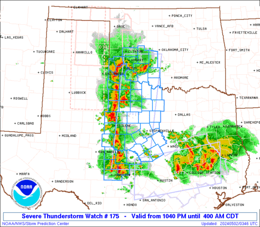
    Decent look at the SPC's thinking for OUN's area...


  24. Default Re: Oklahoma Severe Weather Discussion - April 2011

    Probably won't rain a drop. Maybe forecasts should go out only 1-2 hours in advance.

  25. #200

    Default Re: Oklahoma Severe Weather Discussion - April 2011

    Quote Originally Posted by Bostonfan View Post
    Probably won't rain a drop. Maybe forecasts should go out only 1-2 hours in advance.
    It is frustrating but it is still nice to know what we can expect (at least sometimes). :/

Thread Information

Users Browsing this Thread

There are currently 8 users browsing this thread. (0 members and 8 guests)

Similar Threads

  1. US Volcano Activity Discussion - 2011
    By venture in forum Current Events & Open Topic
    Replies: 9
    Last Post: 09-17-2011, 06:17 PM
  2. Oklahoma Severe Weather Discussion - March 2011
    By venture in forum Weather & Geosciences
    Replies: 94
    Last Post: 04-03-2011, 11:39 AM
  3. Winter Weather Discussion - Jan/Feb 2011
    By venture in forum Weather & Geosciences
    Replies: 620
    Last Post: 02-23-2011, 02:31 AM
  4. Winter Weather Discussion - Feb 2011
    By Matt in forum Current Events & Open Topic
    Replies: 0
    Last Post: 01-31-2011, 02:28 AM
  5. Oklahoma Weather!
    By houseguy2007 in forum Weather & Geosciences
    Replies: 2
    Last Post: 08-04-2010, 05:27 PM

Bookmarks

Posting Permissions

  • You may not post new threads
  • You may not post replies
  • You may not post attachments
  • You may not edit your posts
  •  
Single Sign On provided by vBSSO