Widgets Magazine
Page 2 of 12 FirstFirst 1234567 ... LastLast
Results 26 to 50 of 287

Thread: Oklahoma Severe Weather Discussion - April 2011

  1. Default Re: Oklahoma Severe Weather Discussion - April 2011

    New Fire Warning...

    BULLETIN - EAS ACTIVATION REQUESTED
    FIRE WARNING
    OKLAHOMA CITY FIRE DEPARTMENT
    RELAYED BY NATIONAL WEATHER SERVICE NORMAN OK
    431 PM CDT WED APR 6 2011

    THE FOLLOWING MESSAGE IS BEING TRANSMITTED AT THE REQUEST OF THE
    OKLAHOMA CITY FIRE DEPARTMENT.

    SOME RESIDENTS OF THE JONES AND SPENCER AREA ARE AGAIN BEING URGED
    TO EVACUATE...AS A WILDFIRE CONTINUES. THE EVACUATION ORDER IS FOR
    THOSE PEOPLE LOCATED BETWEEN BRITTON ROAD AND NORTHEAST 63RD
    STREET...AND BETWEEN POST ROAD AND ANDERSON ROAD. YOU ARE INSTRUCTED
    TO EVACUATE TOWARD THE NORTH ALONG EITHER WESTMINSTER ROAD OR
    ANDERSON ROAD. THEN PROCEED TO THE EAST OR WEST ONCE YOU HAVE
    DISTANCED YOURSELF FROM THE FIRE.

  2. Default Re: Oklahoma Severe Weather Discussion - April 2011

    NOTE: The ChatOKC.com room is now online and will remain live through Sunday. Comments are initially moderated, but you will be approved after the first comment and avoid further moderation.

    NWS Norman highlighting Sunday as a potential "High Impact" fire weather day. Surface relative humidity values are expected to be well below 30% anywhere from I-35 to the west. Winds will be extremely high with gusts up to 60 mph in addition to a wind shift (front) later in the day.


  3. #28

    Default Re: Oklahoma Severe Weather Discussion - April 2011

    Slight risk for Friday is gone now.


  4. Default Re: Oklahoma Severe Weather Discussion - April 2011

    Quote Originally Posted by jn1780 View Post
    Slight risk for Friday is gone now.
    Its pretty much always been a conditional risk if enough lift develops and storms pop up. GFS is holding tight showing convection, NAM and others aren't. So we'll see what happens. If a storm goes up tomorrow, it will be severe regardless. The outlined risk area was removed since coverage won't be extensive at all.

  5. Default Re: Oklahoma Severe Weather Discussion - April 2011

    More fires out there still. LW is up, but its not enjoyable anymore with Demoman2k10 talking too much, being to controlling, and knocking Ryan down. *sighs* Venture, is your chat up for fires, too?

  6. Default Re: Oklahoma Severe Weather Discussion - April 2011

    Yeah the chat is running (check your email for the invite). I'll be out this evening, but it will be up through Sunday.

  7. Default Re: Oklahoma Severe Weather Discussion - April 2011

    I don't see the email.

    I forgot to mention in previous post that I was going to write about.

    4 is doing a horrible job with the fire coverage.

    5 is okay, not constant, but main feature going for them is online.

    9 has been the one to provide the most fire coverage and superior videos.

    So, yeah, I have been watching 9 for the fires.

  8. #33

    Default Re: Oklahoma Severe Weather Discussion - April 2011

    Quote Originally Posted by Thunder View Post
    I don't see the email.

    I forgot to mention in previous post that I was going to write about.

    4 is doing a horrible job with the fire coverage.

    5 is okay, not constant, but main feature going for them is online.

    9 has been the one to provide the most fire coverage and superior videos.

    So, yeah, I have been watching 9 for the fires.
    You don't see much helicopter coverage from KFOR. Maybe their trying to save on jet fuel. They need another sponsor, the Bob Moore- Loves- Chopper Four.

  9. #34

    Default Re: Oklahoma Severe Weather Discussion - April 2011

    90 degrees in April and a few scant inches of rain since last july....I think we all need to start praying we get some major moisture asap.
    Anyone have a extended outlook for the rest of april and may?

  10. Default Re: Oklahoma Severe Weather Discussion - April 2011

    Quote Originally Posted by Achilleslastand View Post
    90 degrees in April and a few scant inches of rain since last july....I think we all need to start praying we get some major moisture asap.
    Anyone have a extended outlook for the rest of april and may?
    Here is a high level look at the forecast from GFS for the next couple of weeks. Any mention of precip encompasses the full 24-hour time period of the day, nothing specific like "afternoon" or "morning storms". Unfortunately, no drought busters coming. In all reality, our best hope may very well end up being a tropical system coming out of the Gulf once summer gets here.

    4/8 - Chance of isolated storms Central & Northern OK. Severe probably with any storm that can get established.
    4/9 - Chance of an isolated storm along the KS border. Marginal severe chance.
    4/10 - Chance of scattered storms Western OK (mainly NW) and fart Eastern OK...central looks dry.
    4/11 - Dry.
    4/12 - Dry.
    4/13 - Chance of storms mostly Northern half, more isolated south of I-40.
    4/14 - Chance of storms Southern & Eastern OK. Severe possible mainly east of I-44 to OKC and east of I-35 to KS.
    4/15 - Dry.
    4/16 - Dry.
    4/17 - Chance of an isolated storm. Marginal severe threat.
    4/18 - Chance of storms most of the state - heavier East.
    4/19 - Chance of storms most of the state again, better chance SE.
    4/20 - Dry.
    4/21 - Dry. Some instability around could pop a stray storm.
    4/22 - Chance of an isolated storm. Severe possible mainly from Central OK north into KS & NE.
    4/23 - Chance of an isolated storm far eastern OK. Severe Possible Central and Eastern OK.

  11. Default Re: Oklahoma Severe Weather Discussion - April 2011

    Just wanted to highlight OUN's Thursday PM forecast discussion on the brewing of a possible fire storm setup for Sunday.

    SUNDAY IS OF PARTICULAR CONCERN. THE PAST 2 RUNS OF THE ECMWF
    REPRESENTS A WORSE CASE SCENARIO. THE NAM IS FAIRLY CLOSE TO THAT
    SCENARIO...AND THE GFS IS TRENDING THAT DIRECTION. NAMELY...A
    TIGHTLY WOUND UPPER LOW EJECTS ACROSS NORTHWEST OKLAHOMA AND
    WESTERN KANSAS...WHILE A SURFACE LOW DROPS TO ABOUT 990 MB IN THE
    SAME AREA. A PACIFIC FRONT/DRYLINE SWEEPS THROUGH EARLY IN THE
    DAY...RESULTING IN A PROLONGED PERIOD OF DEEP MIXING...FOLLOWED BY
    THE LATE DAY ARRIVAL OF A STRONG CONTINENTAL FRONT AND SHARP WIND
    SHIFT. THIS IS REMINISCENT OF GRADIENT WIND STORMS OF THE
    PAST...INCLUDING SOME EXCEPTIONAL FIRE WEATHER DAYS. WE EXPECT
    SUSTAINED WINDS 30 TO 40 MPH...AND SEVERE GUSTS TO 60 MPH ARE
    POSSIBLE.

  12. Default Re: Oklahoma Severe Weather Discussion - April 2011

    Slight Risk is back for mainly northern OK, but storms will be possible anywhere along the dryline.

    ...OK/KS INTO MID MS AND OH VALLEYS THIS EVENING...
    SURFACE BOUNDARY EXTENDING FROM NEAR THE OK/KS BORDER EASTWARD
    INTO MO/IL WILL LIKELY BE FOCUS OF SEVERE THUNDERSTORM DEVELOPMENT.
    OPERATIONAL AND EXPERIMENTAL MODEL
    SOLUTIONS CONTINUE TO SUPPORT THE DEVELOPMENT OF ISOLATED
    THUNDERSTORMS BY LATE THIS AFTERNOON OVER NORTHERN OK AND SOUTHEAST
    KS DESPITE WEAK FORCING ALOFT. STRONG HEATING AND INCREASING
    MOISTURE WILL HELP TO REDUCE CAP AND AID IN INITIATION. WITH
    MLCAPES RISING TO 3000 J/KG SUPERCELL STORMS WILL BE LIKELY WITH
    LARGE HAIL AND DAMAGING WINDS POSSIBLE. THE ACTIVITY IS EXPECTED TO
    INCREASE IN COVERAGE AS IT SPREADS EASTWARD ALONG THE BOUNDARY INTO
    THE MID MS VALLEY...AND EVENTUALLY INTO THE OH VALLEY AFTER
    MIDNIGHT. DAMAGING WINDS WILL LIKELY BE THE MAIN THREAT...ALTHOUGH
    LARGE HAIL WILL REMAIN POSSIBLE. IF SUPERCELL STRUCTURES CAN BE
    SUSTAINED IT WILL INCREASE THE POTENTIAL FOR TORNADOES AND VERY
    LARGE HAIL. EXPECTED COVERAGE PRECLUDES THE INCREASING LOWER RISK
    COVERAGE PROBABILITIES ATTM.

  13. Default Re: Oklahoma Severe Weather Discussion - April 2011

    So here is what the models are currently thinking if you take them all and figure out the middle ground between them.

    Isolated storm or two should fire early on the dryline in SW OK...probably around 4-6PM. These will move off to the N or NE, but don't look to go crazy. The strong stuff looks to form more towards early evening in NW OK and move off to the east, but die off quickly after midnight. If you look at the simulated radar products by the models - the NW OK activity has trended to be around two main large supercells while the SW stuff is mostly the junk convection that can't get it going.

    Most models though are in agreement now of something firing today in Oklahoma...with the greater chance north of I-40. We will see what happens and I'll have the chat up all afternoon/evening.

  14. Default Re: Oklahoma Severe Weather Discussion - April 2011

    Latest rapid refresh model has storm developing in Caddo/Kiowa/Grady county area around 4PM. Other storms firing between 5PM and 7PM in the OKC metro area and back to the west. Storms move out of the Metro area by Midnight and start to weaken rapidly.

    http://rapidrefresh.noaa.gov/hrrrcon...main=t5&wjet=1

  15. Default Re: Oklahoma Severe Weather Discussion - April 2011


    MESOSCALE DISCUSSION 0371
    NWS STORM PREDICTION CENTER NORMAN OK
    0226 PM CDT FRI APR 08 2011

    AREAS AFFECTED...PORTIONS OF CNTRL INTO NRN OK...S CNTRL KS

    CONCERNING...SEVERE POTENTIAL...WATCH POSSIBLE

    VALID 081926Z - 082100Z

    WATCH MAY BE NEEDED IN NEXT HOUR OR SO AS CONDITIONAL SEVERE THREAT
    CONTINUES TO DEVELOP ACROSS PARTS OF OK INTO FAR S-CNTRL KS. MAIN
    THREAT WILL BE LARGE HAIL WITH ANY STORMS THAT DO FORM AND CAN BE
    MAINTAINED.

    WHILE A CAP IS EXPECTED TO PREVENT WIDESPREAD CONVECTION FROM
    DEVELOPING BENEATH LARGE SCALE UPPER RIDGE NOW SHIFTING EWD INTO THE
    OZARK MTNS...A WEAK SHORTWAVE IMPULSE MIGRATING THROUGH SWLY UPPER
    LEVEL FLOW INTO WRN OK MAY PROVIDE ENOUGH SUPPORT...IN CONJUNCTION
    WITH SFC CONVERGENCE ALONG N-S ORIENTED DRY LINE ACROSS WRN OK...TO
    FOCUS DEEP LAYER ASCENT AND DEVELOP AN UPDRAFT OR TWO STRONG ENOUGH
    TO BREAK THE CAP.

    CONDITIONS APPEAR MOST FAVORABLE FOR CONVECTIVE INITIATION AROUND
    21Z IN THE VICINITY OF KFSI. VIS SATELLITE SHOWED A DEVELOPING CU
    FIELD ALONG THE RED RIVER TO NEAR KLTS TO NEAR KFSI. WHILE THIS
    CONVECTION REMAINED SHALLOW AS OF 1830Z...MESOANALYSIS INDICATED
    THAT MLCAPE VALUES HAD INCREASED TO AROUND 3000 J/KG AND THE CAP WAS
    WEAKENING DUE TO SFC HEATING. SFC OBS INDICATED SIGNIFICANT WARMING
    OVER THE LAST COUPLE OF HOURS WITH TEMPERATURES IN THE LOW TO MID
    80S. DEWPOINTS WERE ALSO BEING MAINTAINED IN THE MID 60S ON SELY SFC
    FLOW OF 10-15 KT. IN ADDITION TO THESE OBSERVATIONAL CLUES...HI-RES
    MODELS /HRRR AND WRF-NMM/ HAVE BEEN IN GOOD AGREEMENT WITH THIS
    INITIATION LOCATION/TIMING. HOWEVER...AS STATED EARLY...MODELS ALSO
    INDICATE A VERY CONDITIONAL THREAT WITH ONLY ONE OR TWO STORMS BEING
    GENERATED. ANOTHER AREA OF POSSIBLE INITIATION COULD BE FURTHER N
    TOWARD N-CNTRL OK CLOSER TO A W-E ORIENTED STATIONARY
    BOUNDARY/MOISTURE GRADIENT WHICH IS ALSO SERVING AS AN AREA FOR WEAK
    SFC CONVERGENCE. HOWEVER...THE CAP IS STRONGER HERE AND INSTABILITY
    IS SOMEWHAT WEAKER. ADDITIONALLY...SATELLITE PRESENTATION OF CUMULUS
    IN THIS REGION REMAINS POOR.

    THE MAIN THREAT WITH ANY STORMS THAT CAN OVERCOME THE CAP IS
    EXPECTED TO BE LARGE HAIL WITH MID LEVEL LAPSE RATES AROUND 7.5-8.5
    C/KM. STRONG WIND GUSTS WOULD ALSO BE POSSIBLE GIVEN SFC
    TEMPERATURE-DEWPOINT SPREADS OF AROUND 20 TO 25 DEGREES AND
    RELATIVELY DRY MID LEVELS ABOVE SHALLOW MOIST BOUNDARY LAYER.

  16. Default Re: Oklahoma Severe Weather Discussion - April 2011

    18Z Rapid Refresh simulated radar: http://rapidrefresh.noaa.gov/hrrrcon...main=t5&wjet=1

    I'll be in the chat room publishing comments for the rest of the afternoon and evening as this gets going.

  17. Default Re: Oklahoma Severe Weather Discussion - April 2011

    Is that link a predictor or actual radar? Its confusing, cuz I see an explosive development coming toward us then suddenly disappear.

  18. Default Re: Oklahoma Severe Weather Discussion - April 2011

    Quote Originally Posted by Thunder View Post
    Is that link a predictor or actual radar? Its confusing, cuz I see an explosive development coming toward us then suddenly disappear.
    That is the HRRR model. So no, it is not actual reflectivity that is currently happening.

  19. Default Re: Oklahoma Severe Weather Discussion - April 2011

    So, its saying what the potential to happen hours away?

  20. Default Re: Oklahoma Severe Weather Discussion - April 2011

    Chances are increase for development in the next hour in Blaine, Kingfisher, Garfield, and Noble counties. Also watching Comanche, Harmon, Jackson, and Greer counties.

    First cell is now south of Waukomis and Enid near Bison in southern Garfield County.

  21. Default Re: Oklahoma Severe Weather Discussion - April 2011

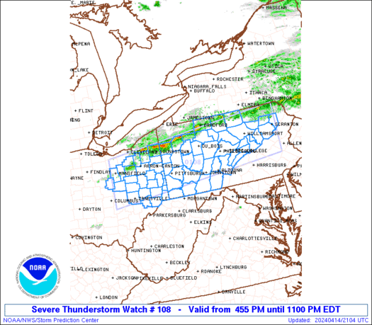
    Ww 108 tornado ks ok 082235z - 090600z
    axis..65 statute miles north and south of line..
    35n csm/clinton ok/ - 25ene cnu/chanute ks/ ..aviation coords.. 55nm n/s /45se gag - 39sw bum/ hail surface and aloft..2.5 inches. Wind gusts..60 knots.
    Max tops to 550. Mean storm motion vector 24025.

  22. Default Re: Oklahoma Severe Weather Discussion - April 2011

    Bulletin - immediate broadcast requested
    severe thunderstorm warning
    national weather service norman ok
    536 pm cdt fri apr 8 2011

    the national weather service in norman has issued a

    * severe thunderstorm warning for...
    Garfield county in northern oklahoma...
    Southern grant county in northern oklahoma...

    * until 630 pm cdt

    * at 536 pm cdt...national weather service radar indicated a severe
    thunderstorm near waukomis...moving northeast at 25 mph.

    Hazards in the warning include...
    Hail up to the size of golf balls...
    Wind gusts to 60 mph...

    * locations in the warning include bison...breckenridge...
    Covington...douglas...enid...fairmont...garber...h ayward...
    Hunter...jefferson...kremlin...lamont...medford... north enid...pond
    creek...vance air force base and waukomis.

  23. Default Re: Oklahoma Severe Weather Discussion - April 2011


    PROBABILITY TABLE:
    PROB OF 2 OR MORE TORNADOES : 30%
    PROB OF 1 OR MORE STRONG /F2-F5/ TORNADOES : 20%
    PROB OF 10 OR MORE SEVERE WIND EVENTS : 30%
    PROB OF 1 OR MORE WIND EVENTS >= 65 KNOTS : 20%
    PROB OF 10 OR MORE SEVERE HAIL EVENTS : 40%
    PROB OF 1 OR MORE HAIL EVENTS >= 2 INCHES : 30%
    PROB OF 6 OR MORE COMBINED SEVERE HAIL/WIND EVENTS : 80%


    URGENT - IMMEDIATE BROADCAST REQUESTED
    TORNADO WATCH NUMBER 108
    NWS STORM PREDICTION CENTER NORMAN OK
    535 PM CDT FRI APR 8 2011

    THE NWS STORM PREDICTION CENTER HAS ISSUED A
    TORNADO WATCH FOR PORTIONS OF

    SOUTH CENTRAL INTO EAST CENTRAL KANSAS
    WESTERN AND NORTHERN OKLAHOMA

    EFFECTIVE THIS FRIDAY AFTERNOON AND SATURDAY MORNING FROM 535 PM
    UNTIL 100 AM CDT.

    ISOLATED TORNADOES
    SCATTERED LARGE HAIL
    ISOLATED HAIL TO 2.5 INCHES IN DIAMETER POSSIBLE
    WIDELY SCATTERED DAMAGING WINDS TO 70 MPH

    THE TORNADO WATCH AREA IS APPROXIMATELY ALONG AND 65 STATUTE
    MILES NORTH AND SOUTH OF A LINE FROM 35 MILES NORTH OF CLINTON
    OKLAHOMA TO 25 MILES EAST NORTHEAST OF CHANUTE KANSAS. FOR A
    COMPLETE DEPICTION OF THE WATCH SEE THE ASSOCIATED WATCH OUTLINE
    UPDATE (WOUS64 KWNS WOU8).

    REMEMBER...A TORNADO WATCH MEANS CONDITIONS ARE FAVORABLE FOR
    TORNADOES AND SEVERE THUNDERSTORMS IN AND CLOSE TO THE WATCH
    AREA. PERSONS IN THESE AREAS SHOULD BE ON THE LOOKOUT FOR
    THREATENING WEATHER CONDITIONS AND LISTEN FOR LATER STATEMENTS
    AND POSSIBLE WARNINGS.

    OTHER WATCH INFORMATION...CONTINUE...WW 106...WW 107...

    DISCUSSION...TSTMS HAVE FORMED IN THE PAST HALF HOUR ALONG LOW-LVL
    CONFLUENCE AXIS OVER N CNTRL OK. TWRG CU EXTEND SSW FROM THAT AREA
    ALONG DRY LINE INTO SW OK. SFC-BASED CU ALSO ARE APPARENT ALONG W/E
    FRONT OVER S CNTRL/E CNTRL KS. DESPITE APPARENT RIDGING ALOFT /PER
    WV IMAGERY/...COMBINATION OF STRONG INSTABILITY AND LOW-LVL
    CONFLUENCE MAY SUPPORT SUSTAINED STORMS/POSSIBLE SUPERCELLS WITH
    LARGE HAIL/LOCALLY DMGG WIND THROUGH LATE EVE. WHILE LOW-LVL SHEAR
    ATTM IS SOMEWHAT MARGINAL FOR TORNADOES...EXPECTED STRENGTHENING OF
    850-700 MB FLOW AFTER DARK INTERACTING WITH EXISTING SUSTAINED
    STORMS MAY YIELD A THREAT FOR TORNADOES.

    AVIATION...TORNADOES AND A FEW SEVERE THUNDERSTORMS WITH HAIL
    SURFACE AND ALOFT TO 2.5 INCHES. EXTREME TURBULENCE AND SURFACE
    WIND GUSTS TO 60 KNOTS. A FEW CUMULONIMBI WITH MAXIMUM TOPS TO
    550. MEAN STORM MOTION VECTOR 24025.

  24. Default Re: Oklahoma Severe Weather Discussion - April 2011

    Looks like activity is going to start developing extremely fast. Majority of the updates will be on the chat room at ChatOKC.com, but will try to keep major things updated here as well.

  25. Default Re: Oklahoma Severe Weather Discussion - April 2011

    We are now dealing with rapid developing storms across the state. Tornado risk is highly there. Severe hail producers. Latest report about 3" and higher is falling. Stay up-to-date on Venture's chat at http://www.chatokc.com to protect your life.

Thread Information

Users Browsing this Thread

There are currently 8 users browsing this thread. (0 members and 8 guests)

Similar Threads

  1. US Volcano Activity Discussion - 2011
    By venture in forum Current Events & Open Topic
    Replies: 9
    Last Post: 09-17-2011, 06:17 PM
  2. Oklahoma Severe Weather Discussion - March 2011
    By venture in forum Weather & Geosciences
    Replies: 94
    Last Post: 04-03-2011, 11:39 AM
  3. Winter Weather Discussion - Jan/Feb 2011
    By venture in forum Weather & Geosciences
    Replies: 620
    Last Post: 02-23-2011, 02:31 AM
  4. Winter Weather Discussion - Feb 2011
    By Matt in forum Current Events & Open Topic
    Replies: 0
    Last Post: 01-31-2011, 02:28 AM
  5. Oklahoma Weather!
    By houseguy2007 in forum Weather & Geosciences
    Replies: 2
    Last Post: 08-04-2010, 05:27 PM

Bookmarks

Posting Permissions

  • You may not post new threads
  • You may not post replies
  • You may not post attachments
  • You may not edit your posts
  •  
Single Sign On provided by vBSSO