Widgets Magazine
Page 4 of 4 FirstFirst 1234
Results 76 to 95 of 95

Thread: Oklahoma Severe Weather Discussion - March 2011

  1. Default Re: Oklahoma Severe Weather Discussion - March 2011

    :-) I was just getting ready to do the extended outlook post, and yes snow is part of the forecast as of right now.

    Precip Outlook

    3/25 - Slight chance for some storms in SE OK that could approach severe limits, but nothing to big.

    3/26 - Slight chance of storms from roughly just west of I-35 and to the east. Anything that forms will move quickly so rain chances will be brief.

    3/29 & 3/30 - Light to moderate rain chances for western and northern Oklahoma. Amounts don't look all that great, but anything else.

    3/31 - Moderate to Heavy precip chances kick in. Yes I said the ever non-descrip "precip". Heaviest precip appears to be roughly from I-44 and to the north. As it looks right now, anything in Central OK should remain liquid...but it will be a very cold rain. However, don't be shocked if we see some mixing to maybe a late change over to snow and pick up a quick inch. Western OK (especially in the panhandles) could see a heavy wet accumulating snow that may put down a few inches. Will need to watch it and see if this will actually happen.

    4/5 - Chance of storms Central & SW OK.

    4/6 - Looks wet as well. Should be mostly rain, and a very broad coverage of precip hopefully. However central and western oklahoma could see a dusting or more of snow as well in the morning.

    Fire Danger Outlook - Keep in mind with it being so dry, nearly every day is a "high" category day. This outlook assumes that and builds off of it.

    3/25 - High Fire Danger most of the state, humidity values will be up from 30% west to 60% east.
    3/26 - Very High to Extreme Danger Central and West. Humidity values around 10% west to 30% central and 70% east. Wind won't be too high, so should remain below Red Flag status.
    3/27 - High to Very High mostly West and South.
    3/28 - High - Mostly SW OK.
    3/29 - High - Mostly west.
    3/30 - Very High to Extreme Central to SW Oklahoma. Humidity values under 30% and winds will be up a bit.
    3/31 - Moderate to High. Mainly south.
    4/1 - Moderate
    4/2 - High
    4/3 - High to Very High
    4/4 - High to Very High
    4/5 - High to Very High
    4/6 - Moderate to High
    4/7 - High to Very High
    4/8 - High to Very High
    4/9 - High

  2. Default Re: Oklahoma Severe Weather Discussion - March 2011

    Drought map updated...


  3. Default Re: Oklahoma Severe Weather Discussion - March 2011

    Several fires burning across the state...


    Also Severe Weather concerns south.


    MESOSCALE DISCUSSION 0271
    NWS STORM PREDICTION CENTER NORMAN OK
    0343 PM CDT FRI MAR 25 2011

    AREAS AFFECTED...NCNTRL/NERN TX...SCNTRL/SERN OK...SWRN AR AND
    EXTREME NRN LA

    CONCERNING...SEVERE POTENTIAL...WATCH POSSIBLE

    VALID 252043Z - 252315Z

    LATEST VISIBLE SATELLITE IMAGERY DEPICTS A DEEPENING CUMULUS FIELD
    ACROSS THE WARM SECTOR OVER SCNTRL/SERN OK AND NCNTRL TX.
    HOWEVER...RIDGE/ANTICYCLONIC CHARACTER TO HIGH-LEVEL CLOUDS MOVING
    OVER THE REGION AND LACK OF SUBSTANTIAL LOW-LEVEL CONVERGENCE WILL
    PROBABLY BE DETRIMENTAL TO SURFACE-BASED CONVECTIVE INITIATION UNTIL
    AFTER 23Z OR SO. THEREAFTER...WEAK HEIGHT FALLS ASSOCIATED WITH AN
    UPSTREAM TROUGH AND THE PRE-EXISTING WARM BOUNDARY LAYER MAY BECOME
    SLIGHTLY MORE FAVORABLE FOR INITIATION. THERE APPEARS TO BE ENOUGH
    EVIDENCE TO SUPPORT LATEST RUC/GFS/NAM SOLUTIONS FOR AT LEAST
    ISOLATED THUNDERSTORMS NEAR THE TRIPLE POINT AND SWD ALONG THE
    DRYLINE FROM SCNTRL OK INTO NCNTRL TX NEAR SUNSET WHERE NRN-EXTENT
    OF 1000-1500 J/KG MLCAPES WILL EXIST.

    SHOULD A STORM FORM...ROUGHLY 45-50 KTS OF LARGELY UNIDIRECTIONAL
    DEEP-LAYER SHEAR AND MID-LEVEL LAPSE RATES IN EXCESS OF 7 DEG C PER
    KM WILL BE FAVORABLE FOR SPLITTING SUPERCELLS CAPABLE OF LARGE HAIL.
    A SUSTAINED SURFACE-BASED STORM EVOLVING ALONG/N OF THE RED RIVER
    NEAR A WARM FRONT COULD PRODUCE A TORNADO OR TWO...BUT THE HAIL RISK
    WILL DOMINATE.

    OTHERWISE...ADDITIONAL ACTIVITY IS EXPECTED TO EVOLVE AND/OR DEVELOP
    ALONG/N OF THE WARM FRONT AS ELEVATED ENTITIES OVER ERN OK AND CNTRL
    AR LATER THIS EVENING WITH POSSIBLE LARGE HAIL.

  4. Default Re: Oklahoma Severe Weather Discussion - March 2011


    URGENT - IMMEDIATE BROADCAST REQUESTED
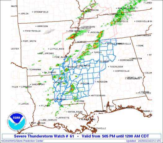
    SEVERE THUNDERSTORM WATCH NUMBER 61
    NWS STORM PREDICTION CENTER NORMAN OK
    1050 PM CDT FRI MAR 25 2011

    THE NWS STORM PREDICTION CENTER HAS ISSUED A
    SEVERE THUNDERSTORM WATCH FOR PORTIONS OF

    WESTERN ARKANSAS
    NORTHWEST LOUISIANA
    SOUTH-CENTRAL AND SOUTHEAST OKLAHOMA
    NORTHEAST TEXAS

    EFFECTIVE THIS FRIDAY NIGHT AND SATURDAY MORNING FROM 1050 PM
    UNTIL 600 AM CDT.

    WIDELY SCATTERED DAMAGING WINDS
    ISOLATED WIND GUSTS TO 70 MPH POSSIBLE
    SCATTERED LARGE HAIL
    ISOLATED HAIL TO 2.0 INCHES IN DIAMETER POSSIBLE
    ISOLATED TORNADOES

    THE SEVERE THUNDERSTORM WATCH AREA IS APPROXIMATELY ALONG AND 70
    STATUTE MILES NORTH AND SOUTH OF A LINE FROM 45 MILES NORTHWEST
    OF DURANT OKLAHOMA TO 50 MILES EAST OF TEXARKANA ARKANSAS. FOR A
    COMPLETE DEPICTION OF THE WATCH SEE THE ASSOCIATED WATCH OUTLINE
    UPDATE (WOUS64 KWNS WOU1).

    REMEMBER...A SEVERE THUNDERSTORM WATCH MEANS CONDITIONS ARE
    FAVORABLE FOR SEVERE THUNDERSTORMS IN AND CLOSE TO THE WATCH
    AREA. PERSONS IN THESE AREAS SHOULD BE ON THE LOOKOUT FOR
    THREATENING WEATHER CONDITIONS AND LISTEN FOR LATER STATEMENTS
    AND POSSIBLE WARNINGS. SEVERE THUNDERSTORMS CAN AND OCCASIONALLY
    DO PRODUCE TORNADOES.

    DISCUSSION...TSTMS ARE EXPECTED TO INCREASE IN COVERAGE AND
    INTENSITY OVERNIGHT TO THE N OF QUASI-STATIONARY BOUNDARY EXTENDING
    FROM SFC LOW OVER N-CNTRL TX ESEWD INTO NRN LA. THE COMBINATION OF
    STEEP MIDLEVEL LAPSE RATES AND INCREASING LOW-LEVEL MOISTURE ARE
    YIELDING A MODERATELY UNSTABLE AIR MASS WITH MUCAPE OF 1000-2000
    J/KG.
    CURRENT THINKING IS THAT NOCTURNAL COOLING IN THE BOUNDARY LAYER AND
    MODEST MOISTURE CONTENT WILL RESULT IN SUFFICIENT SURFACE-BASED
    CONVECTIVE INHIBITION SUCH THAT STORMS SHOULD REMAIN SLIGHTLY
    ELEVATED. GIVEN THE PRESENCE OF 40-50 KT OF EFFECTIVE BULK
    SHEAR...ENVIRONMENT WILL BE SUPPORTIVE OF SUPERCELLS. WHILE A BRIEF
    TORNADO IS POSSIBLE...HAIL APPEARS TO BE THE PRIMARY HAZARD.

    AVIATION...A FEW SEVERE THUNDERSTORMS WITH HAIL SURFACE AND ALOFT
    TO 2 INCHES. EXTREME TURBULENCE AND SURFACE WIND GUSTS TO 60
    KNOTS. A FEW CUMULONIMBI WITH MAXIMUM TOPS TO 500. MEAN STORM
    MOTION VECTOR 27035.

  5. Default Re: Oklahoma Severe Weather Discussion - March 2011

    Slight risk of severe weather has been issued for the area today (monday) due to risk of hail at or above severe limits.


    DAY 1 CONVECTIVE OUTLOOK
    NWS STORM PREDICTION CENTER NORMAN OK
    1244 AM CDT MON MAR 28 2011

    VALID 281200Z - 291200Z

    ...THERE IS A SLGT RISK OF SVR TSTMS MONDAY NIGHT ACROSS PARTS OF
    WRN...CENTRAL AND SRN OK...

    ...SYNOPSIS...
    A BAND OF WLY MID-UPPER LEVEL FLOW WILL REMAIN ACROSS THE SRN
    TWO-THIRDS OF THE CONUS TO THE SOUTH OF A PERSISTENT OMEGA BLOCKING
    PATTERN LOCATED ACROSS THE NRN EXTENT OF NORTH AMERICA. A MIDLEVEL
    TROUGH EXPECTED TO BE OVER THE TN VALLEY AT 12Z TODAY WILL TRACK EWD
    TO AND THEN OFF THE MID ATLANTIC COAST THIS EVENING. A SECOND
    MIDLEVEL TROUGH EMBEDDED WITHIN THE AFOREMENTIONED FLOW ALOFT WILL
    TRACK SEWD FROM ITS CURRENT POSITION OVER THE PACIFIC NW...PER WATER
    VAPOR IMAGERY...AND REACH THE CENTRAL ROCKIES/HIGH PLAINS BY 12Z
    TUESDAY.

    A STALLED FRONT WILL PERSIST FROM NRN FL WWD ALONG THE GULF COAST
    TODAY. THE WRN EXTENSION OF THIS BOUNDARY IS EXPECTED TO ADVANCE
    NWD THROUGH TX AS A LEE CYCLONE DEVELOPS OVER THE SRN HIGH PLAINS.
    THIS LOW SHOULD MOVE INTO WEST CENTRAL TX LATE IN THE FORECAST
    PERIOD. MEANWHILE...THE ERN EXTENSION OF THE STALLED FRONT IS
    FORECAST TO SHIFT SWD MONDAY NIGHT TOWARD CENTRAL FL AS SURFACE HIGH
    PRESSURE BUILDS INTO THE SERN STATES IN THE WAKE OF THE DEPARTING
    MIDLEVEL TROUGH.

    ...PARTS OF WRN/CENTRAL AND SRN OK...
    THE AIR MASS ALONG THE RETREATING FRONT THROUGH TX AND ALONG THE DRY
    LINE IN W TX IS EXPECTED TO REMAIN CAPPED THROUGH PEAK HEATING...
    PRECLUDING THE DEVELOPMENT OF CONVECTION/TSTMS. THE GREATEST
    POTENTIAL FOR TSTMS IS FORECAST ACROSS OK LATE IN THE FORECAST
    PERIOD /MAINLY AFTER 29/06Z/.

    A SSWLY LLJ WILL STRENGTHEN MONDAY EVENING/NIGHT TO 35-45 KT FROM
    WEST CENTRAL TX INTO OK IN RESPONSE TO HEIGHTS BEGINNING TO FALL
    WITH THE APPROACH OF THE PACIFIC NORTHWEST TROUGH. STRONG LOW LEVEL
    MOISTENING AND WAA/ISENTROPIC ASCENT WITHIN THE NOSE OF THE LLJ WILL
    AID IN THE DEVELOPMENT OF ELEVATED TSTMS ACROSS MUCH OF OK BETWEEN
    29/06-12Z. FORECAST SOUNDINGS SHOW MUCAPE AROUND 1000 J/KG WITH
    EFFECTIVE BULK SHEAR INCREASING TO 40-50 KT. THIS COMBINED WITH
    STEEP MIDLEVEL LAPSE RATES /7.5-8 C PER KM/ WILL SUPPORT SEVERE HAIL
    WITH THE STRONGER CORES. GIVEN THE DEGREE OF INSTABILITY/SHEAR AND
    OVERALL AGREEMENT WITH THE AREA FOR CONVECTION BY THE MODELS...A
    SLIGHT RISK AREA FOR HAIL HAS BEEN INTRODUCED ACROSS OK.

  6. Default Re: Oklahoma Severe Weather Discussion - March 2011

    Each time Venture make a post, it feels like Christmas morning. :-D

  7. #82

    Default Re: Oklahoma Severe Weather Discussion - March 2011

    Quote Originally Posted by venture79 View Post
    Slight risk of severe weather has been issued for the area today (monday) due to risk of hail at or above severe limits.

    Yay... Hail..

  8. Default Re: Oklahoma Severe Weather Discussion - March 2011

    Quote Originally Posted by diggyba View Post
    Yay... Hail..
    It is more like for David to be the most excited, because he has been waiting for extreme hail and/or tornado to destroy his roof. He has been waiting for years to file a serious claim on his insurance policy for a glorious roof.

  9. #84

    Default Re: Oklahoma Severe Weather Discussion - March 2011

    Hopefully this thread gets more active in the next couple weeks. It has been pretty quiet so far this season.

  10. #85

    Default Re: Oklahoma Severe Weather Discussion - March 2011

    We're in that period between blizzards and tornado's

  11. Default Re: Oklahoma Severe Weather Discussion - March 2011

    Risk area was downgraded in the new update. Looks like most of the energy will go north of OK tonight, but a risk of hail still exists...just not as high as earlier.

    ...OK...
    ZONAL FLOW IN PLACE WITH EMBEDDED S/WV IMPULSES FROM NRN
    INTERMOUNTAIN REGION EWD ACROSS THE CENTRAL PLAINS TO MID ATLANTIC
    STATES. SHALLOW COLD DOME NOW COVERS MUCH OF SRN PLAINS TOPPED BY A
    DRY EML AS FAR N AS SRN KS. GULF MOISTURE IS RETURNING NWD JUST
    ABOVE THE COLD DOME THRU THE SRN PLAINS AND WILL LEAD TO SUFFICIENT
    ELEVATED CAPE BY TONIGHT FOR CONVECTIVE POTENTIAL ACROSS OK. IT NOW
    APPEARS WITH THE NEXT S/WV CURRENTLY MOVING EWD INTO WY/NRN CO
    TRACKING N OF OK AND ONLY A MODEST LOW LVL SLY FLOW TO TRANSPORT THE
    GULF MOISTURE NWD INTO OK TONIGHT...THE THREAT FOR AN ELEVATED HAIL
    THREAT HAS LESSENED. WHILE THUNDERSTORMS ARE POSSIBLE VICINITY OF
    OK...PRIMARILY AFTER 06Z...THE THREAT FOR LARGE HAIL IS NOW LOWER
    THAN EARLIER FORECASTED.

  12. Default Re: Oklahoma Severe Weather Discussion - March 2011

    Updated look go forward...since its obvious forecasts made 12 hours ago aren't very accurate. :-P

    3/31 - Mostly dry, some showers possible NE. 50s NE to near 70 SW. Fire Danger High (west).

    4/1 - Maybe a storm along the Red River. Mostly dry elsewhere. Temps Upper 60s to Mid 70s. Fire Danger High Western 1/3rd.

    4/2 - Maybe an isolated severe storm, but looks like the atmosphere will be mostly capped. Temps 70s to Mid 80s. Winds 10-20 mph with gusts out of the SE. Looks like a pretty humid day as well, so fire danger should be kept down some except in far SW OK where the dryline may push through by afternoon. Mostly likely area for storm development will be east of I-35 after dark.

    4/3 - Western 1/2 of OK... Very dry and warm. Temps 80s to near 90. Extreme Fire Danger. Eastern 1/2 of OK... Potential for scattered severe storms (a lot of instability is being forecast). Precip forecasts are very low to dry, but the risk will be there it seems if anything can pop. Very moist atmosphere (dewpoints near 70...which is likely way overforecast, but i'll mention it anyway)...temps in the mid to upper 70s.

    4/4 - Cooler with the passage of the very strong cold front. Temps in the 50s north to low 70s south. Scattered severe storms along the Red River (mainly SE OK). Very windy with winds from the North and NE around 20-30 mph. Dry with high fire danger (thanks to winds) but humidity won't be extremely low.

    4/5 - Some moisture around finally. Very cool to cold. Temps could be in the 30s in the morning over much of OK warming into the 50s by afternoon. Chance of rain south with a better chance of rain, mixing with snow, in the NW and NC part of the state. GFS wants to put down a quick 1-2 inches of snow between Woodward and Elk City...but its not happening. :-P

    4/6 - Dry. Warming back up. Temps in the 70s west to 60s east. Windy. High to Very High fire danger in the west.

    4/7 - Warm. Temps mainly 70s and 80s. Chance of storms NW. Very High to Extreme fire danger Western OK.

    4/8 - Chance of storms Eastern 1/2 of OK. Temps 70s and 80s. Windy. Very High to Extreme fire danger I-35 and west.

    4/9 - Cooler. Temps 60s and 70s. Chance of Rain/Storms east and south. High fire danger Central and West.

    4/10 - Potential for significant statewide rainfall. Still a low chance this will happen since it is so far out, but will roll with it for now. Widespread forecast of 1" or more of rainfall from central into eastern OK. General area of at least 1/2 inch of rain elsewhere. Severe threat appears marginal across southern OK. Temps 50s and 60s. Fire danger obviously low to moderate if this takes place.

    4/11 - Light to Moderate Rain exiting to the east. Light amounts west to over a half inch east. Temps 50s and 60s. Strong north winds. Fire danger moderate to high in the west (depending on how much moisture we actually get).

    4/12 - Scattered showers NW. Temps 50s with gusty north winds. Fire threat looks moderate.

    4/13 - Dry. Temps 50s and 60s (probably lowballing it0. Winds out of SE. Fire threat looks moderate.

  13. #88

    Default Re: Oklahoma Severe Weather Discussion - March 2011

    Jeeeez! Can we get this cloud bank to do a shuttle liftoff?? It's been like Seattle here for a week!

  14. Default Re: Oklahoma Severe Weather Discussion - March 2011

    Quote Originally Posted by OKCisOK4me View Post
    Jeeeez! Can we get this cloud bank to do a shuttle liftoff?? It's been like Seattle here for a week!
    I know. I couldn't believe it when there was such a "risk" for any hail to be falling when the weather is just too cold lately. And no sunshine. It is quite sad. :-( I really want the warmer weather to return. Its getting too cold here.

  15. Default Re: Oklahoma Severe Weather Discussion - March 2011


  16. Default Re: Oklahoma Severe Weather Discussion - March 2011

    I like that, UNF.

    And the clouds finally went away. I don't remember how long the clouds been around, but each day was totally unexpected to see clouds....clouds....clouds. Ahhh, good ole sunshine. :-D

    Lets see when I can move to Rhode Island, or that Mesa, Arizona town. Okay, I'll stay here, and tough out the tornadoes with everyone on here. Hey, when I totally stop posting, ya know one of those tornadoes finally got me. :-)

  17. Default Re: Oklahoma Severe Weather Discussion - March 2011

    Oklahoma may be turning black today.


  18. Default Re: Oklahoma Severe Weather Discussion - March 2011

    We've moved on to April. :-)

    http://www.okctalk.com/showthread.php?t=25319

  19. #94

    Default Re: Oklahoma Severe Weather Discussion - March 2011

    Smells like Texas is blowing past. Are we due a dust storm?

Thread Information

Users Browsing this Thread

There are currently 3 users browsing this thread. (0 members and 3 guests)

Similar Threads

  1. US Volcano Activity Discussion - 2011
    By venture in forum Current Events & Open Topic
    Replies: 9
    Last Post: 09-17-2011, 06:17 PM
  2. Winter Weather Discussion - Jan/Feb 2011
    By venture in forum Weather & Geosciences
    Replies: 620
    Last Post: 02-23-2011, 02:31 AM
  3. Replies: 2
    Last Post: 02-19-2011, 07:51 PM
  4. Winter Weather Discussion - Feb 2011
    By Matt in forum Current Events & Open Topic
    Replies: 0
    Last Post: 01-31-2011, 02:28 AM
  5. Oklahoma Gardening School set for March 10
    By Keith in forum General Civic Issues
    Replies: 4
    Last Post: 02-06-2007, 05:18 PM

Bookmarks

Posting Permissions

  • You may not post new threads
  • You may not post replies
  • You may not post attachments
  • You may not edit your posts
  •  
Single Sign On provided by vBSSO