Widgets Magazine
Page 1 of 2 12 LastLast
Results 1 to 25 of 26

Thread: Severe Weather Potential - 4/28 and 4/29

  1. Default Severe Weather Potential - 4/28 and 4/29

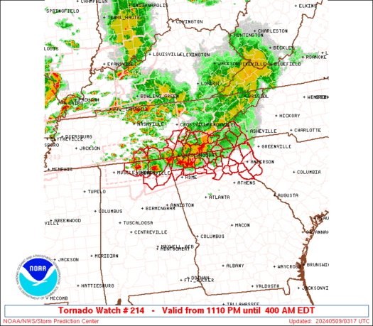
    Since I know people are expecting this. LOL

    Slight risk of severe weather from I-35 to the west from overnight tonight through tomorrow. Main risk is going to be some hail storms. Little to no tornado threat. So if you get woke up in the middle of the night, the worst thing expected is that your yard is getting a nice buffing.

    SPC Outlook for tomorrow:

    ...SRN THROUGH CNTRL PLAINS AREAS...

    AREAS OF ONGOING CONVECTION AND TIMING OF IMPULSES EJECTING INTO THE
    PLAINS CONTINUE TO COMPLICATE THIS FORECAST. A FEW STORMS AND
    POSSIBLY A MCS OR TWO MAY BE IN PROGRESS EARLY IN THE PERIOD ACROSS
    A PORTION OF THE SRN AND CNTRL PLAINS WITHIN ZONE OF WARM ADVECTION
    AND ISENTROPIC LIFT ASSOCIATED WITH THE SLY LOW LEVEL JET. SOME
    THREAT FOR MARGINALLY SEVERE HAIL MAY EXIST WITH THE EARLY ACTIVITY.
    MODELS CONTINUE TO INDICATE A SHORTWAVE TROUGH WILL ADVANCE EWD
    THROUGH THE SRN AND CNTRL PLAINS DURING THE FIRST HALF OF THE DAY
    AND HELP TO MAINTAIN THE LOW LEVEL JET THAT WILL GRADUALLY VEER AS
    THE IMPULSE CONTINUES EWD. THESE PROCESSES SHOULD SUSTAIN EARLY
    STORMS EWD INTO THE MID MS VALLEY BY LATE AFTERNOON. DESTABILIZATION
    POTENTIAL WILL BE LIMITED ALONG THE CONVECTIVELY ACTIVE WARM
    CONVEYOR BELT...BUT EVEN MODEST WARMING OF THE BOUNDARY LAYER COULD
    PROMOTE STORMS BECOMING SURFACE BASED GIVEN DEWPOINTS IN THE 60S IN
    WARM SECTOR. VERTICAL SHEAR AND LOW LEVEL HODOGRAPHS FROM CNTRL TX
    NWD INTO OK WILL FAVOR ORGANIZED STORMS INCLUDING THREAT OF
    SUPERCELLS AND BOW ECHOES. HOWEVER...ANY SEVERE THREAT WITH THIS
    ACTIVITY REMAINS CONDITIONAL DUE TO LIKELIHOOD OF A MARGINAL
    THERMODYNAMIC ENVIRONMENT. MID LEVEL FLOW AND BULK SHEAR WILL LIKELY
    BE SOMEWHAT WEAKER ACROSS KS BETWEEN FASTER NRN STREAM FLOW AND SRN
    STREAM IMPULSE.

  2. Default Re: Severe Weather Potential - 4/28 and 4/29

    Came home bout an hour ago and seeing some storms far SW portion of the state moving NE. No watches. Just that one Heavy T-Storm warning that I've seen.

  3. Default Re: Severe Weather Potential - 4/28 and 4/29

    Here an update for those this morning that checks OKCTalk without turning on the TV.

    Storms in the SW portion of the state continues to expand and move NE toward the metro. Here is the radar posted at 4:40am.


    The below pix may change since the time of this post.


    The cold front that swept thru the state yesterday stalled around the Red River border. It is now a warm front and moving back north thru the metro. The front is sparking storms in the SW portion of the state and these storms are ongoing and moving NE toward the metro.

    What to expect? Heavy rain. Some hail and lightning. At this time, there is no concern for a tornado.

    THE NATIONAL WEATHER SERVICE HAS ISSUED SEVERE THUNDERSTORM WATCH
    208 UNTIL 11 AM CDT THIS MORNING WHICH REPLACES A PORTION OF
    SEVERE THUNDERSTORM WATCH 206. THE NEW WATCH IS VALID FOR THE
    FOLLOWING AREAS

    IN OKLAHOMA THE NEW WATCH INCLUDES 7 COUNTIES

    IN SOUTHWEST OKLAHOMA

    COMANCHE COTTON GREER
    HARMON JACKSON KIOWA
    TILLMAN

    IN TEXAS THE NEW WATCH INCLUDES 5 COUNTIES

    IN NORTHERN TEXAS

    FOARD HARDEMAN KNOX
    WICHITA WILBARGER

    THIS INCLUDES THE CITIES OF...ALTUS...CHILLICOTHE...CROWELL...
    FREDERICK...HOBART...HOLLIS...KNOX CITY...LAWTON...MANGUM...
    MUNDAY...QUANAH...VERNON...WALTERS AND WICHITA FALLS.
    Throughout the night, additional watches placed.

    THE NATIONAL WEATHER SERVICE HAS ISSUED SEVERE THUNDERSTORM WATCH
    208 IN EFFECT UNTIL 11 AM CDT THIS MORNING FOR THE FOLLOWING
    AREAS

    IN OKLAHOMA THIS WATCH INCLUDES 18 COUNTIES

    IN CENTRAL OKLAHOMA

    CANADIAN CLEVELAND GRADY
    MCCLAIN OKLAHOMA POTTAWATOMIE

    IN NORTHWEST OKLAHOMA

    BLAINE

    IN SOUTHERN OKLAHOMA

    CARTER GARVIN JEFFERSON
    LOVE MURRAY STEPHENS

    IN SOUTHWEST OKLAHOMA

    CADDO

    IN WESTERN OKLAHOMA

    BECKHAM CUSTER ROGER MILLS
    WA****A

    IN TEXAS THIS WATCH INCLUDES 3 COUNTIES

    IN NORTHERN TEXAS

    ARCHER BAYLOR CLAY

    THIS INCLUDES THE CITIES OF...ANADARKO...ARCHER CITY...ARDMORE...
    CHEYENNE...CHICKASHA...CLINTON...CORDELL...DUNCAN. ..EL RENO...
    ELK CITY...HENRIETTA...MARIETTA...MOORE...MUSTANG...NO RMAN...
    OKLAHOMA CITY...PAULS VALLEY...PURCELL...SAYRE...SEYMOUR...
    SHAWNEE...SULPHUR...WATONGA...WAURIKA...WEATHERFOR D AND YUKON.
    Bottom line, grab an umbrella, drive safely with the extra drive time, and have a great work day!

  4. Default Re: Severe Weather Potential - 4/28 and 4/29

    At this time, over the next 3 days, the state is under a Slight Risk for any severe weather. Keep in mind, anything can change in a flash.

  5. Default Re: Severe Weather Potential - 4/28 and 4/29

    Here is a further out west view and posted around 4:50am.


    Storms continue to develop and move E/NE.

    Areas that are prone to flood risk need to be on alert for sudden rising flood water. Specifically the NW and North Central part of the state that had already seen 5 to 10" of rain recently will especially need to be on high alert. Elsewhere, flooding can occur at any time rapidly, especially areas that are at risk for flooding. Be prepared, know alternative routes, and do not drive thru any water that covers the road.


  6. Default Re: Severe Weather Potential - 4/28 and 4/29

    This is not confirmed. Possible tornado, meaning there is rotation, but as of now, no confirmed sighting or funnel touchdown. People down south need to be on alert. Things can change suddenly.


  7. #7

    Default Re: Severe Weather Potential - 4/28 and 4/29

    As of 10am there appears to be a mesolow over central Oklahoma. It looks like the main threat for the next few hours will be heavy rain and flooding. If the complex now in place over central Oklahoma moves on out and we get some sunshine this afternoon we may get some more substantial development out west.

  8. Default Re: Severe Weather Potential - 4/28 and 4/29

    A good couple inches of rain here. I was mildly entertained watching bags of grass from a house down the street go floating by. Now if only I could get rid of the lake in the front yard.

  9. Default Re: Severe Weather Potential - 4/28 and 4/29

    Not super heavy rain downtown, but it's steady. What is most notable is how DARK it is, I think.

  10. #10

    Default Re: Severe Weather Potential - 4/28 and 4/29

    It is very dark, indeed.

  11. #11

    Default Re: Severe Weather Potential - 4/28 and 4/29

    At least my AC is getting a break, the rain washed the oak pollen off my truck, the lawn is watered and the wildfire season should come to an end. But yeah, its really dark this morning. Clouds are clearing out west so it sould start to lighten up some soon.

    Just checked radar, there appears to be some very strong winds from Ada (65mph per mesonet) to Sulphur to Ardmore. Probably be some light damage down there from wind.


    Just to add something, notice there are a few missing data points from south central Oklahoma on the mesonet. OG&E is also reporting several power outages down south, so the damage could be a little worse than I thought.

  12. #12

    Default Re: Severe Weather Potential - 4/28 and 4/29

    Carter County Emergency mgmt is reporting damage and minor injuries at the elementary school in Healdton. All from straight-line winds of around 70 mph. I would expect widespread straigh-line wind damage in southern Oklahoma form the looks of the radar presentation.

  13. #13

    Default Re: Severe Weather Potential - 4/28 and 4/29

    I'm so ready for some tornadoes

  14. #14

    Default Re: Severe Weather Potential - 4/28 and 4/29

    Quote Originally Posted by ultimatesooner View Post
    I'm so ready for some tornadoes
    ooooo me too

  15. #15

    Default Re: Severe Weather Potential - 4/28 and 4/29

    Y'all are crazy.

  16. #16

    Default Re: Severe Weather Potential - 4/28 and 4/29

    Quote Originally Posted by Luke View Post
    Y'all are crazy.
    can't disagree with you there

  17. Default Re: Severe Weather Potential - 4/28 and 4/29

    Quote Originally Posted by Luke View Post
    Y'all are crazy.
    C'mon, Luke, we all know you love tornadoes!

  18. #18

    Default Re: Severe Weather Potential - 4/28 and 4/29

    What are your thoughts on tonight and especially tomorrow Venture. I noticed new storms out west. Is it to cool for the storms to maintain themselves into c. ok tonight?

  19. Default Re: Severe Weather Potential - 4/28 and 4/29

    I think it is a matter of where the boundaries go. The cold front to the south should start moving back north tonight, and should bring the rain back with it. The storms out west I could see moving in, I don't think they'll be at the intensity they are now though. I wouldn't be shocked if we have another repeat of this morning tomorrow.

    I will say that these various MCSs do pose a bit of difficulty in forecasting them. This morning's spawned a quick tornado in Seminole, even though is was a near classic bow structure MCS. Out in the southern Panhandle right now there are about 3-4 supercells just cruising along...I would imagine these will eventually merge together and start moving east along the boundary. As the boundary moves north, that could push the storms over us. However, there is also the part of the complexes forcing the boundary further south with the cold pools they are putting out.

    However, forecast as it is now is the front moving north, storms along it and more strong-severe storms tomorrow afternoon along and north of it. Say what you want about tornadoes and such, but I am really wanting to see a derecho event with that classic mothership cloud formation. Now not that I don't want to see the widespread damage, but visually, these events are more stirring than tornado in my opinion.

    http://www.spc.noaa.gov/misc/AbtDere...1/oklagust.wmv

  20. #20

    Default Re: Severe Weather Potential - 4/28 and 4/29

    Quote Originally Posted by venture79 View Post
    Say what you want about tornadoes and such, but I am really wanting to see a derecho event with that classic mothership cloud formation. Now not that I don't want to see the widespread damage, but visually, these events are more stirring than tornado in my opinion.

    http://www.spc.noaa.gov/misc/AbtDere...1/oklagust.wmv

    Yeah, Anytime there are MCS/MCC's around the forecasting is a dog. I hadn't heard of the tornado in Seminole, but from the radar presentation this morning thats very close to where the vortex of the MCS was (coma). About the Drechos .... are you my lost twin? I love them too, usually have to wait til June for those (like clockwork) and they usually come about 3am. Unfortunately they tend to cause alot of damage in our neck of the woods. (lotta trees) But yeah they are photogenic along the leading edge. I was thinking that this morning. Wishing I was in Shawnee or further south to see the shelf cloud moving in. It had to be very impressive this morning.

    Very cool video, was that this morning?

    edit

  21. Default Re: Severe Weather Potential - 4/28 and 4/29

    Video is from the May 27th Derecho which I remember quite well. I'm with you, would love to have seen the leading edge of the complex this morning when it got ramped up.

    On the Panhandle storms...they've started their merging into a complex, so the Red River area will need to start getting ready for a windy night.

  22. Default Re: Severe Weather Potential - 4/28 and 4/29

    Venture, THAT WAS SO KOOL!!!

  23. #23

    Default Re: Severe Weather Potential - 4/28 and 4/29

    Flooding could become pretty severe down south as well. Over 9 inches of rain today in parts of s.c. Ok.

  24. Default Re: Severe Weather Potential - 4/28 and 4/29

    Flooding in central part of the state is possible. Creek, natural and manmade, in a neighborhood where mom is at is very swollen and rushing.

    Extra care driving at night is important, some roads have decline/hill/steep that some portions can have water buildup. Driving too fast can result in loss of control.

    Storms out west in the TX panhandle is moving into the state. Expect rain for the metro overnight throughout the morning hours.

    The front will move back up and somewhat stall thru half the state. There is a slight risk, including the metro area Thursday into Friday.

  25. Default Re: Severe Weather Potential - 4/28 and 4/29

    Severe Weather update...

    Severe Thunderstorm watch is up until 3AM for SW and South Central OK. There is a slight potential this could be expanded northward, but it is way too early to see if th convection can maintain intensity as it builds north.


    Bow Echo MCS is moving through Western North Texas right now. Widespread winds up to 65-70mph looks likely with this line. Some large hail looks like it may be embedded, but I wouldn't be shocked if it is just extremely heavy rain. Tail end of the bow has a history of tornadoes through the evening and this part will stay well south of the Red River. Will need to watch the comma head of the bow for any enhanced areas of rotation that could cause quick spin ups as well as gustnadoes along the leading edge of the bow.

    Looks like one hail storm moving into Harmon County here in a bit. Elsewhere scattered storms, some embedded hail storms, cover the southern parts of the state. This activity is moving mainly east with a slight northward component. While the individual cells are going this way, the activity is actually increasing to the north and will as the front and warm unstable air moves back north.

    Right now OKC metro should expect widely scattered storms later tonight and through tomorrow. Some hail storms will be embedded and any storms that do get severe could cause some damaging winds. Don't see a chance for any major MCS activity tonight that would impact the metro. Storms that would have had a chance to organize into a complex in the northern Panhandle have weakened to just an area of showers and some lightning that is over parts of western Oklahoma.

Thread Information

Users Browsing this Thread

There are currently 3 users browsing this thread. (0 members and 3 guests)

Bookmarks

Posting Permissions

  • You may not post new threads
  • You may not post replies
  • You may not post attachments
  • You may not edit your posts
  •  
Single Sign On provided by vBSSO