Widgets Magazine
Page 1 of 3 123 LastLast
Results 1 to 25 of 58

Thread: Severe Weather Risk - 3/9/2009

  1. Default Severe Weather Risk - 3/9/2009

    This was originally posted in the Politics/Current Events forum but unfortunately, it gets buried under all the political screaming like every other non-political post there. LOL

    Welcome to Spring...well from a meteorological point of view. : )

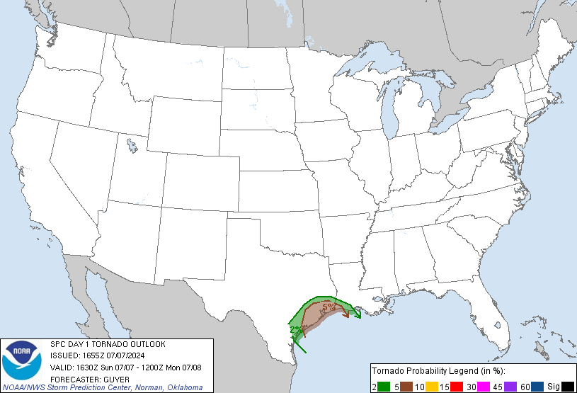
    Slight risk for severe weather today across most of the state. Main threats seems to be hail, wind and tornadoes - which I guess is just about everything. Main show looks to start in mid-Afternoon through evening. Two target areas, one will be from Central OK up through the Northeast. The second will be up and down Western Oklahoma along the dryline - that will come east into the Metro later in the evening. Main inhibiting factors look to be cloud cover and any activity that starts up tonight.

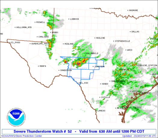
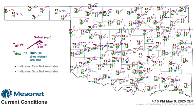
    Below are some images that should auto refresh throughout the day to make sure the best info is in this first post.

    Links:
    NWSFO Norman Enhanced Page: NWS Norman, Oklahoma - Enhanced Weather Page
    SPC Mesoanalysis Page: SPC Hourly Mesoscale Analysis Page
    WRF-NMM 4KM Forecast Model: 4.0 km WRF-NMM Precipitation Graphics

    SPC Day 1 Outlook


    Satellite Image (1KM)


    NEXRAD Mosaic Radar


    Oklahoma Mesonet Current Conditions (red air temp, green dewpoint)
  2. Default Re: Severe Weather Risk - 3/9/2009

    Storm initiation is slowly going now in western Oklahoma with one loan cell. Model data seems to indicate that we'll have one or two isolated storms develop this afternoon and move through Central OK. Then we'll have a strong/severe line develop tonight in western OK that will break apart as it moves towards us and become a broken line of maybe supercells heading our way.

    Cloud cover is hanging pretty tight now, but some breaks are developing. If the sun breaks out for a longer period of time, the more "fun" we all get to have. Latest mesonet has the 50 degree dewpoiunts well into the OKC Metro now, so moisture return is well under way. Additional updates out in about an hour.

    Side note - thought this was amusing. It is the opening paragraph from the NWS Norman office's forecast discussion for today.

    DISCUSSION...
    VERY CHALLENGING FORECAST... ON MULTIPLE LEVELS OVER THE ENTIRE
    NEXT 7 DAYS. ISSUES OF GREATEST SIGNIFICANCE ARE MAGNITUDE AND
    DURATION OF MAJOR CHILLDOWN LATER IN THE WEEK... AND POTENTIAL FOR
    ONE OR MORE WINTER PRECIP EVENTS LATTER HALF OF WEEK. OTHER
    CHALLENGES INCLUDE BUT ARE NOT LIMITED TO HIGHS... LOWS... POPS...
    CLOUDS... SEVERE POTENTIAL... PRECIP TYPE... AND FIRE WEATHER. AS
    FOR PLATE TECTONICS... WE WILL DEFER TO USGS AND OKLAHOMA GEOLOGICAL
    SURVEY TO ASSESS THE POTENTIAL FOR RESIDUALS FROM YESTERDAY`S
    MAGNITUDE 3.5 EARTHQUAKE IN OKLAHOMA CITY. AT LEAST ALASKA`S REDOUBT
    VOLCANO IS FAIRLY QUIET - FOR NOW.

  3. #3

    Default Re: Severe Weather Risk - 3/9/2009

    venture79-
    The last time you started a severe weather thread, it was almost prophetic. That said, I hope this isn't a jinx.
    Regardless, keep up the good work. Unleash your knowledge.

  4. Default Re: Severe Weather Risk - 3/9/2009

    Here are the updates. First Mesoscale Discussion from SPC on possibility of watch of for ongoing and afternoon activity.


    AREAS AFFECTED...WRN OK...NRN OK...SRN KS

    CONCERNING...SEVERE POTENTIAL...WATCH POSSIBLE

    VALID 091551Z - 091715Z

    THE HAIL THREAT WILL LIKELY INCREASE AS STORMS MOVE NEWD ACROSS WRN
    AND NRN OK LATE INTO FAR SRN KS THIS MORNING INTO EARLY THIS
    AFTERNOON. ADDITIONAL DEVELOPMENT MAY OCCUR IN PARTS OF SW OK AND
    THIS ACTIVITY SHOULD ALSO POSE A HAIL THREAT. A WW MAY BECOME
    NECESSARY IF CONVECTIVE COVERAGE AND INTENSITY CONTINUE TO INCREASE.

    LOW-LEVEL MOISTURE WILL CONTINUE TO SURGE NWD INTO SRN AND CNTRL OK
    LATE THIS MORNING AS CONVECTION FROM FAR WRN OK GRADUALLY MOVES NEWD
    INTO THE MOIST AXIS. ALTHOUGH SFC DEWPOINTS REMAIN IN THE 30S F NEAR
    THE STORM IN WRN OK...THE OUN SOUNDINGS SHOWS AN ELEVATED MOIST
    PLUME JUST BELOW 850 MB. THIS ALONG WITH WARM ADVECTION ASSOCIATED
    WITH THE LOW-LEVEL JET SHOULD SUPPORT THE ACTIVITY NEWD INTO THE
    I-35 CORRIDOR OVER THE NEXT FEW HOURS. AS LOW-LEVEL MOISTURE
    INCREASES AND SFC TEMPS WARM...STORM COVERAGE SHOULD INCREASE AND
    THE CONVECTION MAY BECOME SFC-BASED RESULTING IN A GRADUAL
    INTENSIFICATION WITH TIME. THE STRONG VERTICAL SHEAR OF 55 TO 65 KT
    ON THE PURCELL AND LAMONT OK PROFILERS ALONG WITH COLD AIR ALOFT
    /RUC ANALYZED 500 MB TEMPS OF -12 TO -14C/ SHOULD SUPPORT AN
    INCREASING HAIL THREAT AS STORMS INTENSIFY. IF THE CELLS CAN BECOME
    SFC-BASED...ISOLATED STRONG WIND GUSTS WOULD ALSO BE POSSIBLE.

    No HWO update from Norman WFO just as of yet.

    ---

    Ongoing storm in Blaine County is pretty much heavy rain and a bunch of lightning. Overall nothing that impressive. Trends continue towards weakening. Broken skies over OK continue to develop. Moisture is surging north with the warm front with dewpoints in the 60s getting more and more widespread. Short term forecast models all continue to show scattered/isolated development through this afternoon, and then a strong squall line developing between 5-8PM tonight across western Oklahoma that will march east.

  5. Default Re: Severe Weather Risk - 3/9/2009

    Quote Originally Posted by jstanthrnme View Post
    venture79-
    The last time you started a severe weather thread, it was almost prophetic. That said, I hope this isn't a jinx.
    Regardless, keep up the good work. Unleash your knowledge.
    One of these times things will flop, but i try to keep these threads mostly informational with some opinion here and there.

    I don't think today is a major tornado threat for us by any stretch. Looks like most of that will be just north of the City, but things can change and we all know they probably will now that I just said that. LOL

  6. #6

    Default Re: Severe Weather Risk - 3/9/2009

    Interesting jump in tornado % for NE Oklahoma when the latest convective outlook came out:


  7. #7

    Default Re: Severe Weather Risk - 3/9/2009

    Venture, Thanks for the updates. I'm glad I'm not the only one who finds severe weather interesting. I noticed the clouds are clearing quickly from the south and its getting pretty warm, so maybe it'll get interesting later today. We really need the rain.

    You might find this sight interesting NWS HotSeat - The NWS Warning Decision Simulator

    A little O.T. ----> Did you happen to read the forecast discussion on the NWS sight for later in the week?

    Quote from NWS:

    TEMPS LIKELY TO CRASH TUE NIGHT AS COLD AIR SURGES S. THIS IS AN
    IMPRESSIVE ARCTIC AIRMASS FOR THIS LATE IN THE COLD SEASON - PRECIP FORECAST IS THE GREATER CHALLENGE FOR MID-LATE WEEK. LONGWAVE
    PATTERN IS SETTING UP IN A WAY THAT WOULD SUPPORT POSSIBLE SNOW...
    AND POTENTIAL FOR SIGNIFICANT SNOW IF THE THERMODYNAMICS ARE RIGHT.

  8. Default Re: Severe Weather Risk - 3/9/2009

    Yeah. One thing is for sure, Norman is never a boring office to work at for those guys. LOL

  9. #9

    Default Re: Severe Weather Risk - 3/9/2009

    ANd then we are gonna got back down into the 30's and 40's... Great... and everything that I have is starting to bloom....

    Joe

  10. Default Re: Severe Weather Risk - 3/9/2009

    Looks like CU (cumulus) field is starting to develop across Central and SW Oklahoma. These are areas that have been partly to mostly cloudy for most of the day now. Dewpoints now range from upper 50s to low 60s across most of the area. Warm front is lingering just north of the OKC Metro area with the dryline extending from W of Fairview to Taloga to Butler to Sayre to Hollis. Winds mostly from the S to SSW across the area, some minor backing in the far north due to convection up in that area.

    More thoughts in a second, MCD has been issued for the area as I was typing this.


    MESOSCALE DISCUSSION 0217
    NWS STORM PREDICTION CENTER NORMAN OK
    0213 PM CDT MON MAR 09 2009

    AREAS AFFECTED...PARTS OF NW TX / CNTRL OK

    CONCERNING...SEVERE POTENTIAL...WATCH LIKELY

    VALID 091913Z - 092015Z

    SEVERE POTENTIAL WILL LIKELY INCREASE STEADILY THIS AFTN. A WW MAY
    BE NEEDED AS EARLY AS 20Z.

    VISIBLE SATELLITE IMAGERY SHOWS DEVELOPING CU FIELD ACROSS MUCH OF
    N-CNTRL TX AND S-CNTRL OK. RECENT SURFACE ANALYSIS INDICATES RAPID
    MOISTURE RETURN ACROSS THE S-CNTRL PLAINS BEHIND WARM FRONT WITH
    DEWPOINTS IN THE UPPER 50S TO NEAR 60 F IN OKLA WITH LOWER 60S IN
    N-CNTRL TX. THIS HAS OCCURRED IN PART DUE TO DIABATIC
    HEATING--RESULTING IN SUFFICIENT PBL MIXING OF 925-875 MB MOISTURE
    TO SURFACE.

    CONVECTIVE INITIATING UNCERTAINTIES ARE WHETHER ISOLD TSTMS CAN
    BREACH THE CAP THIS AFTN ALONG LOW LEVEL CONFLUENCE ZONE AHEAD OF
    INCREASING ASCENT ASSOCIATED WITH IMPULSE MOVING INTO THE REGION
    FROM NM. LATEST RUC FORECAST SOUNDINGS INDICATE THE CAP WILL WEAKEN
    SUBSTANTIALLY IN SWRN OK --FSI 79/60F-- BY 21-22Z. IF THIS OCCURS
    /20-22Z PERIOD/ A WW WILL LIKELY BE NEEDED IN THE NEXT FEW HRS.
    STRONG...VEERING WIND PROFILES WITH HGHT WILL FAVOR DISCRETE
    STORMS...INCLUDING SUPERCELLS. LARGE HAIL/DMGG WINDS AND ISOLD
    TORNADOES WILL BE POSSIBLE...ESPECIALLY WITH ANY LONGER LIVED
    SUPERCELL AS LLJ STRENGTHENS TOWARDS 00Z.

    ..SMITH.. 03/09/2009


    ATTN...WFO...TSA...FWD...OUN...SJT...LUB...

  11. Default Re: Severe Weather Risk - 3/9/2009

    Great, kids are out for Spring Break next week.. snow? snow???

    I knew I should booked Cancun.
    " You've Been Thunder Struck ! "

  12. Default Re: Severe Weather Risk - 3/9/2009

    Venture, I love your updates. Very informative. Thanks!

  13. Default Re: Severe Weather Risk - 3/9/2009

    Initial dryline development is showing signs of starting. Concentrated line of CU going up in far NW Oklahoma from NE of Buffalo to Shattuck. Radar in the area is indicating some very weak echos that matches up with the area. CU field across the rest of the state continues to firm up pretty good. Should see the watch roll out here shortly.

  14. #14

    Default Re: Severe Weather Risk - 3/9/2009

    Hope nobody was looking forward to the premier of Dancing with the Stars, I'd bet that Rick Mitchell will preempt it.

    What kind of watch do you expect venture?

  15. #15

    Default Re: Severe Weather Risk - 3/9/2009

    I love your updates too V. Thanks again. Looks like there is a storm trying to form just west of childress. Also a wildfire (ugh) showing up on radar in western Mcclain county, bring on the rain!!!!!

  16. Default Re: Severe Weather Risk - 3/9/2009

    They may default with a tornado watch, we'll see. Good pick up on the Childress cell, we'll see what happens. Some of the echos in the NW are slowly picking up, will be interesting to see how badly this shear blows things apart today.

  17. #17

    Default Re: Severe Weather Risk - 3/9/2009

    Winds are primarily out of the south, could this push most of the severe weather into KS, or does it mean the line will move slower than expected to the E?

  18. #18

    Default Re: Severe Weather Risk - 3/9/2009

    A tornado watch has just been issued including OKC.

  19. #19

    Default Re: Severe Weather Risk - 3/9/2009

    Watch #52 is out until 10pm.

    hasn't been posted to the spc's website...here is the prelim watch:

    AXIS..70 STATUTE MILES EAST AND WEST OF LINE..
    35SSW FSI/FORT SILL OK/ - 35NW CNU/CHANUTE KS/
    ..AVIATION COORDS.. 60NM E/W /12N SPS - 63NNW OSW/
    HAIL SURFACE AND ALOFT..2 INCHES. WIND GUSTS..60 KNOTS.
    MAX TOPS TO 450. MEAN STORM MOTION VECTOR 25040

  20. Default Re: Severe Weather Risk - 3/9/2009

    The OKC area is officially in a tornado watch. Nothing is going on right now. Stay safe everyone.

  21. Default Re: Severe Weather Risk - 3/9/2009

    This is what I get for watching West Wing re-runs right now. LOL


    URGENT - IMMEDIATE BROADCAST REQUESTED
    TORNADO WATCH NUMBER 52
    NWS STORM PREDICTION CENTER NORMAN OK
    350 PM CDT MON MAR 9 2009

    THE NWS STORM PREDICTION CENTER HAS ISSUED A
    TORNADO WATCH FOR PORTIONS OF

    SOUTHEAST KANSAS
    CENTRAL AND NORTHEAST OKLAHOMA

    EFFECTIVE THIS MONDAY AFTERNOON AND EVENING FROM 350 PM UNTIL
    1000 PM CDT.

    TORNADOES...HAIL TO 2 INCHES IN DIAMETER...THUNDERSTORM WIND
    GUSTS TO 70 MPH...AND DANGEROUS LIGHTNING ARE POSSIBLE IN THESE
    AREAS.

    THE TORNADO WATCH AREA IS APPROXIMATELY ALONG AND 70 STATUTE
    MILES EAST AND WEST OF A LINE FROM 35 MILES SOUTH SOUTHWEST OF
    FORT SILL OKLAHOMA TO 35 MILES NORTHWEST OF CHANUTE KANSAS. FOR
    A COMPLETE DEPICTION OF THE WATCH SEE THE ASSOCIATED WATCH
    OUTLINE UPDATE (WOUS64 KWNS WOU2).

    REMEMBER...A TORNADO WATCH MEANS CONDITIONS ARE FAVORABLE FOR
    TORNADOES AND SEVERE THUNDERSTORMS IN AND CLOSE TO THE WATCH
    AREA. PERSONS IN THESE AREAS SHOULD BE ON THE LOOKOUT FOR
    THREATENING WEATHER CONDITIONS AND LISTEN FOR LATER STATEMENTS
    AND POSSIBLE WARNINGS.

    DISCUSSION...CU/TCU FIELD CONTINUES TO GROW ACROSS MUCH OF CENTRAL
    OK...WHILE AIRMASS DESTABILIZES INTO SOUTHEAST KS. LEADING EDGE OF
    STRONGER FORCING IS MOVING THROUGH THE TX PANHANDLE AND WILL LIKELY
    RESULT IN SCATTERED THUNDERSTORM INITIATION SOON OVER WESTERN OK.
    THESE STORMS WILL TRACK EASTWARD ACROSS WATCH AREA DURING THE LATE
    AFTERNOON AND EVENING. FAVORABLE LOW LEVEL SHEAR PROFILES WILL
    PROMOTE SUPERCELL STRUCTURES WITH A RISK OF A FEW TORNADOES.

    AVIATION...TORNADOES AND A FEW SEVERE THUNDERSTORMS WITH HAIL
    SURFACE AND ALOFT TO 2 INCHES. EXTREME TURBULENCE AND SURFACE
    WIND GUSTS TO 60 KNOTS. A FEW CUMULONIMBI WITH MAXIMUM TOPS TO
    450. MEAN STORM MOTION VECTOR 25040.

  22. Default Re: Severe Weather Risk - 3/9/2009

    Plenty sun here, pluffy clouds, but plenty of openings. I can feel the heat, the air and the sun. I think most importantly is what heats above us, specifically the clouds. Those areas are for sure being heated by the sun, plus take into account of lightnings being hotter than the sun.

    Wind shear will be abundant, so expect rotations in many of the passing storms.

    As I find severe storms exciting, I also hope it won't rain at Crest!!! I gotta work this afternoon thru evening.

    Just picture this, pushing a cart full of grocery out to a car and seeing a funnel coming my way!

  23. #23

    Default Re: Severe Weather Risk - 3/9/2009

    Quote Originally Posted by Thunder View Post
    Plenty sun here, pluffy clouds, but plenty of openings. I can feel the heat, the air and the sun. I think most importantly is what heats above us, specifically the clouds. Those areas are for sure being heated by the sun, plus take into account of lightnings being hotter than the sun.

    Wind shear will be abundant, so expect rotations in many of the passing storms.

    As I find severe storms exciting, I also hope it won't rain at Crest!!! I gotta work this afternoon thru evening.

    Just picture this, pushing a cart full of grocery out to a car and seeing a funnel coming my way!
    HUH???


    Which one? If it's the one here at NW 23rd & Meridian, I'll be sure to watch the parking lot from over here near CiCi's as you run through it! ;-)

  24. #24

    Default Re: Severe Weather Risk - 3/9/2009

    I shop at that Crest. Love it!

  25. Default Re: Severe Weather Risk - 3/9/2009

    The small one on Reno in MWC. I'm the deaf dude.

Thread Information

Users Browsing this Thread

There are currently 4 users browsing this thread. (0 members and 4 guests)

Similar Threads

  1. False weather warnings being investigated
    By PUGalicious in forum Current Events & Open Topic
    Replies: 6
    Last Post: 06-11-2007, 01:44 PM
  2. Local weather coverage: Too much of a good thing?
    By PUGalicious in forum Arts & Entertainment
    Replies: 16
    Last Post: 03-21-2006, 10:49 AM
  3. Norman - The Weather Capital of the World
    By floater in forum General Civic Issues
    Replies: 11
    Last Post: 01-13-2005, 12:50 PM

Bookmarks

Posting Permissions

  • You may not post new threads
  • You may not post replies
  • You may not post attachments
  • You may not edit your posts
  •  
Single Sign On provided by vBSSO