

Why does the Uptown area seem so susceptible to flooding when it looks like it's on the peak between Belle Isle and Downtown?


It is my understanding that the design guidelines or the historic design guidelines for a four lane street in OKC allowed up to half of the outside lane to be used as storm water conveyance. This allowed the city to install less storm water infrastructure which lead to a lower cost of projects. This allowed the inside lanes to remain open to traffic without risking damage to people or property.
Plans are moving forward for the pedestrian bridge.
Note that on the north end of the bridge it shows "Tram Access". They must be planning a shuttle tram from the Boathouse Row area. Trams are used by Riversport for the Regatta Festival -- they are basically just small busses. The big question is: How will the trams get to this bridge?


Not sure how the trams would get there unless they are small enough to use the new trails.
They might send them down Reno, south on Eastern, then on a new roadway parallel to the bike trail.
I'm not sure the newly installed bridges are wide or sturdy enough.
The Chickasaws actually have development rights on that property on the north side of the river, so a new road would make sense.
Of course, I'm just speculating.


With no columns is this going to be a suspension bridge? Or are those arrows pointing to very specific points of the bridge?
I've heard the goal is to get the pedestrian bridge completed by the end of 2024. Slightly before OKANA finishes up.
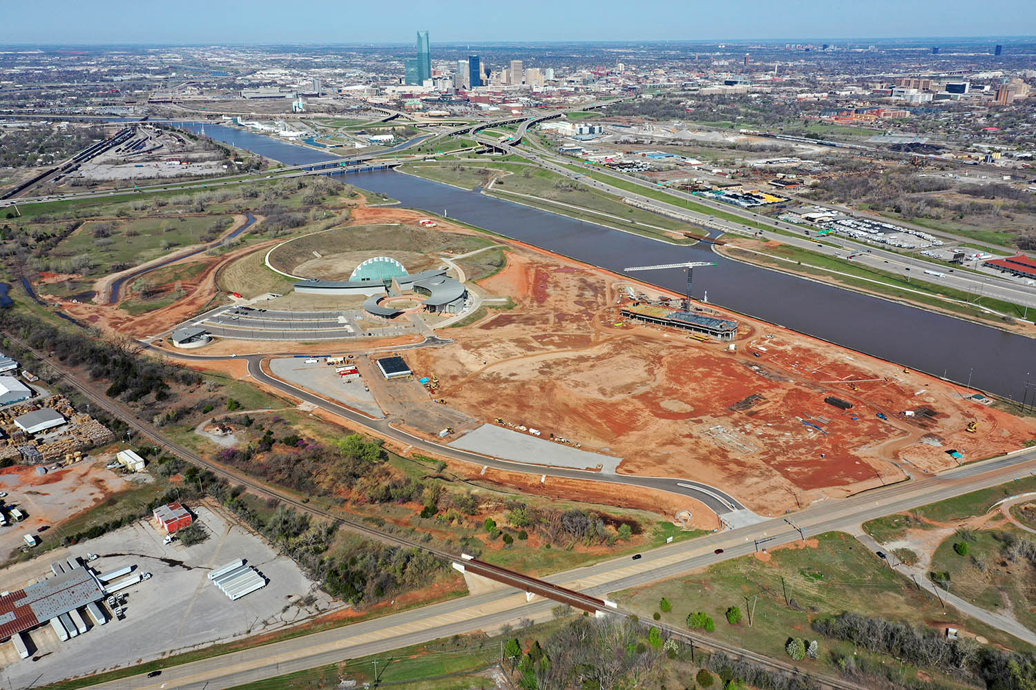
This is the clearest sign yet that city officials have a long-term goal to acquire a replacement for the 1-35 bridge (shown in drone photo). Oklahoma City is currently limited by the columns in that bridge. Specifically we are precluded from a full-menu international rowing event, which requires clear-span and no obstruction on the course. Building this pedestrian bridge with a clear span over a prospective race course implies the upstream bridge will also eventually be clear-span.
^^^ the city has been on the record saying they are working with ODOT to build a new “signature” I-35 bridge.
^^^^^^^
Yes, we all know this is the case. My point was that this is the clearest indication to date of just how serious everyone involved is about it actually happening. I’m certain this clear span portion of the pedestrian bridge will drive significantly more expense than would a bridge built with traditional piers over the full length. You don’t do one if you don’t fully expect the other.
From this (Sunday) morning:


The land the Chickasaws own on the north side of the river is outlined in blue and I've also indicated the approximate location of the pedestrian bridge.

This this is flying, super exciting for OKC!
I hope the Chickasaws are planning on some significant tree planting on the river. It's a nice bike trail along the river, but it gets roasted by the sun without trees.
I think OKC would really benefit from a Up with Trees type of organization across the entire city. Can never have too many trees.
they're possibly misusing the word tram unless there's a plan to extend rail to the site. Tram is a light rail vehicle, also known as a streetcar. I think what they mean to write is "Trolley", which is rubber tire bus shuttles. Nevertheless, nice to see and HOPE they do extend rails that way.
Oklahoma City, the RENAISSANCE CITY!
I came across this link that has a rendering: https://oklahoma.gov/content/dam/ok/...escription.pdf
It also shows a new I-35 bridge with 6-7 lanes in each direction which is awesome. You can barely see the bridge but it gives a glimpse of what it could look like. Iím sure itís still early in conceptual design but what the hell do I knowÖ


I can get behind that idea! I could imagine a streetcar that would run Reno Ave and Exchange Ave that would connect Okana/F.A.M. <--> Bricktown <--> Scissortail (link to other lines) <--> Farmer's Public Market <--> Stockyards. Would it be viable? Not a clue, but could drive tourism (and maybe residential development if I'm playing City Skylines with infinite budget) in both the southwestern and southeastern corners of downtown that currently feel out of reach from the main downtown area without a car or willingness to walk three miles.


There are currently 3 users browsing this thread. (0 members and 3 guests)
Bookmarks