


Doesn't matter, but academically interesting to look at.Originally Posted by David

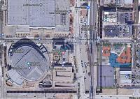
So I took a screenshot of the area on maps, then I very crudely cloned the end of the canal directly south, and then west. I then superimposed the site plan, and reduced the opacity, and the road they propose exactly matches up with where the canal would need to be, which I thought was interesting. IMO they could do this, and even have it go under the condos (imagine having basement level access to the canal level from your building?) if they wanted to. Again, I'm not necessarily a proponent of this, but it represents a bit of a potentially missed opportunity.


 Reply With Quote
Bookmarks