I'm betting on the Dry Slot. It usually always happens.


I'm betting on the Dry Slot. It usually always happens.


Nws as of 30 min ago saying 4-6 for the metro


Latest HRRR has continued trend of increasing amounts of the NW snowfall. However, it is also trending toward a dryslot that will interrupt any measurable snowfall from the wrap-around.
Remember there was signs earlier today that we could have snow basically constantly falling across some areas. Now this looks like it may not be the case. If the dry air erodes the connected precipitation between the initial heavy wave and the wrap-around wave - then amounts will be less.
Here is a shot of the model. The gap between the snow in OK and the snow back in TX, was previously filled in as a solid development line.


Is this going to lead to a lot of ice on the roads in the AM, or will it be more snow-based precipitation?


Ground temperatures in C OK are still around 40F. However, it is expected that precipitation will fall heavy and quickly enough to override any melting rate below. I expect roads to be slick with sleet/snow/slush mix, especially bridges. However, if precipitation stops and cars continue over the same lanes, we will probably see pathing from tires training over the same areas which result in relatively safer conditions.


Dry Slot wins again my friends. Well Damn!!


HRRR still trending track to the north at this time. Amounts are still not as impressive as before, but it looks like the SE sides of I-44 that was originally the bullseye, may end up with more freezing rain and sleet than heavy snow.
1:30am update.
Models are flipping higher snow from east to west of I-44. Warmer upper air profiles are resulting in more freezing rain and sleet rather than snow. Also storm track is tilting more to the north.


Light to Moderate snow moving into OKC as of 2:30am. NAM has confirmed shift in track more north. Suggesting Higher totals will be more aligned with I-44 as opposed to further east.
I would say Norman could be a bullseye point for a localized heavier snow spot.
Dry slot eating away some snow totals after sunrise still looks likely at this time. So nothing too crazy barring new development zones becoming established.


Decent sized flakes falling in Edmond.


Nice Snow!!!!!!


Looks like there is a dry slot, but a lot of snow dumped in the first wave.
Pauls Valley is getting a bunch. I wonder what their total will be when the snow ends.


I think OKC mostly got around 4-5".
I'd say a legit 5" at my house near Penn Square.
By far the biggest snowfall we've had in years.


Right at 4.5 inches in Surrey Hills.


Here is an idea of where any wrap-around snow may come through later this afternoon. Mostly light snow, maybe some pockets of moderate.


Here are preliminary totals. You can see how the shift in track completely altered the amounts. The west side of I-44 ended up getting the higher amounts as opposed to the forecasted double amounts to the E. Every mile matters so much in these situations.

^
Greatly appreciate all the info. Great asset to all of us.
Due to the very warm days that preceded this snowfall, you can now see that most paved areas are rapidly melting the snow. Will refreeze overnight I'm sure but most streets seem to be pretty clear.


Yes, thanks!!
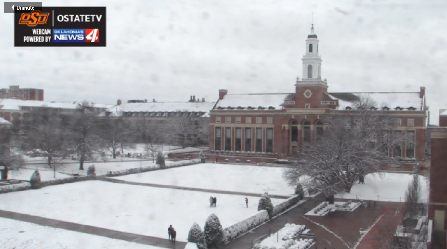
The winter scene at OSU Library. Around 4 in. of snow. Classes canceled. Tickets well be free tonight at the OSU vs TCU basketball game.


Now that this thing is over, on to the next.
We will have a very quick rebound in temperatures. Close to 60s by Sunday. The reason for the warm up is because there is a massive storm approaching. At this time, it looks like impacts to OK may be minimal other than winds. Maybe some rain chances for the eastern half of the state. Will monitor.


Tues/Wed storm is showing signs of bread and milk. Will see what it looks like as we get closer. Right now we may have snow chances NW 1/2 of the state.


Temperatures will be just above freezing for majority of the state (far NW has some decent snow chances). So precipitation with this next storm should remain as rain in C OK. Majority of the rain will be across E/SE OK.


This has been one of the most consistent winters for moisture in a long time across the state. This will surely setup for a booming Spring growing period. Allergy sufferers beware.

There are currently 19 users browsing this thread. (0 members and 19 guests)
Bookmarks