


OKC reached 82 degrees on Friday destroying a 121 year old daily record high!

OKC reached 82 degrees on Friday destroying a 121 year old daily record high!
Wind advisory has expanded to include all the state except for the panhandle.
The state needs some moisture. Unfortunately this entire week looks dry, possibly some showers the weekend after Thanksgiving.
 Participating Member

Actually we're doing quite well at the moment, and there's still water in the ditches in many areas from the last rain.
https://www.mesonet.org/index.php/ag...ht_monitor_map
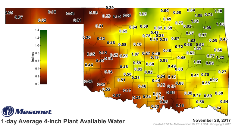
As a whole, the state is at normal to -2 inches for the year, and we still have 42 days to go. Looking at averages, we can expect another 2-4 between now and New Year's.
37.07" of rain for the year here, so far. The heavy parts of the storms didn't miss too often here on the east side of Stillwater. Average annual is 36.71" for Stillwater.
More talking about in the past 2-3 weeks there hasn't been much moisture which is creating a very high fire danger with these warm, windy and dry conditions.Originally Posted by stile99

Participating Member

Stupidly windy weather continues Tuesday. Extreme fire danger.
Tuesday night a slight chance for rain in OKC, best chance is NE OK over Tulsa area. High temperatures will be knocked down into the 50s beginning Wednesday. Still no sign of legitimate moisture in the next week. We are entering dangerous fire conditions heading into winter.
First major cold could be looming around the December 4-7 timeframe.
Participating Member
This will be for the eventual December thread. But GFS is beginning to consistently suggest a large storm late next week. The timing is similar to the colder air I mentioned above.

Gold Member
Rain mostly yes?
Participating Member
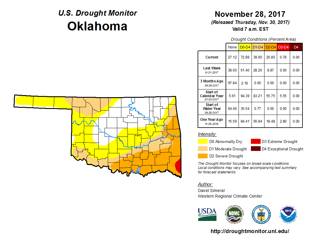
Hopefully rain, most of the state is entering drought conditions into winter.
Latest has the storm ejecting more to the south across TX. Leaving OK dry and cold.

Participating Member
Total precip for this storm is a couple tenths for central OK to around an inch in SE OK. A very dry first part of December for us.
Participating Member
Not a good trend. http://ticker.mesonet.org/
Next two weeks look to be cooler than average but still dry...
There are currently 2 users browsing this thread. (0 members and 2 guests)
 Posting Permissions

 Reply With Quote
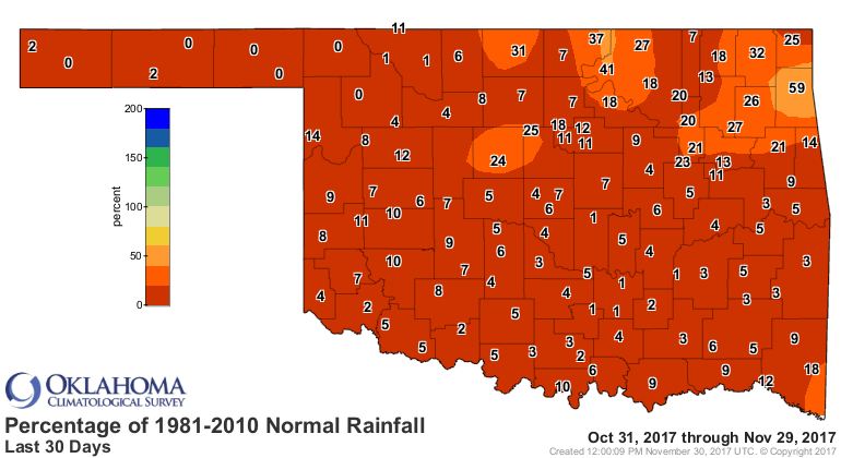
Bookmarks