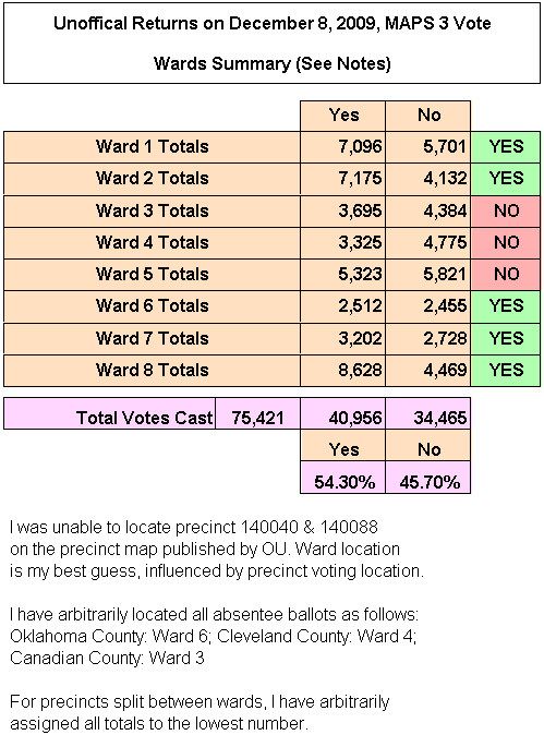
For some reason, press reporting of the MAPS 3 vote detail has been slow in coming. So I went to the County Election Board yesterday and was kindly supplied a printout of the vote, precinct by precinct. Unfortunately, a vote tally by wards was not available, however they were able to furnish a list of precincts in each Oklahoma County ward — for precincts located in Cleveland, Canadian, and Pottawatomie Counties, most of that information was available via the Center for Spatial Analysis at the University of Oklahoma. After OCR'ing the printout and assigning precincts to wards, this is the result:
The complete detail is located in the just posted blog article: Doug Dawgz Blog: MAPS 3 — Unofficial Vote Totals


 Reply With Quote
Bookmarks