


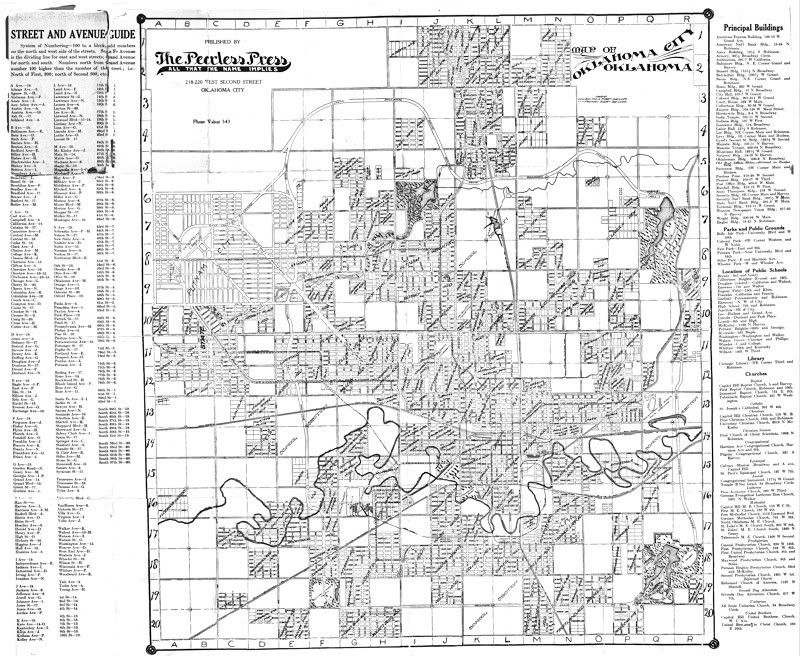
Thanks to mmm's good lead in the Capitol Hill definition thread, I've found several other old Okc maps at the OHS website, all in PDF format. As to the Peerless Press map described here, I've extracted the full map and changed it to greyscale and lightened it up for better reading, and the full high resolution map is here, for map lovers: http://i8.photobucket.com/albums/a49..._1910_1911.jpg. I'm too preoccupied with my vintage map right now to make a blog post, so consider this to be the same, for now, just for youz guys.
A much-shrunken version of this map appears below so that you can see if you want to download it or not:
Even though undated, it contains a list of Oklahoma City public schools and principal buildings, and the list which shows building names and addresses is valuable just by itself. Reviewing the list, several 1910 buildings are in it but the Post Office hadn't yet moved to NW 3rd, which it did in 1912. So, the map would have been made between 1910 and 1911 but the date is almost certainly 1911, as you will see below.
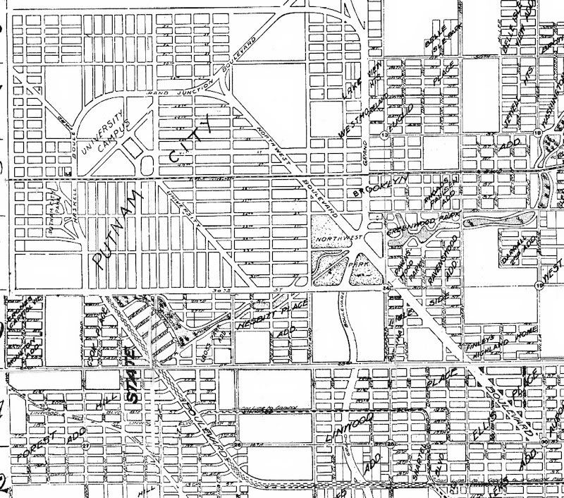
The fascinating part of the map, in the NW quarter, and that which needs to be taken with a grain of salt, is the impressive and extensive "Northwest Boulevard" running from NW 13th & Villa northwest to a "Grand Boulevard Junction Boulevard" around NW 46th & Ann Arbor in Putnam City Addition with a university campus located near the terminus ... I've cropped and reduced the size of that area for posting here ...
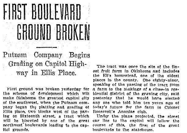
But, the thing is, in 1910, I.M. Putnam had hoped that the state capitol would be located in the area shown by the proposed university. But, that didn't happen. A September 3, 1910, Oklahoman article shows that at least some construction began on southeast end of the boulevard, but, as far as I know right now, that was pretty much all that came of it:
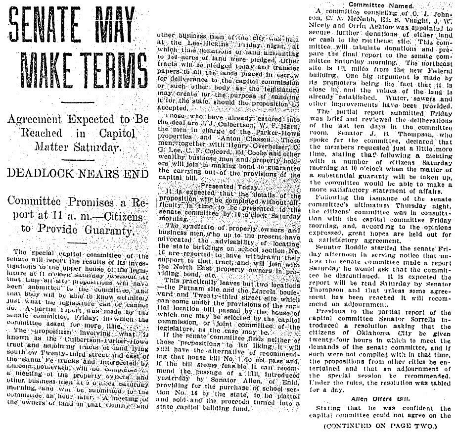
The showdown on the state capitol location occurred late 1910. The following December 10, 1910, article reflects that the location choice had pretty much narrowed down to two, the Putnam location and, of course, the site which won approval shortly after the article was written, the Harn property on 23rd Street.
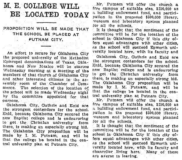
Putnam's state capitol plan having not succeeded, being undaunted, he then pursued, in 1911, a plan to have a new university located where he had hoped the capitol would have been. By this time, Epworth University had closed its Oklahoma City doors and in September 1911 reopened under a different name in Guthrie (which didn't last very long). So, the city was without a significant college or university. Putnam had other thoughts.
The May 24, 1911, article below shows his plan:
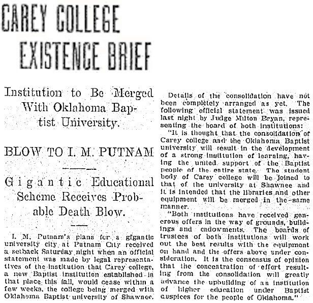
But, that didn't happen, either, and neither the hoped for university nor the fine roadways leading to it in the Putnam City Addition ever happened. The October 15, 1911, article below tells why:
So, that's the short story of some fine Oklahoma City roads that never happened. It would surprise me not if I.M. Putnam didn't commission The Peerless Press to make this fine map.


 Reply With Quote
Bookmarks