Widgets Magazine
Page 1 of 5 12345 LastLast
Results 1 to 25 of 116

Thread: Severe Weather Outlook - May 12 & 13th

Hybrid View

Previous Post Previous Post   Next Post Next Post
  1. Default Severe Weather Outlook - May 12 & 13th

    I'm going to hold off on the pretty pictures for right now, but will post the Day 2 and Day 3 outlooks. Day 2's focus will be western Oklahoma, but like today, the weather will probably make it into the Metro but maybe not severe. Day 3 looks more widespread for severe weather, but nothing out of control though at this time.

    DAY 2 CONVECTIVE OUTLOOK
    NWS STORM PREDICTION CENTER NORMAN OK
    1240 AM CDT MON MAY 11 2009

    VALID 121200Z - 131200Z

    ...THERE IS A SLGT RISK OF SVR TSTMS ACROSS PARTS OF THE SRN PLAINSAND CNTRL HIGH PLAINS...

    ...THERE IS A SLGT RISK OF SVR TSTMS ACROSS PARTS OF THE NRN PLAINS...

    ...SRN PLAINS/CNTRL HIGH PLAINS...
    AN UPPER-LEVEL TROUGH WILL AMPLIFY IN THE WRN STATES AS A SUBTLE UPPER-LEVEL RIDGE MOVES EWD INTO THE MS VALLEY TUESDAY. AT THE SFC...A DRYLINE SHOULD BIN PLACE FROM THE VICINITY OF WRN NEB SWD INTO FAR WRN KS AND THE ERN TX PANHANDLE. SFC DEWPOINTS IN THE LOWER 60S F...LOW-LEVEL CONVERGENCE AND SFC HEATING SHOULD ALLOW ISOLATED THUNDERSTORMS TO DEVELOP EAST OF THE DRYLINE LATE TUESDAY AFTERNOON AS THE CAP WEAKENS. FORECAST SOUNDINGS AT 00Z WEDNESDAY IN NW OK AND SW KS SHOW A VERY UNSTABLE AIRMASS WITH STRONG VERTICAL SHEAR AND STEEP MID-LEVEL LAPSE RATES. THIS SHOULD BE FAVORABLE FOR SUPERCELLS WITH LARGE HAIL. THE ENVIRONMENT MAY ALSO SUPPORT AN ISOLATED THREAT FOR TORNADOES AND VERY LARGE HAIL. THE GREATEST SEVERE POTENTIAL WILL DEPEND HOW FAR WEST THE DRYLINE SETS UP AND UPON HOW MANY STORMS CAN DEVELOP IN THE WEAKLY FORCED ENVIRONMENT.


    DAY 3 CONVECTIVE OUTLOOK
    NWS STORM PREDICTION CENTER NORMAN OK
    0230 AM CDT MON MAY 11 2009

    VALID 131200Z - 141200Z

    ...THERE IS A MDT RISK OF SVR TSTMS ACROSS PARTS OF IL AND MO...

    ...THERE IS A SLGT RISK OF SVR TSTMS ACROSS PARTS OF THE OH VALLEY...SRN GREAT LAKES...MID-MS VALLEY...OZARKS...CNTRL PLAINS AND SRN PLAINS...

    ...UPPER TO MID-MS VALLEY/OZARKS/SRN PLAINS...
    AN UPPER-LEVEL TROUGH WILL AMPLIFY AND MOVE EWD ACROSS THE NRN STATES AS A WELL-DEFINED MID-LEVEL JET ROUNDS THE BASE OF THE TROUGH. AHEAD OF THE SYSTEM...RETURNING LOW-LEVEL MOISTURE SHOULD CREATE A LARGE WARM SECTOR FROM THE SRN PLAINS NNEWD ACROSS THE MID TO UPPER-MS VALLEY. STRONG LARGE-SCALE ASCENT WITH THE UPPER-LEVEL TROUGH AND STRONG VERTICAL SHEAR PROFILES ASSOCIATED WITH THE MID-LEVEL JET OVER THE WARM SECTOR SHOULD RESULT IN THE POTENTIAL FOR A WIDESPREAD SEVERE WEATHER EVENT WEDNESDAY AND WEDNESDAY NIGHT.


    EARLY IN THE PERIOD...AN MCS SHOULD BE ONGOING IN THE MID-MS VALLEY WITH THIS CONVECTIVE CLUSTER MOVING EWD ACROSS PARTS OF THE OH VALLEY. IN THE WAKE OF THE MCS...SFC-BASED THUNDERSTORMS SHOULD INITIATE ALONG AND AHEAD OF A COLD FRONT WEDNESDAY AFTERNOON FROM NCNTRL IL SWWD ACROSS MO INTO SE KS. MODEL FORECASTS REMAIN CONSISTENT THAT THIS CONVECTION WILL ORGANIZE INTO A WELL-DEVELOPED LINEAR MCS EWD ACROSS THE WRN PORTION OF THE OH VALLEY SWWD ACROSS THE MID-MS VALLEY...NRN OZARKS INTO ERN OK WEDNESDAY EVENING. THE GFS AND ECMWF ARE IN GOOD AGREEMENT WITH THE POSITION OF THE UPPER-LEVEL TROUGH. THIS COMBINED WITH GOOD CERTAINTY CONCERNING THE DEVELOPMENT OF NUMEROUS STORMS IN A STRONGLY SHEARED ENVIRONMENT SUPPORTS THE ISSUANCE OF A MODERATE RISK IN IL AND MO WEDNESDAY AFTERNOON AND EVENING. PARAMETERS ON FORECAST SOUNDINGS SUGGEST THE ENVIRONMENT WILL BE FAVORABLE FOR A SIGNIFICANT SEVERE WEATHER EVENT WITH A STRONGLY FORCED LINE OF INTENSE STORMS. SWWD ACROSS THE OZARKS AND SRN PLAINS...THUNDERSTORMS SHOULD BE MORE ISOLATED DUE TO WEAKER FORCING. A GRADUAL DROP OFF IN SEVERE REPORT COVERAGE SHOULD OCCUR IN THE OZARKS AND SRN PLAINS FOR THIS REASON.

    ..BROYLES.. 05/11/2009

  2. Default Re: Severe Weather Outlook - May 12 & 13th

    Severe weather risk will go up later today in SW Oklahoma, but a more widespread severe threat will exist tomorrow across the entire area.

    DAY 2 CONVECTIVE OUTLOOK
    NWS STORM PREDICTION CENTER NORMAN OK
    1220 PM CDT TUE MAY 12 2009

    VALID 131200Z - 141200Z

    ...THERE IS A MDT RISK OF SVR TSTMS ACROSS PORTIONS OF MISSOURI AND
    ILLINOIS...

    ...THERE IS A SLGT RISK OF SVR TSTMS FROM THE MID TO UPPER MS VALLEY
    SWWD INTO THE SRN PLAINS...

    ...SYNOPSIS...
    AN INTENSE UPPER LEVEL TROUGH AND AN ACCOMPANYING 90-100 KT JET MAX
    WILL MOVE EWD FROM THE NRN PLAINS INTO THE WRN GREAT LAKES ON WED.
    BY EVENING TIME...AN ASSOCIATED COLD FRONT IS FORECAST TO EXTEND
    FROM THE MN ARROWHEAD SWD ALONG TO THE IA/IL BORDER AND THEN SWWD
    INTO NRN OK/TX PANHANDLE. A WARM FRONT...PROGGED TO STRETCH EXTEND
    FROM WRN IA SEWD INTO NERN AR AT DAYBREAK...WILL SHIFT NEWD INTO THE
    SRN GREAT LAKES REGION BY LATE DAY 2. THE PREVIOUSLY MENTIONED
    FEATURES SHOULD RESULT IN WIDESPREAD SEVERE WEATHER...WITH VERY
    LARGE HAIL AND WIND DAMAGE LIKELY FROM THE UPPER MS VALLEY SWWD INTO
    THE SRN PLAINS. A FEW STRONG TORNADOES ARE ALSO POSSIBLE...MAINLY
    ACROSS PORTIONS OF IL AND NERN MO.

    ...SERN KS/SWRN MO/NWRN AR AND OK...
    THE AREA WILL BE CAPPED MOST OF THE DAY...SO TEMPERATURES ARE
    EXPECTED TO CLIMB WELL INTO THE 80S BEFORE THE COLD FRONT ARRIVES
    LATE IN THE DAY. THESE TEMPERATURES COMBINED WITH MID LEVEL LAPSE
    RATES FROM 7-8C/KM AND DEWPOINTS IN THE UPPER 60S WILL RESULT IN A
    VERY UNSTABLE AIR MASS...MLCAPES IN EXCESS OF 3000 J/KG. ALTHOUGH
    THE MAIN FORCING WILL PASS NORTH OF THIS REGION...STRONG HEATING AND
    CONVERGENCE SHOULD PROVIDE SUFFICIENT FORCING FOR THUNDERSTORMS TO
    DEVELOP NEAR THE FRONT AFTER 21Z. ALTHOUGH DEEP LAYER SHEAR WILL BE
    MARGINAL FOR SUPERCELLS...THE DEGREE OF INSTABILITY IS EXPECTED TO
    RESULT IN VERY STRONG UPDRAFTS WITH MID LEVEL ROTATION. AN ISOLATED
    TORNADO OR TWO IS POSSIBLE...THOUGH THE MOSTLY VEERED LOW LEVEL WIND
    PROFILES SUGGEST VERY LARGE HAIL WOULD BE THE INITIAL THREAT. GIVEN
    THE DEGREE OF INSTABILITY AND FRONTAL CONVERGENCE...A FEW HOURS
    AFTER INITIATION...STORMS ARE EXPECTED TO CONSOLIDATE INTO A LINEAR
    SYSTEM AND MOVE S/SEWD THROUGH THE EVENING INTO A 30-40 KT LOW LEVEL
    JET AND STRONG INSTABILITY. THE POTENTIAL EXISTS FOR NUMEROUS SEVERE
    STORMS AND VERY LARGE HAIL...SO PORTIONS OF THIS AREA MAY BE
    UPGRADED TO A MODERATE RISK ON THE DAY 1 OUTLOOKS.

  3. #3

    Default Re: Severe Weather Outlook - May 12 & 13th

    This is slightly off topic... but is anyone else having problem accessing the NWS enhanced weather page? http://www.srh.noaa.gov/oun/enhanced.php

  4. Default Re: Severe Weather Outlook - May 12 & 13th

    Quote Originally Posted by Brad Neese View Post
    This is slightly off topic... but is anyone else having problem accessing the NWS enhanced weather page? http://www.srh.noaa.gov/oun/enhanced.php
    Venture overloaded it.

  5. #5

    Default Re: Severe Weather Outlook - May 12 & 13th

    yea...it has been down all day (or at least I have not been able to get to it all day)!

  6. #6

    Default Re: Severe Weather Outlook - May 12 & 13th

    Another kinda off topic... I subscribed to the alert texts (I saw in another thread). Has anyone else done that? Its kind of annoying because I wanted to save their number as "Weather Alert" but they use a different number to text me each time. So, I got 4 or 5 alerts today because of the severe weather this morning, all from different numbers.

  7. Default Re: Severe Weather Outlook - May 12 & 13th

    Luke, try KFOR? I'm gonna try the Text Alerts from them.

    4Warn Text Alert Sign-up - KFOR

    4Warn Phone Alert Sign-up - KFOR

  8. #8

    Default Re: Severe Weather Outlook - May 12 & 13th

    Whatever the problem with the NWS site is it is also affecting the Tulsa and the Amarillo sites. All the others seem to be working fine. I hope they get it up and running before this evening. Grrrrrrr

    The warm front is now crossing the red river with temps in the upper 80's and low 90's in north Texas. Im really tired of this cool grey weather.......and so are my plants......come on wf.

  9. Default Re: Severe Weather Outlook - May 12 & 13th

    Special Bulletin Message

    Many forecast office pages are currently unavailable due to maintenance being performed today. Down time may last until about 5pm Central time. We regret any inconvenience.

  10. Default Re: Severe Weather Outlook - May 12 & 13th

    We have a Moderate Risk for Wednesday at this time mainly from the metro toward the north, a lil to the west, and much of the NE portion of the state. Isolated tornadoes isn't ruled out, but the threat will mainly be large hails, frequent lightnings, and damaging winds.

  11. #11

    Default Re: Severe Weather Outlook - May 12 & 13th

    So much for the back online by 5 huh.

    Severe storms now south of Amarillo with a severe t-storm watch for most of west Texas. Also a severe cluster diving south thru NW Arkansas. I wonder where V2 is today?

  12. Default Re: Severe Weather Outlook - May 12 & 13th

    Quote Originally Posted by Thunder View Post
    We have a Moderate Risk for Wednesday at this time mainly from the metro toward the north, a lil to the west, and much of the NE portion of the state. Isolated tornadoes isn't ruled out, but the threat will mainly be large hails, frequent lightnings, and damaging winds.
    Not official yet. Question tomorrow ill be the strong cap and little upper air forcing. Not saying they won't upgrade, but local media is doing their own thing right now.

    Yeah, I was hoping the OUN site would be back up...oh well, hopefully it will be back up any minute.

  13. Default Re: Severe Weather Outlook - May 12 & 13th

    Quote Originally Posted by venture79 View Post
    Not official yet. Question tomorrow ill be the strong cap and little upper air forcing. Not saying they won't upgrade, but local media is doing their own thing right now.

    Yeah, I was hoping the OUN site would be back up...oh well, hopefully it will be back up any minute.
    It could be that the NWS had already sent the info to the media and that it is not posted online where we view since most of the contents on the NWS site is still down.

    I did read a message on the NWS site saying Moderate Risk for tomorrow. Probably the map isn't updated, Venture? All I saw was the news in text.

    Luke, I suscribed to the Text Alerts from KFOR and I picked only Oklahoma County along with specific warning alerts that I want. It's neat and you should try it, Luke. We will probably also need to add the next few counties that is touching the south side of Oklahoma county, because we live on the south side.

  14. Default Re: Severe Weather Outlook - May 12 & 13th

    Quote Originally Posted by Thunder View Post
    It could be that the NWS had already sent the info to the media and that it is not posted online where we view since most of the contents on the NWS site is still down.

    I did read a message on the NWS site saying Moderate Risk for tomorrow. Probably the map isn't updated, Venture? All I saw was the news in text.
    Nope not yet. There is a mod risk tomorrow, for MO and IL only for now. There is the possibility they'll upgrade a portion of the area.

  15. Default Re: Severe Weather Outlook - May 12 & 13th

    ugh... what 17 days of clouds and rain, rain, rain... ?

    I'm having a Vitamin D deficiency! I'm depressed as hell and I'm pale as a ghost. lol

    I could never, ever, ever adapt to Seattle.
    " You've Been Thunder Struck ! "

  16. Default Re: Severe Weather Outlook - May 12 & 13th

    Quote Originally Posted by Karried View Post
    ugh... what 17 days of clouds and rain, rain, rain... ?

    I'm having a Vitamin D deficiency! I'm depressed as hell and I'm pale as a ghost. lol

    I could never, ever, ever adapt to Seattle.
    Not that I love this weather, but I'll take this over a cold, windy, dry day any day of the week.

  17. Default Re: Severe Weather Outlook - May 12 & 13th

    Welcome to growing up in the Great Lakes in the winter, where the sun comes out maybe 3-4 times a month from October through March. At least it is warm here. ; )

  18. #18

    Default Re: Severe Weather Outlook - May 12 & 13th

    I love this weather. I don't know that I could handle it year round.. I like that we have 4 distinct seasons.

    Karried, can you make it so the Current Events, specifically, these weather threads come up on the "Recent Threads" on the main page.

  19. Default Re: Severe Weather Outlook - May 12 & 13th

    Oklahoma weather is so strange. After the Feb storms we had, I remember thinking we were in for a bad spring. Nothing but cool and wet. I know, I know, I shouldn't have said that.

  20. Default Re: Severe Weather Outlook - May 12 & 13th

    Large supercells moving into SW Oklahoma. Gawd...raiding on WoW is getting in the way of things here. LOL


    URGENT - IMMEDIATE BROADCAST REQUESTED
    SEVERE THUNDERSTORM WATCH NUMBER 292
    NWS STORM PREDICTION CENTER NORMAN OK
    845 PM CDT TUE MAY 12 2009

    THE NWS STORM PREDICTION CENTER HAS ISSUED A
    SEVERE THUNDERSTORM WATCH FOR PORTIONS OF

    SOUTHWEST OKLAHOMA
    EXTREME NORTHWEST TEXAS

    EFFECTIVE THIS TUESDAY NIGHT FROM 845 PM UNTIL MIDNIGHT CDT.

    HAIL TO 2 INCHES IN DIAMETER...THUNDERSTORM WIND GUSTS TO 70
    MPH...AND DANGEROUS LIGHTNING ARE POSSIBLE IN THESE AREAS.

    THE SEVERE THUNDERSTORM WATCH AREA IS APPROXIMATELY ALONG AND 40
    STATUTE MILES EAST AND WEST OF A LINE FROM 35 MILES NORTH OF
    ALTUS OKLAHOMA TO 85 MILES SOUTH OF ALTUS OKLAHOMA. FOR A
    COMPLETE DEPICTION OF THE WATCH SEE THE ASSOCIATED WATCH OUTLINE
    UPDATE (WOUS64 KWNS WOU2).

    REMEMBER...A SEVERE THUNDERSTORM WATCH MEANS CONDITIONS ARE
    FAVORABLE FOR SEVERE THUNDERSTORMS IN AND CLOSE TO THE WATCH
    AREA. PERSONS IN THESE AREAS SHOULD BE ON THE LOOKOUT FOR
    THREATENING WEATHER CONDITIONS AND LISTEN FOR LATER STATEMENTS
    AND POSSIBLE WARNINGS. SEVERE THUNDERSTORMS CAN AND OCCASIONALLY
    DO PRODUCE TORNADOES.

    OTHER WATCH INFORMATION...CONTINUE...WW 289...WW 290...WW 291...

    DISCUSSION...MERGING RIGHT AND LEFT MOVING THUNDERSTORM CLUSTERS MAY
    SUPPORT UPSCALE GROWTH INTO A SMALL MCS NEAR THE RED RIVER IN THE
    NEXT COUPLE OF HOURS. THOUGH THE CAP STRENGTHENS WITH EWD
    EXTENT...RESIDUAL STEEP LAPSE RATES AND STRONG INSTABILITY WILL
    SUPPORT A THREAT FOR ADDITIONAL SEVERE STORM DEVELOPMENT WITH THE
    STORM MERGERS. DAMAGING WINDS /INCLUDING THE POSSIBILITY OF HEAT
    BURSTS/ AND LARGE HAIL WILL BE THE MAIN SEVERE THREATS BEFORE THE
    STORM WEAKEN IN A FEW HOURS.

  21. Default Re: Severe Weather Outlook - May 12 & 13th

    Storms approaching the metro, but not sure how much longer they can hold. One of them seem to be gunnin' for Karrie.

  22. Default Re: Severe Weather Outlook - May 12 & 13th

    Last update for the night. For Thursday, the entire metro area has been placed in the Moderate Risk for the day. Main threat will be extremely large hail with storms that are able to bust through the cap.


    AY 1 CONVECTIVE OUTLOOK
    NWS STORM PREDICTION CENTER NORMAN OK
    0100 AM CDT WED MAY 13 2009

    VALID 131200Z - 141200Z

    ...THERE IS A MDT RISK OF SVR TSTMS FROM THE MIDDLE MISSISSIPPI VALLEY TO THE SOUTH CENTRAL PLAINS...

    ...THERE IS A SLGT RISK OF SVR TSTMS MUCH OF THE MIDWEST TO SOUTHERN PLAINS...

    ...SYNOPSIS...
    ON THE LARGE SCALE...PRIMARY IMPETUS FOR DEEP CONVECTIVE POTENTIAL ACROSS THE CENTRAL STATES TODAY WILL BE TIED TO A POTENT UPPER TROUGH WHICH WILL CROSS THE NORTHERN PLAINS TODAY...AND REACH THE UPPER MISSISSIPPI VALLEY/WESTERN GREAT LAKES LATE TONIGHT AS IT BEGINS TO TAKE ON MORE OF A NEGATIVE TILT. AHEAD OF THIS SYSTEM...A RATHER MOIST AIRMASS WILL CONTINUE TO QUICKLY SURGE NORTHEASTWARD INTO THE MIDWEST AHEAD OF AN EAST-SOUTHEAST MOVING COLD FRONT ACROSS THE MIDWEST/SOUTH CENTRAL PLAINS.

    ...MIDWEST TO SOUTH CENTRAL PLAINS...
    INITIALLY...ON THE NOSE OF A RATHER STRONG SOUTHWESTERLY LOW LEVEL JET AND EASTERN FRINGE OF A PLAINS ELEVATED MIXED LAYER...SCATTERED TO NUMEROUS TSTMS ARE LIKELY TO BE ONGOING AT THE BEGINNING OF THE PERIOD ACROSS THE MIDWEST... INCLUDING PORTIONS OF IA/MO/IL/INDIANA. AT LEAST SOME OF THESE ELEVATED TSTMS WILL BE CAPABLE OF SEVERE HAIL THROUGH THE MORNING.

    ALTHOUGH SOME QUESTIONS EXIST REGARDING THE TIMING/DEGREE OF DIURNAL DESTABILIZATION WITH NORTHEASTWARD EXTENT ACROSS THE MIDDLE/UPPER MISSISSIPPI VALLEY IN THE WAKE OF EARLY DAY ACTIVITY...RAPID DESTABILIZATION IS EXPECTED TO OCCUR FROM THE SOUTHWEST...WITHIN A NARROW PRE-COLD FRONTAL WARM/UNSTABLE SECTOR ACROSS MO/SOUTHEAST IA INTO ADJACENT IL. PROVIDED SUFFICIENT DESTABILIZATION THROUGH THE AFTERNOON/EARLY EVENING...STRONG/SEVERE TSTMS SHOULD QUICKLY DEVELOP...WITH A MIXED MODE OF SUPERCELLS/BOWS POSSIBLE BENEATH 50 KT MID LEVEL FLOW. ASIDE FROM SEVERE HAIL...TORNADOES WILL BE POSSIBLE GIVEN STRONG 40-50 KT FLOW IN THE LOWEST 1 KM AND AMPLE LOW LEVEL SRH. THIS THREAT COULD BE HEIGHTENED IN VICINITY OF WARM FRONT AND/OR ANY REMNANT MODIFIED OUTFLOW ACROSS THE MIDDLE MISSISSIPI VALLEY INCLUDING PORTIONS OF MO/SOUTHEAST IA INTO IL. OTHERWISE...DAMAGING WIND POTENTIAL MAY ULTIMATELY INCREASE THROUGH THE EVENING AS STORMS CONGEAL/RACE EASTWARD ACROSS THE MIDWEST.

    FARTHER SOUTHWEST...TSTMS SHOULD DEVELOP LATE THIS AFTERNOON/EARLY EVENING ALONG/JUST BEHIND THE SOUTHEASTWARD ADVANCING SURFACE COLD FRONT FROM MO/SOUTHEAST KS INTO OK...AND PERHAPS IN VICINITY OF THE DEEPLY MIXED AIRMASS IN CLOSE PROXIMITY TO THE SURFACE LOW/DRYLINE TRIPLE POINT NEAR THE WESTERN OK/TX PANHANDLE BORDER. EVEN WITH WEAKER MID LEVEL FLOW AT THIS LATITUDE...VERY STEEP MID LAPSE RATES/VEERING WIND PROFILES WILL BE FAVORABLE FOR LARGE/POTENTIALLY SOME SIGNIFICANT HAIL WITH SUPERCELLS. A FEW TORNADOES MAY BE POSSIBLE...ALONG WITH DAMAGING WINDS GIVEN THE STEEP LAPSE RATE ENVIRONMENT. AS AN UPSWING IN TSTM COVERAGE CONTINUES THROUGH THE EVENING ALONG THE FRONTAL ZONE...AND A SOUTH-SOUTHWESTERLY LOW LEVEL JET NOCTURNALLY INCREASES ACROSS TX...THERE IS SOME POTENTIAL THAT THESE TSTMS COULD CONSOLIDATE AND GROW UPSCALE INTO A FORWARD PROPAGATING MCS...WITH HEIGHTENED DAMAGING WIND POTENTIAL ACROSS OK/AR INTO THE ADJACENT ARKLATEX VICINITY.

  23. Default Re: Severe Weather Outlook - May 12 & 13th

    Short-Med term model guidance tonight indicates that if storms are able to form, they will be after 7PM for the metro area and more likely into the overnight hours. We'll have to see. Timing has been a little off.

    All models are in agreement that instability will be extreme tomorrow across Oklahoma as long as skies clear. Tonight's storms may leave an outflow boundary across Central or Eastern Oklahoma that may have a role to play tomorrow, we'll just have to wait and see. Currently most models don't develop precip much further west than the western sides of the metro area. Most of the major models do not account for the ongoing activity tonight, and that could throw things off a bit. The WRF-NMM run for SPC however did account for it, but had the timing about 5 hours off.

    It has storms initiated in western Oklahoma around 7PM, and additional storms along the cold front up in southern Kansas at the same time. It has the storms along the dryline from the west organizing into a complex moving through the Metro around 10PM. The storms quickly move off to the east with in a couple hours.

    We'll see how it plays out. More later in the morning. Here is a quick look at the WRF-NMM simulated radar image for the 10PM time frame.


  24. Default Re: Severe Weather Outlook - May 12 & 13th

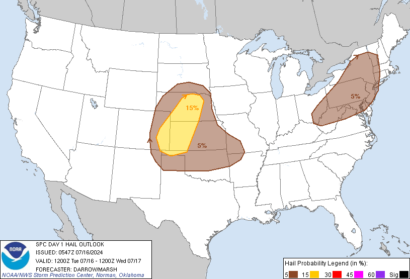
    Update Day 1 to go with the graphics above (the outlook graphics are linked to the images that will automatically refresh with new outlooks).

    DAY 1 CONVECTIVE OUTLOOK
    NWS STORM PREDICTION CENTER NORMAN OK
    0712 AM CDT WED MAY 13 2009

    VALID 131300Z - 141200Z

    ...THERE IS A MDT RISK OF SVR TSTMS THIS AFTERNOON AND EVENING OVER PARTS OF OK...SOUTHEAST KS...NORTHWEST AR...MUCH OF MO...AND MUCH OF IL...

    ...THERE IS A SLGT RISK OF SVR TSTMS FROM PARTS OF THE CENTRAL/SOUTHERN PLAINS INTO THE MID MS VALLEY...

    A PROGRESSIVE SHORTWAVE TROUGH WILL TRACK RAPIDLY EASTWARD ACROSS THE NORTHERN HIGH PLAINS TODAY...WITH AN ASSOCIATED 90-100 KNOT MID LEVEL JET MAX NOSING INTO THE GREAT LAKES REGION BY TONIGHT. AT THE SURFACE...A COLD FRONT WILL SWEEP EASTWARD INTO THE MID MS VALLEY BY AFTERNOON...TRAILING IN THE CENTRAL PLAINS. THIS FRONT AND THE MOIST/UNSTABLE AIRMASS TO ITS SOUTHEAST WILL BE THE PRIMARY AREA OF CONCERN FOR SEVERE THUNDERSTORMS THIS AFTERNOON AND TONIGHT. IT APPEARS THAT A LARGE AREA WILL SEE AN ACTIVE SEVERE WEATHER EVENT DURING THIS PERIOD.

    ...KS/OK/AR THIS AFTERNOON AND EVENING...
    AN EXTREMELY UNSTABLE AIRMASS IS FORECAST TO DEVELOP OVER OK THIS AFTERNOON WITH DEWPOINTS NEAR 70...TEMPERATURES WELL INTO THE 80S...AND NEAR DRY-ADIABATIC MID LEVEL LAPSE RATES. MLCAPE VALUES OVER 4000 J/KG WILL BE COMMON ACROSS THE REGION...BUT A STRONG CAPPING INVERSION WILL SUPPRESS DEEP SURFACE-BASED CONVECTION THROUGH MOST OF THE DAY. BY EARLY EVENING...DEEP BOUNDARY LAYER MIXING SHOULD BE SUFFICIENT FOR CONVECTIVE INITIATION ALONG THE DRYLINE OVER WESTERN OK. OTHER STORMS WILL LIKELY DEVELOP AROUND THIS TIME ALONG THE COLD FRONT SAGGING INTO NORTHERN OK/SOUTHERN KS. VERTICAL SHEAR PROFILES WILL BE IMPROVING RAPIDLY DURING THIS TIME AS THE LOW LEVEL JET STRENGTHENS. GIVEN THE DEGREE OF INSTABILITY AND SUFFICIENT EFFECTIVE SHEAR VALUES...LARGE SLOW-MOVING SUPERCELL STORMS CAPABLE OF VERY LARGE HAIL AND DAMAGING WINDS ARE EXPECTED. SOME POTENTIAL WILL ALSO EXIST FOR ISOLATED TORNADOES...MAINLY AFTER DARK. STORMS WILL CONGEAL INTO A LARGE MCS AND SPREAD SOUTHEASTWARD THROUGH THE NIGHT ACROSS MUCH OF OK AND INTO ADJACENT PARTS OF WESTERN MO/AR.

  25. #25

    Default Re: Severe Weather Outlook - May 12 & 13th

    Before I think about todays storms I still have to recover from last night. I had just got to bed last night when I heard the wind pick up around 1am, so of course I had to get up and watch it. We lost a lot of branches, (one fell across our koi pond, luckily no punctures....I hope) the patio umbrella was shredded, and half of our redbud broke away. AARRGGHH. Luckily no major damage that Ive seen so far but it'll be a big mess to clean up this evening. Peak wind gust of 74mph last night at wiley post, and it blew between 60-70 mph at our house for over an hour. I was standing on the porch watching the trees bend and break and finally had to put on goggles to protect my eyes from all the dust and debris flying around. Finally got back to bed around 3am........Did I mention I dont get much sleep in the spring when storms come through.....lol

    Thankfully we still have power (BIG surprise after seeing all the power flashes last night) Funny thing was it kept getting warmer and warmer as I sat out on the porch and watched the storm. I saw where Chandler got up to 88 degrees during the storm around 1:30am.

    Today will be interesting, but at least like I mentioned earlier we still have power to clean up the debris.....and watch tonights storms. I noticed NWS site is still sketchy. Bad time to do maintenance.

Thread Information

Users Browsing this Thread

There are currently 2 users browsing this thread. (0 members and 2 guests)

Similar Threads

  1. Severe Weather - April 26th - Potential Tornado Outbreak
    By venture in forum Current Events & Open Topic
    Replies: 78
    Last Post: 04-27-2009, 02:18 AM
  2. Severe Weather - Apr 25 (Sat)
    By venture in forum Current Events & Open Topic
    Replies: 72
    Last Post: 04-26-2009, 02:00 AM
  3. Upcoming Weather Outlook
    By venture in forum Current Events & Open Topic
    Replies: 41
    Last Post: 04-25-2009, 01:33 PM
  4. Severe Weather - March 30, 2009
    By venture in forum Current Events & Open Topic
    Replies: 17
    Last Post: 03-31-2009, 07:29 PM

Bookmarks

Posting Permissions

  • You may not post new threads
  • You may not post replies
  • You may not post attachments
  • You may not edit your posts
  •  
Single Sign On provided by vBSSO