Widgets Magazine
Page 1 of 4 1234 LastLast
Results 1 to 25 of 83

Thread: Severe Weather Risk - 3/23/2009 (Monday)

Hybrid View

Previous Post Previous Post   Next Post Next Post
  1. Default Severe Weather Risk - 3/23/2009 (Monday)

    While there will be isolated storms next few days which may get a little loud, next chance of organized severe weather coming up will be on Monday. Looking at this evenings model data, best chances look to be in Northern and Central Oklahoma, where the fare southern 2 tiers of counties will have more isolated activity. Greatest instabilities at the end of the day will stretch from the OKC area (or just west) due north in a narrow area. Some indication it could just be a strong squall line event, but we will have a better setup here for more isolated supercell activity than farther north, but may not have the best shear. I won't go much more in depth since we are still a ways out.

    I'm going to post the same info below as I normally do. Please keep in mind, that the SPC Outlook I link will be the Day 1 Outlook since I want that in the top post and this board restricts editing of posts. I'll post a reply after this with the Day 3 outlook and then Day 2 when we are in that time period on Sunday.

    -----

    Links:
    NWSFO Norman Enhanced Page: NWS Norman, Oklahoma - Enhanced Weather Page
    SPC Mesoanalysis Page: SPC Hourly Mesoscale Analysis Page
    WRF-NMM 4KM Forecast Model: 4.0 km WRF-NMM Precipitation Graphics

    SPC Day 1 Outlook


    Satellite Image (1KM)


    NEXRAD Mosaic Radar


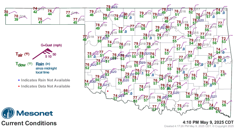
    Oklahoma Mesonet Current Conditions (red air temp, green dewpoint)
  2. Default Re: Severe Weather Risk - 3/23/2009 (Monday)

    Is the Ford Center a safe place to be Monday afternoon and night?
    " You've Been Thunder Struck ! "

  3. #3

    Default Re: Severe Weather Risk - 3/23/2009 (Monday)

    Quote Originally Posted by Karried View Post
    Is the Ford Center a safe place to be Monday afternoon and night?
    Are you going to go see Lil Wayne? I had no idea you were the hip-hop type LOL!

  4. Default Re: Severe Weather Risk - 3/23/2009 (Monday)

    I believe they have a pretty extensive tornado shelter/safety system. It'll take a lot to bring down that hunk of concrete.

  5. #5

    Default Re: Severe Weather Risk - 3/23/2009 (Monday)


  6. Default Re: Severe Weather Risk - 3/23/2009 (Monday)

    It'll take a lot to bring down that hunk of concrete.
    ugh, that's what I was afraid of.... that hunk of concrete falling on my family!

    I'll keep checking your updates.. thanks!
    " You've Been Thunder Struck ! "

  7. Default Re: Severe Weather Risk - 3/23/2009 (Monday)

    Discussion from Norman tonight for the potential event on Monday. Long story short, if dewpoints can get above 60, we'll have a pretty good show since everything else is in place.

    AREA FORECAST DISCUSSION
    NATIONAL WEATHER SERVICE NORMAN OK
    257 PM CDT SAT MAR 21 2009

    .DISCUSSION...
    CONCERNS NEXT 7 DAYS INCLUDE STRONGER SFC WINDS SUNDAY AND
    ESPECIALLY MONDAY... FIRE DANGER OUT W BOTH AFTERNOONS... SEVERE
    T-STORM POTENTIAL MON AND MON NIGHT... AND POTENTIAL FOR ANOTHER
    CONVECTIVE EVENT AROUND THU-FRI. NAM HAS BEEN USED HEAVILY FOR GRIDS
    THROUGH TUE... TRENDING OVER TO GFS AND RELATED MOS THEREAFTER.

    LIGHT SHOWERS SHOULD DECREASE TONIGHT AS WEAK UPPER TROUGH MOVES
    ACROSS AREA AND WEAKENS AS IT MOVES INTO THE RIDGE AXIS. POPS HAVE
    BEEN DROPPED TO 10 PCT OVERNIGHT... BUT MAY NEED TO INCLUDE PRE-1ST
    PERIOD OPTION IN THE AFTERNOON ZFP TO ACCOUNT FOR ANY LINGERING
    PRECIP THIS AFTERNOON.

    MAJOR UPPER SYSTEM NOW APPROACHING W COAST IS HANDLED SIMILARLY BY
    ALL MODELS. INITIAL EFFECTS WILL INCLUDE INCREASING S WINDS ON
    SUNDAY AS SFC LOW ORGANIZES OVER E CO... AND CORRESPONDING INCREASE
    IN MOISTURE/CLOUDS MAINLY ABOVE 4-6K FT TONIGHT-SUNDAY. WINDS COULD
    APPROACH ADVISORY LEVELS ON SUNDAY BUT CONFIDENCE NOT HIGH ENOUGH AT
    THIS TIME TO GO WITH A HEADLINE. RETURN FLOW WILL BRING DEWPOINTS
    UP THROUGH MONDAY EVENING... BUT THE INCREASE IS LIKELY TO BE SLOWED
    THROUGH AT LEAST SUNDAY BY LESS-THAN-FAVORABLE NE-E WINDS ACROSS
    MOST OF THE GULF BRINGING MODIFIED CONTINENTAL AIR AROUND THE BIG
    SFC HIGH OVER THE E CONUS. RIDGING NEAR THE WESTERN GULF COAST ALSO
    WILL SLOW THE MOISTENING PROCESS OVER THE S PLAINS. LOW-LEVEL
    MOISTURE LIKELY TO START MOVING N AT A FASTER PACE SUN NIGHT INTO
    MON... LEADING TO SHARPENING OF THE DRYLINE OVER THE CENTRAL/S HIGH
    PLAINS. BUT THERE IS STILL A QUESTION AS TO THE QUALITY OF LL
    MOISTURE - AND THUS THE AMOUNT OF INSTABILITY - THAT WILL BE PRESENT
    BY LATE MONDAY. CURRENT MODEL PROGS SUGGEST SFC DEWPOINTS ONLY IN
    THE 50S BY 00Z TUE AND MAX SBCAPES AROUND 500-1000 J/KG AHEAD OF THE
    ADVANCING DRYLINE. THAT MAY BE THE ONLY SIGNIFICANT LIMITING FACTOR
    TO AN OTHERWISE POTENT SEVERE-WX SETUP AS NOSE OF STRONG UPPER JET
    PUNCHES NE ACROSS DRYLINE INTO OK/KS TO SET UP STRONG DEEP-LAYER
    SHEAR. IF DEWPOINTS/INSTABILITY END UP GREATER THAN CURRENTLY
    FORECAST... AND STORMS REMAIN RELATIVELY DISCRETE... TORNADIC
    SUPERCELL POTENTIAL WILL INCREASE ACCORDINGLY. BUT AS IT CURRENTLY
    STANDS IT LOOKS MORE LIKELY THAT WE WILL HAVE A STRONG-SHEAR
    WEAK-INSTABILITY SITUATION AND THE GREATER RISK WILL BE DAMAGING
    WINDS AND LARGE HAIL. STORMS LIKELY TO ORGANIZE INTO A LINE BY MON
    EVENING AS COLD FRONT OVERTAKES DRYLINE AND MOVES SE. HIGHEST POPS
    THUS ARE MON NIGHT.... THEN TAPERING OFF SE TUE AS LINE MOVES
    THROUGH AND OUT OF SE OK.

    FIRE WEATHER... LOW-LEVEL MOISTURE RETURN SHOULD BE ADEQUATE TO KEEP
    RH WELL ABOVE CONCERN LEVELS SUNDAY BUT STRONG S WINDS ARE PUSHING
    SPREAD INDICES UP ENOUGH TO SUPPORT A VERY HIGH WINDFIRE POTENTIAL.
    GREATER CONCERN WILL BE BEHIND DRYLINE MONDAY. WE HAVE BASED
    DEWPOINTS/RH ON THE 12Z NAM... WHICH BRINGS RH DOWN TO 10-20PCT OVER
    EXTREME W ZONES LATE MON AFTERNOON INTO EVENING. MODEL OFTEN
    ADVANCES THE DRYLINE A BIT TOO FAR E... AND IF THIS IS THE CASE THE
    GREATER FIRE DANGER LATE MON WILL BE CONFINED TO AREAS FARTHER W. WE
    THUS WILL DEFER THE DECISION FOR A FIRE WX WATCH TO LATER SHIFTS AS
    WE STILL CAN REEVALUATE AND ISSUE TONIGHT OR SUNDAY.

    DRY PERIOD TO FOLLOW AROUND WED AS MOISTURE IS SWEPT OUT. GENERAL
    TREND THEREAFTER IS FOR ANOTHER SYSTEM TO DIG INTO THE W BY THU WITH
    BACKING MID/UPPER FLOW SUPPORTING RE-ESTABLISHMENT OF RETURN FLOW AT
    LOW LEVELS AND A N-WARD RETURN OF LOW-LEVEL MOISTURE. POPS ARE
    INTRODUCED AGAIN THU AND CARRIED THROUGH FRI BEFORE DECREASING BY
    SAT WHEN MOST OF THE MODELS HAVE THE UPPER SYSTEM MOVING OFF TO OUR
    E. QUALITY OF LL MOISTURE RETURN AGAIN IS LIKELY TO BECOME A
    LIMITING FACTOR TO SEVERE POTENTIAL THU-FRI. HIGH/LOW TEMPS WED-SAT
    HAVE BEEN LOADED FROM MEX MOS GUIDANCE AND ARE REASONABLY CONSISTENT
    WITH GOING FORECAST AND WITH NEIGHBORING ISC GRIDS.

  8. Default Re: Severe Weather Risk - 3/23/2009 (Monday)

    Are you going to go see Lil Wayne? I had no idea you were the hip-hop type LOL!
    lol, no Disturbed! We're more of a rocker family. Actually, dad has the honor this time... taking the boys and friends... so I'll be worried all night about them since we won't be together.

    Coming up? Korn and Slipknot... heavy sigh.

    Venture, now I'm getting worried.
    " You've Been Thunder Struck ! "

  9. Default Re: Severe Weather Risk - 3/23/2009 (Monday)

    Now, I dunno if I should be worried or not.

    Lets see here, how many times this year, the past month or two, we've had potential outbreaks to only be nothing? I wonder if that'll happen again on Monday. We'll find out.

    I think that the rain lately stablized the air up above, so it shouldn't be that bad, unless a weather miracle happens on Sunday and Monday to destablize it all so quickly.

  10. Default Re: Severe Weather Risk - 3/23/2009 (Monday)

    Quote Originally Posted by Thunder View Post
    Now, I dunno if I should be worried or not.

    Lets see here, how many times this year, the past month or two, we've had potential outbreaks to only be nothing? I wonder if that'll happen again on Monday. We'll find out.

    I think that the rain lately stablized the air up above, so it shouldn't be that bad, unless a weather miracle happens on Sunday and Monday to destablize it all so quickly.
    The key to remember, there are probably a couple dozen times during the year here we are one ingredient away from a major outbreak. May 3rd - was a day that started out as a slight risk day and nothing major expected. As the day progressed, things came together extremely fast. So yes, you are going to have days where the potential is great - they'll throw a moderate or high risk outlook out there, but it'll bust because one thing didn't happen. Whether it is the cap hung tough (which usually means if it would have broke, the instability would have been huge and it would be a major day) or the moisture return was poor.

    The light rain we've had the last couple days really isn't going to do much. There are plenty of times we'll have 2-4 severe days in a row come April and may. Usually you need the atmosphere to get extremely worked over to stabilize it, that hasn't happened...nor is it really unstable right now. If it is pouring down rain Monday morning, then we can look at that. A little light rain here and there which out any major depletion of moisture isn't going to do anything. They keys to look out for come Monday is the quality of moisture coming up from the Gulf that night (think 60 degree dewpoints or higher) and a good amount of sunshine - I would guess Monday morning will have some fog and low thin stratus blowing through as moisture increases. Those two things will deliver the instability component that will be in question.

    So yeah, people love to talk down how forecasts bust, but when you are talking severe events - so many things have to come together you have to outline the risk when say 5 of 7 ingredients are there even though the other 2 are in question. If those other two don't show, hey guess what...it'll be a sunny day or we'll just get some heavy rain (depending on the setup). If they do come together, praise will be abound for getting the forecast right but the clean up will begin.

    Day 2 forecast is out, posting it in the next reply.

  11. Default Re: Severe Weather Risk - 3/23/2009 (Monday)

    SPC Forecasts...

    Quick mention. On the Sunday forecast (Day 1) there is a marginal risk of severe weather across western Oklahoma. Since it is falls in Day 1, the first post in this thread should cover that pretty well. Long story short - instability won't be together just yet, but the chance for some hail or wind storms in far W OK and the panhandles. On to Day 2 for Monday...Oklahoma relevant information is in Green Text.

    ----


    DAY 2 CONVECTIVE OUTLOOK
    NWS STORM PREDICTION CENTER NORMAN OK
    1226 AM CDT SUN MAR 22 2009

    VALID 231200Z - 241200Z

    ...THERE IS A SLGT RISK OF SVR TSTMS FROM THE MID MO VALLEY SWD TO
    THE RED RIVER VALLEY...

    ...SYNOPSIS...

    A DYNAMIC LARGE-SCALE PATTERN WILL EXIST OVER THE CNTRL CONUS DURING
    THE DAY TWO PERIOD AS INTENSE MID/UPPER-LEVEL LOW SHIFTS NEWD FROM
    THE CNTRL HIGH PLAINS INTO SD/NEB. AS THIS PROCESS
    OCCURS...SIGNIFICANT HEIGHT FALLS/DYNAMIC FORCING FOR ASCENT WILL
    SPREAD EWD THROUGH THE CNTRL/SRN PLAINS...AND EVENTUALLY MORE NEWD
    THROUGH THE DAKOTAS INTO UPPER MS VALLEY.

    AT THE SURFACE...LOW PRESSURE INITIALLY OVER NERN CO WILL DEEPEN
    SLIGHTLY EARLY MONDAY BEFORE SLOWLY FILLING DURING THE OCCLUSION
    PROCESS WHILE DEVELOPING NEWD THROUGH CNTRL NEB INTO ERN SD.
    TRAILING PACIFIC FRONT/DRYLINE WILL PUSH EWD INTO CNTRL PARTS OF
    NEB/KS BEFORE BEING OVERTAKEN BY POLAR COLD FRONT SURGING SEWD FROM
    THE NRN HIGH PLAINS. FARTHER S...DRYLINE WILL MIX EWD INTO WRN OK
    AND NWRN TX BY AFTERNOON/EARLY EVENING BEFORE MERGING WITH POLAR
    FRONT LATER MONDAY NIGHT OVER CNTRL OK INTO N-CNTRL TX.


    ...GREAT PLAINS...

    RECENT TRENDS IN GOES TPW DATA INDICATE THAT SLOW AIR MASS
    MODIFICATION IS NOW OCCURRING OVER THE FAR WRN GULF OF MEXICO WITH
    LOWER TO MID 60S DEWPOINTS NOW OBSERVED AS FAR N AS DEEP S TX.
    HOWEVER...LATEST MODEL GUIDANCE CONTINUES TO CONFIRM THAT DEEPER
    CONTINENTAL PBL MIXING WILL LIMIT MOISTURE QUALITY WITH DEWPOINTS
    REMAINING LARGELY IN THE 50S ACROSS SYSTEM WARM SECTOR.
    THIS MOISTURE WILL COMBINE WITH A RESERVOIR OF STEEP MIDLEVEL LAPSE
    RATES /7-8 C PER KM/ SITUATED ON CYCLONIC SIDE OF MID AND HIGH-LEVEL
    JET CORES TO SUPPORT POCKETS OF MODERATE INSTABILITY OVER THE CNTRL
    PLAINS BY AFTERNOON WHERE MLCAPE WILL APPROACH 1000 J/KG.

    OVER THE SRN PLAINS...MIDLEVEL LAPSE RATES WILL TEMPORARILY WEAKEN
    MONDAY WHICH WILL HAVE AN IMPACT ON AIR MASS DESTABILIZATION INTO
    THE AFTERNOON. HOWEVER...MODEL DATA CONTINUE TO INDICATE THAT A
    SECONDARY PLUME OF STEEPER LAPSE RATES WILL ACCOMPANY A TRAILING JET
    STREAK/VORTICITY MAXIMUM SHIFTING EWD ACROSS THE TX PNHDL AND
    OK...BOOSTING MLCAPE TO AROUND 1000 J/KG TOWARD 24/00Z FROM SRN KS
    INTO OK.


    INITIAL SURFACE-BASED TSTM ACTIVITY WILL LIKELY OCCUR MONDAY
    AFTERNOON INVOF SURFACE LOW AND IMMEDIATELY TO THE S ALONG OCCLUDING
    PACIFIC AND POLAR FRONTS OVER PARTS OF NEB/KS. WHILE HAIL/DAMAGING
    WINDS WILL BE THE PRIMARY SEVERE WEATHER THREATS...SETUP WILL BE
    FAVORABLE FOR LOW-TOPPED SUPERCELL DEVELOPMENT NEAR OCCLUDING
    SURFACE LOW OVER N-CNTRL/NERN NEB INTO SERN SD WHERE ISOLATED
    TORNADOES ARE POSSIBLE. RAPIDLY BACKING DEEP-LAYER SHEAR VECTORS
    WITH TIME ACROSS NEB INTO NRN KS SUGGESTS THAT STORMS MAY EVOLVE
    INTO A LINEAR SYSTEM WITH THE THREAT FOR HAIL AND DAMAGING WINDS
    CONTINUING EWD THROUGH THE MID AND LOWER MO VALLEYS MONDAY NIGHT.

    FROM CNTRL KS INTO THE RED RIVER VALLEY...MORE NORMAL ORIENTATION OF
    DEEP-LAYER SHEAR VECTORS TO THE DRYLINE AND GENERALLY WEAKER
    LARGE-SCALE FORCING MAY BE MORE FAVORABLE FOR BROKEN LINE SEGMENTS
    OR DISCRETE STORMS MONDAY AFTERNOON INTO MONDAY NIGHT. WHILE
    ENVIRONMENT WILL NOT BE PARTICULARLY UNSTABLE...THE PRESENCE OF
    RATHER STRONG LOW AND DEEP-LAYER SHEAR /I.E. 0-1 KM SHEAR OF 25-35
    KT AND EFFECTIVE BULK SHEAR OF 50-60 KT/ SUGGESTS THE THREAT FOR A
    FEW SUPERCELLS CAPABLE OF DAMAGING WINDS...HAIL AND PERHAPS
    TORNADOES. HERE TOO...STORMS MAY TEND TO GROW UPSCALE INTO A LINEAR
    SYSTEM MONDAY NIGHT WITH A HAIL/WIND THREAT PERSISTING EWD ACROSS OK
    PERHAPS INTO PARTS OF THE OZARK PLATEAU AND NRN TX. EMBEDDED
    SUPERCELLS WILL REMAIN POSSIBLE HOWEVER...AND GIVEN THAT BOUNDARY
    LAYER MOISTURE WILL CONTINUE TO INCREASE IN AN ENVIRONMENT OF STRONG
    LOW-LEVEL SHEAR...ISOLATED TORNADOES CANNOT BE RULED OUT.


    ..MEAD.. 03/22/2009

  12. Default Re: Severe Weather Risk - 3/23/2009 (Monday)

    Central OK to the north has been upgraded to a Moderate Risk for tomorrow. Cleaned up SPC outlook to remove any non-relevant info for Oklahoma.


    DAY 2 CONVECTIVE OUTLOOK
    NWS STORM PREDICTION CENTER NORMAN OK
    1228 PM CDT SUN MAR 22 2009

    VALID 231200Z - 241200Z

    ...THERE IS A MDT RISK OF SVR TSTMS ACROSS PARTS OF ERN KS...NRN OK...CNTRL OK...

    ...THERE IS A SLGT RISK OF SVR TSTMS ACROSS PARTS OF THE GREAT PLAINS AND UPPER MIDWEST...

    ...OKLAHOMA/KANSAS/NORTH TEXAS...
    A WELL-DEVELOPED UPPER-LEVEL TROUGH OVER THE DESERT SOUTHWEST SUNDAY NIGHT WILL MOVE INTO THE SRN ROCKIES MONDAY WITH SOUTHWEST FLOW IN PLACE ACROSS THE SRN AND CNTRL PLAINS. AN IMPRESSIVE 80 TO 100 KT MID-LEVEL JET WILL EJECT ENEWD ACROSS THE CNTRL PLAINS. SOUTH OF THE AXIS OF THE JET...CONVECTION SHOULD NOT INITIATE THROUGH MUCH OF MONDAY AFTERNOON DUE TO A CAPPING INVERSION. MODEL FORECASTS ARE IN GOOD AGREEMENT WEAKENING THE CAP AND RAPIDLY INITIATING STORMS BETWEEN 21Z AND 00Z ALONG THE INTERSTATE-35 CORRIDOR IN ERN KS WITH THE CONVECTION DEVELOPING SSWWD INTO NRN AND CNTRL OK DURING THE EARLY EVENING. DUE TO THE STRENGTH OF THE UPPER-LEVEL TROUGH AND POSITION OF THE INSTABILITY AXIS...THERE IS SUBSTANTIAL CERTAINTY
    THAT A LARGE AMOUNT OF THUNDERSTORMS WILL DEVELOP FROM NNE TO SSW ACROSS THE REGION DURING THE EARLY TO MID-EVENING.

    AS THE MID-LEVEL JET EJECTS ENEWD ACROSS THE CNTRL PLAINS...VERTICAL SHEAR PROFILES WILL STRENGTHEN ACROSS THE SRN AND CNTRL PLAINS. BY 00Z TUESDAY...FORECAST SOUNDINGS SHOW 0-6 KM SHEAR VALUES RANGING FROM AROUND 50 KT IN NCNTRL KS TO ABOUT 75 KT IN SRN OK. IN ADDITION...MID-LEVEL LAPSE RATES WILL BE QUITE STEEP ALONG THE INSTABILITY AXIS. THIS COMBINED WITH THE STRONG VERTICAL SHEAR SHOULD BE FAVORABLE FOR SUPERCELLS WITH LARGE HAIL. THE MOST INTENSE STORMS COULD PRODUCE VERY LARGE HAIL FROM SE KS SSWWD ACROSS WCNTRL OK WITH ISOLATED LARGE HAIL ALSO POSSIBLE IN NORTH TX. IN ADDITION...FORECAST SOUNDINGS BY EARLY EVENING ACROSS CNTRL OK AND SRN KS SHOW 0-1 KM SHEAR VALUES IN THE 30 TO 40 KT RANGE SUGGESTING TORNADOES WILL BE POSSIBLE WITH THE MORE ORGANIZED STORMS. A FEW STRONG TORNADOES WILL BE POSSIBLE ALONG THE INTERSTATE-35 CORRIDOR ESPECIALLY IF SUPERCELLS CAN REMAIN DISCRETE THROUGH THE EARLY EVENING. IF A SQUALL-LINE RAPIDLY DEVELOPS BY EARLY EVENING...THEN THE DOMINATE SEVERE THREATS WOULD LIKELY BE HAIL AND WIND DAMAGE. ALTHOUGH UNCERTAINTY STILL EXISTS CONCERNING STORM MODE...THE POTENTIAL FOR A CONCENTRATED AREA FOR SEVERE CONVECTION WARRANTS A MODERATE RISK FROM ERN KS SSWWD ACROSS NRN AND CNTRL OK.

    ..BROYLES.. 03/22/2009

    ----------

    WFO Norman Noon HWO:

    .DAYS TWO THROUGH SEVEN...MONDAY THROUGH SATURDAY...

    THUNDERSTORM OUTLOOK...
    A STRONG STORM SYSTEM WILL MOVE INTO THE PLAINS MONDAY...ALONG WITH A SHARPENING DRYLINE THAT WILL MOVE EAST INTO WESTERN OKLAHOMA AND WESTERN NORTH TEXAS. THERE IS A RISK OF SEVERE THUNDERSTORMS ACROSS OKLAHOMA AND WESTERN NORTH TEXAS LATE MONDAY THROUGH EARLY TUESDAY...WITH THE GREATEST RISK OVER CENTRAL AND NORTH-CENTRAL OKLAHOMA. SEVERE STORMS WILL BE POSSIBLE DUE TO THE STRONG WIND SHEAR THAT IS EXPECTED TO DEVELOP ACROSS THE AREA. HOWEVER... THE QUALITY OF MOISTURE AVAILABLE MAY BE SOMEWHAT LIMITED. THE MAIN CONCERNS WILL BE LARGE HAIL AND DAMAGING WINDS. TORNADOES ALSO CAN NOT BE RULED OUT... ESPECIALLY WITH ANY DISCRETE STORMS THAT MAY
    DEVELOP. THUNDERSTORMS WILL REMAIN POSSIBLE INTO TUESDAY AS A COLD FRONT MOVES ACROSS THE REGION. STORM SPOTTER GROUPS AND EMERGENCY MANAGERS ARE ENCOURAGED TO LISTEN FOR FURTHER UPDATES... AND TO BE PREPARED FOR THE POSSIBILITY OF AN ACTIVE PERIOD OF SEVERE WEATHER LATE MONDAY.

    AFTER A BRIEF BREAK WEDNESDAY... THUNDERSTORM CHANCES WILL RETURN THURSDAY AND CONTINUE INTO EARLY THIS WEEKEND.

  13. Default Re: Severe Weather Risk - 3/23/2009 (Monday)

    I'm getting excited!

  14. Default Re: Severe Weather Risk - 3/23/2009 (Monday)

    Looks like all the action to be north of I-40.

    I'll still expect that guess to be wrong. I think the storms will start further west/southwest and move on thru the metro.

  15. #15

    Default Re: Severe Weather Risk - 3/23/2009 (Monday)

    looks like more like a squall line event, few early storms would be only chance for tornadic activity.

  16. Default Re: Severe Weather Risk - 3/23/2009 (Monday)

    Quote Originally Posted by Thunder View Post
    Looks like all the action to be north of I-40.

    I'll still expect that guess to be wrong. I think the storms will start further west/southwest and move on thru the metro.
    I would expect development along the majority of the dryline tomorrow. However like rod stated....

    Quote Originally Posted by rod4soonrs View Post
    looks like more like a squall line event, few early storms would be only chance for tornadic activity.
    ...will probably be the more likely storm mode unless the cap can hold longer and keep everything from going up all at once. It'll probably be classic March fast moving, quick spin up storms. Though it may be like a few weeks ago with a high shear environment could keep thing from establishing themselves.

  17. #17

    Default Re: Severe Weather Risk - 3/23/2009 (Monday)

    I love it that you post this stuff. Thanks!

  18. Default Re: Severe Weather Risk - 3/23/2009 (Monday)

    Update tonight has the MDT risk moved up around the Stillwater area and north. Main concern that caused this is moisture return. Won't post anything else tonight since we really want know until we see 1) what the moisture return is like through the night and tomorrow morning and 2) how much sun we get.

  19. Default Re: Severe Weather Risk - 3/23/2009 (Monday)

    KOCO's last night.


    KOCO's this morning.


    And I watched KFOR's prediction still having the moderate risk covering OKC this morning.


    Venture, could you explain a bit bout this?

    1. How can moisture magically jump over such a vast area and be in northern area?
    2. Why would the moderate risk only be a smaller portion of the northern area while the dryline actually extends all the way down south?
    3. Isn't the energy actually coming up from the south/southwest?

    (The above images may change at a later time since this post. It is linked.)

  20. #20

    Default Re: Severe Weather Risk - 3/23/2009 (Monday)

    Hopefully we will get the Moderate risk covering more of central and southern oklahoma in later outlooks. My fingers are crossed we see this happen. I want some big a** storms this season.

  21. Default Re: Severe Weather Risk - 3/23/2009 (Monday)

    Yeah, it is totally exciting to see a tornado up close!

    Few hours ago, I was outside, smoking, and I was watching these lil clouds floating on by so fast. Now, imagine that swirling around! Now, it's getting more cloudy and they all floating on by fast.

  22. #22

    Default Re: Severe Weather Risk - 3/23/2009 (Monday)

    New SWODY1 out. Looks like the Moderate risk is pretty much to the metro, similiar to KFOR's graphic posted above.

  23. #23

    Default Re: Severe Weather Risk - 3/23/2009 (Monday)

    Quote Originally Posted by Nermel View Post
    New SWODY1 out. Looks like the Moderate risk is pretty much to the metro, similiar to KFOR's graphic posted above.
    all right now were talkin, hopefully we will get these clouds outta here soon so we can get some sun to heat things up.

  24. #24

    Default Re: Severe Weather Risk - 3/23/2009 (Monday)

    New SWODY1 out. Looks like the Moderate risk is pretty much to the metro
    link?

  25. #25

    Default Re: Severe Weather Risk - 3/23/2009 (Monday)

    Quote Originally Posted by rod4soonrs View Post
    link?
    Storm Prediction Center Mar 23, 2009 1630 UTC Day 1 Convective Outlook

    New SWODY1 out... Also, looks like a convective watch will be out soon for Nebraska.

Thread Information

Users Browsing this Thread

There are currently 1 users browsing this thread. (0 members and 1 guests)

Similar Threads

  1. Severe Weather Risk - 3/9/2009
    By venture in forum Current Events & Open Topic
    Replies: 57
    Last Post: 03-10-2009, 05:19 PM
  2. Weather charts between different news stations
    By Chefdavies in forum General Civic Issues
    Replies: 52
    Last Post: 06-12-2008, 06:11 PM
  3. False weather warnings being investigated
    By PUGalicious in forum Current Events & Open Topic
    Replies: 6
    Last Post: 06-11-2007, 01:44 PM
  4. Risk the drive Monday or stay home?
    By pepper37 in forum Current Events & Open Topic
    Replies: 12
    Last Post: 01-15-2007, 07:52 PM

Bookmarks

Posting Permissions

  • You may not post new threads
  • You may not post replies
  • You may not post attachments
  • You may not edit your posts
  •  
Single Sign On provided by vBSSO